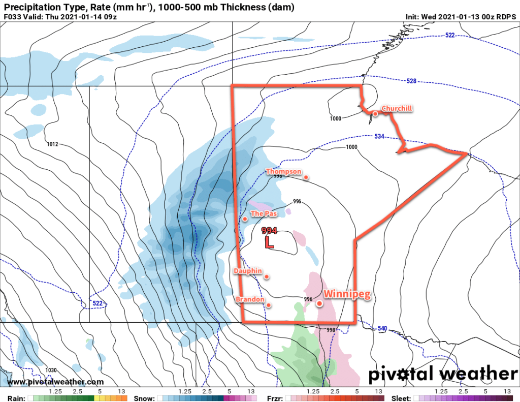
One more warm day, then a blustery storm system moving through will shift Winnipeg into a cooler weather pattern.
A low pressure system moving into the province tonight will usher in a change for Winnipeg’s general weather pattern. Today will still be mild with temperatures climbing up to around -1 °C with mixed skies becoming cloudy this evening. The wind will be a little more noticeable today, picking up out of the south into the 20–30 km/h range for the afternoon and evening.
The low will arrive this evening, bringing warm air that will send temperatures up above 0 °C overnight. There will be a chance for a wintery mix overnight (snow, freezing rain, rain), but what exactly falls is highly dependent on the track of the low and how warm it ends up being. The temperature will drop below freezing to around -1 °C by Thursday morning.

Moderate northwest winds will move in on Thursday, strengthening to 30–40 km/h with gusts up to 60 km/h. Much of the region will see periods of light snow with widespread accumulations of 2–4 cm. A cold front passing through on Thursday night will reinforce the winds and bring more light snow to the region. This snow and wind will likely produce some areas of poor visibility in blowing snow on Thursday night. Temperatures will head to a low near -8 °C.
By Friday, it’s all cold air advection. Temperatures will struggle to move much from their starting point in the morning as the moderate northwest winds continue. Temperatures will only climb a degree or two above the day’s starting point for a high near -7 °C. The snow should taper off through the day, but skies will stay cloudy. The winds will ease Friday night with temperatures heading to a low near -13 °C under mostly cloudy skies.
Long Range Outlook
Cooler temperatures will persist right through next week with daytime highs generally in the -5 to -10 °C range and overnight lows dipping into the minus teens. Skies will stay on the cloudier side, and with the expected temperatures there will be a chance for some non-accumulating light snow on many days.
By the end of next week, it looks increasingly like the polar vortex will shift southwards and begin to flood central and eastern Canada with much colder polar air. This will likely mark the start of an extended period of generally below-seasonal temperatures with the potential for outbreaks of extreme cold.
Winter had to arrive at some point…enjoy the pleasant conditions while they last!
Today’s seasonal daytime high in Winnipeg is -13 °C while the seasonal overnight low is -24 °C.
