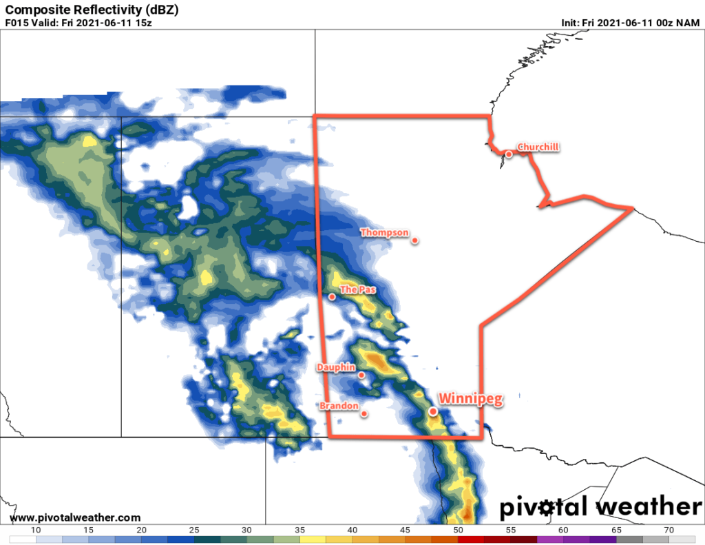
Winnipeg will see a few more showers or thunderstorms today before sunnier conditions return to the region.
A low pressure system lifting through the province this morning will bring more unsettled weather to the Red River Valley. This system produced widespread thunderstorm activity over Montana and southern Saskatchewan yesterday that continued through the night and moved into southern Manitoba. The remnants of that nocturnal convection will move over the Red River Valley this morning, bringing a good chance of showers or thunderstorms to Winnipeg through the morning hours. Once this initial line passes, some sunny breaks should develop for the afternoon hours.

Winds will be breezy out of the southeast through the morning near 30 gusting 50 km/h. Once the line passes, they’ll shift southerly and strengthen to 40 gusting 60 km/h for the afternoon. Temperatures will reach a high around 21 °C today then head to a low near 14 °C tonight with clearing skies. Winds will stay out of the southwest overnight as they ease to around 30 km/h.
On Saturday, the upper-level pattern will change as a broad ridge begins building over western Canada. This will bring sunny skies to Winnipeg for the weekend with highs climbing into the upper 20s. Westerly winds will continue on Saturday at around 30 km/h, then ease on Saturday night. The winds will stay light on Sunday as a high pressure system moves into the province.
Long Range Outlook
The sunny and warm weather will continue through next week with highs in the mid- to upper-20s, lows in the mid- to upper-teens, and comfortable humidity levels.
Today’s seasonal daytime high in Winnipeg is 23 °C while the seasonal overnight low is 10 °C.
