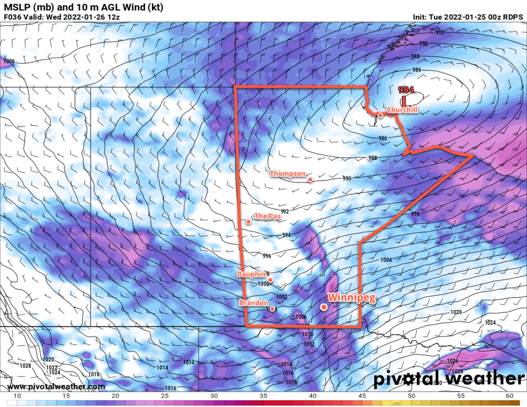
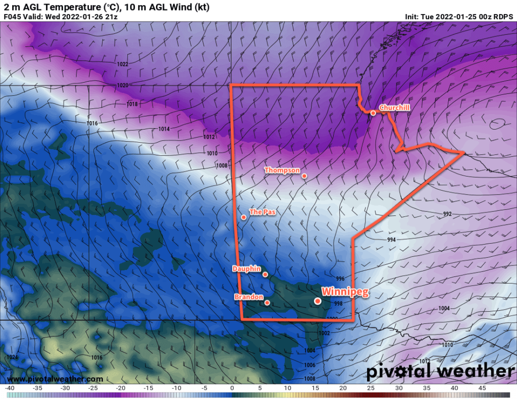
The Red River Valley will see another period of strong winds and blowing snow as a surge of mild Pacific air moves into the region.
Before the warmth arrives, though, the region will see another cold day today. Recovering from our cold morning, highs will climb to around -22 °C today under mainly sunny skies. The wind will stay light through the day as an Arctic ridge slumps over the region.

Conditions will deteriorate tonight as southerly winds strengthen. With warmer air pushing in from the west, southerly outflow winds from the Arctic high will intensify. The wind will pick up to around 30 km/h by midnight, then to 50 gusting 70 km/h by Wednesday morning. These strong winds will combine with the loose snowpack to produce widespread blowing snow across much of the Red River Valley. White-out conditions will be possible in some areas. The worst of the blowing snow will likely be between 5 AM and 10 AM Wednesday morning, followed by improving conditions midday. Temperatures will rise close to the mid-minus teens by the time the sun comes up on Wednesday morning.
Temperatures will continue to rise as the wind and blowing snow eases. A warm front pushing through the region will shift winds towards the west through the day with a high climbing above freezing on Wednesday afternoon. The region should see a fair amount of cloud, but little by way of any notable snowfall.

A cold front will then slump through the region on Wednesday evening, shifting winds back to the north with some flurries. A bit of blowing snow is again possible on Wednesday night, but with after a mild day and with slightly weaker winds near 40 gusting 60 km/h, it shouldn’t be as extensive or severe as seen earlier in the day. Temperatures will head back into the -15 to -20 °C range for Thursday morning.
The Winnipeg area will see seasonably cool temperatures for the rest of the work week. Highs will sit near -15 °C with lows dipping into the -20 to -25 °C range. The city should see partly cloudy skies, but more cloud cover will work into the region on Friday evening.
Long Range Outlook
Cloudier conditions will move into the Red River Valley this weekend with seasonably mild conditions. A near-seasonal temperature trend will continue into next week with skies likely staying on the cloudier side.
The general long-wave pattern shows a consistent shift of the polar vortex back to the high Arctic. This should mean that, for the next little while at least, the extremely cold Arctic outbreaks should come to an end!
Today’s seasonal daytime high in Winnipeg is -12 °C while the seasonal overnight low is -23 °C.
