Southern Manitoba will finally see a break from the cold with several days of near-seasonal temperatures ahead.

A series of weak low pressure systems will move through southern Manitoba over the next few days. They will gradually push warmer air into southern Mantioba, alongside some cloudier conditions and occasional snow.
Southern Manitoba will see increasing cloud on Friday night with temperatures warming up close to 10 °C for Saturday. The low moving through the province tomorrow will bring some light snow to the province, but it will mainly move from northern Manitoba to east of Lake Winnipeg. The Red River Valley should just see mainly cloudy skies. Southerly winds tonight will turn northwesterly on Saturday up to around 30 gusting 50 km/h.
Some clearing will move across the region on Saturday night as the low exits the region. This will allow temperatures to head back to a low near the -20 °C mark.

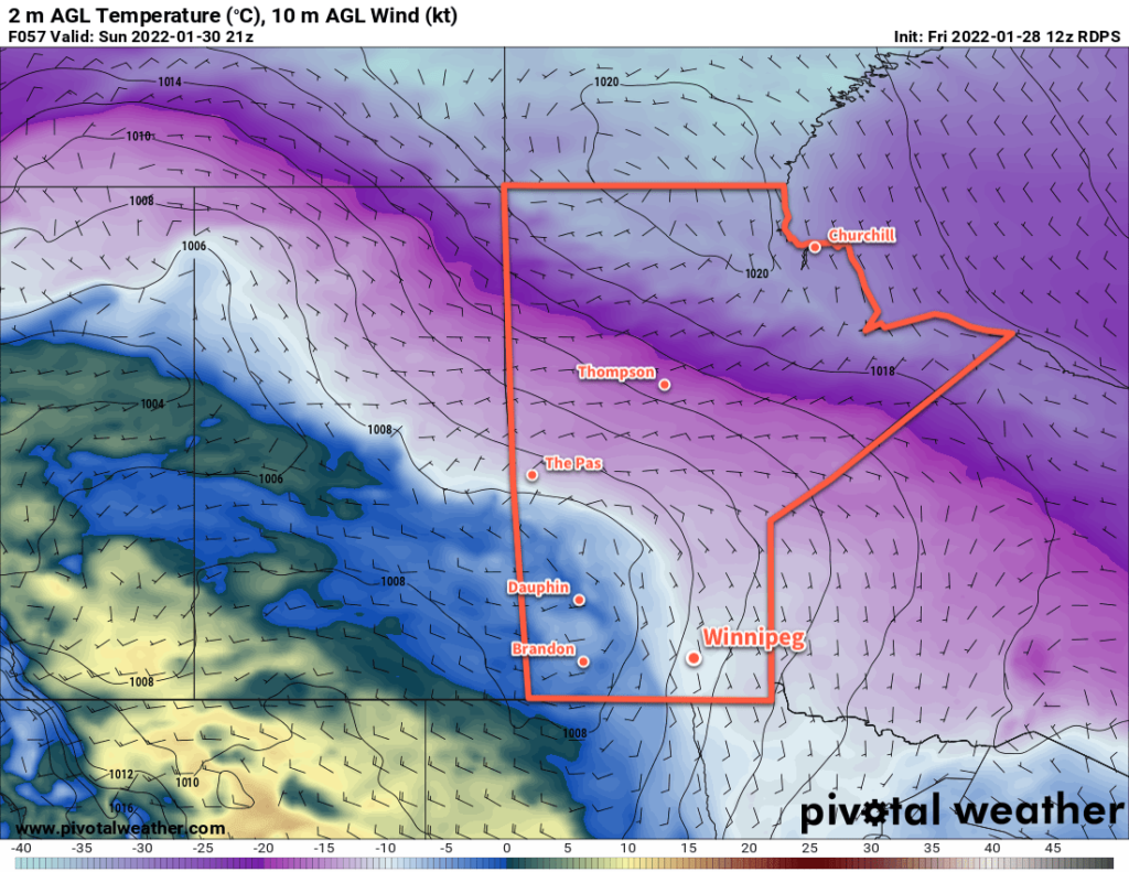
The next low will follow hot on the heels of Saturday’s, spreading more cloud into the region on Sunday morning. This system will a couple centimetres of snow to the region as highs climb into the -5 to -10 °C range. It will be a bit breezy in the Red River Valley with southerly winds near 30 km/h. The snow will clear out for Sunday night, but temperatures will stay steady as a stronger low pressure system moves towards the region from Saskatchewan.
Long Range Outlook
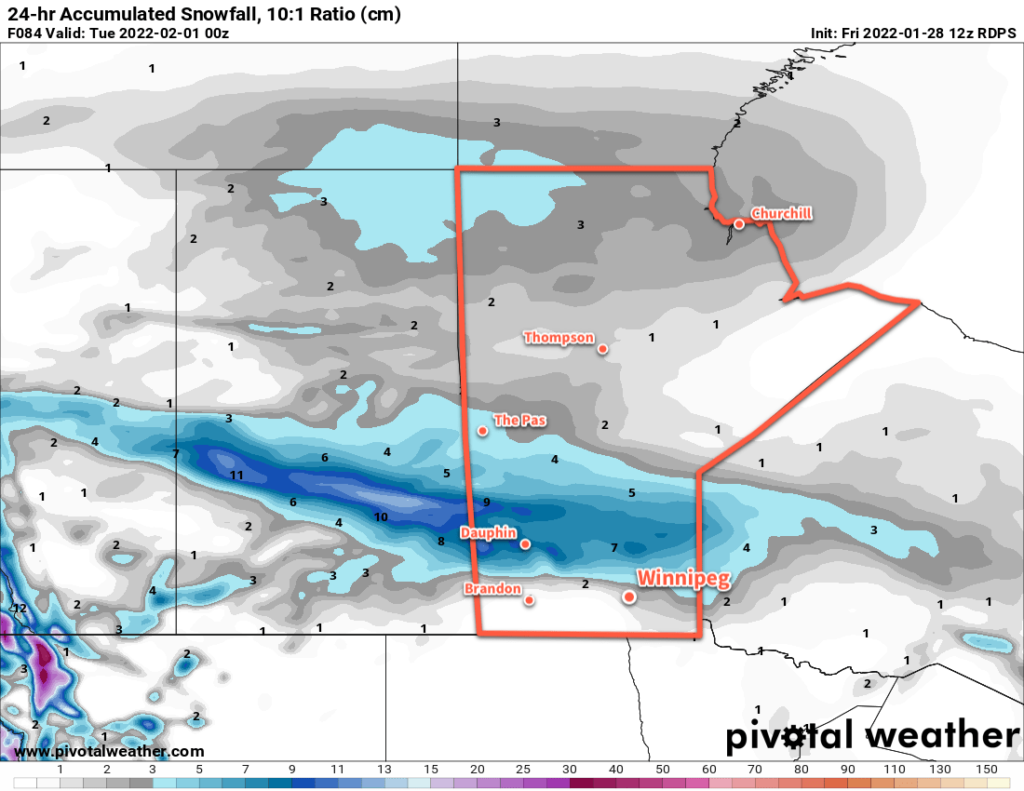
Monday’s low will bring even warmer conditions to Winnipeg on Monday with highs climbing into the 0 to -5 °C range. This system will bring a more intense are of snow to the province on Monday. Beginning over the Parkland region and drifting east-southeast, as much as 10 cm of snow will fall with this system. The Red River Valley will likely sit on the southern flank of the area of snow with 2–5 cm possible.
This system will push a strong cold front through the region on Monday evening, bringing strong northwesterly winds and colder temperatures. Blowing snow could be a concern on Monday night.
The region will plummet back into a period of seasonably cold conditions with daytime highs falling back into the -20 to -25 °C range and overnight lows dipping back towards the -30 °C mark. Some improvement could be seen by the following weekend.
Today’s seasonal daytime high in Winnipeg is -11 °C while the seasonal overnight low is -22 °C.
