Seasonably cool weather will be the trend for much of this week with sunny conditions interrupted mid-week as more snow moves through the province.

Cool weather will continue across southern Manitoba this week, supported by a slow-moving upper-air pattern called a “high over low block.” In the upper levels of the atmosphere today, an upper low sits over southern Alberta and Saskatchewan while an upper high sits to its north over the northern Prairies. This configuration of upper-level features is stable and results in a slow-moving pattern. As a result, the weather will be gradual to change this week, save for a mid-week system that brings more snow.
Today, a ridge of high pressure crossing the province will bring sunny skies and cool weather. It’s a chilly start to the day and the recovery will bring Winnipeg to a high near -10 °C this afternoon. A few clouds will linger overnight as temperatures drop into the mid-minus teens.
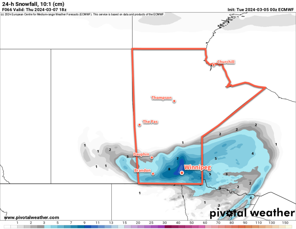
On Wednesday, a low pressure system will lift out of the Dakotas into southeastern Manitoba, spreading a band of moderate to heavy snow into the province with it. Skies will cloud over early in Winnipeg with snow likely beginning midday and lasting through the night. Daytime highs will climb to near-seasonal values with a brisk northeast wind up to 30 gusting 50 km/h.

Winds will shift westerly overnight as the low lifts to the north and the snow tapers off. This storm will leave behind close to 10 cm of snow across much of southern Manitoba by Thursday morning. Fortunately, areas hit hardest by the weekend’s storm system will see lesser amounts from this system than areas in the Red River Valley and east. Temperatures will head to a low in the -15 to -10 °C range on Wednesday night.
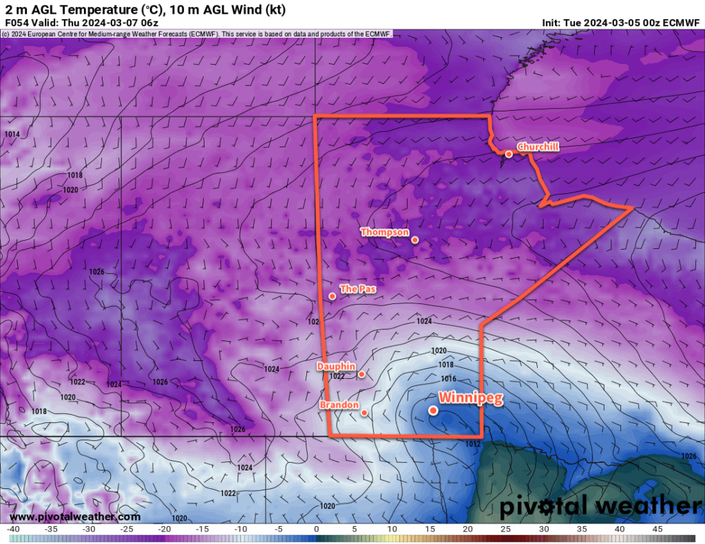
Skies will clear out on Thursday with temperatures rebounding into the -10 to -5 °C range. Winds will taper off through the day. Temperatures will dip back down close to -20 °C on Thursday night as another Arctic High moves into the province.
Long Range Outlook
The Winnipeg area will see below-seasonal temperatures on Friday with highs in the -10 to -5 °C, but a shift in conditions will begin to develop on the weekend.
That high over low block will finally exit the region, and an upper ridge will begin to develop in the west. As it amplifies and begins to spread eastwards, milder air will push back across the Prairies. Temperatures will rise to near-seasonal values on Saturday and likely to above-seasonal values on Sunday.
Above-freezing daytime highs look likely beginning Sunday and lasting through the first half of next week.
Today’s seasonal daytime high in Winnipeg is -4 °C while the seasonal overnight low is -14 °C.
