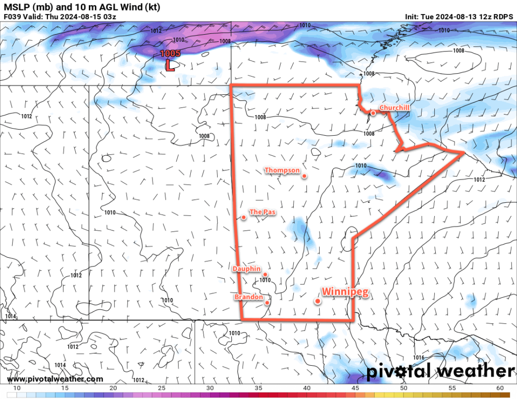
Seasonably warm weather will continue in Winnipeg as a slow-moving disturbance brings unsettled conditions to the region mid-week.

For today, though, the Winnipeg area will have a beautiful day. A ridge of high pressure over the region will keep skies mainly sunny as temperatures climb to highs in the upper 20s. Humidity levels will stay comfortable with light southeast winds.
A change in the weather will begin tonight. A broad and slow-moving disturbance that stretches from the southern Arctic all the way south to the United States will begin pushing a more humid and unsettled air mass into the province. This system will begin as a low pressure system in Saskatchewan today that will support the development of showers and thunderstorms that tracks towards western Manitoba overnight.
Further east in the Red River Valley, a chance of showers or thunderstorms will develop overnight as a strengthening low-level flow is lifted over a warm front. Elevated showers or thunderstorms could be possible through the second half of the night into Wednesday morning. Temperatures will drop to a low in the upper teens with southeast winds picking up into the 20 to 30 km/h range.
The forecast gets…fuzzier heading into Wednesday. This system will separate into a low centre that tracks into northern Manitoba and a second low center that consolidates further south in the Dakotas. Both of these systems will support their own area of showers and/or thunderstorms, but what happens between the two is unclear.
As this system will begin slow-moving, it’s likely that both Wednesday and Thursday will bring mainly cloudy skies to the Winnipeg area with southeast winds of 20 to 30 km/h on Wednesday becoming light for Thursday. There will be a chance of showers this whole period, though the highest chance looks to be Wednesday night into Thursday morning. Temperatures will be mild with seasonal highs in the mid-20s and lows in the mid- to upper-teens.
At this point it’s unclear if there’s much of a severe weather threat or not for the region. If there’s enough lift from this system, then widespread showers or more likely, and if there’s not enough, there could be little precipitation at all. There is a sweet spot, though, that a few high-resolution weather models pick up on, that could produce rounds of more intense thunderstorms. There’s nothing to do but wait and watch for now, though, and see how this system evolves. Make sure that you stay aware of any weather alerts issued by the Storm Prediction Centre in Winnipeg over the next couple days.
Long Range Outlook
This system will exit the region on Friday, brining sunnier skies back to the region with light to moderate northerly winds. A ridge of high pressure will build into the region through the weekend, bringing light winds, highs in the mid- to upper-20s, and lows in the mid-teens. After a couple unsettled days, it looks like a strong finish to the work week and a wonderful summer weekend ahead.
Today’s seasonal daytime high in Winnipeg is 25 °C while the seasonal overnight low is 12 °C.
