After a cold start to Friday morning, temperatures in southern Manitoba will jump back to seasonably warm values, though the weekend will end with blustery conditions and cooler temperatures after rain showers move through on Saturday.
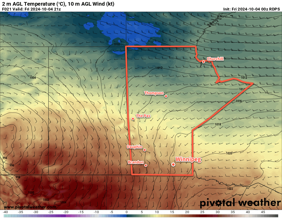
Despite a frosty start to the day for many places in southern Manitoba, temperatures will quickly bounce back to above-seasonal values today. A low pressure system developing over the western Prairies will begin spreading warmer air eastwards into Manitoba. Southerly winds will pick up into the 30 gusting 50 km/h range today with sunny skies and an afternoon high in the upper teens. Those winds will continue right through the night as the low tracks through Saskatchewan, keeping temperatures mild with lows in the low teens.
Despite being relatively warm, Saturday will be a bit of an unpleasant day. The main driver for the weather will be a low pressure system crossing through the Interlake, with an energetic cold front that sweeps through later in the day. The day will start with increasing cloudiness as moderate southerly winds continue across the region. Temperatures will climb back into the upper teens as rain spreads into western Manitoba. There’s a small chance of some midday showers in Winnipeg, but the better chance for rain will develop later in the afternoon as a cold front sweeps through. Winds will shift from southerly to westerly and strengthen to 50 gusting 70 km/h as rain wraps into the region.
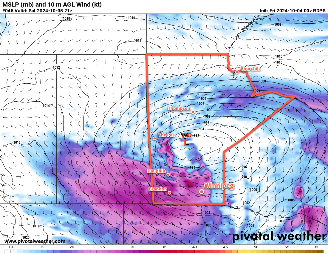
The rain will taper off overnight as temperatures head to a low in the mid-single digits. The winds will continue through the night, shifting to the northwest and gradually easing into the 30–40 km/h range by Sunday morning. By the end of the night, the main area of rain will be well to the east of the Red River Valley, but a couple bands of lake-effect showers may linger in the lee of the lakes into Sunday morning.
Sunday will be a cooler day with northwest winds of 30 gusting 50 km/h and a high in the low teens. Skies should clear for the afternoon bringing sunshine back to the region. Temperatures will dip close to freezing on Sunday night with clear skies and easing winds.
Long Range Outlook
Next week will bring warmer conditions back to southern Manitoba as the upper low over western Hudson Bay retreats northwards and upper ridging is able to redevelop over the Prairies. Much of the week will bring daytime highs in the upper teens or low 20s with overnight lows near the 10 °C mark. The week should also be dry with no significant precipitation in the forecast.
Today’s seasonal daytime high in Winnipeg is 14 °C while the seasonal overnight low is +2 °C.