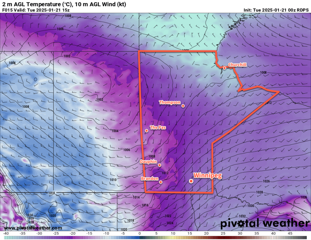
Brisk southerly winds will move through southern Manitoba today as the bitter cold eases across the region.

It’s a cold start to the day, but a low pressure system dropping into the region from northern Saskatchewan is slowly dragging some milder temperatures back towards the region. It will push a warm front towards the region this morning, bringing light snow to the Red River Valley alongside strengthening southerly winds.
Those winds will climb to 40 gusting 60 km/h hour this morning. Combined with the falling snow, the recent cold, and the ice crystals that fell across the region over the weekend, it’s likely that we’ll see widespread blowing snow through the Red River Valley with some near-blizzard conditions possible on area highways running west-east.
Those southerly winds will keep wind chill values locked into the -30s despite the temperature warming into the -20 to -15 °C range.
As the low moves into southern Manitoba this afternoon, the winds will ease as the light snow mostly pushes out of the region. Some lingering flurries will be possible into the evening as temperatures reach as high as around -15 °C.
The low will exit the region overnight, bringing northerly winds back that usher in another push of Arctic air. Temperatures will dip close to -20 °C on Tuesday night under clearing skies. Temperatures will only recover a few degrees on Wednesday with breezy northwest winds around 30 gusting 50 km/h. Some local blowing snow is likely in the areas surrounding Winnipeg and skies should be partly cloudy to mixed.
Temperatures will head back into the -30 to -25 °C range on Wednesday night, but easing winds should keep wind chill values to the mid-minus 30s or so.
Thursday will be a cool day with temperatures returning to a high in the low minus teens under sunny skies.
Long Range Outlook
On Friday, a low pressure system moving through the southern Arctic will push a much broader swath of milder temperatures across the Prairies. For Winnipeg, this will mean temperatures won’t drop much on Thursday night as southerly winds up to 30 gusting 50 km/h redevelop through the Red River Valley.
On Friday, more cloud and light snow will move through the region as temperatures warm back up into the low minus single digits.
The weekend should bring pleasant winter weather with near-seasonal temperatures across the Red River Valley with a couple chances of light snow.
Looking ahead to the longer-range trends, it looks like January should wrap up trending on the milder side, though early February could bring another outbreak of bitterly cold air. There are no major snowfall events in the short or medium-range outlook for the region.
Today’s seasonal daytime high in Winnipeg is -13 °C while the seasonal overnight low is -23 °C.
