Winnipeg will see sunny skies and seasonably cool temperatures today, but another low crossing the Prairies will bring cloudier and warmer weather to the region mid-week.
For today, skies will gradually clear as a ridge of high pressure shifts east of the Red River Valley. Winnipeg should see morning sunny breaks give way to mainly sunny skies this afternoon. Winds will be light through the day as temperatures climb into the upper single digits this afternoon. Heading into the evening, a low pressure system moving across Saskatchewan will push a warm front into southern Manitoba tonight. This will build cloud cover back into the region as temperatures head to a low near the freezing mark.
On Wednesday, the region will see mixed skies as the warm front pushes through in the morning and a cold front approaches in the evening. It will be a much warmer day with highs in the mid-teens across the region along with southerly winds of 30–40 km/h. The cold front will push a band of rain showers across the region early Wednesday night. The cloud cover will begin to break up overnight as winds ease and temperatures dip down to the low single digits.
Thursday will bring mixed skies to the region; morning cloud likely giving way to midday sun then a broader area of cloud beginning to build in from the northwest. Temperatures will climb into the 10 to 15 °C range with northwest winds picking up to around 30 km/h.
A colder air mass will settle into the region on Thursday night as temperatures dip below freezing with northwest winds continuing in the 20 to 30 km/h range.
Long Range Outlook
Friday will bring chilly weather to southern Manitoba with highs in the low single digits and cloudy skies. After another cool night on Friday night, seasonal temperatures will build back into the region for Saturday.
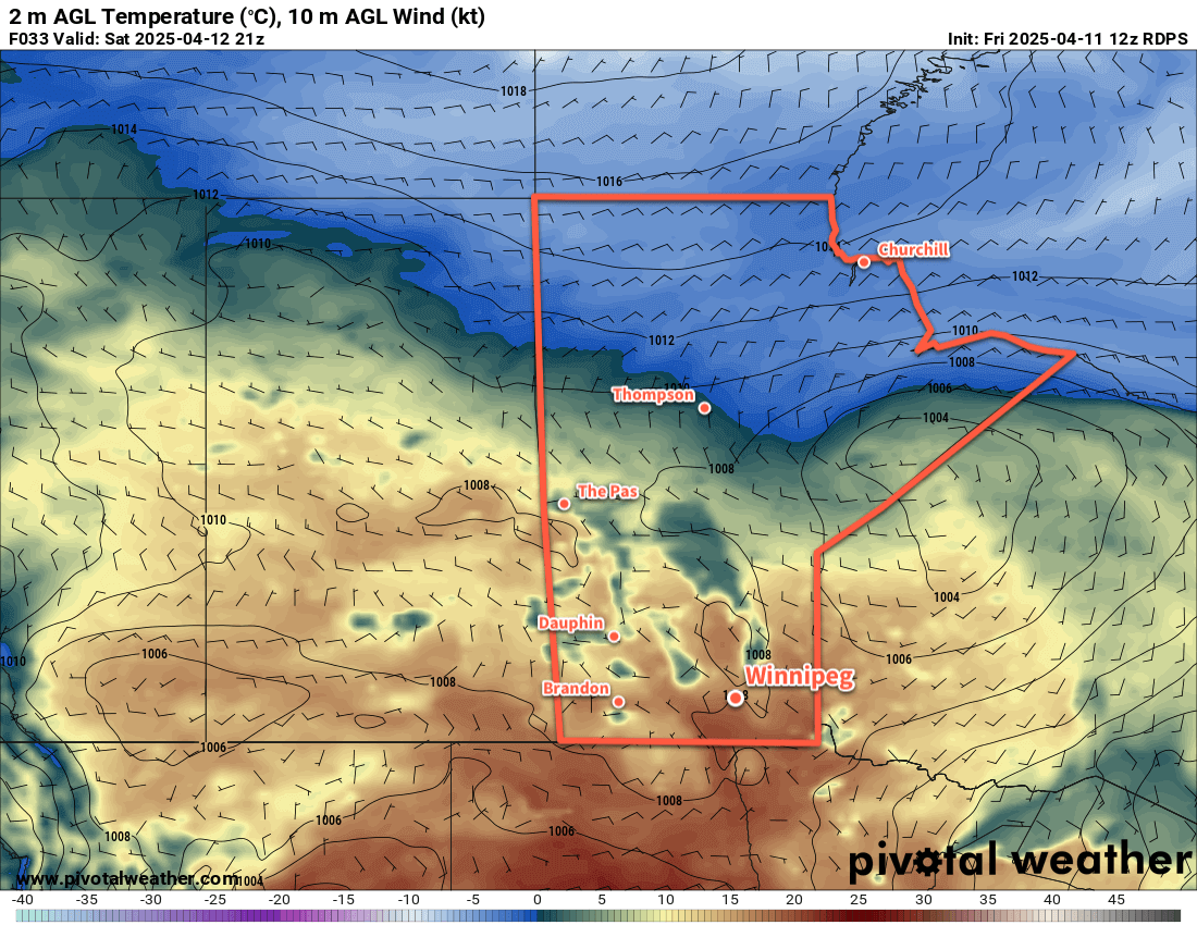
Saturday and Sunday should both bring pleasant conditions to Winnipeg with highs in the mid-teens. Conditions for next week are less clear; some weather models suggest a prolonged stretch of mild weather, while others suggest a slow-moving low pressure system lifting north that could bring a few days of cloudier weather with chances for rain.
Today’s seasonal daytime high in Winnipeg is 10 °C while the seasonal overnight low is -2 °C.