It’s been a wet and wild week in Southern Manitoba as muttiple rounds of thunderstorms have pummeled the region with heavy rain. On Thursday, 75mm of rain fell in southwest Winnipeg, causing substantial amounts of flooding to neighborhoods, schools and retail locations. On Friday night a area of heavy rain and thunderstorms pushed into Western Manitoba bringing as much as 175–200mm of rain to some regions in the southwestern portion of the province. The town of Reston, MB has declared a state of emergency after about 7.5” of rain fell on Friday night (~ 190mm). Approximately 2/3rds of the town’s population has been affected by the flood waters that engulfed the town as it’s drainage system simply could not keep up with the intense downpour.
On Saturday evening, an intense line of thunderstorms developed along the western escarpment of the Red River Valley and remained stationary for almost 3 hours. The hardest-hit areas just west and northwest of Portage la Prairie where – as evidenced by RADAR-estimated rainfall accumulations and a report from the town of Westbourne, MB – as much as 225mm (9”) of rain fell. On Sunday, an area of rain and thunderstorms lifting northwards through western Manitboba brought another 50–75mm of rain. This additional rainfall in an already waterlogged region has brought more overland flooding and caused mutliple highways to be closed near Riding Mountain National Park.
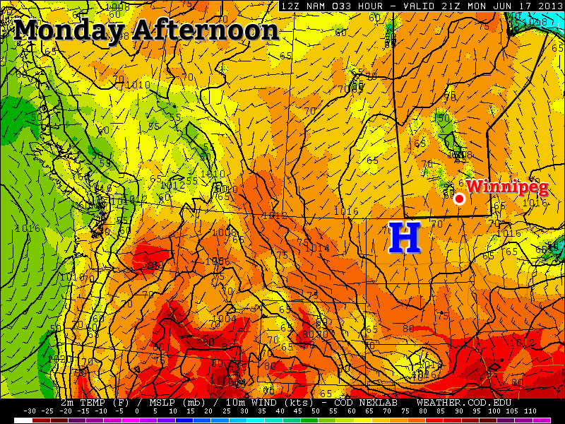
But a reprieve is in store for Southern Manitoba as the upper low that has been drawing a moist, unstable air mass from the Gulf of Mexico and brought catastrophic flooding to Calgary and southwest Alberta finally moves out of the region. This will allow a slightly drier, more stable air mass to move into Southern Manitoba on Monday. Things are not meant to last, though, as the heat and moisture is set to return on Tuesday as another system pushes into the Prairies and brings the storm threat back.
The Next Few Days
26°C / 15°C
Mainly Sunny
29°C / 18°C
Hot and humid. Thunderstorms possible in the evening & overnight.
26°C / 15°C
Mostly cloudy; showers likely.
We’ll see a beautiful day today with mainly sunny skies. A westerly wind will bring in slightly dryer air which will help things feel a little more comfortable as we head to a high of around 26°C. Skies will be mainly clear tonight as we drop to around 15°C.
Heat and humidity will begin to build in on Tuesday as a southeasterly wind develops and begins drawing Gulf moisture northwards again. Dewpoints should climb back towards 19–20°C as our temperature soars into the high 20’s. While the high will top out around 28 or 29°C, when combined with the humidity it will feel much closer to 35°C out there. An approaching trough will push into SW Manitoba through the afternoon and move into the Red River Valley in the evening.
Thunderstorms should fire along this feature in the afternoon and pretty much every single thunderstorm parameter looks fantastic. CAPEs are expected to exceed 2500J/kg, LI values are expected to be beween –5 and –10°C, surface dewpoints should pool to around 20°C along the trough and a decent shear profile will be in place. It looks likely that any storms that develop will likely have the potential to become severe with threats of large hail, torrential rain and tornadoes. The storms will likely grow into a line of storms as they slowly progress eastwards towards the Red River Valley, with a good chance of heavy showers or thunderstorms in the late evening or overnight here in Winnipeg.
On Wednesday we’ll be stuck underneath a low pressure complex. The overnight convection should clear out through the morning hours then we’ll move into a mix of sun and cloud with scattered showers through southern Manitoba. We’ll see a high climb into the mid–20’s and clearing skies overnight with a low near 15°C.
Rest of the Week
It looks like we’ll finally move into a dryer pattern for at least a few days as a weak upper ridge pushes into the Prairies. Temperatures will be mid–20’s with significantly dryer air in place making for some pleasant, warm and comfortable summer weather. A few thunderstorms may be possible throughout the latter half of the week, but with less moisture available they shouldn’t produce the excessive rainfall totals we’ve seen over the past several days.


