Northern Hemisphere Waters Seeing Increased Storm Activity

The hurricane and typhoon seasons (Atlantic and Pacific basin, respectively) both ramped up this past week as three significant storms spun up with another one expected to strengthen.

Different model tracks for Danny - some models want to curve it northwards faster than others. (Source: Tropical Tidbits)
Different model tracks for Danny – some models want to curve it northwards faster than others. (Source: Tropical Tidbits)

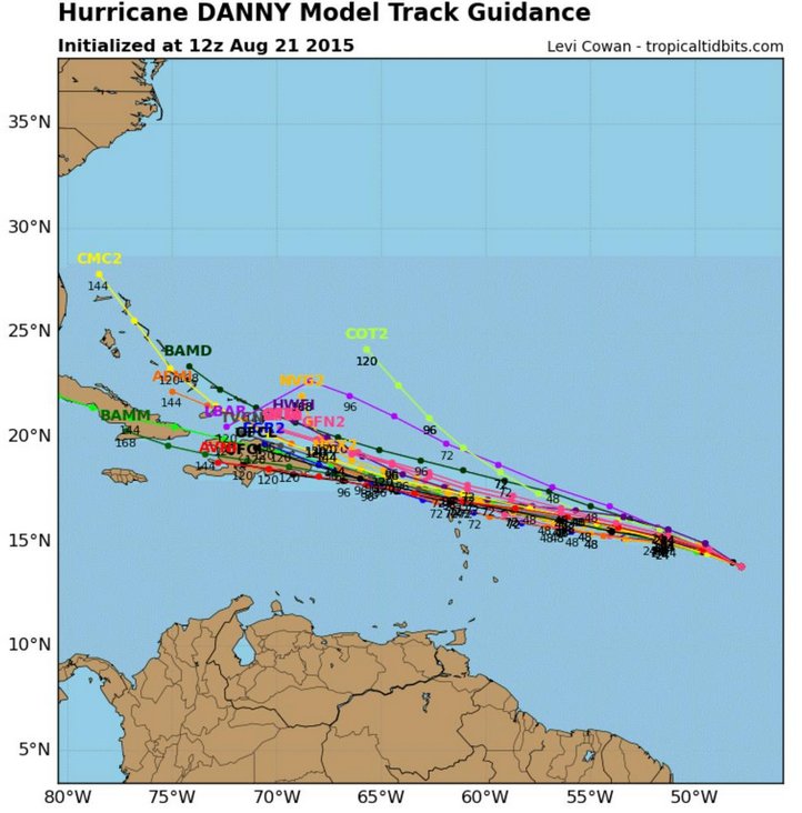
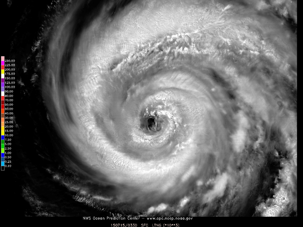
The first, hurricane Danny, formed a few days ago west of Cape Verde Islands, in the Atlantic basin. The conditions in the past days were good for steady intensification, until about Friday midday when the hurricane encountered dry air and began ingesting it. Before then however, a recon plane flew into Danny and registered winds that suggested the storm was already a major hurricane, of category three on Friday morning. This is the first major hurricane of the Atlantic this year and the earliest since 2009. As Danny is still far from the US mainland it is impossible to say which states it will affect, if any at all. Before then however, it is expected to move through the northern Antilles, but only as a tropical storm due to the fact that it will continue to gradually weaken due to high shear/dry air present east of the Antilles.

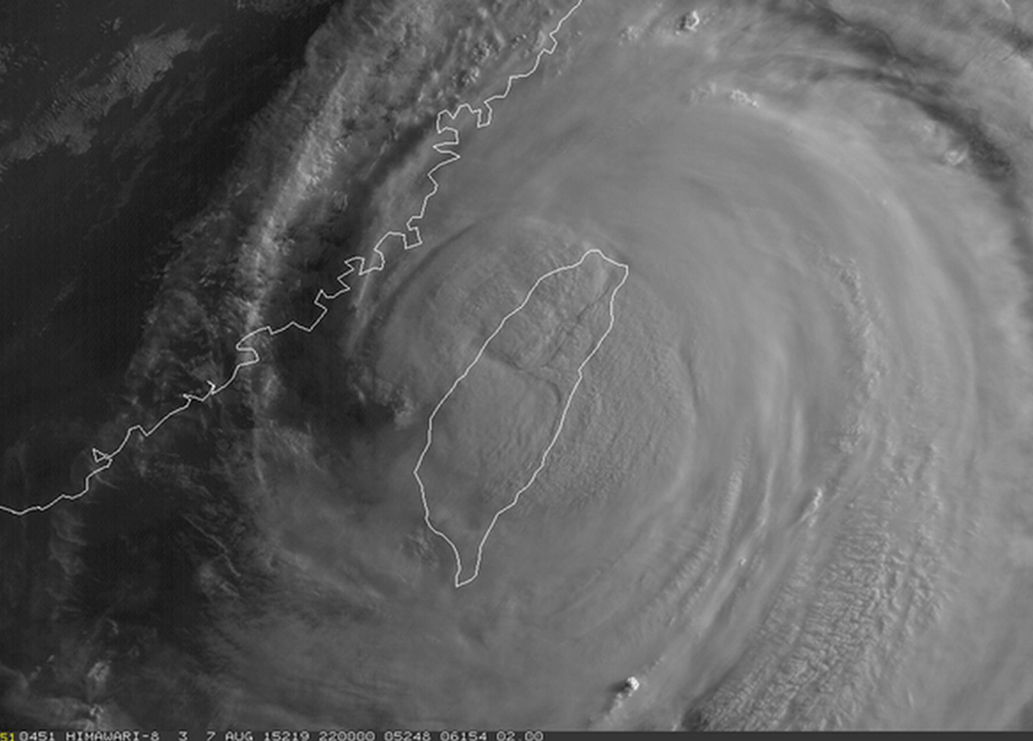
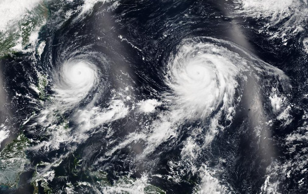
Two typhoons are also currently spinning simultaneously in the western Pacific, one off the western coast of Thailand (Goni), and one further west (Atsani). These were both once very powerful typhoons, of category four and five (super typhoon), respectively. They have since gradually weakened to category two equivalent storms however. Neither of them are expected to make direct landfall, but Goni has already had adverse effects on the northern Philippines and Thailand, bringing heavy rain and fairly strong winds as it brushed the islands. What is special about these two very powerful storms (category four and higher) was that they were churning in the western Pacific simultaneously, a feat that is fairly uncommon.

Beautiful satellite image taken on the 20th that captures both Goni and Atsani in the western Pacific. (Source: NASA)

Finally, the last storm of concern is tropical depression Kilo, located southeast of the Hawaiian Islands. As of Friday night Kilo was only a weak storm with sustained winds of 60km/h. However, Kilo is expected to continue curving northwestwards towards the Hawaiian Islands and strengthen. National Hurricane Centre is forecasting that it will strengthen to a category two hurricane and could come very close to making landfall on the island of Kauai. There’s still some uncertainty of its exact track this far out but it appears that this will be a major event for at least the western Hawaiian Islands.

Typhoon Soudelor Takes Aim at Taiwan and China

A tropical disturbance that was once a powerful super typhoon over the open waters of the Western Pacific earlier this week has now slightly weakened and is taking aim at southeastern Asia.

As of Friday night Soudelor was a typhoon of strength equivalent to a category two hurricane and had just made landfall on Taiwan’s northeast shores. The typhoon packed sustained winds of about 170km/h gusting to over 200km/h Friday night as it made a direct landfall on the island of Taiwan. The biggest threat with the typhoon, however, was rainfall. Taiwan’s rugged terrain meant that orographic lift (lifting of air pushed up the mountains) would greatly enhance precipitation amounts, especially on the north side of the island. Models showed that as much as a metre of rainfall (or more) could fall before it is all said and done.

Visible satellite image of Soudelor at sunrise late Friday evening (our time). (Source: Himawari Sat.)

The effects of typhoon Soudelor are still uncertain as of Friday evening but the Taiwanese authorities reported that there were over 2.6 million residents without power, wreaking havoc on day to day activities as well as travel in the region. In addition to that, as of Friday night there were four confirmed deaths associated with the typhoon, two of which were associated with the storm surge which had the biggest impact on the northeast shoreline. The station that clocked the highest rainfall amounts as of Friday evening was the town of Taipingshan, which was already well over a metre of rainfall (1,241mm). Taipei, which is less than 50km from this town, had already recorded an astonishing 500mm in some parts of the city.

Conditions are expected to continue to be poor until later today, as the heavy rains are expected to continue to fall in the northern half of the country. Soils will become saturated, if not already, and overwhelmed by the rainfall, resulting in mudslides in the mountainous regions – a region of Taiwan which is known to be very prone to these types of disasters. Soudelor’s effect on China isn’t expected to be as severe, but heavy rain/flooding will once again be the main threat as the tropical system moves over China’s mainland and begins to weaken.

Western Prairies get Hammered by Severe Thunderstorms

Severe storms fired across much of Alberta on Tuesday evening and Wednesday morning as well as Saskatchewan on Wednesday, and brought with them some large hail that inflicted major damage in some cities.

[map autofit=”1″ disable_scrollwheel=”1″]
[pin]Lacombe[/pin]
[pin]Kerrobert[/pin]
[pin]Priddis[/pin]
[/map]

A deep trough on the west coast of Canada was present on Tuesday and provided plenty of shear in the region to support organized storms. That, combined with some relatively high amounts of instability off the foothills of Alberta made for an environment not only supportive of organized storms, but created conditions that were prime for producing hail. In addition to these factors, the freezing level was low (just above 700mb) which meant that the hail had less time to melt before it reached the ground.

In total, there were two notable severe storms that caused major damage. The first was on Tuesday evening as it initiated off the foothills and headed west and at times had supercell characteristics as it drifted east and rooted down into the boundary layer. Lacombe, Alberta took a direct hit from this storm – hen’s egg-size hail or even slightly larger was reported across town. Damage was widespread in town, with car and house windows blown out, siding shredded, and crops badly damaged. The second storm, which occurred on Wednesday in the late morning and initiated off the foothills, also dropped large hail in the Calgary area. This time however, the supercell produced a rare Albertan tornado near Priddis, AB. The tornado didn’t do any significant damage to any structures (passed through a forest) but it did provide the opportunity for stunning photos.

The tornado near Priddis, AB as seen from air by cloud seeders. (Source: Twitter - @Ringosmyuncle)
The tornado near Priddis, AB as seen from air by cloud seeders. (Source: Twitter – @Ringosmyuncle)

The same storm later consolidated with another storm nearby and reached central Saskatchewan by mid-evening. The town of Kerrobert, SK was especially hard hit with hail larger than the size of golf balls. It even prompted the town to issue a state of emergency because the damage was so severe to buildings and property – according to residents, over two thirds of the town’s houses had broken windows. Damage costs from these storms has yet to be determined but is estimated to be in the tens of millions at the very least.

Golf green in Kerrobert, SK badly damaged by the hail. (Source: Twitter - @EarlsSalesMarc)
Golf green in Kerrobert, SK badly damaged by the hail. (Source: Twitter – @EarlsSalesMarc)

Typhoon Nangka Wreaks Havoc on One of Japan’s Main Islands

This past week a typhoon made landfall on one of Japan’s islands, the island of Shikoku and with it brought winds the equivalent of a category one hurricane gusting up to 185km/h.

[map type=”terrain” autofit=”1″ disable_scrollwheel=”1″]
[pin]Island of Shikoku[/pin]
[pin]Kamikitayama, Japan[/pin]
[/map]


Nangka initially formed in the middle of the Western Pacific Ocean about over a week ago and slowly strengthened as it approached Japan; it traveled over 5000km to make landfall. Over open waters it peaked at the equivalent of a category four hurricane, with sustained winds of over 200km/h and gained super typhoon status. Slightly cooler ocean waters (of 26°C to 27°C) towards Japan weakened the typhoon somewhat before it made landfall, but with that said, the typhoon’s impacts were still fairly significant. In expectation of the typhoon 550,000 residents were either issued a mandatory evacuation notice or voluntary evacuation notice, in the most prone-to, low-lying areas near the coast.

Beautiful satellite image of Nangka earlier this week while it was still over open waters. (Source: NWS OPC)

In total, two people perished from the typhoon and about three dozen people sustained injuries – thankfully it wasn’t worse due to good planning by authorities to get the people most at risk out. Numerous rail runs and flights were cancelled, affecting about 200,000 people’s daily activities. Some flooding did occur as the typhoon brought a plume of tropical moisture to the region with it, which led to rainfalls in excess of 700mm in the hardest hit areas in 48 hours (740mm reported in Kamikitayama). Just over 100 houses were reported to have been completely flooded out

Since Nangka has made landfall it has progressed to its dissipating stage, and possibly extratropical transition by the end of the weekend. However, it will still bring with it the threat of heavy rainfall in the northern Japanese islands and mountainous areas even though it continues to weaken. On average there are 16 typhoons in the Western Pacific in a year, and this year’s count is currently at seven. Most storms form in the Western Pacific between May and November (because shear is weaker) but there are occasional storms that form in the other months of the year.