A Stretch of Above-Seasonal Temperatures

The weather this week will remain well above seasonal with high temperatures generally in the minus single digits.

Today will be mainly cloudy with a good chance of flurries as a strong upper-level disturbance passes through southern Manitoba. No significant accumulations of snow are expected. Temperatures will be in the mid minus single digits with north-westerly winds at 20-30km/h.

Skies should clear on Tuesday as a drying north-west flow persists over the region. Temperatures will be slightly cooler than Monday, but still in the minus single digits. Winds will generally be light and variable.

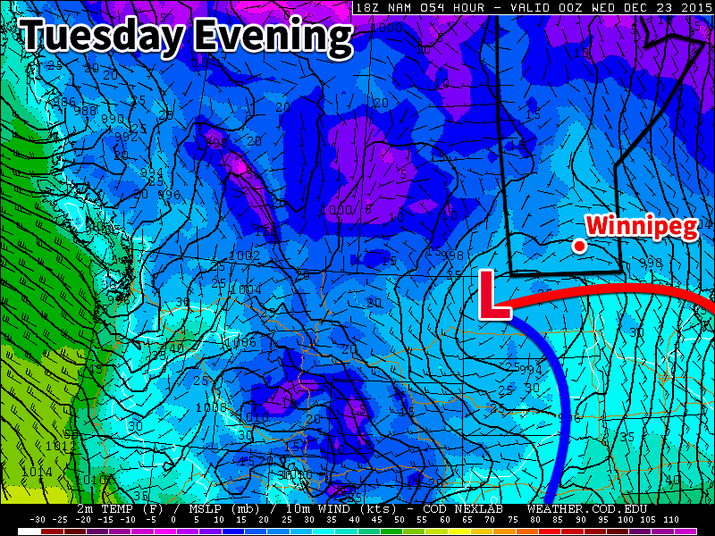
A strong low pressure system will be the focus of Wednesday’s weather in southern Manitoba. A warm front will pass through during the day, bringing with it a small, but heavy band of snowfall. Given the warmth of the air associated with this front, there is a chance of some mixed phase precipitation in some areas, but it’s too early to discuss those details. It appears that 2-4 cm of snow is probable with this system, but again that total should be revisited closer to the event.

Long Range
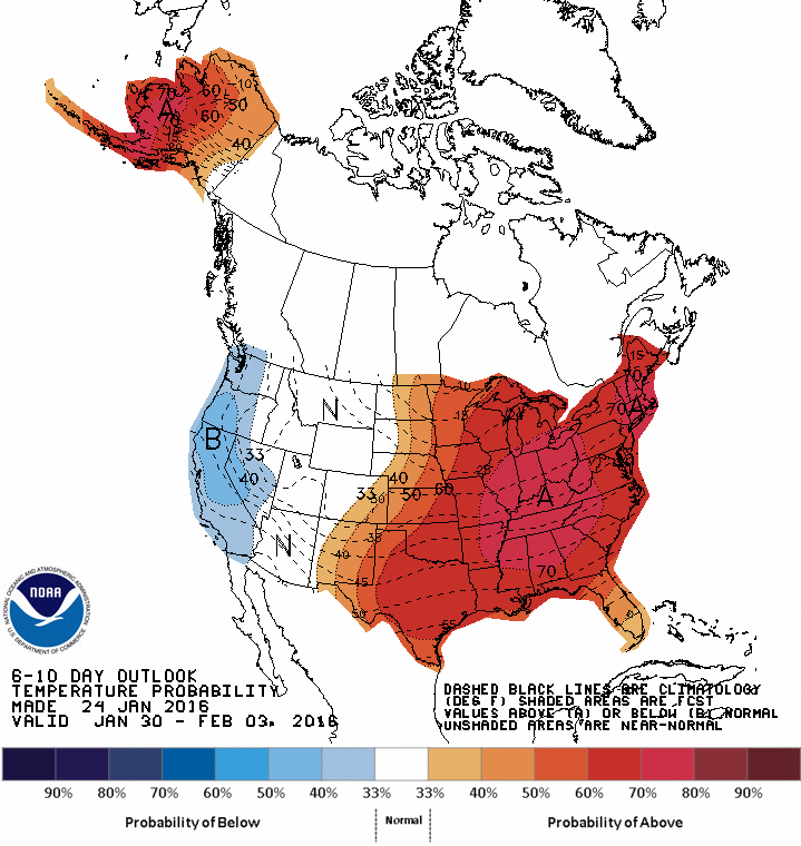
CPC 6-10 Day Temperature Anomaly Forecast
The CPC’s 6-10 day temperature anomaly forecast shows a strong return to El Nino winter conditions.

In the longer range it appears we’ll see above-seasonal weather last for the rest of the week before more normal weather returns next week. Long range models aren’t showing a clear signal for February’s weather at this time, which suggests fluctuations between above and below normal conditions.
Gradually Warming Up This Week

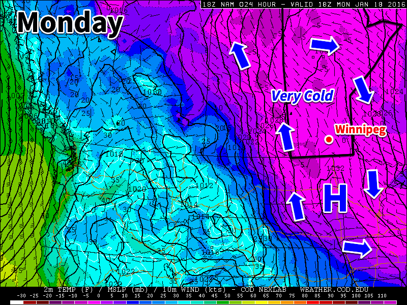
The early part of this week will remain very cold, but gradual warming is expected as the week progresses.

A surface ridge of high pressure will be centred over southern Manitoba on Monday

Monday

A surface ridge of high pressure will be centred over southern Manitoba today, continuing the chilly conditions that have plagued us for some time. The only good part about this ridge is that it will bring light winds to the region, at least keeping wind chill values at bay. High temperatures in southern Manitoba are expected to be near the -20C mark today under clearing skies. There is a slight chance of flurries early in the day before the clouds clear.

Tuesday

Tuesday will see slightly warmer weather in southern Manitoba as the surface high moves off to the east. Skies will be mainly cloudy, helping to maintain these slightly warmer conditions. Due to the presence of these clouds we may see some light flurry activity, but only trace accumulations will be possible. Winds will be noticeable stronger than Monday, with values of 20-30km/h out of the south.

Wednesday

Wednesday will remain mainly cloudy as a weak low pressure system approaches. We may again see some flurry activity throughout the day, but large accumulations are not expected. Some models bring measurable, but still light, accumulations of snow to southern Manitoba on Wednesday, so don’t be surprised if this forecast changes a bit. Winds will be generally light and from the south.

Long Range

The long range forecast shows us continuing to warm as we approach the weekend. Models suggest that late January will generally be warmer than normal (the normal high is currently around -13C). The current El Nino in the Pacific Ocean is hovering around record levels, thus we can expect it to begin more profoundly exerting its influence on our weather again before this winter is over.

Staying on the Cool Side

Temperatures will remain on the cooler side early this week, although values won’t be far from seasonal.

Today will be a mixture of sun and cloud with temperatures in the mid minus teens. Some mid and upper level cloud cover will likely be in place during the morning, but may begin to clear out by the afternoon – although Winnipeg may be on the edge of this transition. Winds will be breezy from the south-east.

Tuesday will see temperatures near seasonal values under mainly cloudy skies. High temperatures will sit in the low minus teens with a light northerly wind.

Wednesday will be much the same as Tuesday, with temperatures in the low minus teens and mainly cloudy skies. Winds will be light from the west or north-west.

Long Range

Long range models suggest a return to warm weather around New Years. El Nino is reaching peak strength as we approach mid-winter and thus its impacts will continue to be pronounced through the remainder of winter.

More Snow This Week?

It looks like someone forgot to turn off the snow machine as yet another round of snow is possible early this week.

Today will be near seasonal with temperatures around -10C. Skies are expected to be mainly cloudy with a low stratus deck hanging over the Red River Valley. Winds will be from the south-east at 20km/h.

A low pressure system may bring more snow to southern Manitoba on Tuesday

Tuesday will see the arrival of another low pressure system that will likely bring shovel-able snow to parts of southern Manitoba. At this point it appears that 5-10 cm of snow is most probable for the Red River Valley, although that could be more or less depending on the eventual track of the system. Below is a current rundown of model predictions from December 20 for this storm (assuming a 15:1 snow to liquid water ratio):

Wednesday will be seasonably mild in the wake of the departing low from Tuesday. Temperatures will be in the mid to upper minus single digits under mainly cloudy skies and light winds. Luckily there won’t be a large pressure gradient with Tuesday’s low pressure system so winds will be relatively light, so extensive blowing snow won’t be an issue.

Long Range

The long range forecast shows generally seasonable weather up to Christmas. There are some hints of slightly below normal weather developing just after Christmas, but models suggest it won’t last long. A return to above-seasonal weather appears possible around New Year’s.