Above Seasonal Temperatures Continue

The first part of this week will see the continuation of seasonably warm weather.
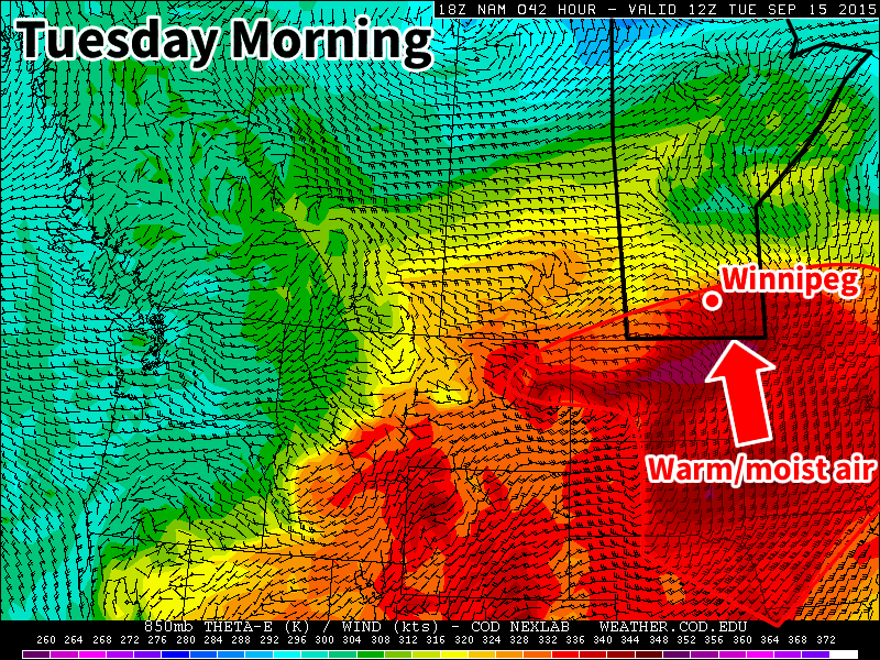
A push on warm, moist air on Monday night may trigger storms in southern Manitoba

Monday

Today will be near seasonal, with high temperatures around 20C and mainly sunny skies. Winds will light from the east. The main feature worth talking about for Monday’s weather is the risk of thunderstorms overnight. It appears most likely that storms will develop early Tuesday morning near the International border then drift north-east, but some storms may be possible on Monday night as well. The main threats will any storms that develop will be hail and heavy rain.

Tuesday

Tuesday will be a variable day across southern Manitoba. The Red River Valley and south-eastern Manitoba should be hot, with high temperatures in the upper twenties. On the other hand, western Manitoba will likely be cool, with temperatures staying stuck in the teens, along with a good chance of rain.

Wednesday

Wednesday looks to be a pleasant day in southern Manitoba with high temperatures in the low twenties. Winds should be light and skies should be mainly sunny!

Long Range

Long range models suggest normal to above-normal conditions are likely in southern Manitoba for the rest of September. That doesn’t mean we won’t see cooler stretches or weather here and there, but the general pattern should remain on the warmer side.
Cooler Week Ahead

This week will be significantly cooler than last week as we see cooler air filter down from the north. However, temperatures will remain at, or slightly above, seasonal values.

Monday

Today will see temperatures in the low to mid twenties under a mixture of sun and cloud. There may be a few showers throughout the day as we remain behind a departing low pressure system. Winds will be breezy from the south-west.

Tuesday

Tuesday will be a mainly cloudy day with a strong likelihood of showers. Despite the departure of Monday’s low pressure system, a large upper disturbance will remain to our north, helping to generate additional precipitation. Accumulations from these showers isn’t expected to be large, but the chance for more rain is definitely not welcome in most of southern Manitoba.

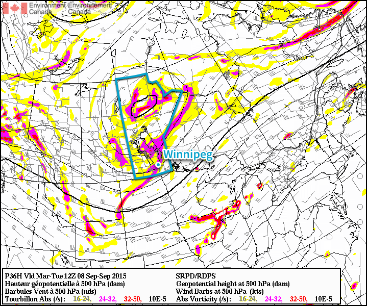
RDPS 500mb Heights & Vorticity for Tuesday Morning
Shown here by the RDPS 500mb forecast, a large upper-level low will impact much of Manitoba on Tuesday.

Wednesday

Wednesday will see very similar conditions to Tuesday. There will once again be a strong chance of rain, with accumulations perhaps a bit higher than Tuesday. This round of rainfall will be the result of a new system moving up from the northern United States.

Long Range

The long range forecast suggests we’ll generally see near seasonal conditions over the next week, which means high temperatures near 20C. At this point long range models suggest we may turn toward cooler conditions by mid-month, but it’s too early to tell if that will come to fruition.

Summer Isn’t Over Yet!

We’ll see more summer-like weather this week in Winnipeg and across the Red River Valley as it continues to feel more like July than the beginning of September.

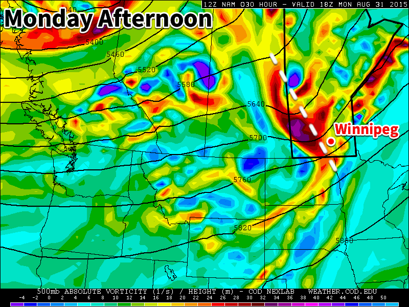
A shortwave trough (white dashed line) will pass through southern Manitoba on Monday, bringing clouds and a risk of thunderstorms.

Monday

Today will start out mainly cloudy as a potent upper disturbance moves through southern Manitoba. This disturbance may trigger some thunderstorms early on Monday morning, some of which could impact Winnipeg and the Red River Valley. Once the disturbance moves through, skies should clear, likely at some point in the afternoon. Temperatures will be in the mid to upper twenties with the wind becoming westerly due to the passage of this system.

Tuesday

Tuesday will be a nice day, as temperatures climb into the upper twenties under mainly sunny skies. Winds will be relatively light and from the south. No precipitation is expected on Tuesday, although some storms may develop overnight into Wednesday.

Wednesday

Like Monday, we may see some morning thunderstorms on Wednesday. A strong push of moisture from the south may help to trigger these storms. Should storms develop, they could be severe, but this forecast is still a few days away, so it could change. Besides the risk of storms, Wednesday will be hot and humid, with temperatures near 30C and breezy south winds.

Long Range

The long range forecast shows us cooling down after this week. Once a strong system passes through on Thursday temperatures will drop down to more seasonal values near 20C. Enjoy this little blast of heat while it lasts, it could be one of our last warm spells this year!

Slowly Warming Up

Conditions will slowly warm this week as the weekend’s potent weather system departs our region. Temperatures should return to seasonal values by midweek.

Monday

Today will remain on the cool side, with high temperatures in the upper teens. Winds will remain gusty as well, as we continue to deal with the stiff north-west flow behind the weekend’s low pressure system. Skies will finally become sunny however, which is a welcome change from the grey and rainy conditions of the weekend.

Tuesday

Tuesday will see temperatures warm further, with highs reaching the low twenties. Skies will remain mainly sunny and winds will be light making for a nice day.

Wednesday

Wednesday should see temperatures climb back toward seasonal, or even above-seasonal values. High temperatures will be in the mid to upper twenties as we return to a mild southerly flow. Skies may be somewhat variable due to the passage of an upper-level disturbance.