Seasonal Weather Returns

We’ll see seasonal weather return this week after a chilly weekend. Temperatures will climb into the mid to upper teens by midweek.
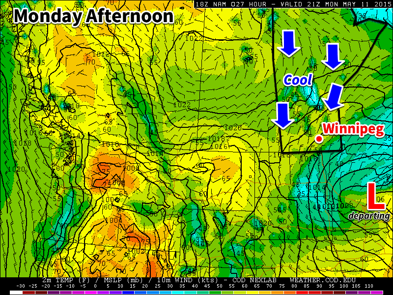
Monday will remain cool as we stay in a northerly flow behind a departing low pressure system

Monday

Today will remain below-seasonal, but temperatures will warm somewhat over the weekend’s values. High temperatures should climb into the mid teens in the Winnipeg and Brandon areas. However, areas closer to the US border will remain under thicker cloud cover and will struggle to reach double-digits. The wind will be brisk at 30 km/h from the north.

Tuesday

Tuesday will be a nice day, as temperatures climb into the mid/upper teens under mainly sunny skies. Winds will be light as high pressure settles in over the region.

Wednesday

Wednesday will be similar to Tuesday, but there will likely be a bit more cloud cover as a system passes to our south. Temperatures will be in the upper teens under a mix of sun and cloud and light winds.

Long Range

It appears that temperatures will continue to warm through the end of the week. However, long range models hint at another weather system passing to our south next weekend, which may once again draw down some cooler air from the north. In general, models suggest that our weather will hover near normal values for the next couple weeks.
Nice Start to the Week, Then Some Rain

This week will start out very nice, with temperatures in the twenties. However, a strong low pressure system will move in toward the middle of the week, bringing more unsettled conditions.

Monday

Today will be a great day in southern Manitoba. Temperatures will be near the 20C mark with sunny skies and light winds. There isn’t much else to say, enjoy the weather!

Tuesday

Tuesday will be another very nice day as temperatures climb into the low twenties, once again under mainly sunny skies. Winds will be from the south-east at about 20 km/h.

Wednesday

Wednesday will remain warm, but more unsettled conditions will begin to take hold in southern Manitoba. An approaching low pressure system is expected to bring rain showers to southern Manitoba late in the day and into Wednesday night. This system may bring us more significant precipitation on Thursday, but it is too early to speculate on potential rainfall amounts.

Long Range

It looks like we’ll see cooler weather late this week into the weekend as a much cooler air mass gets pulled down from the north. This push of cool air will result from the departure of this week’s low pressure system. Long range models suggest we’ll return to above-seasonal conditions at some point next week.

Showers to Start the Week

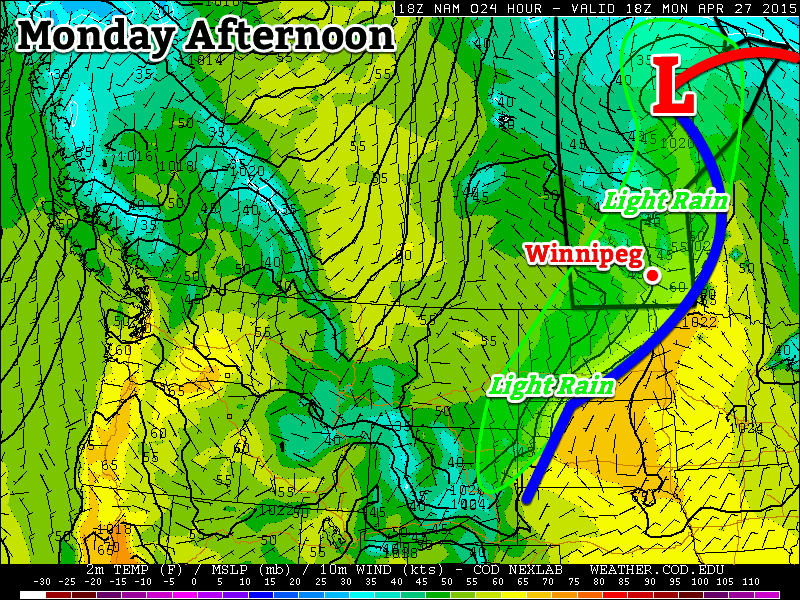
We’ll see some shower activity today as a frontal zone remains stalled through southern Manitoba. Conditions will improve rapidly by Tuesday however, as sunny skies return.

A frontal zone in southern Manitoba will bring some rain showers to the region on Monday

Monday

We will receive some light rain today as a frontal zone is draped through southern Manitoba. Rainfall accumulations will be small in general, not amounting to more than a few millimetres in most cases. Despite the rain, temperatures will climb into the low teens under mainly cloudy skies and light winds.

Tuesday

Tuesday looks to be a beautiful day as temperatures climb into the mid to upper teens under mainly sunny skies. Winds will remain as we sit under a surface high, making for very nice conditions!

Wednesday

Wednesday looks to be even nicer than Tuesday, as temperatures climb into the low twenties under mainly sunny skies. Winds will be a bit stronger than on Tuesday, but not by a lot. An approaching low pressure system will be responsible for pumping these increasingly warm temperatures into Manitoba.

Long Range

Weather models suggest we’ll continue to see above-seasonal temperatures for the remainder of the week. Further out into the long-range the forecast is a bit uncertain, so I won’t delve into that right now. Get out and enjoy what should be a great week (aside from Monday)!

A Change for the Cooler

This week’s weather will be significantly cooler than what we experienced last week as a upper-level system to our east pulls down chillier air from the north.

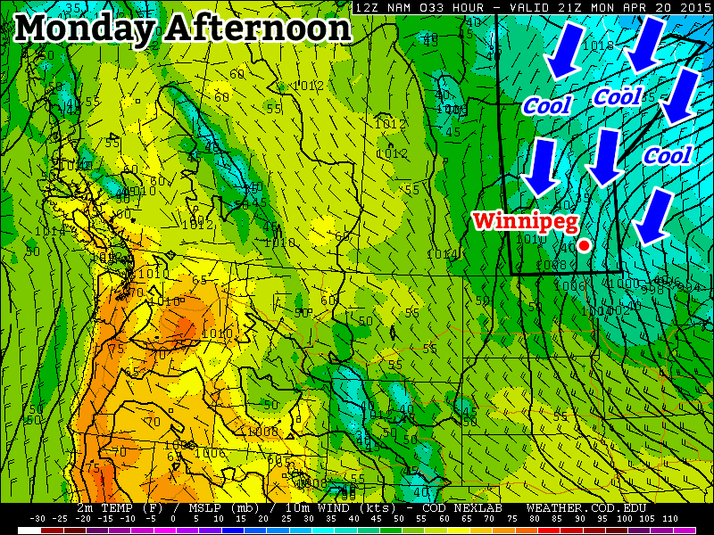
Cool weather will prevail on Monday under a stiff northerly flow

Monday

Today will be cool, cloudy, and precipitation-y. We’ll see some mixed showers and flurries throughout the day as a strong low pressure system exits our region. High temperatures will be in the mid single digits, meaning that even if it does snow it won’t stick around for long. Winds will be gusty due to the departure of that weather system, with values from the northwest of 40km/h gusting to 60km/h.

Tuesday

Tuesday will remain cool and breezy, but we will see some sun! High temperatures will be in the upper single digits under mainly sunny skies. Winds will be northerly at 20-30 km/h, making it feel on the chilly side.

Wednesday

Wednesday will be slightly cooler than Tuesday as more cool air pours in from the north. High temperatures will be in the mid to upper single digits, but skies will remain mainly sunny. Winds will be northerly at 20-30km/h once again

Long Range

The long range forecast suggests that this cooler pattern will stick around for at least the rest of the week. A persistent trough is expected to remain parked just to our east, meaning that cool air will be continually pumped into southern Manitoba during the short to medium-term. However, in the longer range this pattern is expected to break-down, ushering in a return of more seasonal conditions.