Beautiful Start to May

May is getting off on the right foot, with sunny skies and mild temperatures expected this week. No major precipitation is expected either, helping to continue the drying process after our heavy April rains.

Today will be one of the warmest days of the year thus far, as temperatures climb above the 20C mark. High temperatures in the 21-23C range are generally expected. Skies will be mainly sunny, with only some light upper cloud cover rolling through. Light winds and dry soil should develop superadiabatic profiles near the surface, helping to ensure we warm as much as possible today. There isn’t much else to be said about today’s conditions, so enjoy it!
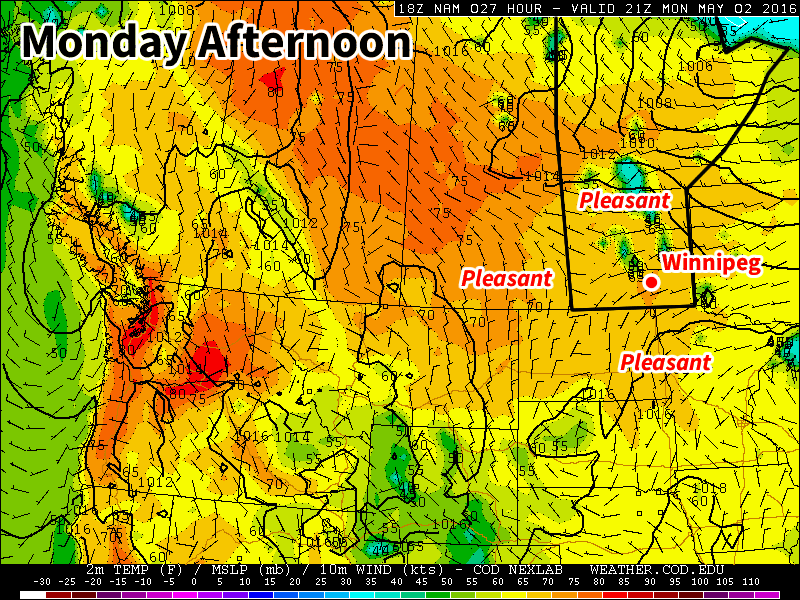
Very pleasant conditions are expected in southern Manitoba today

Tuesday will feature a slight cool-down as a cold front passes through early in the morning. You’ll notice that this front has passed because winds will be brisk throughout the day, with speeds of 40 km/h gusting to 60 km/h out of the north. Temperatures won’t drop too much though, with highs still expected to be in the mid teens under sunny skies.

Wednesday will see temperatures hovering in the mid teens once again, but the gusty winds from Tuesday will have died down. Skies are expected to remain sunny as we will be under the influence of a surface high pressure system.

Long Range

Long range models suggest that the first half of May will generally see above-seasonal temperatures. A large upper ridge is expected to remain over Western Canada, helping to keep our skies sunny and temperatures mild. There is no indication yet about how the second half of May will fare, but it appears the month as a whole will end up being warmer than normal.

Near-Seasonal Conditions Continue

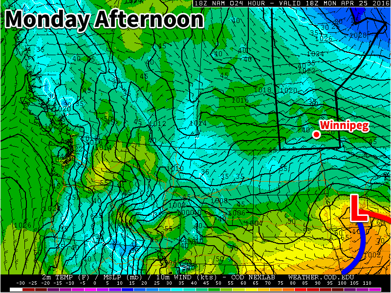
This week will feature near seasonal temperatures and a brisk easterly flow as a stalled upper low sits to our south.

Today will be mainly cloudy, as a low pressure system to our south spreads clouds and showers over southern Manitoba. The main shower activity is expected to remain near the International border, though a few showers may creep a bit further north. Temperatures will be in the low teens with easterly winds at 20-30 km/h.

A low pressure system will sit to our south on Monday

Tuesday will be much the same as Monday, with temperatures in the low to mid teens under mainly cloudy skies. No rain is expected in the Red River Valley, though some light showers may occur in western Manitoba. Winds will be easterly at 20 km/h.

Wednesday will likely see a bit more sun, with skies being a mixture of sun and cloud. High temperatures will be in the mid teens with winds out of the east at 30 km/h.

Long Range

The long range forecast suggests that we will see more above seasonal weather as we move into May. The remainder of April will likely see temperatures around seasonal values, with highs in the mid teens.

Finally, a warm-up!

We’ll finally see a warming trend this week after a nasty weekend of cold, windy, and snowy weather. The persistent trough over central North America will finally lift, allowing warmer air from the west to spill into southern Manitoba.

Today will be relatively nice compared to the nasty weather of the weekend. While temperatures will still be cooler than normal, today’s highs near zero will be pleasant since skies will be sunny and winds will be light. Not a perfect April day by any means, but definitely an improvement.

A warming trend will take hold beginning Tuesday

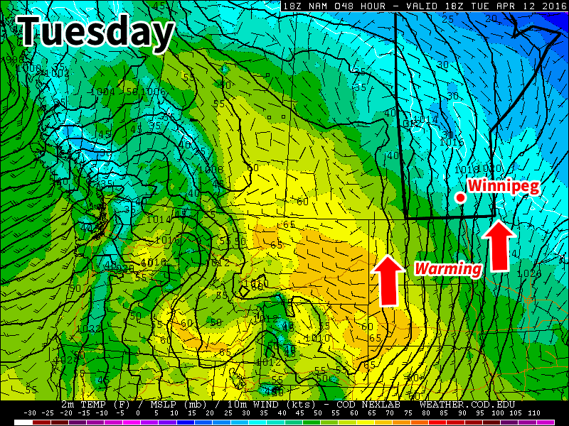
Tuesday’s weather will see us warm closer to seasonal values, with high temperatures in the mid to upper single digits across southern Manitoba. However, skies are expected to turn mainly cloudy as a weak upper disturbance passes through. Winds will also be gusty from the south at 30 km/h gusting to 50 km/h.

Wednesday is expected to be the first really nice day in awhile, as temperatures climb up around 10C under mainly sunny skies. Winds are also expected to remain light, making for a very pleasant day.

Long Range

There is still some uncertainty as to how warm it will be for the rest of this week. Some models put us close to 20C by Thursday, while others keep us down in the single digits. Time will tell exactly how warm we’ll get this week, but the general trend calls for warmer than normal conditions for the second half of the month.

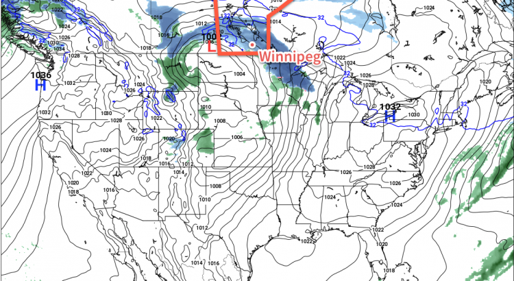
NAM Forecast Reflectivity w/Precipitation Type – 21Z April 5, 2016

Winter Ain’t Over Yet

Another bout of ugly winter weather is on the way this week as two back-to-back systems bring more snow to southern Manitoba.

Today will be one of the nicer days this week, although that’s not saying much. We should see mainly sunny skies and temperatures just below the freezing mark, which is almost 10C below normal for this time of year. Winds will be light as we’ll be stuck under a surface high pressure system.

A strong low pressure system will bring snow to southern Manitoba on Tuesday

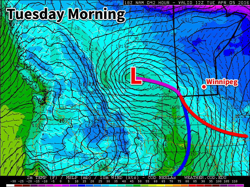
The weather will begin to turn ugly early on Tuesday morning as a low pressure system pushes snow into southern Manitoba. A band of moderate to heavy snow is expected on Tuesday morning as the system initially pushes into the region. This band will likely persist for only a few hours before snow rates become lighter. However, light snow is expected to continue off and on for most of Tuesday, pushing total snow accumulations into the 5-10 cm by the time this system moves out late on Tuesday. Gusty north winds are expected to develop on Tuesday night, causing poor visibility in open areas.

Wednesday will see yet another low pressure system bring additional snow to southern Manitoba. This round of snow is expected to push in later in the day, bringing another 2-6 cm by Thursday morning. It’s a bit early to be very confident in the amount of snowfall this system will bring, so check back for updates as the week progresses.

Long Range

The long range forecast doesn’t show any indication of improving weather for the next while. Conditions are generally expected to remain at or below normal for most of the first half of April. More snow isn’t out of the question either, so don’t take off those snow tires just yet!