Mild Early Week Weather

The weather this week will start out mild, with temperatures in the mid to upper single digits. However, cooler conditions are on the way later in the week, so enjoy it while it lasts!

Today will be pleasant, with temperatures in the mid to upper single digits over southern Manitoba. Skies will remain mainly sunny, with generally just some upper-level cloud cover passing through. Winds will be easterly at about 20 km/h.
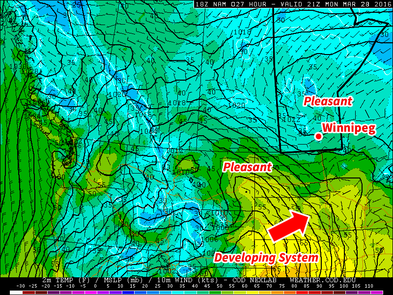
Pleasant conditions are expected early this week in southern Manitoba

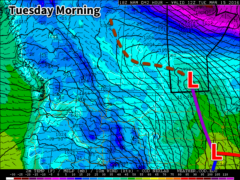
Tuesday will remain mild, with temperatures once again in the mid to upper single digits. A weak disturbance will bring a chance of flurries or showers to southern Manitoba; no significant accumulations are expected, but it will be a drearier day. To our south a much stronger system will be passing through the central US Plains, but it is not expected to significantly affect southern Manitoba. Winds will be northerly at 20-30 km/h.

Wednesday will be slightly cooler than temperatures earlier in the week, with highs in the mid single digits. Skies are expected to turn mainly sunny again though, making for a generally nice day. Winds will be northerly at about 20 km/h.

Long Range

The long range forecast is a bit uncertain at this time, but overall it doesn’t look great. Models suggest that a much colder air mass will surge down from the north late this week, bringing with it below seasonal temperatures. This colder pattern is expected to stay with us as we move into early April.
Staying Cool

This week will remain on the cool side, but temperatures won’t be far from normal.

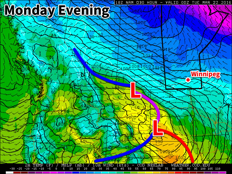
Today will be mainly cloudy with temperatures near the freezing mark. The main weather feature in the short-term will be a low pressure system passing to our south today. This system is expected to spread some light snow throughout southern Manitoba this afternoon into this evening. Accumulations in the Winnipeg region aren’t expected to be more than one or two centimetres, but areas closer to the U.S. border could see somewhat larger amounts. Winds will be from the east at 20-30 km/h.

A low pressure system passing to our south will bring a chance of flurries today

Skies are expected to gradually clear on Tuesday as a dry north-easterly flow develops over southern Manitoba. Temperatures are expected to be just below zero in most areas, which is slightly below seasonal for this time of year. Winds will be north-easterly at 20-30 km/h.

Wednesday will be mainly sunny, with temperatures again just below the freezing mark. A surface high pressure system is expecting to reside over southern Manitoba, allowing for those sunnier skies and light winds.

Long Range

The long range forecast shows generally seasonal to below-seasonal weather through the end of March. There are no large warm-ups currently in the forecast.

Winnipeg’s seasonal daytime high is currently 1°C while the seasonal overnight low is -9°C.

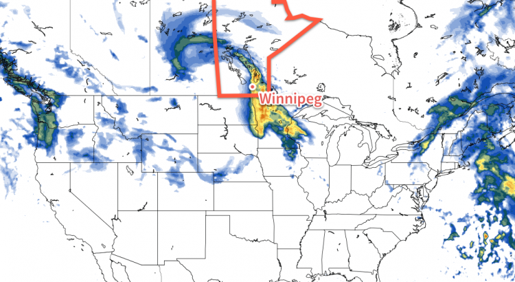
NAM Simulated Reflectivity valid 18Z Tuesday March 15, 2016

Major Storm System Looms

We’ll see one more nice day today before a potentially significant weather system affects us on Tuesday and Wednesday. Rain and snow is expected in southern Manitoba with this system, but exact amounts remain unclear.

Today will be another very nice day. Temperatures will climb into the mid teens over much of southern Manitoba, allowing our snow melt to continue. Many rural parts of southern Manitoba are already snow-free, but there is still snow to melt in sheltered areas. Skies will be mainly sunny, with breezy south-east winds.

A major low pressure system will affect southern Manitoba this week

A major low pressure system is expected to affect southern Manitoba on Tuesday and Wednesday. This system will bring a combination of rain and snow, which makes it difficult to forecast. At this time it appears that rain will be the main mode of precipitation over the Red River Valley. Models disagree widely on potential accumulation, so it is difficult to say exactly how much rain will fall. A “best guess” is that Winnipeg will see about 5-15 mm of rain. More or less rain could fall depending on how the system evolves.

We will continue to be under the influence of this system on Wednesday, but temperatures will fall as we experience a stiff north-westerly flow. As a result of this cold air surging in from the north, rain is expected to change over to snow, with a couple centimetres of accumulation being possible. The exact amount of snow will depend on how much the system stalls over our area and how much cold air manages to infiltrate southern Manitoba. High temperatures on Wednesday are currently expected to be near 2C, which would not favour large accumulations.

Long Range

The end of the week is expected to be colder as the system from earlier in the week pulls down colder air from the north. Longer range models suggest that the second half of March will see a cooler pattern with outbreaks of colder arctic air. However, if we remain mainly snow-free following this week’s system, it will be difficult for very cold conditions to last long as the darker soil will be able to absorb much more sunlight than snow would.

Mild Weather Continues

This week will remain mild with temperatures generally on the positive side of zero. However, there will be a chance for precipitation on Tuesday.

Today will see a continuation of Sunday’s warm weather. High temperatures will be in the mid single digits in the Red River Valley, and perhaps a bit higher over the snow-free area to our west. Skies over the Red River Valley will be a mixture of sun and cloud, while conditions over western Manitoba are mainly cloudy. The only wrinkle in today’s forecast is the potential for fog tonight, aided by the additional moisture generated by the snow melt.

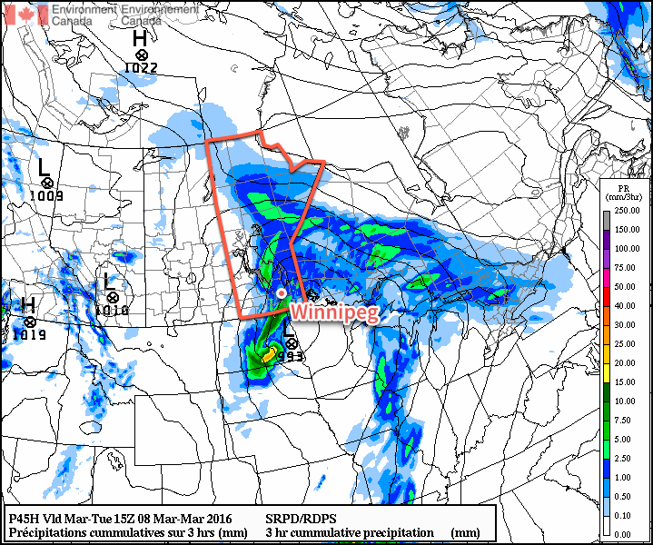
A low pressure will pass to our south on Tuesday, bringing rain and snow to southern Manitoba. At this point it looks like precipitation over south-eastern Manitoba will primarily come in the from of rain. The Red River Valley will probably see a mix of rain and snow, while western Manitoba sees primarily snow. Large amounts of rain/snow are not expected, but models hint at the potential for localized bands of moderate precipitation which could bump up totals in some areas. Most areas will probably see 3-6 mm of accumulation, in the form of rain and/or snow.

RDPS MSLP & 3hr. QPF valid Tuesday morning.
A weak Colorado Low will bring precipitation to the Red River Valley on Tuesday.

Wednesday will be a slightly cooler day as a colder air mass surges southward behind Tuesday’s departing low pressure system. High temperatures will be near the freezing mark with breezy north winds.

Long Range

The long range forecast shows no indication of winter returning. Models strongly suggest that most, if not all, of March will be seasonably warm. Enjoy the snow now, it may not last much longer!