Elsewhere in Weather News: June 7th, 2014

Large Hailstorm causes Millions in Damages

This past week featured severe thunderstorms that tore through the Nebraska countryside producing extremely large hail in the region. Conditions were primed for a severe weather outbreak this past Tuesday; moisture streamed up from the Gulf of Mexico, a strong jet streak was in place overhead and the environment was relatively uncapped. Convective Available Potential Energy (CAPE) was quite high that day which was a significant contributor to the large hail sizes observed. Generally the higher the CAPE, the faster the updraft velocity which means that the updraft can support larger hailstones. Supercell thunderstorms were triggered Tuesday afternoon and persisted through the evening, trailing along the warm front that bisected the region.

In total over 200 hail reports were submitted on Tuesday and of these 38 were considered large hail reports (hail of 5cm in diameter or larger). The most damage caused that day appeared to come out of the town of Blair, Nebraska where hail caused major damage. Windows were blown out and car windshields smashed by the baseball size hail that fell – damage totaled in the hundreds of millions. Other storms along the warm front, the weather feature that triggered the severe weather, moved into the Omaha area not only bringing hail, but also torrential downpours. 13.5mm of rain was recorded in 3 minutes at the Omaha airport!
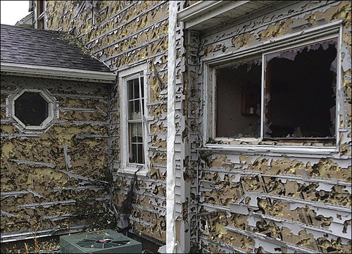
Hail damage in Hoover, NE shows the strength of baseball size hail, completely shredding the siding and breaking the windows. (Source: Kevin Krohn)

There is a possibility for more severe storms this weekend in Texas and New Mexico, but the parameters are not as as favourable for severe weather as seen this past Tuesday in Nebraska. Models show the active pattern continuing in the US Plains into next week, and rightfully so as severe weather season nears its peak.
Elsewhere in Weather News: May 31st, 2014

Saskatchewan/Manitoba Border Chase – May 29th, 2014

Three quarters of the A Weather Moment team (plus a U of Manitoba student) went storm chasing on Thursday. This is a summary of what happened, written by Scott.

We left Winnipeg around 11am and drove straight to Brandon, arriving by 1:30pm. Once in Brandon we made our obligatory stop at Subway and reassessed the situation. We figured from Brandon we’d have to go west for sure, but the question was whether to go straight west, north-west, or south-west. We opted to not commit, and just drive another 45min west to Virden to reassess there again.

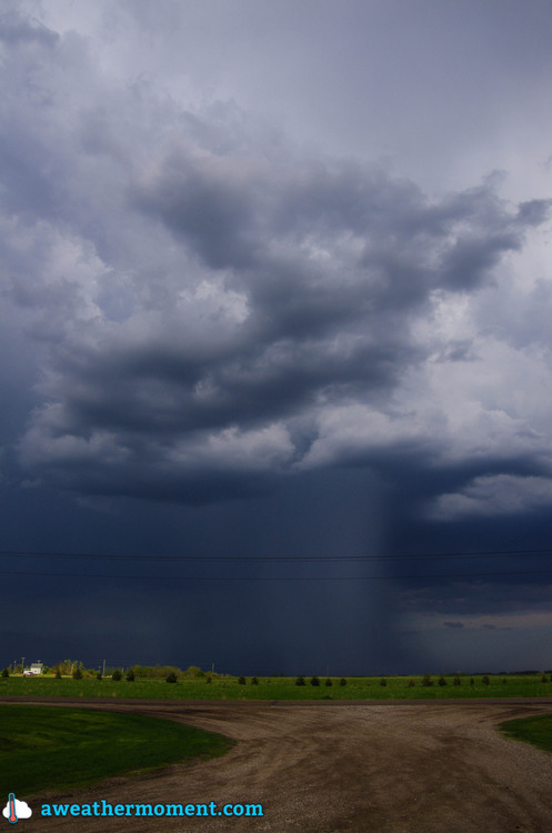
While in Virden we noticed a decent looking cell coming out of Saskatchewan, but it was expected to move well north into the Riding Mountains. We drove toward it a bit in case it decided to right move, but of course it did not (it was heading into the forest), so we then backtracked to Virden. On our way back we saw some good activity developing near Melita, so we went to investigate that. Upon arrival in Pipestone (just north of Melita), we got a clear view of that Melita storm, but it was featureless and high based…yuck. It then appeared that there were some supercellish structures coming out of Saskatchewan, so we figured we’d check them out. The surface winds in their vicinity had already switched to westerly, but we figured if they moved into Manitoba quickly enough they might have a chance. However, we quickly found out they were already too far behind the front for that to happen. So that was that, no supercells for us! We then turned around and started heading for home.

High based storm near Pipestone; featureless with a rain/hail shaft. (Taken by Matt)

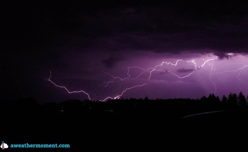
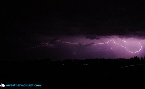
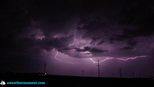
As we drove back, a couple of core punches were performed around Brandon to get through a line of storms. Upon reaching the other side of the line near Carberry it was getting dark, so we decided to stop for lightning pictures – good idea. The lightning was beginning to pick up and some CG strikes were noted. It then began to rain and we moved east again to Portage and stopped for more pictures – very good idea! In Portage there were powerful CG strikes every 5-20 seconds (roughly), which made for many really great pictures. We took pictures there for a while, but then it started to rain again, so we moved east again, this time to Oakville.

Fork lightning south of Portage. (Taken by Matt)
Overall, it was a disappointing day for daytime storms, but the nighttime lightning made up for a lot of that. Even though the storms weren’t that great, it was still a fun day just chatting and joking about our misfortune. It’s only May after all, so we’re still in a bonus month for storms as far as I’m concerned.

Elsewhere in Weather News: May 24th, 2014

Balkan Flooding Could be Billion Dollar Disaster

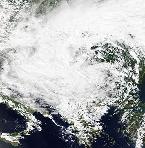
This past week the full effects of the Balkan floods have been coming to head as floodwaters retreat. The Balkans are located in Southeast Europe just to the east of Italy across the Adriatic sea. The flooding event which started on May 14th and lasted up until Saturday May 17th, caused the most severe flooding to Serbia and Bosnia. The flooding was caused by a deep low pressure system which moved from the Adriatic Sea and stalled for a few days over the Balkan Peninsula. The low was not only able to tap into a great amount of moisture but also use the mountainous terrain to its advantage. By forcing air up the mountain, the air then cools, condenses and subsequently falls as precipitation; this is also called orographic lift.

Low spinning just northwest of the Balkan Peninsula bringing heavy rain to the region. (Source: NASA)

Several towns from both countries were severely hit from this event including Belgrade, the capital of Serbia, where a whopping 205mm of rain fell and broke the previous record (175mm) from 1897. Across both countries, over 2,100 landslides were reported and the Bosna River also overflowed its banks inundating numerous large cities (Doboj, Maglaj). Unfortunately 55 people died in the event as well as large amounts of livestock. In total over one million people in the region have been affected. The magnitude of the damage to the infrastructure is significant – 3,000km of roads have been damaged or washed out as well as about a third of all railroad lines. This is likely to be counted as a billion dollar disaster.

Search and rescue efforts have eased in the region this past week and the next phase will be the cleanup. Weather looks to be variable in the coming days as popup showers and thundershowers are possible in the afternoon hours.

Elsewhere in Weather News: May 17th, 2014

Wildfires Torch California, Helped by Strong Winds and Drought

This past week several wildfires have been burning out of control in San Diego County, just north of San Diego. It is not known whether any of the fires were started intentionally or not, however, the weather has played a significant role in hampering firefighting efforts. As of Friday evening there were four wildfires burning in the county which were all over 1,000 acres in size, and only one of these four was above 25% contained. There are two main points to note of as to why weather has played such a significant role in fueling the fires.

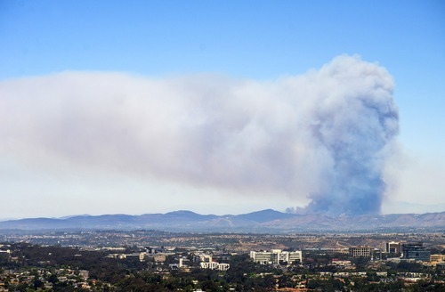
A large pyrocumulus cloud could be seen on Wednesday from San Diego looking towards the Cocos San Marcos fire. (Source: Mashable/Kent Horner)

The Santa Ana Winds are the first to have a big impact on wildfires currently burning out of control in Southern California. These winds occur when air blows towards the Pacific Ocean from the mountain ranges to the east. As the air descends the mountain sides it warms and its relative humidity decreases causing for hot and dry winds. This past week, relative humidity as low as 3% was observed by stations in southern California, coupled with winds of 50km/h, this produced prime wildfire conditions. The second reason as to why the wildfires have been difficult to contain is the current drought situation in the region. A large ridge of high pressure has been persistent over the west coast for most of this past winter and part of this spring, making precipitation difficult to come by. The drought index currently indicates that an extreme drought (second highest tier) is occurring in the region where the fires are burning. In turn, the wildfires have little trouble spreading to moisture-starved vegetation and dried out brush.

This weekend offers a mixed-bag to firefighters. Strong winds and scorching temperatures will persist during the day, but winds will now be out of the west causing for slightly moister air coming onshore from the Pacific. Regardless, the Storm Prediction Center maintains an “elevated” fire risk for this weekend.