Elsewhere in Weather News: February 8th, 2014

Massive Ice Storm Paralyzes Slovenia

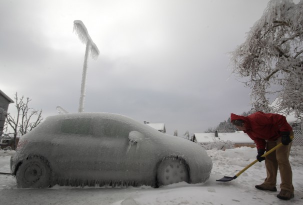
A massive ice storm crippled a large part of the Central European country of Slovenia earlier this week. Freezing rain accumulations of 100mm wrecked havoc, encasing all unheated surfaces in a thick layer of ice. The ice brought down power lines, fell trees, and froze vehicles in place, leaving at least 50,000 houses without power at one point. Slovenian authorities estimate that the storm caused at least $89 million in damages and destroyed 40% of Slovenia’s alpine forests. The pictures coming out of Slovenia from this event are extraordinary:


  • A car encased in ice
    A car encased in ice.
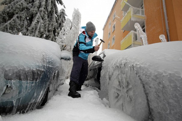
  • A man chips the ice off his car in Postojna, Slovenia
    A man chips the ice off his car in Postojna, Slovenia.
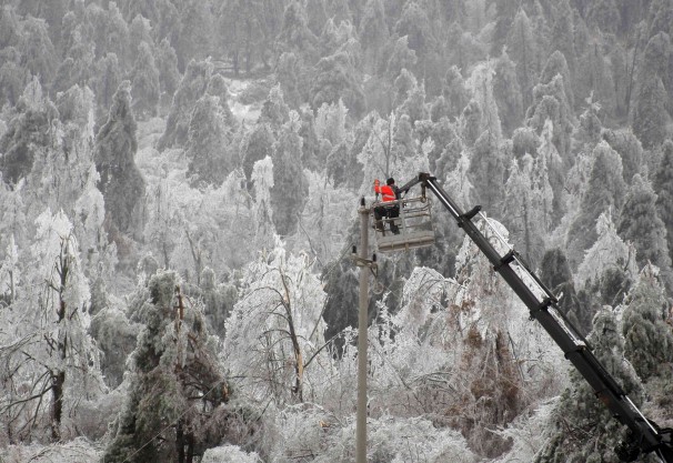
  • Forests were severely damaged by the ice storm.
    Forests were severely damaged by the ice storm.
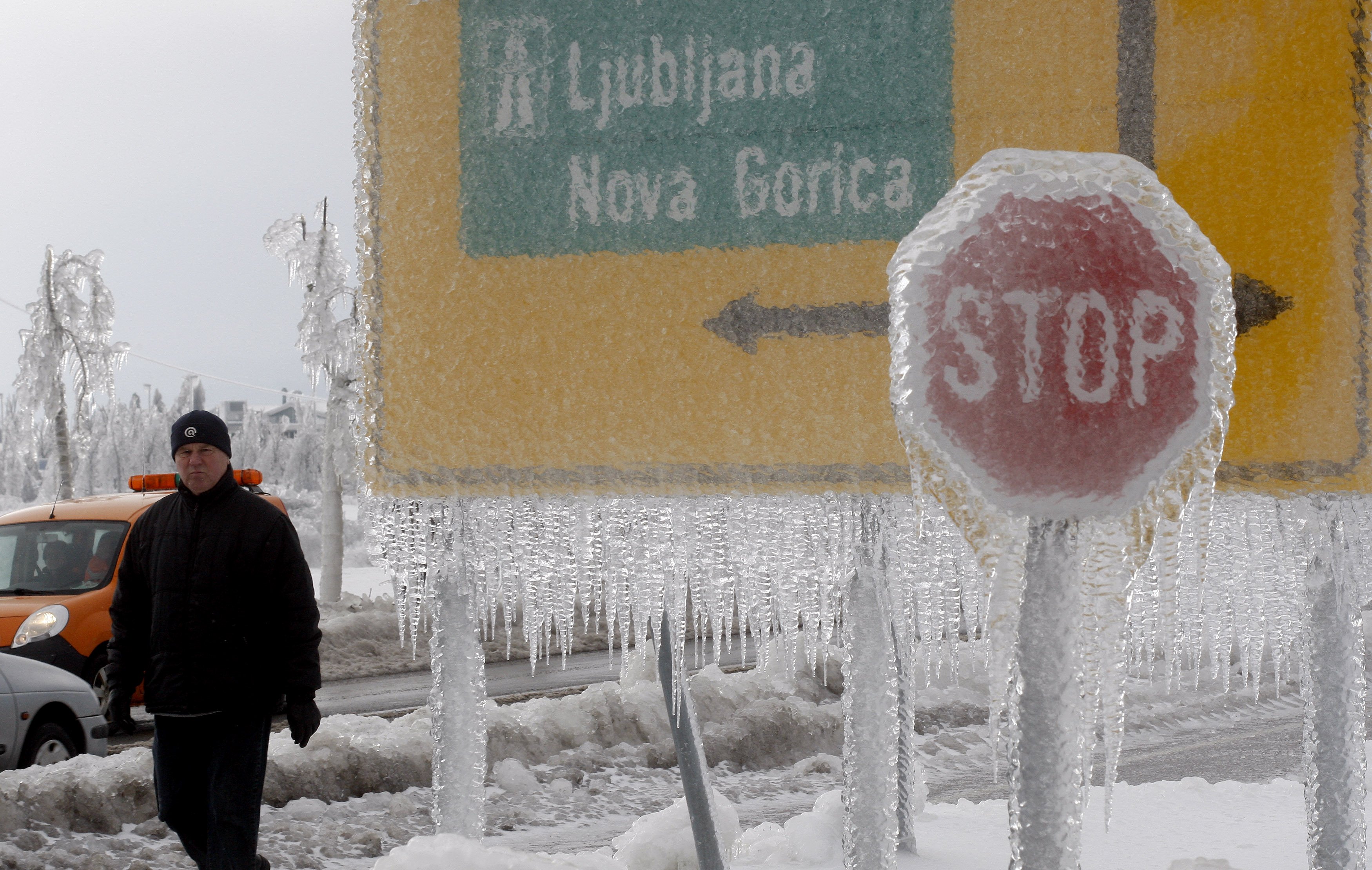
  • Road signs coated in a thick layer of ice.
    Road signs coated in a thick layer of ice.

Freezing rain is a common weather phenomena, but for it to occur on this scale is rare. In most situations, freezing rain occurs ahead of a warm front as warm, above-freezing air overrides a shallow layer of below-freezing air near the surface. As snowflakes fall through that warm above-freezing layer they melt into rain drops. This allows it to rain, since those rain drops don’t have a chance to refreeze before hitting the surface. However, once this rain strikes the surface, it freezes instantly, forming a layer of ice. Usually the warm front that causes the freezing rain will be moving, preventing the freezing rain from sitting over one area for a prolonged period of time. However, in some situations the warm front will stall out, or move parallel to an area, causing freezing rain to persist for an extending period of time. In the case of Slovenia’s ice storm, it appears a slow moving weather pattern allowed the freezing rain to sit over the same area for an extended period of time, generating the large ice accumulations seen above.

Sources:

http://www.businessinsider.com/photos-of-ice-storm-in-slovenia-2014-2
http://www.washingtonpost.com/blogs/capital-weather-gang/wp/2014/02/07/craziest-ice-storm-photos-youll-ever-seen-from-slovenia-photos/

Elsewhere in Weather News: February 1st, 2014

Southeast US Paralyzed by Storm

On Tuesday a large trough was in place over the eastern half of the US. The longwave trough extended all the way down to the southeastern states and brought adverse weather conditions along with it. This trough did not produce the typical severe weather the southeast would see around this time of the year; thunderstorms and flooding rain, but produced an event featuring snow, ice pellets and freezing rain.

Arctic air flooded in behind the cold front all the way down from Texas to the Gulf of Mexico to Florida, providing good environment for freezing precipitation right behind the front. Freezing rain fell as far south as Pensacola in the Florida panhandle where over 200km of interstate had to be shut down because it was deemed to be too dangerous for travel. The last time Pensacola saw snow was 2010 – it melted the same day it fell. In comparison, Atlanta saw a trace of snow in 2008. This time around the city received 6cm, which snarled traffic on the commute back home. Officials decided to not cancel schools and students were stranded in schools and buses overnight until the next morning. Commuters were in the same situation, being stranded on roads overnight as many commuters are not accustomed to winter weather leading to many accidents. The sub-freezing temperatures across the Deep South also wreaked havoc, bursting water pipes above ground.

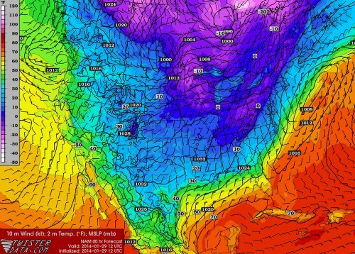
Wednesday morning surface temperatures. Freezing temperatures can be seen reaching all the way down into Mexico and the Deep South. (Source: Twisterdata)

Medium range models continue to show cold air entrenched across the Canadian Prairies and most of the United States, even infiltrating into the Deep South again next week. A persistent ridge off the West Coast, partially associated with the well above normal temperatures in the North Pacific, can be blamed for the persistent troughing and Arctic air over Canada and US the past few weeks. Longer range models do show the ridge eventually breaking down in a week but this remains to be seen as it’s still a long ways out.

Elsewhere in Weather News: January 25th, 2014

Flooding Problems Return to Philippines

It has been just over two months since typhoon Haiyan ravaged the Philippines and yet another tropical system has swept across the Philippines this past week to cause problems. Agaton, which was only rated a tropical depression bearing winds of 55km/h, was very slow-moving at only 5km/h towards the west. This was mainly due to high pressure to its west-northwest blocking its movement. In turn, severe flooding and landslides over the mountainous terrain was possible as the storm churned over land and was able to drop large amounts of rain at the same time.


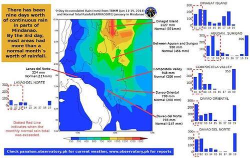
The Manila Observatory posted a compilation of rainfall amounts between January 10th to 19th in the Mindanao region. (Source: Manila Observatory)
The Manila Observatory posted a compilation of rainfall amounts between January 10th to 19th in the Mindanao region. Click on image to enlarge. (Source: Manila Observatory)

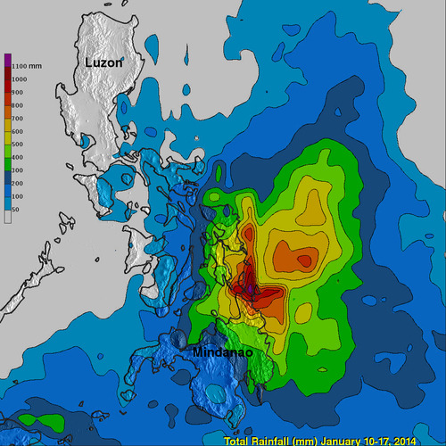
The bulk of the rain passed south of the areas ravaged by Haiyan, affecting the provinces of Suriago, Agusan, Leyte and various others. Rainfall rates between 10-50mm/h were observed on radar but in the strongest convective bands reached up to 140mm/h. Total accumulations for the week reached over 1200mm (1.2m) in the hardest hit areas of northern Mindanao where the average January rainfall is 370mm! Unfortunately with this extreme rainfall came flooding and landslides which contributed to 42 deaths and has displaced 129,000 people.


Total rainfall for Philippines between Jan. 10th and 17th, while Agaton was affecting the region (NASA-TRIMM image). (Source: NASA)

After making landfall Agaton slowly weakened and was downgraded to a low pressure system. This weekend it is no longer a threat to the Philippines.

Elsewhere in Weather News: January 18th, 2014

Severe Californian Drought

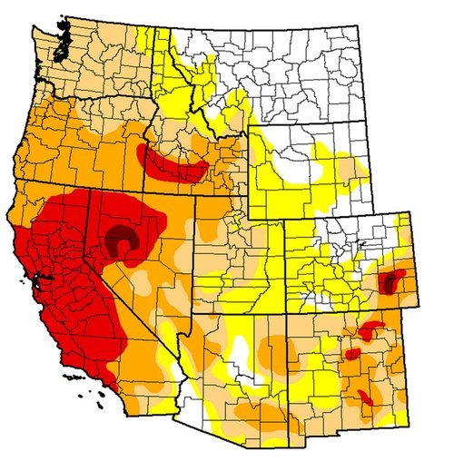
A severe drought has settled into a good part of the state of California and is starting to be of concern to residents as numerous brush fires have been sparking up this past week. A strong upper level ridge which has persisted over California for a good part of the past month has diverted all low pressure systems well north into BC. With this, a large area of California has been left dry and drought conditions have worsened significantly in the past month. The Drought Index shows that levels have reached extreme for over 50% of California, including Los Angeles. Los Angeles, on average, receives 80mm of rain during the month of January but they have yet to record any rainfall this January. To make matters worse, no pattern changes are in the forecast; the ridge is expected to remain in place at least until the end of January. Models show no precipitation in the foreseeable future for the southern half of California, which means that Los Angeles has a possibility of going the whole month of January without any precipitation.


Drought Index for the West Coast, ranging from abnormally dry (yellow) to exceptional (dark red). A good chunk of California is under extreme (red). (Source: USDA)

The snow pack in the Sierras has shown telltale signs of drought with only having 20% of the average snow water equivalents for this time (about 25mm of SWE). In this tweet sent out by the Boise NWS a drastic comparison in the snow pack can be seen over the Sierras. If no significant precipitation arrives before spring, California will be setting itself into a long-term drought.

A drought emergency had been issued for California, asking residents to limit their use of water. Bushfires have been flaring up due to the dry conditions, including the Glendora fire which is a fire that started on Thursday and has already burned 1,700 acres east of Los Angeles. Santa Ana winds gusting to 35km/h have been fueling the fire and will continue to do so until tomorrow, making it difficult for crews. Relative humidity in the area has a chance to dip as low as 5% during the day – making for ideal wildfire conditions. This has prompted the National Weather Service to issue a red flag warning east and northeast of Los Angeles.