Warmer, Windier Weekend Ahead

The coming weekend brings both warmer temperatures and windier weather to Winnipeg alongside a mix of cloudy and sunny days. Fortunately, it appears that any rain or snow will hold off until the end of the weekend.

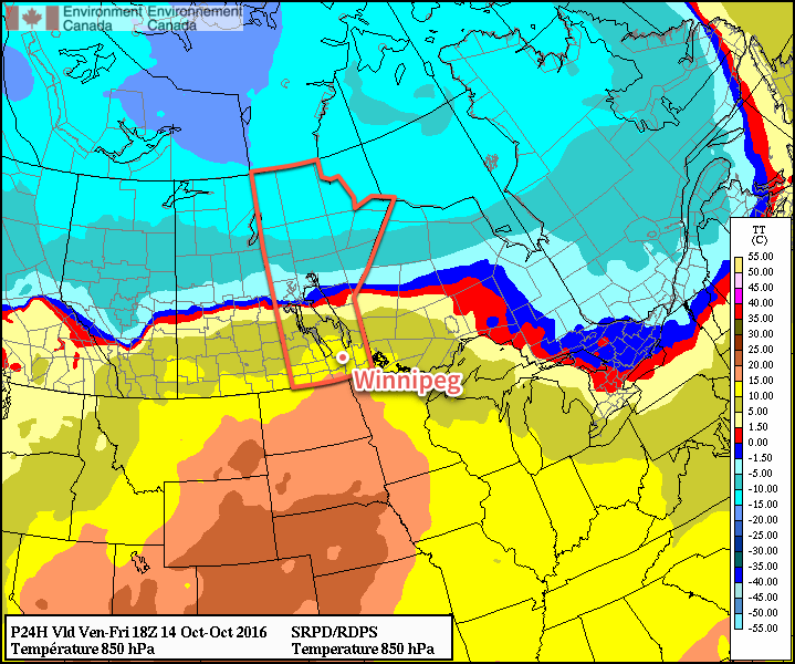
Today will mark the first wave of warmer temperatures moving into the Red River Valley as a low pressure system moving across the central Prairies brings gusty southerly winds to the region that draw warmer air northwards. Temperatures will climb to a high near 15°C today under more cloud than sun as winds pick up out of the south to 30-40 km/h with gusts on top of that. Plenty of cloud will be streaming overhead through the day; it won’t likely be completely overcast all day and the sun may poke out occasionally, but overall there will be more cloud than sun.

Warmer air will be pushing northwards across the eastern Prairies today.

Expect a low tonight near 10°C under mostly cloudy skies with winds out of the south at around km/h.

Saturday will be a beautiful day with cloud clearing in the morning, leaving a mainly sunny day behind with a high near 16°C and westerly winds of 20-30 km/h. Skies will remain clear on Saturday night with a low near 2°C.

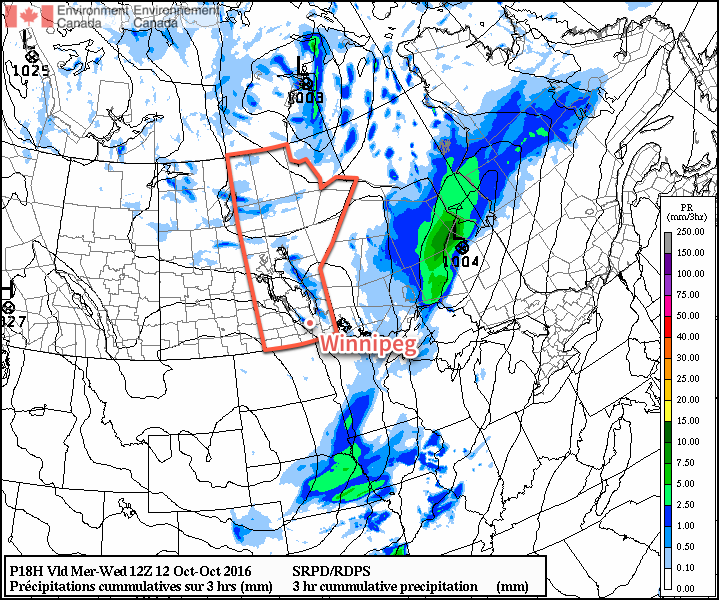
The weather will start to turn on Sunday, but it will still be a fairly nice for a good portion of the day. Cloud will begin moving in through the morning hours as winds pick up out of the southeast to 30-40 km/h with gusts on top of that once again. Temperatures will climb to a high near 11°C before an area of rain begins moving through the Red River Valley in the mid- to late-afternoon.

Some weather models, such as the NAM pictured here, are giving Winnipeg as much as 10-15mm of rain on Sunday evening.
The rain will taper off late Sunday night as temperatures head to a low near 7°C.

Long Range

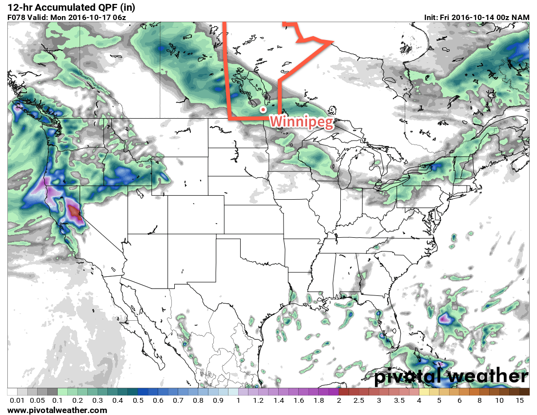
The start of next week looks fairly unsettled with more showers possible on both Monday and Tuesday. Below-normal temperatures seem likely to return mid-week.

Winnipeg’s seasonal daytime high is currently 11°C while the seasonal overnight low is 0°C.

An Improvement In The Weather Ahead

I can't speak for others, but I think I've nearly forgotten what the sun looks like. Fortunately, a reminder is on the way as the persistent cloud that's been locked into the region for so long will be exiting stage right. While it'll take several days until temperatures climb back to seasonal values, the sunshine alone will be a much welcome change.

This morning will start off with some remnant cloud in the Red River Valley–particularly in areas downwind of the lakes where flurries will be possible–but the cloud will clear through midday, with plenty of sun appearing. It will be chilly, though, with temperatures climbing only to around 6°C. A hard freeze is on the way tonight as temperatures drop to -2 to -3°C under mainly clear skies.

A few flurries are possible in Winnipeg on Wednesday morning from a streamer off Lake Manitoba.

Thursday will be a mainly sunny day with a high near 8°C. Winnipeg will likely see a few afternoon clouds, but otherwise no significant weather is expected. Temperatures will dip to around 2°C on Thursday night.

Breezy southerly winds on Friday will bring warmer temperatures back to the region with daytime highs topping out around 14°C. This warmer air will also come with a fair amount of cloud, though, with mixed to mainly cloud skies in place over the Red River Valley. The winds will be notable, though, increasing out of the south to 30-40 km/h in the afternoon.

Above-normal temperatures (red) will push into Southern Manitoba on Friday.

With a warmer air mass in place, temperatures will be milder on Friday night with a low near 8°C.

Long Range

The weekend looks milder with seasonal to slightly above-seasonal temperatures in the Red River Valley. A major low pressure system will track through the region, however the precipitation associated with it should remain north of the Trans-Canada corridor, falling primarily across the Parkland, Interlake, and portions of Central Manitoba.

Despite not expecting much precipitation, we'll probably see a fair amount more cloud associated with the warmer weather, so enjoy these sunny days while we have them!

Winnipeg’s seasonal daytime high is currently 11°C while the seasonal overnight low is 0°C.

Cool Weather Starts The Week

This week will remain on the cool side as we continue to deal with chilly air flooding down from the north.

Cool air will continue to push down from the north today

This Week

Today will be another cool one in southern Manitoba. High temperatures in the upper single digits are expected with breezy north winds. A weak low pressure system will pass through the region, perhaps bringing a few showers to southern Manitoba. Portions of western Manitoba and the Interlake may receive some heavier precipitation, with periods of light to moderate rain possible. There may even be some snow mixed in, especially as temperatures cool in the evening and after dark.

Tuesday will remain cool, with temperatures once again in the mid to upper single digits across southern Manitoba. Skies will be mainly cloudy with a slight chance of a shower or flurry. Winds will be breezy out of the north at 20 km/h.

Cool weather will continue on Wednesday as high temperatures only climb into the mid single digits. Skies will remain mainly cloudy with a slight chance of showers or flurries. Winds will be westerly at 20 km/h.

Long Range

Medium- to long-range models suggest that above-normal weather may make a come back as we move toward mid-month with temperatures that may begin to climb back to normal or above-normal values by the weekend and continue into next week. This should stave off the risk of any significant snow for the foreseeable future.

Chilly Weekend Ahead

Cool, unsettled weather will dominate the weather for much of the coming few days as a northwesterly flow of Arctic air puts a damper on the weekend.

The chill northwesterly flow will be in place for today and tomorrow, keeping temperatures well below normal and spreading plenty of clouds across the region and bringing several chances for showers or flurries. High temperatures will sit near 6°C and 8°C tomorrow, with overnight lows near 1°C both tonight and tomorrow night. Winds will be breezy today out of the west at around 30 gusting to 50 km/h and lighter on Saturday.

A smattering of showers and flurries are expected across Southern Manitoba today.

Today will bring widespread showers or flurries to Winnipeg & area today, with enhancement in the lee of the lakes leading to isolated bands of heavier precipitation. The unsettled weather will diminish overnight until all that’s left into Saturday morning is some streamer activity off of both Lake Manitoba and Lake Winnipeg. There’s a slight chance that the lake-effect activity will clip through Winnipeg Saturday morning, but otherwise it should be cloudy & fairly dry.

A new disturbance will move into the region on Sunday, shifting winds out of the south and spreading some light rain across much of Southern Manitoba. Temperatures will climb a bit higher than they’ve been lately with a high near 11°C, but winds will be a bit breezy out of the south.

Long Range

Cooler weather will persist into the start of next week, but hope is on the horizon.

NAEFS Temperature Anomaly Forecast valid October 14 to October 21, 2016.

Models are all very consistent in building a fairly substantial upper ridge into the United States, bringing slightly above-normal temperatures for next week and fewer chances for precipitation.