Winnipeg Hammered By Torrential Rain; Thunderstorm Threat Continues Through Weekend

Portions of Winnipeg experienced a tremendous amount of rainfall yesterday evening as a thunderstorm developed over the southern half of the city and sat in the same spot for over an hour. While many areas in the city saw less than 10mm of rainfall, reports of localized flooding were numerous as rainfall rates that climbed as high as 300mm/h dumped between 50–80mm of rain over a small area of southwestern portions of the city.

image-1

24hr. rainfall accumulations from Thursday evening. Given that we had no significant precipitation on Wednesday in Winnipeg, this is effectively the rainfall accumulations for Thursday’s thunderstorm in Winnipeg. Amounts outside Winnipeg wiil be representative of the full 24hr. period.

The storm moved into Winnipeg around 7:15PM Thursday evening as a small thunderstorm southeast of the city near Ils Des Chene moved northwestwards toward another thunderstorm stationed over Headingly that had been warned for producing heavy rainfall in that area. By 7:40PM, the storm west of the city merged into the storm inside the city and intensified. At this point, everything stopped moving.

image-2

Flooded Roads on Sterling Lyon Parkway; Photo courtesy @shelzolkewich.

In an area roughly bounded by McGillvery Blvd., Pembina Highway and Portage Avenue, the rain simply kept coming and coming. Numerous reports started showing up under #MBstorm on Twitter. Early on it was clear that areas near Kenaston & the Sterling Lyon Parkway were being hit very hard with photos coming in showing flooded roads with water as much as just over a foot deep.

Reports began to come in of actual rainfall amounts, too. @robsobs, a very reliable source for rainfall data in SW Winnipeg (as well as the person who runs the excellent Rob’s Blog reported a peak rainfall rate of 300mm/h under the heaviest rainfall. Near the end of the event, he reported a total of 69mm that fell over the course of 2 hours:

In addition to roads being flooded, there were numerous reports of ditches & pools overflowing. The heavy rainfall also impacted one of Winnipeg’s newest and largest stores: IKEA. The IKEA on Kenaston was evacuated yesterday evening as water began pouring into the main floor of the store:

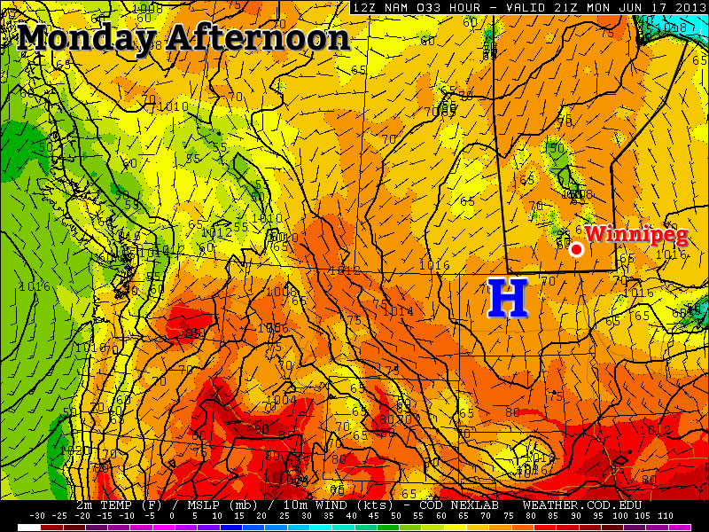
It may not have seemed like a day where severe weather was likely since skies were mostly cloudy through the day and temperatures climbed only into the mid–20’s. There was plenty of moisture building into the region, though, and many of the conditions we look for with convection were in place.

image-3

Another shot of the flooding on Sterling Lyon Parkway. Photo by @tracylkj.

While we didn’t have enough sunshine to get the storms started, a strengthening trough of low pressure laying across the Red River Valley managed to initiate storms which then fed off the abundant low-level moisture and produced just one significant storm that impacted Headingly and Winnipeg. The Winnipeg region was included in our Slight Risk area on Thursday morning.

Friday


26°C / 16°C
A mix of sun and cloud. Small chance of thunderstorms in the afternoon & overnight periods.

Today will be a warm, humid day with temperatures climbing once again to around 25–26°C and with dew points hovering in the 18–20°C range. Once again we’ll see a risk of thunderstorms develop in the afternoon as the atmosphere destabilizes. The key ingredient for today’s threat will be our daytime high. If dew points stay close to 19 or 20°C and we can get to 27°C, we’ll see a much greater chance of thunderstorms than if the dew point is closer to 18°C and we stay near 25 or 26°C. Should storms develop in the Red River Valley, they’ll see a potent environment to develop in with substantial instability aloft and CAPE values of nearly 2500J/kg. The big limiting factor in their development will be the near absence of shear. The wind will be extremely light below 500mb which will make it very difficult for storms to develop the structure required to make them long-lasting entities. As such, any storms that develop in the afternoon will likely be pulse-type storms whose main threats would be heavy rain and/or large hail.

By the evening another round of elevated convection looks to fire up and lift northwards. It may end up west of, over, or east of the Red River Valley. It’s simply too early to tell at this point. We’ll be sure to update our thoughts below as things become more clear. We’ll head to an overnight low of around 16°C tonight.

The Weekend

Saturday

23°C / 14°C
A mix of sun and cloud. Chance of a shower.
Sunday

23°C / 12°C
Mainly cloudy. Showers or thunderstorms likely.

We’ll see the main upper low that’s been pulling moisture northwards and setting up our instability begin to work it’s way eastwards through the Prairies this weekend. Saturday actually looks to be a fairly nice day; dew points will drop towards the mid-teens and we’ll see a slightly cooler high of around 23°C under a mixed sky. There will be a slight chance of showers as a trough swings through, but things seem stable enough that they would be fairly scattered and light. Saturday night will see some cloudy periods with a low of around 14°C.

On Sunday we’ll likely see showers and thunderstorms as the upper low moves over us. Things will destabilize under the upper low early in the day and the relatively warm, moist air mass should have little trouble supplying enough instability and moisture to get things going. No severe weather is expected. Sunday will mark the return of dryer air into the Red River Valley.

Thunderstorm Threat Ramps Up Over Southern Manitoba

A broad shift in the jet stream is set to bring an influx of moisture from the Gulf of Mexico northwards into Southern Manitoba while a southwesterly flow aloft sets up bringing multiple upper-level disturbances & instability over the region. The increased moisture, combined with the relatively unchanging southwesterly flow will set us up for multiple days with a significant thunderstorm risk over the southern portion of the province.

Wednesday

Wednesday

26°C / 15°C
Afternoon clouds; chance of showers/thunderstorms.

Today’s weather will be dominated by an approaching warm front from Saskatchewan. We’ll might see few showers exiting the Red River Valley this morning – left over from some weak nocturnal convection – with plenty of sun through the morning. The sun will heat things up fairly quickly and there’s a chance we’ll see some showers or thunderstorms develop early-to-mid afternoon as we warm up. Any storms that develop today will not likely become severe; a majority of the shear will be isolated in the upper levels and the complete lack of low-level shear may even be substantial enough to inhibit storm development. We’ll drop to an overnight low of around 15°C as we head into a busy end of the week.

Thursday

Thursday

25°C / 16°C
More cloud than sun; getting humid. Showers or thunderstorms likely.

Thursday presents Southern Manitoba with plenty of heat and rising humidity as the day progresses. We’ll see a high of nearly 26°C while the dew point climbs into the high teens through much of the Red River Valley by the end of the afternoon. Whether or not that humidity will make it up to Winnipeg will depend on how soon the winds turn from northeasterly to southeasterly; the sooner they do, the more humid we’ll get. The building heat and humidity will create a fairly potent setup for severe storms, however.

image-1

Severe thunderstorm outlook issued on Wednesday, June 19 @ 6:30AM CDT

By late afternoon CAPE values are expected to climb to 2500–3000J/kg near the international border thanks – in no small part – to the climbing dew points. LI values are forecast to drop to the –8 to –10°C range, indicative of the steep lapse rates aloft and the potent storm potential. Good wind shear will be in place with southeasterly surface winds veering to a strong westerly wind at 500mb. In addition, a shortwave is forecast to eject into Central North Dakota by mid-afternoon and push northeastwards into the RRV by evening, bringing with it enhanced destabilization and lift. One big question mark remains, though. While we have plenty of moisture, instability, shear, and a trigger, the cap may be make or break storms for the day, or rather, the lack of a cap may.

Models are having a hard time determining just how warm it will be in the mid-levels of the atmosphere; some want to establish a cap that will inhibit convection until later in the day, but others keep the environment uncapped which will result in the maintenance of an MCS coming out of Saskatchewan on Thursday morning. In that case, we’d see showers and thunderstorms build into the Red River Valley in the morning and persisting through much of the day. Conditions still look somewhat favourable for the development of isolated strong to severe storms in this scenario, despite the ongoing showers and thunderstorms. If the cap does develop though, the MCS will likely die out to our west and a significant threat for severe thunderstorms would mount in the Southern Red River Valley.

It’s still too early to be too certain on the threat for Thursday as models are still working to resolve the interaction with various shortwaves and the main upper low anchored over the American mountain northwest. For now I’ve extended a slight risk through Southern Manitoba along the International border.

Friday

Friday

26°C / 13°C
Mix of sun and cloud; humid.

Friday will end up a fairly hot day with temperatures climbing into the mid-to-upper 20’s with dew points rising to nearly 20°C. The humidity will make it feel closer to the low-to-mid 30’s, so it definitely looks to be one of the first really hot days of the year. Conditions should hold out through most of the day before thunderstorms develop in North Dakota and begin pushing northwards. It’s still too early to tell their exact path which will be heavily dependant on where exactly upper-level features lie. They may end up moving into SW Manitoba, the RRV or the Whiteshell through Friday night.

We’ll have a busy few days ahead so expect plenty of updates in the comments below! Briefly looking ahead to the weekend, Saturday and Sunday both look showery over much of Southern Manitoba with a risk of thundershowers. There will be some breaks here and there, but we’ll take a closer look at that on Friday.

A Bit of Summer in the Forecast?

This June has felt more like Spring than Summer so far, but that may be changing this week.

A surface high will be positioned over Southern Manitoba early this week.

Monday and Tuesday

Monday

Mainly Sunny
23°C / 12°C
Tuesday

Mix of sun and cloud. Chance of showers, risk of a thundershower
25°C / 14°C

Conditions today and tomorrow will be dominated by a surface ridge of high pressure. This high will keep wind speeds relatively light. It should also suppress the risk of showers for the most part, however by Tuesday there may be enough instability for a pop-up shower or thundershower. Temperatures will be in the low twenties today and in the mid twenties on Tuesday.

Wednesday

Wednesday

Mainly Sunny. Slight risk of a thunderstorm
27°C / 16°C

Wednesday should be one of the warmer days this week, with high temperatures in the mid to upper twenties. A south-east flow will bring more moisture into the region, so you may notice that Wednesday is a bit more humid than Monday and Tuesday. This additional moisture will once again cause the atmosphere to destabilize, so there is a slight risk of a non-severe thunderstorm in Southern Manitoba.

Late Week

The late week period looks interesting. Models bring a significant stream of moisture up into Southern Manitoba for Thursday and Friday. This along with an incoming jet stream may allow for some strong thunderstorms. However, it is still too early to go into great detail about the storm potential. We’ll be sure to post much more about this in the comments if the risk looks legitimate.

Unsettled Weather Returns

After several fairly nice days in a row, unsettled weather will make it’s return to southern Manitoba as a very powerful upper low moves into the Prairies. The unsettled weather will push through in three distinct phases over the next 3 days, varying from just a few showers to the potential for severe thunderstorms. Without further ado, lets get to it.

Today

We’ll see a very mixed day today as multiple weather features make their way over southern Manitoba. We’ll see a decent chance of some showers this morning as some elevated convection moves through the Red River Valley along the nose of an upper-level jet. We’ll then see a mix of sun and cloud through most of the rest of the day as we climb to a temperature around 24°C. The next bout of unsettled weather will move in this afternoon over SW Manitoba and in the late afternoon/evening for the Red River Valley as two distinct features move into the Red River Valley.

Through the afternoon the 850mb low-level jet (LLJ) will be working it’s way eastwards across Southern Manitoba and, while 700mb temperatures are forecast to sit around 6 or 7°C – a little high to get much convection – the LLJ has had a history of being able to get some heavy showers or weak thunderstorms going despite the marginal instability. This first feature will not likely produce any severe weather.

The second feature moving across southern Manitoba will be a surface trough extending from a low pressure centre in central Saskatchewan southeastwards through southern Manitoba. This trough has the potential to produce severe weather in Southern Manitoba, but the threat has to be considered fairly conditional due to two uncertainties:

  1. Uncertainty in cloud coverage could result in cooler daytime highs than expected; the warmer it gets today the more likely storms will develop.
  2. The warm temperatures at 700mb may be enough to prevent convection from developing; the trough will have fairly strong convergence associated with it, and there may be enough broad, synoptic-scale lift to overcome the warm air aloft.

My gut feeling is that we will see storms develop this afternoon; this trough has had a history of producing thunderstorms the past 3 days in a row. Going with this idea, it’s likely storms will initiate somewhere in SW Manitoba in the mid-to-late afternoon and slowly progress eastwards. The main threats with the storms will be:

  1. Heavy Rain: Precipitable water (PWAT) values are expected to sit around 35–40mm this afternoon thanks to quite a deep layer of moisture moving across the province with this system. That’s a lot of water for these storms to work with. The trough line won’t be moving too quickly and, especially near the western escarpment of the RRV, conditions will be somewhat conducive to the development of quasi-stationary storms. Slow or non-existent storm motion could result in rapid accumulations of 2+” of rain in isolated storms.
  2. Strong Straight-line Winds/Tornadoes: 0–6km bulk shear values will sit around 40kt this afternoon with favourable veering profiles. There’s certainly enough directional shear for storms to develop into supercells, however there may be a lack of backing in the lowest levels to produce enough low-level shear for tornadoes to become a threat. For that reason, I think the most likely wind-related threat would be the potential for strong straight-line winds. This threat would be secondary to the heavy rainfall threat.

Fortunately, with limited CAPE, a high freezing level and significantly weaker winds in the upper atmosphere than on Monday, hail will not likely pose much of a threat today. The showers and thunderstorms should develop this afternoon over SW Manitoba, push through the Red River Valley this evening and lift northwards into the Interlake, flattening out into an area of rain overnight. We’ll see clearing skies overnight here in Winnipeg as we drop to a low of around 14°C.

Saturday & Sunday

Through the weekend we’ll see the passage of the upper low as it moves from central Saskatchewan into NW Ontario. It will begin to move into the region on Saturday and allow things to broadly destabilize in the afternoon which will produce scattered showers and thundershowers. No severe weather is expected. We’ll see a high near 23°C on Saturday and then dip to a low of 12°C overnight with some cloudy periods. On Sunday, we’ll see more cloud than sun and a high near 21°C with scattered showers throughout southern Manitoba. Skies will clear out on Sunday night as we dip to near 10°C.

Next Week

It looks nice for the start of next week with sunshine returning and temperatures climbing back into the mid-to-upper 20’s. At this time it looks like another system will move through late next week bringing another chance of showers and thunderstorms.