Sunshine!

After an extremely cloudy, soggy two-week streak of weather over the Red River Valley, sunshine is in the cards. Lots of it.

Sunshine will persist across Southern Manitoba for the near future!

Several days of warm temperatures and sunshine are expected across Southern Manitoba, a welcome change from the cloudy, wet weather that has persisted the past few weeks. Photo: Brad V.

An upper ridge will build in over the Central Prairies through the weekend, bringing plenty of sunshine and warm temperatures to the Red River Valley. Daytime highs will sit near 25°C today and tomorrow. Highs will drop a little bit on Sunday as some cooler air slides down from Central Manitoba, giving us a daytime high near 22 or 23°C. Overnight lows through the next few days will range from 9-14°C.

More heat and humidity is forecast to build in through the first half of next week, pushing daytime highs up into the high 20’s and overnight lows into the high teens. The upper ridge is forecast to break down in the second half of next week, bringing the risk of stormier weather back to Winnipeg.

Enjoy a beautiful weekend!

Another Showery Day; Nicer Weather On The Horizon!

One more day of showers is in store for Winnipeg as another upper low tracks across the province before conditions finally begin to improve as the long-wave upper trough that has been quasi-stationary over the Prairies shifts off to the east and upper ridging begins building in.

6hr. QPF for Thursday afternoon from the GEM-REG

6-hour accumulated rainfall for Thursday afternoon from the GEM-REG. Showers with a slight chance of a thundershower are expected through much of Southern Manitoba today.

Another low will track across Southern Manitoba today, bringing with it more cloud and a chance of showers. This system brought widespread thundershowers to Alberta & Saskatchewan yesterday with multiple sightings of funnel clouds as well. Activity will be more subdued over Manitoba today as the system won’t have quite as much energy to work with as yesterday; in general the clouds should break up over the RRV a little this afternoon with scattered showers developing over SW Manitoba and pushing eastwards through the afternoon. Rain will likely be hit and miss as the disorganized mass pushes eastwards. Showers will move into the Winnipeg area by mid-afternoon and will push out/diminish in the early evening as daytime heating diminishes. There’s a slight chance for a thundershower or two, but that chance is marginal at best.

As the low moves off into NW Ontario tomorrow evening, it will mark the transition to a markedly different weather pattern. Through the day on Thursday, upper ridging will begin to build it’s way into the Prairies. We’ll finally see the sun again on Thursday as temperatures climb into the low 20’s across the RRV. There’s a slight chance of some showers/thunderstorms over SW Manitoba and the RRV as a shortwave slides down through the area. After that, it’s all sunshine as the upper ridge continues building into our area. Temperatures should push into the mid-20’s for the weekend with plenty of sunshine. Finally, some time to dry out!

Unsettled Weather to Continue

This week will continue to be unsettled weather-wise. It appears that we will see the chance for rain virtually every day for the next several days.

A trough of low pressure over the Prairies

A trough of low pressure over the Prairies (the jet stream is in blue)

A trough of low pressure sitting over the Prairie provinces will be responsible for our unsettled weather over the coming days. This trough is created due to the fact that the jet stream will be to our south, allowing cooler air from the north to spill down into lower latitudes. As weather systems track along the jet stream they will create chances for rain in Southern Manitoba. It appears that rain is a possibility on every day from Monday through Thursday. At this time it looks as though rainfall amounts on Monday and Tuesday will be fairly light, if it rains in your location at all, but the precipitation forecast for later in the week is less clear.

Due to the cloudy and potentially wet conditions expected on Monday and Tuesday, temperatures won’t be very warm. Highs on Monday will generally be in the high teens over Southern Manitoba, except for border regions and parts of south-eastern Manitoba where temperatures should be closer to twenty degrees. Tuesday is likewise expected to remain cool, with highs in the mid to upper teens expected. Temperatures on Wednesday will be governed by when and if it rains, but it doesn’t look like it will be warmer than twenty for midweek (if it indeed gets that warm at all).

Too much uncertainty exists in the forecast at this point to talk about the weather much beyond Wednesday. However, at this time it doesn’t appear that we will be going back into a prolonged spell of nice weather in the short-term.

Stormier Weather Set To Return

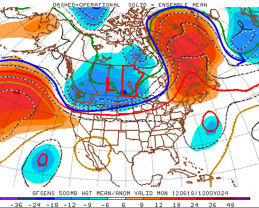
Southern Manitoba will be under an increasing risk of thunderstorms as the week progresses. Heat and humidity will slowly build back into the region as a deep upper trough begins to build over the Rocky Mountains before tracking eastwards across the Prairies later in the week.

GEM-REG 6-hour Precipitation for Thursday Afternoon

6-hour accumulated precipitation through Wednesday afternoon from the GEM-REG model.

We’ll see warmer temperatures today as warmer air pushes in behind a warm front that passed through overnight. Daytime highs should be near the 25°C mark through most of the RRV. By this afternoon a weak frontal wave will be positioned near the international border with a trough extending NW to a low pressure system tracking into Western Manitoba. Showers and thunderstorms will develop over SW Manitoba early this afternoon and slowly develop northeastwards into the Red River Valley. It will mainly be regions through the northern Red River Valley that face the risk for showers or thunderstorms (Portage la Prairie, Winnipeg, Selkirk; as seen in the image above). The showers and thunderstorms will lift northwards into the Interlake overnight while overnight lows drop to the mid-teens over most of Southern Manitoba.

12 hour accumulated precipitation through Thursday

12 hour accumulated precipitation through Thursday from the GFS model.

Opinions differ for Thursday, however it’s generally expected that a north-south band of showers with a chance of an embedded thunderstorm will develop over the Red River Valley or the Whiteshell in the afternoon. This line will slowly move eastwards and intensify into a band of thunderstorms. Again, there’s still quite a bit of uncertainty to where this line will develop, and the potential exists for fairly large (close to 1”) rainfall accumulations. We’ll be keeping close track of this system’s development.

Friday looks to be a fairly nice day with comfortable humdity and daytime highs in the mid-20’s. A large MCS is forecast to develop on Friday night in North Dakota, bringing the chance for a stormy and rainy Saturday. We’ll take a closer look at that system later this week.