Rain, Rain, Go Away

More rain is on the way to Southern Manitoba this week thanks to the development of a significant low pressure system through Saskatchewan & North Dakota, but we should squeeze in one more day of nice weather before it arrives.

This Week

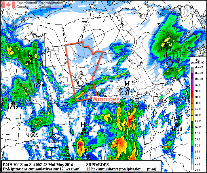
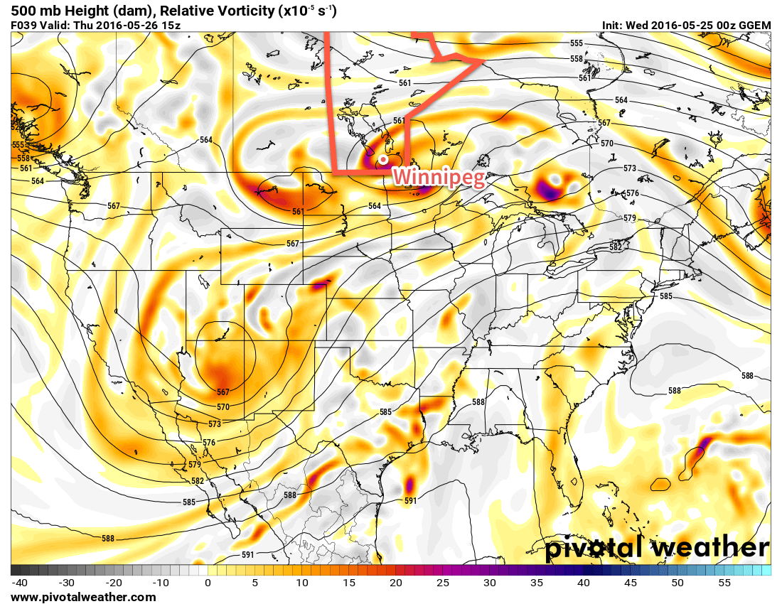
Today will be the last decent day before another unsettled pattern builds in as temperatures reach the mid twenties under mainly sunny skies. We’ll be located north of a sharp warm front, causing our winds to be gusty out of the north-east through the day. Cloud cover will likely begin to roll in late in the afternoon or evening, signalling the end of the nice weather. Overnight rain and thunderstorms from North Dakota will lift into southern Manitoba, ushering in more unsettled weather for the next couple days. Overnight rainfall amounts will be difficult to pin down, but 5-15 mm seems probable in most areas, with locally higher amounts in the more intense cells.

Today will be warm and breezy as we sit north of a warm front

Tuesday will see rain ending in the morning, before drier conditions move in for midday. It appears possible that more showers and thunderstorms will develop in the afternoon, especially if there are some breaks in the cloud to allow for daytime heating. Additional rainfall will be sporadic with isolated patches of moderate amounts in showers and thunderstorms. Winds in the Red River Valley are expected to be southerly near 20 km/h.

A cold front will pass through southern Manitoba by Wednesday morning, allowing cooler air to filter down from the north. High temperatures will only be in the mid teens under mainly cloudy skies. Additional showers are likely through the day on Wednesday, but large accumulations are not expected. Winds will be gusty from the north-west at 30 km/h gusting to 50 km/h.

Long Range

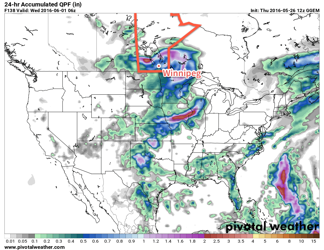
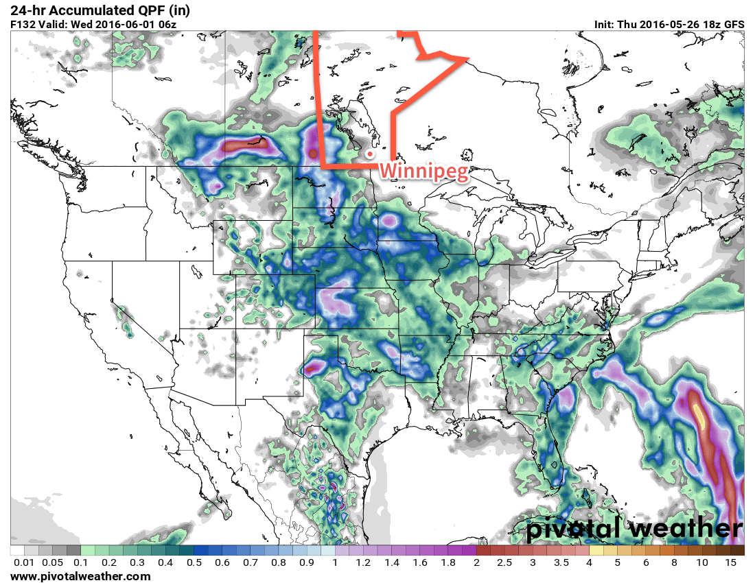
It appears that we will return to a warmer pattern by the end of the week. However, models also hint at numerous chances for storms in an unsettled northwesterly flow 5-10 days from now. Temperatures will likely be near or slightly above seasonal during this time period, although some cool downs will likely be interspersed within the warmer periods.

Unsettled Weather Continues

The wet & unsettled weather seen over the last week in Winnipeg will continue, albeit in a more disorganized fashion, as the series of disturbances that have brought anywhere from 30-70mm of rain to the Red River Valley this week begin moving out of the region only to be quickly replaced.

Today will continue the soggy trend with another round of showers developing through the Red River Valley. Temperatures will be slightly cooler than normal with a daytime high near 19°C. Skies will be mostly cloudy, however there is a chance of seeing the odd sunny break through the day. Winds will be out of the north at around 10-20 km/h through the day. Skies will remain fairly cloudy tonight with a low near 12°C.

RDPS 12hr QPF Amounts valid 00Z Saturday May 28, 2016
One model’s forecast of precipitation totals over Southern Manitoba on Friday

Saturday will bring mixed to cloudy skies to the Red River Valley with a high temperature near 20°C. A few light showers are possible, particularly through the morning hours as a disturbance passes through the Whiteshell, bringing rain through the southeastern portion of the province. Winds will be relatively light through the day. Expect a low on Saturday night near 12°C with some clearing working into the Red River Valley.

Sunday will be the warmest day of the next 3 with a high near 22°C. We'll likely see a fair amount of sun through the morning and midday, but by the late afternoon a trough pushing across the province from the west will bring another chance for showers to Winnipeg & the Red River Valley. Winds will once again be fairly light. Temperatures will dip to around 13°C for a low on Sunday night under partly cloudy skies.

Long Range

The start of next week brings another chance for significant widespread rain for Southern Manitoba as a strong low pressure system develops in Alberta and then pushes eastwards across the Prairies.

GDPS 12hr. QPF Amounts valid 06Z Wednesday June 1, 2016
The GDPS produces a faster system that impacts Southern Manitoba on Tuesady

There's some inconsistency on the timing of this feature. The GDPS is fairly progressive with it and pushes it across the region on Tuesday with another moderate rainfall associated with it. The GFS, however, is much slower.

GFS 12hr. QPF Amounts valid 06Z Wednesday June 1, 2016
The GFS produces a slower system that remains over SK & southwestern MB on Tuesday

The GFS is much slower and holds this system back in Saskatchewan and southwestern Manitoba through Tuesday, and then shifts it in such a way that little rain actually falls over the Red River Valley.

Most long-range models all see this system developing, but with the disagreement in its development & progression, it means at this point we can just say that there's a chance for rain early next week, but we'll have to wait and see.

Winnipeg’s seasonal daytime high is currently 21°C while the seasonal overnight low is 7°C.

Winnipeg’s Weather Takes A Wet & Unsettled Turn

A series of disturbances are set to track into Southern Manitoba through the remainder of the week, brining numerous chances for showers & thunderstorms to the region over the coming days.

Today will start with some sunshine for Winnipeg, but as the day progresses skies will become increasingly cloudy as a disturbance pushes northwards out of North Dakota. Before the sun is hidden away behind the cloud, Winnipeg will reach a warm daytime high near 24°C. By mid-afternoon, showers and/or thunderstorms will be pushing northwards through the Red River Valley, likely reaching Winnipeg for the evening rush hour.

Forecast 500mb Vorticity form the GDPS valid Thursday morning
A complex series of upper disturbances will move through Southern Manitoba through the remainder of the week.

The rainy weather will continue overnight and into Thursday, gradually tapering off by Thursday evening. Expect a low near 14°C tonight, a high near 18°C on Thursday, and a low near 12°C on Thursday night.

The sun should make an appearance again on Friday, returning daytime highs back to the mid-20's. There will be a chance for some showers or an isolated thundershower on Friday afternoon. A weak disturbance moving into the region on Friday night will once again bring the chance for more rain on Friday night.

By the time all is said and done, a fair amount of rain is possible over the coming days throughout the Red River Valley. In general, it's likely that most places will see somewhere between 10-30 mm of rain over the coming 3 days, however with the convective nature of some of the precipitation, it's possible that some areas exceed these amounts and end up closer to the 50 mm mark. Where that may be will depend on exactly how this system sets up, so we'll keep an eye on it and provide updates in the comments below.

Long Range

The unsettled weather will continue into the weekend as a couple more disturbances move through the region. Both Saturday and Sunday show a chance of precipitation for the Red River Valley. Daytime highs will be in the low-to-mid 20's once again.

Winnipeg’s seasonal daytime high is currently 21°C while the seasonal overnight low is 7°C.

Nice End to the Long Weekend

The Victoria Day long weekend will end with good weather after an unsettled Sunday and warm conditions are expected to continue into midweek.

Warm temperatures are expected in southern Manitoba

This Week

Today will be a nice day in southern Manitoba. Skies are expected to be mainly sunny with temperatures climbing into the mid twenties. There will be a slight risk of thunderstorms in the morning in the Red River Valley and south-eastern Manitoba as some instability remains ahead of a weak cold front. The risk of storms should end by the afternoon as westerly winds remove the moist air mass from the region.

Tuesday will be another pleasant day, with temperatures in the mid to upper twenties and mainly sunny skies. A southerly flow will be in place over southern Manitoba, with wind speeds around 20 km/h.

Wednesday will be an unsettled day in southern Manitoba. A south-easterly flow will bring a moist air mass back to the region, causing the atmosphere to become unstable. There will be a risk of thunderstorms in most of southern Manitoba, but at this time it remains unclear how strong storms will become. Models currently show marginal conditions for severe thunderstorms, although it is too early to say what type of risk we’ll end up seeing.

Long Range

Long range models continue to show generally above-seasonal temperatures for southern Manitoba over the next couple weeks. We should see these warm-hot conditions last into early June, if not longer than that. We are only a month away from the beginning of summer, so it is become less likely we’ll see any prolonged periods of cold weather.