An area of high pressure building into Manitoba will bring pleasant summer conditions to southern Manitoba this weekend with a low chance of an isolated thunderstorm or two.
An upper ridge will begin to develop over the Prairies by the end of the weekend, spreading warm weather through the region.
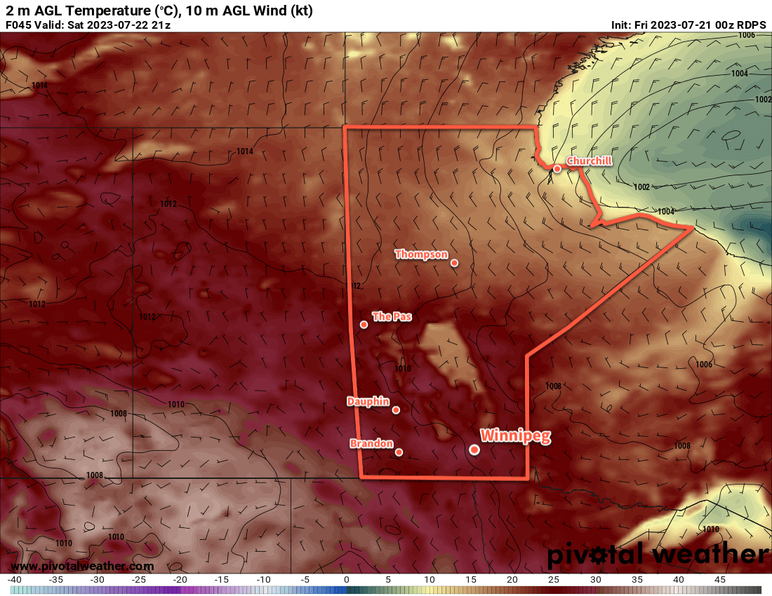
To end the work week in Winnipeg and area, northerly winds behind a cold front will bring seasonably cool temperatures to the area. With gradually clearing skies, temperatures will climb to a high around the 20 °C mark this afternoon. Those northerly winds will ease from around 20 km/h today to light this evening, followed by temperatures dipping to a low near 10 °C.
On Saturday, warmer weather will return to the region with highs back into the mid-20s. Some cloud will develop in the afternoon as a weak upper trough swings across the region; some showers will be possible on Saturday night as it moves through. Winds will be light on Saturday night as an area of high pressure moves in. Temperatures will dip down to the low teens overnight.
On Sunday, warm weather returns with highs climbing back into the upper 20s under sunny skies. A few locations may even see temperatures reach the low 30s. Humidity won’t be an issue, making for a great day to enjoy some time outside.
Long Range Outlook
Next week will kick off with another beautiful day on Monday; daytime highs will again sit in the upper 20s under partly cloudy skies. More humidity arrives Monday night, though, and with it will come variable cloudiness and the chance of showers or thunderstorms. Unsettled conditions are possible, particularly in the late overnight or early morning through mid-week, then more settled conditions should return for the end of the week as the humidity across the region eases.
Today’s seasonal daytime high in Winnipeg is 26 °C while the seasonal overnight low is 13 °C.
Winnipeg will see warm summer temperatures over the next few days with plenty of sunshine for the weekend, but wildfire smoke will make a reappearance.
Warm temperatures will continue across southern Manitoba this weekend with highs in the upper 20s.
Back from vacation, and I’m glad to say our first forecast back is a nice one. Over the next few days, the upper-level pattern over the Prairies will stay relatively stagnant. An upper ridge over the western Prairies will slowly build and nudge eastwards while a few disturbances rotate through central and northern Manitoba.
In Winnipeg, this will mean that temperatures will be fairly consistent in the days ahead; highs should sit in the upper 20s while overnight lows dip to the mid- to upper teens.
There will be plenty of sunshine in the city in the days ahead too. Today will bring some cloudy periods; there’s a small chance of an isolated shower or thunderstorm this morning as a shortwave moves through the area, and then again late in the day as a weak upper trough approaches from the northwest.
Heading into the weekend, conditions will settle with sunny to mixed skies. Winds will be generally light, but Saturday could bring northwesterlies into the 20 to 30 km/h range.
The big question for the coming days will be just how much smoke the city will see with this weather pattern. Satellite pictures last night showed a decent plume of smoke to the northwest, corroborated by reports of poor visibility in The Pas and Flin Flon through the day. That smoke will gradually shift towards southern Manitoba. It shouldn’t be too bad today, but we’ll likely see smokier conditions develop at some point on Saturday and persist into Sunday.
Long Range Outlook
To start off next week, the upper ridge will build eastwards into Manitoba and bring more heat to the region. Temperatures will climb into the low 30s with dew points heading towards the 20 °C mark. This will make for a rather hot and humid first half of the week with Humidex values reaching into the upper 30s. Some unsettled weather is possible mid-week with near-seasonal temperatures returning to end the week.
Today’s seasonal daytime high in Winnipeg is 26 °C while the seasonal overnight low is 13 °C.
An upper ridge building into the eastern Prairies will bring hot conditions to southern Manitoba this weekend.
Sunday will bring the warmest weather of the next few days as hot temperatures and high humidity build into the region.
Seasonably warm conditions will build into southern Manitoba over the next few days with daytime highs climbing towards the 30 °C mark. In Winnipeg, today will bring mainly sunny skies that give way to some cloud in the afternoon while a ridge of high pressure brings sunny skies for Saturday.
Temperatures both days will climb into the upper 20s. Humidity levels will be comfortable in the mid- teens both days. For those heading out to enjoy Canada Day ???????? on Saturday, it will be a beautiful day to spend time outdoors!
On Sunday, the heat will really arrive as temperatures climb into the low 30s with increasing humidity. By the late afternoon, dew point values could reach as high as 20 °C, which would make it feel more like the upper 30s.
On Sunday afternoon, a warm-sector trough — typically an area of lower pressure near the middle of a large area of warmer air — will begin pushing across southern Manitoba. This feature will be an area of concern for severe thunderstorm development later on Sunday.
The thunderstorm potential will be significant on Sunday thanks to ample heat and humidity at the surface and relatively cool temperatures aloft. MLCAPE values could exceed 2,000 J/kg in an environment with 20 to 30 knots of 0–6 km bulk shear. Veering wind profiles would support supercell structures, but moderate westerly forcing along the line would likely support upscale growth into the evening hours. Capping will be marginal — 700 mb temperatures are forecast to be around 9 °C — so there is uncertainty with where the southern end of the line would develop. Wind profiles aren’t overly backed at the surface, so this setup wouldn’t likely produce a widespread tornado threat. If a thunderstorm was able to tap into all the available energy, though, an isolated tornado threat could develop. More likely, these thunderstorms would be capable of severe hail and torrential rainfall.
The details of this could change between now and Sunday, but at this point it looks like Sunday will be the hottest day of the next few and bring an organized severe weather risk to the region for late in the day.
Long Range Outlook
A weak cold front will push through Sunday night easing the humidity across the region.
Through the start of next week, temperatures should sit closer to seasonal values with variable cloudiness as cooler air moves in under a slow-moving upper trough that moves into the region. Some showers could be possible, but right now it looks like the start of the week will be mostly dry for Winnipeg.
Today’s seasonal daytime high in Winnipeg is 25 °C while the seasonal overnight low is 13 °C.
Thunderstorms will be possible for another couple days across southern Manitoba. By the end of the week, an upper ridge moving across the Prairies will bring calmer, warmer weather to the region.
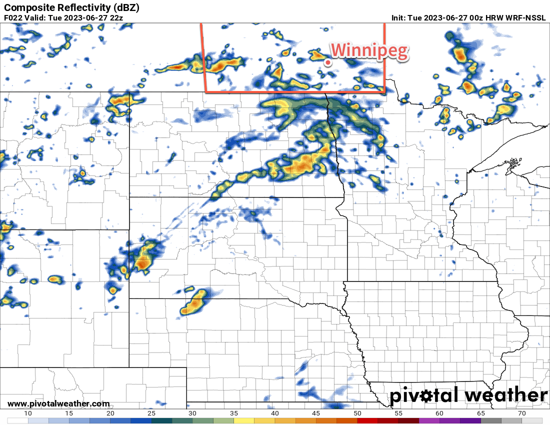
Scattered thunderstorm activity is expected to develop across southern Manitoba and North Dakota this afternoon.
The weather over the next few days will be driven by a disturbance slumping southeastwards across the Prairies into southern Manitoba. As it dips southwards, its cool air aloft will encounter a warmer air mass with more moisture in it. These two features combined will result in a couple days of unsettled conditions over southern Manitoba.
Today will start out with a chance of showers or thunderstorms in the general Winnipeg area; while it’s a bit uncertain as of writing, lingering instability combined with the northward push of a warm front could be enough to trigger some morning convection. If it develops, it should push eastwards out of the area through the morning hours.
Once any morning convection clears out, it won’t take too long for things to get cooking. With mixed skies, most areas will see temperatures climb into the upper 20s fairly quickly. By early afternoon, scattered convection will likely begin to develop across southern Manitoba. With moderate instability and limited wind shear — around 1,000–1,500 J/kg of MLCAPE and 15–25 knots of bulk shear — there will be a risk of severe thunderstorms but it’s not looking like a widespread severe weather day. The most likely area for severe weather will be northwest of Winnipeg, especially in Parkland Manitoba and along the escarpment areas, but there is a small risk of an isolated severe thunderstorm in areas further southeast like Winnipeg.
The biggest unknown with the afternoon convection will be (a) if/where morning thunderstorms develop and (b) what the strength of the cold pool they may leave behind would be. That cold pool could work both ways, limiting thunderstorm development over it, but also acting as a focus along its boundaries to help trigger thunderstorm development.
Much of the activity will diminish tonight with temperatures heading down to a low in the mid-teens. There’s a small chance of an isolated shower or thunderstorm by early Wednesday morning.
On Wednesday, the upper low will dip through southern Manitoba, bringing similar instability, slightly better shear, and less inhibition of thunderstorm development. Scattered thunderstorm activity will develop across the region on Wednesday with mixed to cloudier skies. There will again be a risk of isolated severe thunderstorms.
By Thursday, the upper low will beginning to exit the province. Behind it, an upper ridge will be building eastwards across the Prairies. Skies will likely be mixed and there’s a chance a few showers might linger into the day, but things should really begin to clear out by the afternoon. Temperatures will be a bit cooler in the wake of the upper low with highs in the low to mid-20s. Skies will clear out on Thursday night with temperatures heading to a low in the mid-teens.
Long Range Outlook
The upper ridge will continue to build into the province for the end of the week, bringing sunny skies and warm weather. Temperatures will climb into the upper 20s for Friday, Saturday, and Sunday with relatively light winds shifting from northerly to westerly through the days.
Early indications are that a disturbance will begin working its way into the province later Sunday, bringing a chance of thunderstorms on Sunday night into Monday.
Today’s seasonal daytime high in Winnipeg is 25 °C while the seasonal overnight low is 12 °C.