Cold Front Slams Through Southern Manitoba, Brings Brief Cool Snap

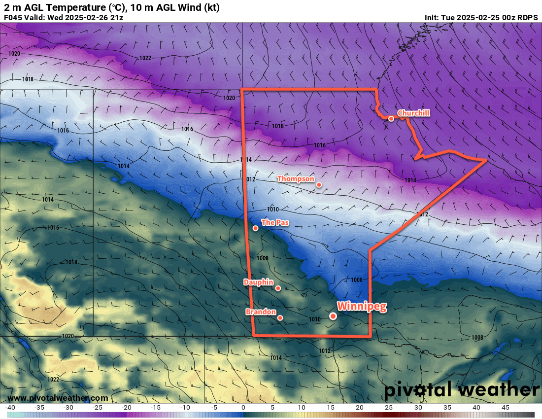
A cold front will slam through southern Manitoba this morning and bring strong northerly winds that usher cooler temperatures into the region for a couple days.

RDPS 10m Wind Forecast valid 09Z Friday February 28, 2025
Southern Manitoba will wake up to strong northwest winds behind a cold front today.

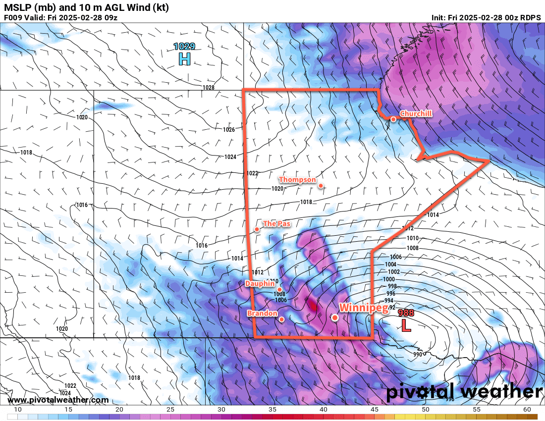
A strong cold front has passed through Winnipeg early this morning and has brought strong northerly winds to the area. Widespread winds of 40 to 50 km/h will spread through the Red River Valley this morning, but stronger winds up to 60 gusting 90 km/h will be possible over and in the lee of Lake Manitoba. In particular, strong winds will persist through the morning hours in the corridor roughly between Portage la Prairie and the Elie region.

Blowing snow could be a concern with these winds, but the recent mild weather has glazed the top of the snow pack with ice. There may be flurries with the cold front, but any new snow will be limited. As a result, we don’t expect blowing snow to pose much of an issue this morning.

The winds will ease as the day progresses while temperatures call into the -15 to -10 °C range by the end of the afternoon. The clouds will clear out this evening as temperatures drop to around -20 °C overnight. The wind will ease to light overnight.

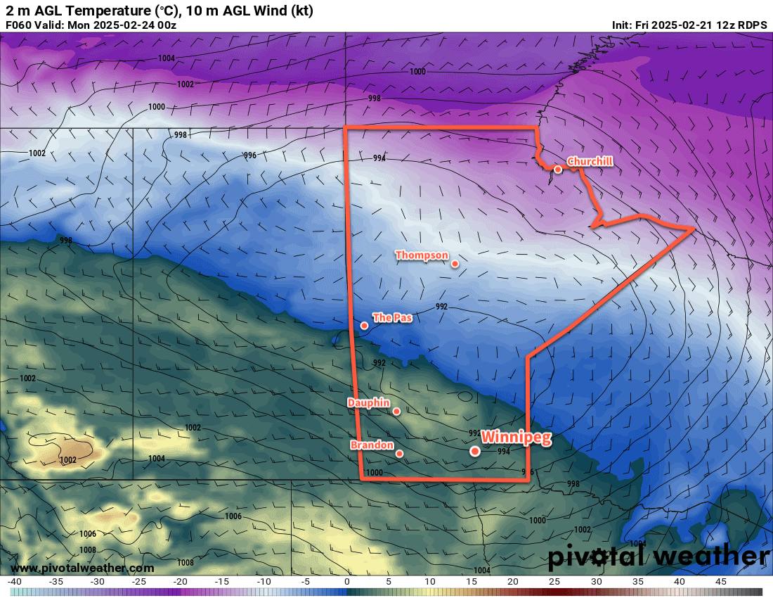
The forecast for the weekend is pretty simple. An Arctic high will slump into the province behind the cold front and gradually make its way southeast through the province. Saturday will bring sunny skies and light winds with highs in the -10 to -5 °C range. Temperatures will drop back down into the -15 to -10 °C range on Saturday night with light southerly winds as a warm front begins to push across the region.

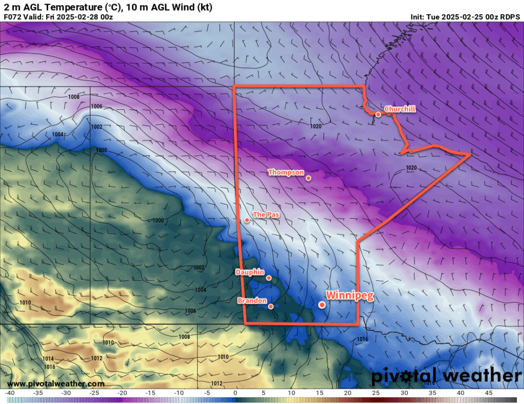
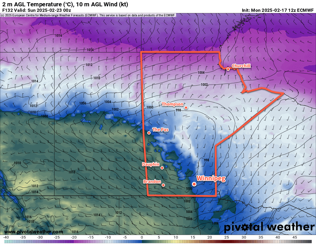
On Sunday, much of southern Manitoba will see itself back into the air mass we were in before the cold front came through. Temperatures will rebound back to around 0 °C with southerly winds of 20 to 30 km/h. The warmer weather will likely bring mixed skies to the region.

Temperatures will dip back down into the -5 to 0 °C range on Sunday night with clear skies.

Long Range Outlook

Looking ahead to next week, temperatures will continue trending mild with daytime highs hovering from around or just below 0 °C to as high as the mid-single digits. No significant precipitation is in the forecast.

The mild weather of late has been a pleasant break from a lengthy stretch of cold weather this month; today’s system will bring a brief shot of cooler weather, but the warm-up will arrive before the end of the weekend!

Today’s seasonal daytime high in Winnipeg is -5 °C while the seasonal overnight low is -16 °C.

#Winnipeg #MBstorm #awm_windy #awm_benign

Mild and Slightly Unsettled

Seasonably mild conditions will continue in Winnipeg this week as a couple disturbances track through the region.

RDPS 2m Temperature Forecast valid 21Z Wednesday February 26, 2025
A weak disturbance will cross southern Manitoba on Wednesday afternoon.

Daytime highs in the 0 to +3 °C range will continue through the rest of the work week for the Winnipeg area. Upper ridging over the western Prairies will continue to allow mild Pacific air to push east across the region.

There will be plenty of cloud cover this week, a result of both the disturbances tracking through the region and the extensive snow melt taking place across the region.

Today will bring mainly cloudy skies to the region with southerly winds picking up to around 20 km/h. Temperatures should climb above freezing for the afternoon. A few clear breaks are possible this evening as temperatures head to a low near -3 °C overnight.

A disturbance will drop into southern Manitoba from the northwest through the day Wednesday. Under cloudy skies, temperatures will climb back above freezing, then temperatures will cool in the evening as light precipitation makes its way through the region. This could fall as either rain or snow, it will depend on how close to 0 °C the temperatures are by the time it begins.

The precipitation will change to flurries on Wednesday night and taper off early Thursday. Temperatures will dip to a low in the -10 to -5 °C range on Wednesday night.

Thursday will bring mixed to cloudy skies to the Winnipeg area with a high close to the freezing mark. A more organized disturbance will push a warm front into southern Manitoba on Thursday night, keeping temperatures within a few degrees of the freezing mark through the night. Breezy southerly winds will pick up overnight as the front approaches.

RDPS 2m Temperature Forecast valid 00Z Friday February 28, 2025
A stronger low pressure system will bring a wintery mix of precipitation to southern Manitoba on Friday.

Friday will bring light rain or snow to the region, but much of the precipitation will likely fall north and east of Winnipeg. It could even end up being a drier day in Winnipeg depending on how dry the air being pulled into this system from the south ends up being.

Temperatures will reach a high near 0°C on Friday with westerly winds near 40 gusting 60 km/h. Those winds will shift northwest later in the day as much of the precipitation moves off. This will bring cooler temperatures and a chance of flurries to the region.

The northwest winds will ease overnight as skies clear and temperatures drop into the -20 to -15 °C range behind the departing system.

Long Range Outlook

Looking further ahead, Saturday will bring cooler weather to the region, but temperatures should bounce back towards freezing on Sunday. The city should see sunshine this weekend, but conditions will trend cloudier into next week as the mild air sticks around.

Today’s seasonal daytime high in Winnipeg is -6 °C while the seasonal overnight low is -16 °C.

Warmer Weather Finally Arrives

Warmer temperatures have finally arrived in southern Manitoba and they’re going to stick around for a while.

RDPS 2m Temperature Forecast valid 00Z Monday February 24, 2025
By Sunday evening, westerly winds will usher above-freezing temperatures into the Red River Valley.

The weakening lobe of the Polar Vortex that was entrenched over the region has finally weakened and quickly tracked out of the country. In its wake, two main pattern changes are underway: the Polar Vortex is re-strengthening further north over Canada’s High Arctic and upper ridging is building into western Canada.

These two changes will result in a major change in the weather over southern Manitoba. The most pronounced, obvious change will be a massive shift towards warmer weather.

Temperatures will climb into the -10 to -5 °C range this afternoon as breezy morning southerlies ease midday. The Winnipeg area will see mixed skies today as morning sun gives way to afternoon clouds as a warm front pushes towards the region. Temperatures will continue to climb tonight, reaching around -5 °C by Saturday morning.

This weekend’s weather will be shaped by a low pressure system that will develop in northern Alberta on Saturday. It will reach northern Saskatchewan/Manitoba border by Sunday evening with a warm front that drops south towards the Red River Valley.

This will bring more cloud to the area this weekend as daytime highs climb to around 0 °C. Winds won’t be too much of an issue this weekend either as they shift to the south and increase into the 15 to 25 km/h range. Overnight lows will warm into the -5 to 0 °C range by Sunday night.

There will be a slight chance of mixed precipitation on Sunday, though a feed of drier air from the south could eat away at anything that tries to fall over Winnipeg or areas south.

Long Range Outlook

The first half of next week will bring mild weather, then the region will shift towards seasonal values in the second half. Winnipeg will see variable cloudiness through the week; a train of weak disturbances will slide through every couple days, bringing a chance for a wintery mix of precipitation. At this point, no significant accumulations of snow or rain are expected in the Red River Valley next week, save for a chance of 4 to 8 cm of snow near the end of the week.

Looking further ahead, the long-range pattern looks to favour near-seasonal temperatures with no major storms on the horizon.

Today’s seasonal daytime high in Winnipeg is -6 °C while the seasonal overnight low is -17 °C.

#Winnipeg #MBwx #awm_above_normal_temperatures

Arctic Grip Weakens Over Southern Manitoba

The bitter cold that’s been entrenched in the region for over a week will finally give way with temperatures gradually warming to above-seasonal values.

RDPS 2m Temperature Forecast valid 12Z Wednesday February 19, 2025
Although change is on the way, it will be cold across the southern Prairies on Wednesday morning.

Winnipeg’s weather is in for a change this week as a lobe of the Polar Vortex exits the region. It will weaken substantially over the next couple days, then rapidly shift east out of the country through the second half of the week.

As a result, there will be little change through the first half of the week, and substantial change in the second.

Over the next few days, as the weakened portion of the polar vortex dissipates, temperatures will gradually rise. By Thursday, daytime highs in Winnipeg will increase from near -20 °C to the mid-minus teens. Overnight lows will follow, rising from the -30 to -25 °C range into the minus teens.

A sprawling (and weakening) Arctic high will dominate the surface pattern, bringing sunshine and light west-northwest winds.

Long Range Outlook

While Thursday will mark the beginning of a pattern change, it will become more pronounced to end the week. The remnants of the Polar Vortex will rapidly shunt east, allowing an upper ridge to build into the Prairies from the Pacific. This will push much milder air across the region, sending daytime highs well above seasonal normals.

Daytime highs will climb to near-seasonal values on Friday, then warm closer to 0 °C on the weekend. For areas west of the Red River Valley, above-freezing temperatures are probable; we’ll have to wait to see how much mild air is able to scour into the Red River Valley to see how warm Winnipeg is able to get.

ECMWF 2m Temperature Forecast valid 00Z Sunday February 23, 2025
Much warmer weather will sweep across the Prairies this weekend, with daytime highs climbing to 0 °C or higher for most regions.

The above-seasonal temperatures will continue right through next week.

With this change, the region will shift closer to the storm track. No major systems are expected, but occasional bouts of light snow or even a wintery mix will be possible beginning this weekend and through much of next week.

Today’s seasonal daytime high in Winnipeg is -7 °C while the seasonal overnight low is -18 °C.

#wx_below_seasonal_temperatures #wx_above_seasonal_temperatures
#Winnipeg #MBwx