The Melt Begins

The spring snow melt will begin in earnest this week as temperatures soar to above-seasonal values.

Monday will be above-seasonal as a mild westerly flow moves across the Prairies

Monday

Monday
5°C / -2°C
Mix of sun and cloud

Today will be well above-seasonal with high temperatures reaching into the mid single digits. We’ll see skies that are a mixture of sun and cloud as some mid and upper cloud streams through from the north-west. Since there will be a lot of snow melting, some fog patches may develop overnight due to the increase in moisture. It will most certainly be another bad day if you happen to be made of ice!

Tuesday

Tuesday
4°C / 0°C
Mainly sunny

Tuesday will see similar conditions to Monday. Temperatures will once again be in the mid single digits with a westerly wind. Skies should be mainly sunny making for yet another beautiful day.

Wednesday

Wednesday
3°C / 0°C
Mainly cloudy

Some clouds will roll in for Wednesday, but temperatures will remain mild. Highs should be in the low to mid single digits under mainly cloudy conditions. We may even see a light rain or snow shower, but accumulations will be minimal. Wednesday will be a gloomier day, but warm nonetheless.
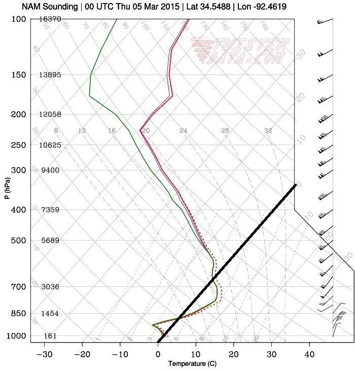
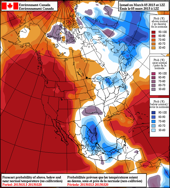
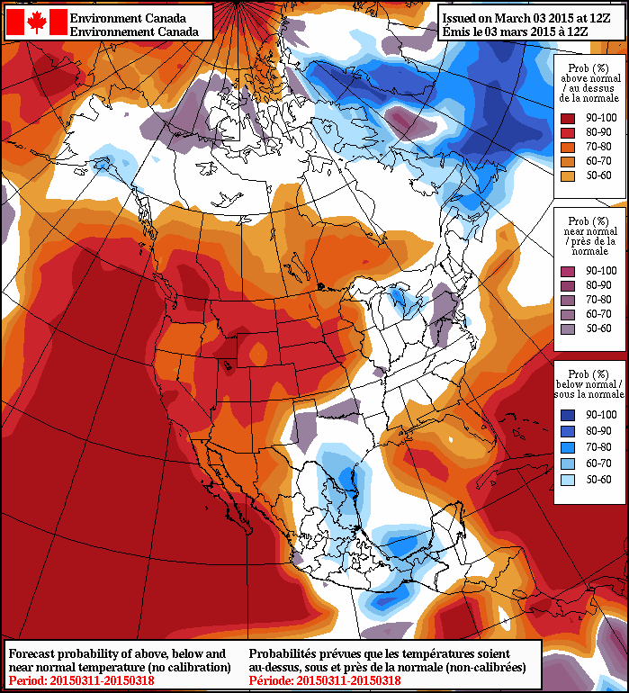
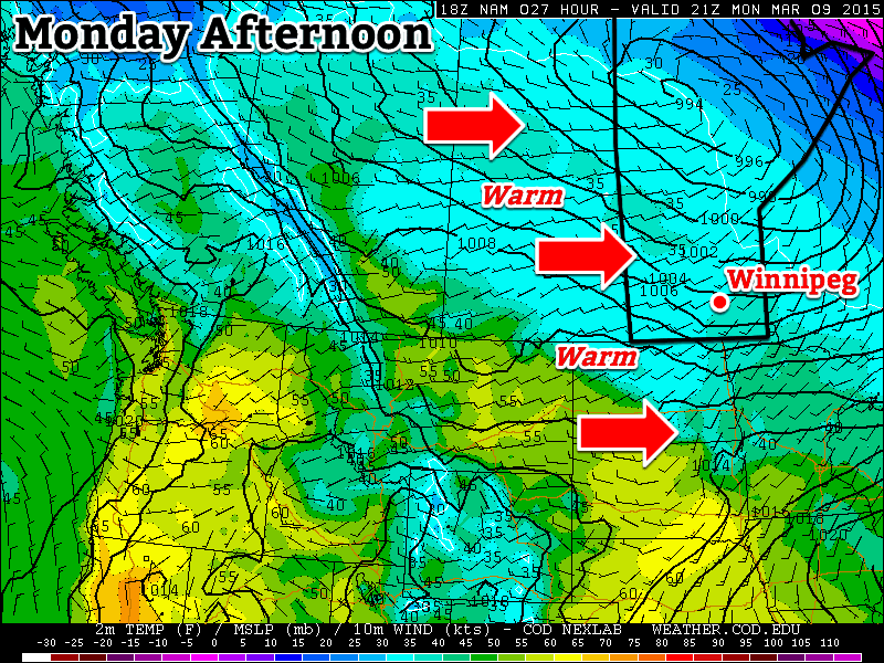
Long Range

The long range forecast continues to look very good. Models suggest that we will see above-seasonal temperatures stick around until at least mid-March. Given the warm weather expected this week, it’s likely that most of our snow will disappear quite quickly. Once the snow is gone the ground will be less reflective, allowing more sunlight to be absorbed, giving us systematically warmer temperatures. Sounds pretty good, doesn’t it!

Elsewhere in Weather News: March 7th, 2015

Winter Storm Races across Southern, Midwest US

This past week a strong late season winter storm made its way across the southern and east-central parts of the United States bringing with it all kinds of precipitation: rain, snow, ice pellets and freezing rain. An Arctic front pushing south across the region was the culprit for the mixed precipitation types. Warm air was able to ride over the cooler air racing south near the surface which made for a melting layer above ground and able to melt/partly melt the precipitation. Before it reached the ground the precipitation encountered below freezing temperatures once again which resulted in the freezing rain, or ice pellets if the melting layer was not as deep.

Sounding from Little Rock, AR show a melting layer with below-freezing temperatures closer to the surface.  Black line is the 0°C isotherm.
Sounding from Little Rock, AR show a melting layer with below-freezing temperatures closer to the surface. Black line is the 0°C isotherm.

Large traffic jams on the freeways due to accidents, school closures and power outages were the result of the storm and 13 deaths across several states were directly related to the storm. Impressive and unusual snow amounts for this time of the year were recorded anywhere from Dallas, Texas to Lexington, Kentucky. Here are a few impressive amounts recorded from the storm, provided by the National Weather Service:

  • Lexington, KY: two-day total of 43.4cm (all-time two day record)
  • Tupelo, MS: one-day total of 18.5cm (second snowiest day on record)
  • Dallas, TX: storm total of 8.9cm
[map type=”terrain” autofit=”1″ disable_scrollwheel=”1″] [pin]Lexington[/pin] [pin]Tupelo[/pin] [pin]Dallas[/pin] [/map]

No more snow is expected in the near future, but record-breaking cold temperatures followed last night. Warmer and closer to normal temperatures are on the way for next week as a pattern change takes place and colder air remains locked up further north.

Warmth Arrives For The Weekend

The wait is over: the warmer weather has arrived. Today will mark the first day of a huge swell of warm air spreading eastwards across the Prairies over the next week that will bring seasonal to above-seasonal temperatures to the region. The warmer weather will be joined by a couple chances for flurries over the next few days as well thanks to multiple weak disturbances rippling along the edge of the warmer air.

Friday
-3°C / -10°C
Increasing cloudiness; a few evening flurries

Saturday
-2°C / -8°C
Mixed skies with a chance of evening flurries

Sunday
0°C / -4°C
Mixed skies

Today will start off sunny but see increasing cloud as temperatures will climb to around -3 or -2°C this afternoon. A weak low pressure system moving through the Interlake will bring the potential of flurry activity through the Red River Valley as it passes this evening, but any amounts from the system would be minimal. Temperatures will drop to around -10°C tonight.

Saturday will bring mixed skies with temperatures once again climbing towards the -2°C mark under mixed skies. Another low tracking through the region will bring another chance for some very light flurry activity through the late afternoon & evening hours. Expect an overnight low near -8°C.

Sunday will be the warmest day of the next few with temperatures climbing to the freezing mark. Skies will likely be mixed with somewhat breezy northwesterly winds to 20-30km/h. Sunday night will bring a balmy low of around -4°C.

Warm Weeks Ahead

NAEFS 8-14 Temperature Anomaly Forecast (issued 12Z March 5, 2015)
NAEFS 8-14 Temperature Anomaly Forecast

Fortunately for us, the warm weather looks like it’s going to stick around for a while. The NAEFS 8-14 day outlook is showing a decent probability of above-normal temperatures while only a brief mid-week cool-down looks on the cards for next week.

With the relatively low amount of snow on the ground, we may be heading into positively spring-like weather!

Big Warm-Up on the Way

A significant large-scale shift in the upper-level weather patterns will result in a rather abrupt end to the cold snap that has plagued Manitoba through much of February and allow seasonal to above-seasonal temperatures to spread eastwards through the Prairies. Unlike the brief warm-ups that occurred through February that lasted perhaps a day or two, since this warming trend will be supported by a shift in the upper-level pattern, the warmer weather is looking like it will remain in place for at least 1-2 weeks.

Wednesday
-17°C / -26°C
Mainly sunny

Thursday
-9°C / ⇒ -10°C
Increasing cloud; chance of flurries

Friday
-2°C / -10°C
Mixed skies

Today will be the last straggling cold day of the bunch with daytime highs struggling into the minus teens. Unfortunately, a breezy northwesterly wind to 20-30km/h will be making things feel quite cool. A few clouds may be seen through the day, however an approaching Arctic ridge of high pressure should keep things fairly sunny. Temperatures will drop to around -26°C tonight with light southerly winds as the ridge slides by to our south.

Thursday will mark the transition towards significantly warmer weather. After a cold start to the day, southerly winds will gradually strengthen to nearly 40km/h as a warm front pushes into the province. We’ll see increasing cloud through the day which may result in some flurry activity at some point through the afternoon/evening. Temperatures will climb to around -9°C. Heading into the evening, winds will shift to the west and diminish; temperatures look like they’ll remain fairly steady around -10°C through the night with a slight chance of flurries continuing under mainly cloudy skies.

The warm weather will keep on pushing eastwards for Friday. Winnipeg should see high temperatures climbing to around the -2°C mark under mixed skies and fairly light winds. Temperatures will drop to around -10°C on Friday night.

Warm Weather Keeps on Coming

For winter-weary Winnipeggers, it’s nothing but good news in the long-range. Warmer weather – either near-seasonal to above-seasonal – is expected to persist for quite a while for the region. A broad upper-level ridge is forecast to shift from being centred over the west coast further eastwards into the Prairies.

NAEFS 8-14 Temperature Anomaly Forecast

The result will be a flow of milder Pacific air spreading eastwards through the Prairies, resulting in daytime highs near the freezing mark. Given the lower-than-normal snowpack, we may potentially see a fair amount of snow melt thanks to the stronger sun & milder temperatures over the coming weeks.