Alberta Clipper To Blast SW Manitoba

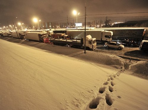
A powerful Alberta Clipper system will push through southwest Manitoba this evening bringing heavy snowfall and blowing snow to the region.

Probability of > 2cm of snow from this AB Clipper

Probability of > 2cm of snow from this AB clipper. Blue boundary marks > 30% chance, green boundary marks > 60% chance.

The weather across Southern Manitoba will be fairly benign today with daytime highs generally sitting just below the freezing mark with increasing clouds through the day. Winds will remain light through the day. Light snow will push into southwestern Manitoba this afternoon, potentially pushing into the western Red River Valley as well. Winnipeg may see some light snow this afternoon, but it’s going to likely remain to our southwest; should snow push into the city, there will be little-to-no accumulation. Regions that see more persistent snow today, potentially including the western Red River Valley, accumulations will likely total around 2-ish cm.

Wednesday

Mostly cloudy with patchy light snow.
-3°C / -16°C

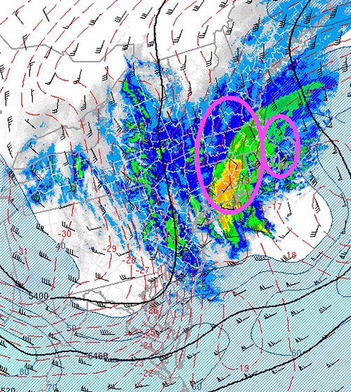
Early this evening the Alberta Clipper will begin working it’s way into the Virden & Melita regions, quickly expanding eastwards towards Brandon and Pilot Mound. General snowfall accumulations will be close to 5cm, but there will also be a very narrow band, just north of the track of the clipper, where accumulations will be closer to 10cm. This corridor of heavy snow will lie across the Trans-Canada highway near the Saskatchewan border; anybody travelling west tonight should prepare to encounter heavy snow, snow drifts and near-zero visibilities near the Saskatchewan border. Further east, there’s a little disagreement on what will happen; most models suggest very little snow will fall in the Red River Vally tonight, however the NAM guidance is suggesting that a fair amount could fall. At this point, I think that most of the snow will push into North Dakota before it pushes eastwards towards Winnipeg or the central Red River Valley. Areas near the International Border may get clipped with a couple cm of snow as this clipper exits the region. Winds will remain relatively light, picking up to 20 gusting 40km/h out of the northeast overnight through much of Southern Manitoba. Temperatures will drop to around –14 to –16°C across Southern Manitoba.

Thursday

Thursday

Clearing in the morning.
-14°C / -21°C

Cooler air will filter into Southern Manitoba on Thursday behind the clipper, bringing us a return to seasonal temperatures. The remaining cloud from Wednesday’s system should clear out fairly early in the day, leaving us with mainly sunny skies. We’ll climb to around –13°C with a light north wind. Temperatures will drop into the –20’s tonight as another Arctic ridge slumps into the Prairies.

Friday

Friday

Clearing in the morning.
-14°C / -20°C

Southern Manitoba will be locked under the Arctic ridge on Friday which will result in another day with seasonal temperatures. Highs will sit near –15°C on Friday across most of Southern Manitoba with temperatures dropping back towards –20°C for the night.

After that, it looks like we’ll head back towards above-normal temperatures for a few days. Little-to-no precipitation is expected over the next while.

Warm for a Bit Longer

With the exception of Monday, we’ll see our fairly warm weather continue into this week.

image

Surface temperatures as forecast by the NAM for Tuesday afternoon

Monday

Monday
image
Clearing. Chance of flurries.
-18°C / -8°C

Monday will be a day of transition, as a strong Colorado Low to our south moves off into Ontario, causing a cooler air mass to filter into Southern Manitoba. It won’t be a super-cold day, but definitely chillier than the conditions experienced on the weekend. Skies will clear through the day as low-level moisture is gradually removed from the area. There may be a bit of light snow in the morning, but otherwise no precipitation is expected.

Tuesday

Tuesday
image
Mix of sun and cloud
-1°C / -9°C

Tuesday looks to a rather mild day in Southern Manitoba, with high temperatures around the zero mark in many areas. Parts of south-western Manitoba are most favoured to get up to, or slightly above, zero. In the Red River Valley temperatures will be in the low minus single digits, with some areas potentially getting just up to the freezing mark.

Wednesday

Wednesday
image
Snow
-1°C / -6°C

We’ll see one more warm day on Wednesday, though the warm conditions will be tempered by another batch of snow. An Alberta Clipper will roll through on Wednesday, bringing light to moderate snowfall to Southern Manitoba. This could be a fairly significant snowfall in some areas, but it’s too early to give a more precise forecast with numerical accumulations. Temperatures will remain quite mild in spite of the, with highs generally in the low minus single digits in most areas.

It looks like this clipper will draw down another cold air mass which will stick around for awhile. Colder weather is expected to last into next weekend.

Elsewhere in Weather News: February 9th, 2013

Snowstorm Hits Moscow

On Tuesday, this past week, Moscow experienced yet another significant snowstorm which caused significant disruptions to traffic and was also the reason for numerous power outages. Several low pressure systems have been steered through the western half of Russia as a strong high pressure remains in place over Central Russia. This has put Moscow in a good spot to receive repeated bouts of snow. The most recent of their snowstorms brought 25cm of snow on Tuesday which meant significant traffic disruptions – as many as 3,000 accidents were reported by Moscow Police.

Moscow traffic jam

Moscow traffic backed up because of snow. (Source: RT)

On average, Moscow receives about 150cm of snow every winter but this year has been significantly above average in terms of snowfall. Winter 2012-2013 totals for Moscow are already at 216cm and with another month and a half to go with the possibility of snow it could be a long, cold spring for Moscow. The weather will turn cold and dry for Moscow next week as the strong high pressure expands a little further west.

New England Snowstorm

Another snowstorm, a little closer to home, is bringing significant amounts of snow to parts of the Eastern Seaboard – more notably New England. The deep low pressure system is located just off the East Coast and has a sharp deformation zone bringing heavy snow and even “thundersnow” to the Atlantic States. The highest accumulations are expected to reach around 80cm (could be higher locally) and it was not uncommon to see snowfall rates of 8cm/h on Friday evening! Power outages were the main concern to residents as below freezing temperatures move in. As of Friday night 500,000 people were without power across the North East US.

500mb analysis

500mb analysis when the strongest bands of snow were in place, at 9pm. Circled areas where the heaviest snow is expected to fall on Friday overnight. (Source: SPC)

Updates on this storm and snowfall totals will be forthcoming in the comments section as the low pulls off into Atlantic Canada.

Warmer Weekend Ahead With An Uncertain Finish

Warmer weather will wash across the Red River Valley this weekend as a south-westerly flow brings in mild Pacific air. While the sun won’t be overly present, conditions will be quite pleasant with mild temperatures and light winds. The weekend will finish on an uncertain note as a Colorado Low ejects from the Central Plains with wavering agreement on where it’s heading after that.

500mb Winds for Sunday Morning

500mb winds valid for Sunday morning at 12Z. A complicated set-up will be underway as the polar jet merges with the sub-tropical jet and a shortwave from the northern Prairies merges into a developing Colorado Low.
Friday

Mostly cloudy.
-6°C / -9°C

Skies will be mainly cloudy today as a warm front pushes eastwards towards the Red River Valley. Temperatures will climb up to –7 or –6°C, a welcome break from the cold temperatures we’ve had over the past week. Winds will pick up out of the south-southeast to 30–40km/h this morning with a slight chance of some local blowing snow through the Red River Valley. There will be a very slight chance of a few flakes of snow but there won’t be anything that can be considered significant. Temperatures will drop a few degrees tonight to about –9°C under mainly cloudy skies.

Saturday

Saturday

A mix of sun & cloud.
-4°C / -9°C

Perhaps the nicest day of the weekend will be Saturday as the clouds begin to break up a little and temperatures climb as high as –4 or –3°C. Winds will remain fairly light through the Red River Valley through the day. Not much to say for Saturday night; skies will likely clear in the evening but fairly quickly cloud over again early in the morning on Sunday.

Sunday

Sunday is a very complicated weather day. As it stands right now, we may see absolutely no snow or…quite a bit of snow, including the potential for a blizzard through portions of the Red River Valley. Temperatures should remain close to what they look to be right now with highs near –5°C across much of the Red River Valley. Winds will likely remain relatively light, regardless of the overall pattern, as there will be no significant Arctic high building into the region.

As for the complicating factors…

Sunday

Mostly cloudy. Snow/freezing rain uncertain.
-5°C / -11°C

The general synoptic pattern will be as such: a significant Colorado Low will be ejecting into central Nebraska on Saturday night with a sharp trough digging northeastwards into SE South Dakota while, at the same time, a relatively weak low pressure system slides south-eastwards out of northern Saskatchewan towards central Manitoba. By Sunday morning, the Canadian low and it’s associated jet stream will merge with the Colorado Low with the CO low situated in central Nebraska with a sharp trough extending northwards through extreme western Minnesota then arcing through the Red River Valley northwestwards towards The Pas, MB. It’s always a concerning issue when the troughs end up west of the Red River Valley, as it can often mean a northward progression of the weather into our area.

Models have notorious struggles with complicated setups where two distinct atmospheric streams merge. It’s an incredibly dynamic, sensitive process in which even small changes can dramatically effect the evolution of the entire system, so models can often waver wildly on what the outcome will be from small changes in their initial conditions. That being said, using ensemble forecasts, the track of the low, and it’s associated snow, has been creeping northwestwards; two days ago the entirety of the snow was forecast to push only into Central Minnesota; now it’s forecast to clip southeastern Manitoba, including Sprague and portions of the Whiteshell. Model trends can sometimes be more helpful than the actual model output, and combining the ensemble’s northwards trend with the knowledge that this is definitely a situation where the model may not tilt the 500mb trough enough and then, as a result, not bring the low far enough north or west, I can’t say with any certainty what Sunday will bring.

There’s a distinct chance that the snow will remain entirely on the US side of the border and we’ll be relatively unaffected by this system. Should things develop in such a way that the low digs a little more and the trough tilts a little more, it’s also entirely possible that another 5–15cm of snow, or potentially higher, will fall across the Red River Valley. In addition to the uncertainty with all these elements, should the precipitation push further to the NW into Southern Manitoba, there will be a distinct potential for freezing rain as 850mb wet bulb temperatures sit on the positive side of the 0°C mark.

The reality is that for this type of setup, it’s simply too early to tell what’s going to happen. We’ll most certainly be providing updates in the comments below on the development of this Colorado Low. For now, it’s safe to assume that Sunday will be a warmer day with winds in the 20–30km/h range, but the actual weather conditions may end up being quite poor depending on the evolution of this system.