A Colorado Low moving into the American Mid-West will spread snow northwards into southern Manitoba this week with significant amounts possible.
The weather driver over the next few days will be a Colorado Low passing to the south. It will eject northwards into Nebraska today, spreading heavy snow across the Dakotas. Some light snow will persist across southwest Manitoba today, but the organized, heavier snow will begin to breach the international border later in the day. Temperatures will be mild through the Red River Valley with daytime highs near the freezing mark and easterly winds picking up into the 20 to 30 km/h range.
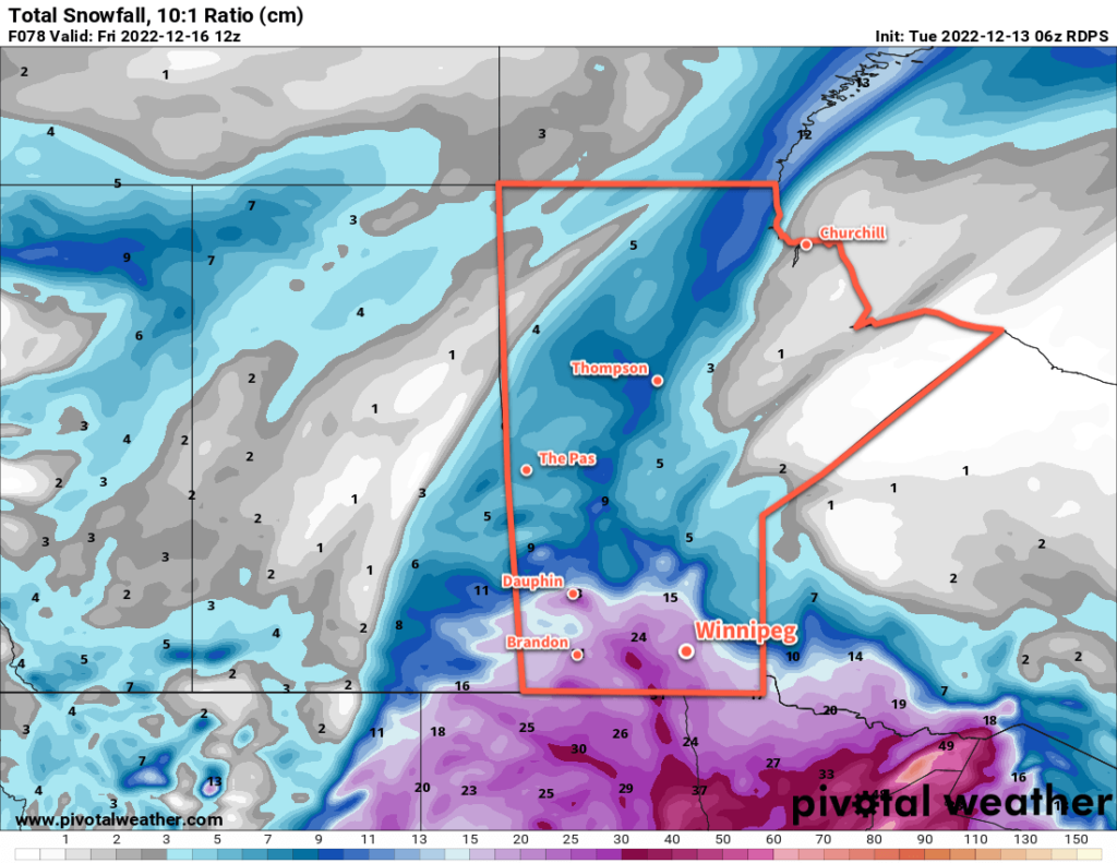
Organized snow will lift north through the Red River Valley overnight and persist into Wednesday as moisture travels northwards along a stalled inverted trough.. The snow will likely arrive in waves through the day on Wednesday with highly variable accumulations across the Red River Valley. The heaviest snow in the region will fall along the western escarpment where easterly winds blowing up the slope will result in more intense snowfall rates. Snowfall accumulations ranging from 2 to 5 cm up to as much as 20 to 30 cm will be possible by Thursday morning.
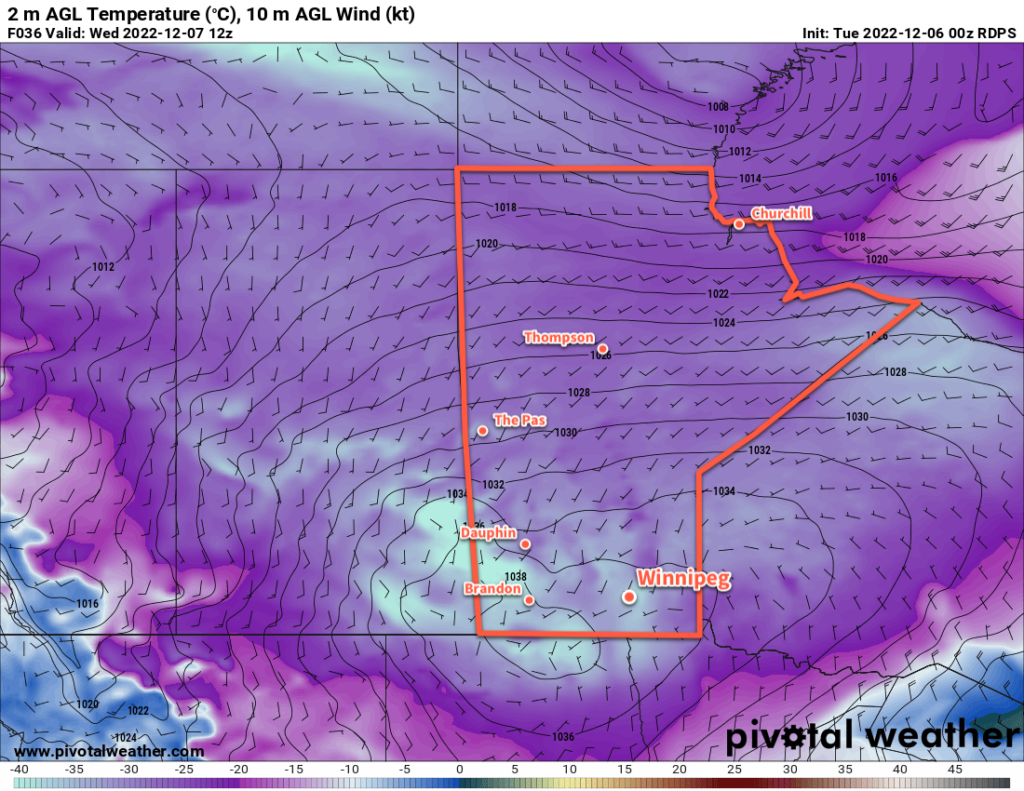
What happens after that is a bit of an interesting interaction with a renewed shot of moisture into the Colorado Low on Thursday, the still-stalled inverted trough hanging back from the system, and a cold front advancing towards the region. There is reasonable confidence that another wave of moderate to heavy snow will push into southern Manitoba from the east later on Thursday. This band of snow will persist through Thursday night, gradually pushing towards the Saskatchewan border. This system could bring another 10 to 20 cm of snow to the Red River Valley by Friday morning, including for Winnipeg.
Daytime highs will hover near freezing through Wednesday, then gradually drop through the day Thursday and Friday to around -5 °C. So while temperatures will be pleasant, most of the region is poised to receive anywhere from “some” to “a lot” of snow over the next few days.
Long Range Outlook
Periods of light snow will likely linger into the weekend, but accumulations will be much less. Daytime highs will fall through the weekend as colder air filters in behind this whole disturbance. While Saturday will be pleasant with a high near -8 °C, by Sunday temperatures will fall into the minus mid-teens and barely recover.
Even colder weather will start next week, but a bit of moderation will occur as another disturbance brings snow to the region on Tuesday into Wednesday.pi…
Today’s seasonal daytime high in Winnipeg is -10 °C while the seasonal overnight low is -19 °C.
#awm #forecast_post