Our left-over moisture will slowly clear out today and tonight ushering in a beautiful weekend with plenty of sunshine and warm temperatures. With Winnipeg’s average daytime high sitting at around -8°C right now, we can expect to see tempeatures nearly 10°C above normal by the end of the weekend!
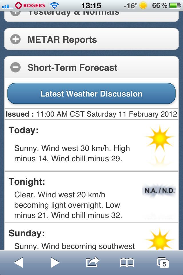
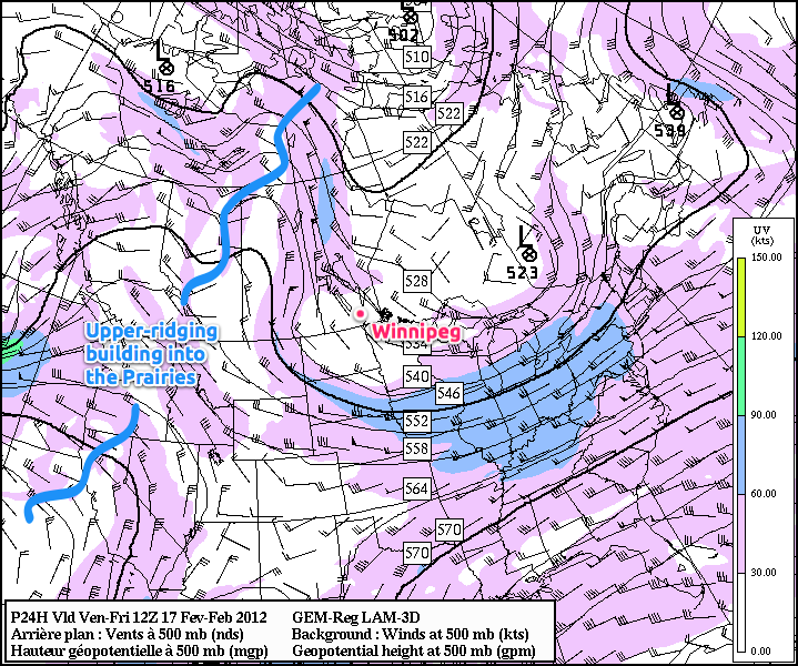
We’ll see a mix of sun and cloud here in Winnipeg today, with the ever-present chance of a few snowflakes, but any snow that does develop will be less significant than the few light flurries we saw yesterday in the city. The daytime high today will be cooler than yesterday, around -4°C, as a trough of cool air aloft swings over Southern Manitoba. The snow much of the Red River Valley recieved between 2 and 5cm of on Wednesday as a shortwave embedded in an upper trough swung across the province will not be sticking around for very long. An upper ridge has begun to build into the Prairies and will continue it’s trek into Southern Manitoba over the next two days. Here in Winnipeg, we’ll see winds switch around to southerly overnight tonight, which will usher in milder air and push our temperatures up for the weekend.
We’ll see temperatures soar this weekend with a light south-southwest flow and mild air pushing in aloft. 850mb temperatures are expected to increase to slightly above 0°C by Sunday night, which will ensure that through the weekend we have daytime highs of 0°C – 3°C in Winnipeg.
Temperatures are expected to reach as high as +2°C this weekend; that’s 10°C above normal for Winnipeg at this time of year.
Any areas that manage to return to snow-free quickly will be able to add a couple degrees to those temperatures. Overnight lows will still be cool, with temperatures dropping down to around -11°C tonight and tomorrow night.
By Sunday, a low-pressure system will begin ambling it’s way out of Alberta into Saskatchewan. This will increase the southerly upper-level flow and provide the needed kick to really push those 850mb temperatures up. With the dramatically warmer 850mb temperatures in place, our overnight low on Sunday night will essentially be just a degree or two cooler whatever the daytime high makes it to.
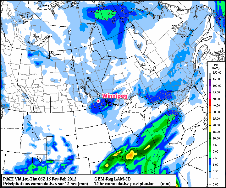
The low will then track eastwards across Manitoba Monday into Tuesday. Models disagree significantly on what will happen happen for Winnipeg, with some giving us 5 to 10cm of snow and others keeping the precipitation 250 miles away from us. We’ll certainly keep our eyes on this system as it develops!