Seasonably Cool, Drier Weather Ahead

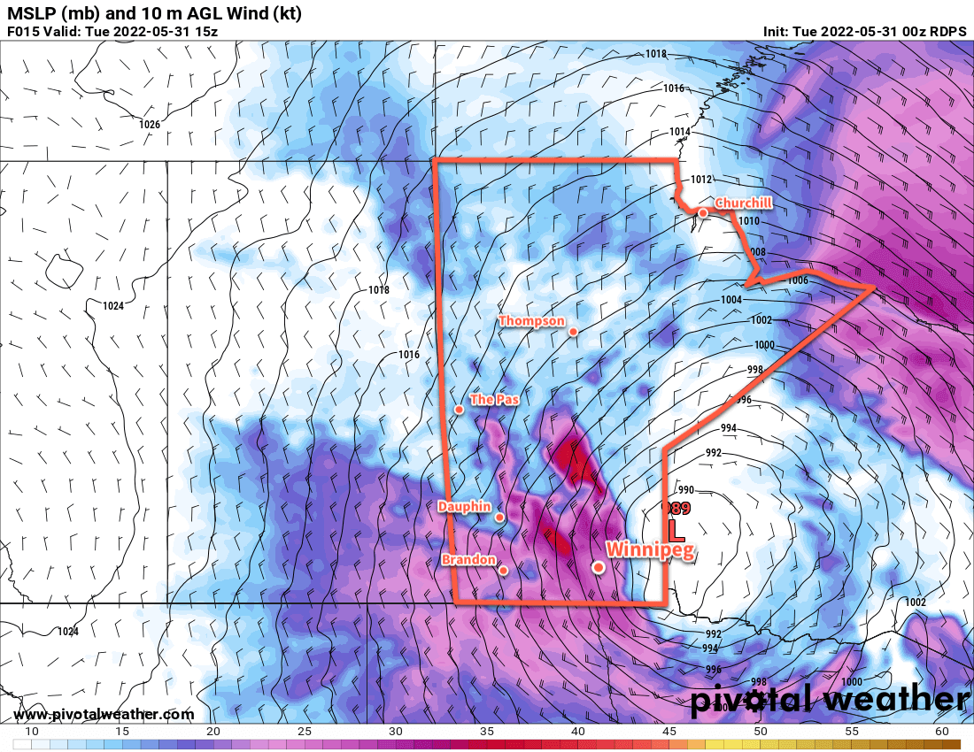
A stalled low pressure system over the province will keep temperatures cool over the weekend. On the bright side, there won’t be much rain in the days ahead.

RDPS 2m Temperature Forecast valid 21Z Friday June 3, 2022
Mild but below-seasonal temperatures will stay in place over southern Manitoba through the weekend. Northern Manitoba will see much cooler conditions.

Below-seasonal temperatures will continue over the coming days as a captured cold low sits stalled over the province. Daytime highs over the next few days will sit in the 15–20 °C range with a northwesterly breeze each day. The region will see plenty of sunshine with some pop-up afternoon clouds. Overnight lows will likewise be cool, generally dipping to around 5 °C.

A bit more cloud will move through the region on Sunday. The stalled low over the province will dip southwards, also bringing slightly cooler temperatures. There’s a slight chance for a bit of rain, but it looks likely that any wet weather will stick to the north of the Red River Valley. Accumulations would be light with just a couple mm of rain possible in a small band.

Warmer weather will return on Monday with highs climbing back into the upper teens with mixed skies.

Long Range Outlook

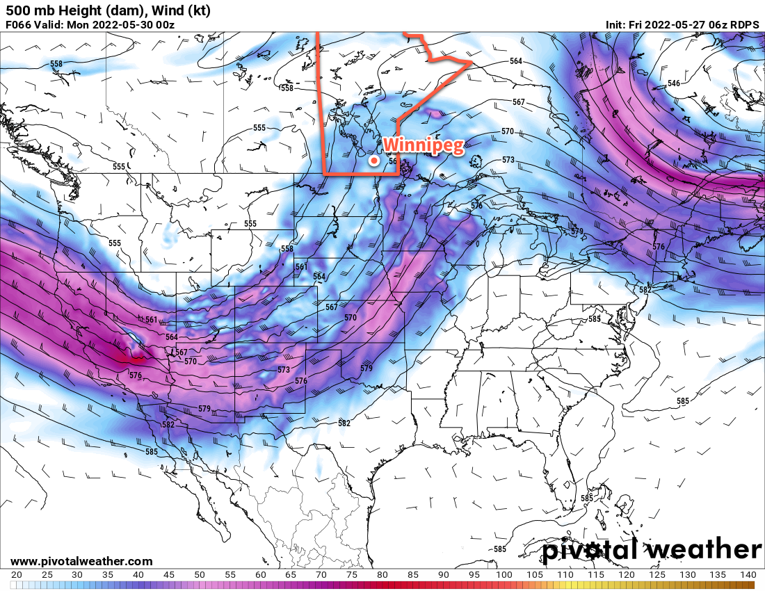
Temperatures will trend back towards seasonal values next week, but no substantial shift into warmer weather is forecast. A weak upper trough will linger across the region through most of the week, bringing the occasional chance of afternoon showers driven by daytime heating. Forecast models show an increasing chance of a large upper ridge building across the Prairies by next weekend. This would bring settled and warmer weather to the region. There is a chance, though, that as that air mass builds across the Prairies through the weekend, there would again be the potential for more organized showers/thunderstorms as a warm front lifts through the region.

But for now, things will be able to dry out a bit with cool, dry conditions, sunny to mixed skies, and a breezy northwest wind.

Today’s seasonal daytime high in Winnipeg is 22 °C while the seasonal overnight low is 9 °C.

Strong Winds as Rain Ends, Seasonably Cool and Dry Conditions Follow

The rain across southern Manitoba will taper off today as very strong northwesterly winds develop across southern Manitoba. Once they ease later today, a stretch of slightly cooler, but mainly dry, conditions takes over.

RDPS 10m Wind Forecast valid 15Z Tuesday May 31, 2022
Strong to severe northwest winds will develop over parts of southern Manitoba early Tuesday morning.

A low pressure system tracking northwards out of Minnesota is the culprit for this latest batch of wet weather across the region. It will continue along the Manitoba/Ontario border today with wrap-around showers lingering through the region into the afternoon. Very strong northwest winds will develop across most of southern Manitoba this morning; sustained winds of 50–60 km/h will spread eastwards this morning, and gusts could reach as high as 80–90 km/h.

The winds will begin to ease later in the day as the low continues off into northern Manitoba. The combination of cloud cover, showers, and that northerly wind will result in a very cool day. Temperatures in Winnipeg will only reach around 10 °C this afternoon. Some clearing will develop tonight as the winds continue to ease to around 20 km/h. Temperatures will fall into the 5–10 °C range.

The weather forecast will be fairly stagnant through the rest of the week. This low moving through will stall out over northern Manitoba for a few days, keeping the weather relatively consistent across the province. Here in Winnipeg, daytime highs will generally sit in the 15–20 °C range with lows in the 5–10 °C range. Northwest winds of 20–30 km/h will be common during the days, but will slowly ease as the system in northern Manitoba weakens through the week. Morning sun with some afternoon cloud will be commonplace.

The only catch might be Thursday; there’s a chance that the Red River Valley is clipped by the remnants of this system as it exits the province. If that happens, Winnipeg would see cloudier conditions on Thursday with a chance of a few showers. It would also be cooler in that situation with highs in the 10–15 °C range.

Long Range Outlook

The end of the week and weekend is looking pleasant overall. Temperatures will nudge back towards 20 °C for the weekend with plenty of sunshine Friday through Sunday.

Today’s seasonal daytime high in Winnipeg is 22 °C while the seasonal overnight low is 8 °C.

After A Mostly Dry Week, An Unsettled Pattern Returns

Conditions will turn unsettled over southern Manitoba as a deep upper trough develops over western North America this weekend.

RDPS 500 mb Wind & Height Forecast valid 00Z Monday May 30, 2022
A deep upper trough will develop over western North America in the coming days, sending Manitoba into a wet and unsettled stretch of weather.

The weather will change over the next few days as an upper low off the west coast moves onshore. As it moves into British Columbia, an upper trough will dig southwards over the Rockies. As it does, it will turn a relatively benign pattern over the Prairies into something much more unsettled.

After a beautiful Friday with temperatures climbing into the mid-20s, cloud will push into the Red River Valley this evening. A shortwave tracking eastwards along the U.S. border will support area of showers or thunderstorms through the night. They will develop this afternoon in southern Saskatchewan and drift into southwest Manitoba tonight. The showers will reach Winnipeg through the second half of the night, but also be weakening as they approach. It’s unlikely that there’s enough “oomph” left by morning for there to be any thunderstorms; the Winnipeg area will see a few showers taper off early Saturday.

Skies will stay cloudy most of Saturday with a few sunny breaks possible in the afternoon. Temperatures will climb to around 20 °C, perhaps warmer if a bit more sun is able to peek out. More cloud will push in on Saturday evening as temperatures dip into the low teens.

The next disturbance will begin lifting northwards through the Dakotas on Saturday night. A broad area of showers and/or thunderstorms will develop across North Dakota on Saturday night and lift northwards. They’ll move into Manitoba early Sunday, and continue northwards through the day. Much of southern Manitoba will see showery conditions through Sunday with increasing humidity as the day progresses. While rainfall will be highly variable, it’s likely that much of the southern Manitoba will see 10–25 mm of rain through Sunday. Locally, depending on the strength of the convection, rainfall totals could reach 25–50 mm.

Temperatures will stay mild, though, with highs near 20 °C and a low on Sunday night in the mid-teens. Cloudy weather will continue on Monday with a chance for a few showers. Another disturbance is forecast to move through on Monday night which may bring more showers and thunderstorms to the region. With humid air in place, rainfall could be quite heavy. This will be a concern given the flood concerns that continue in parts of the province.

Long Range Outlook

Some more showers are possible Tuesday into Wednesday as yet another disturbance moves through the region. Cooler weather with with isolated to scattered showers will move in mid-week. The weather will finally stabilize for the end of the work week.

Today’s seasonal daytime high in Winnipeg is 22 °C while the seasonal overnight low is 8 °C.

Dry Weather and Seasonal Temperatures Settle Over Winnipeg

The Winnipeg area will finally see a stretch of pleasant temperatures and plenty of sunshine.

RDPS 2m Temperature Forecast valid 21Z Wednesday May 25, 2022
Warmer weather will finally spread across southern Manitoba this week.

Settled conditions and warm weather will persist through the work week in Winnipeg as an upper ridge slowly builds into the Prairies. Daytime highs will climb into the low 20s each of the next few days with overnight lows climbing from around 10 °C into the mid-teens.

Skies will stay mainly sunny over the next few days as well. One exception will be a bit of cloud will skimming through the region on Wednesday morning as a system passes to the southeast.

It will be generally breezy over the next few days with southerly winds increasing to around 30 km/h today, Wednesday, and Thursday.

A few weak disturbances will move through the province over the coming days, but they should mainly impact the Parkland and Interlake regions.

Long Range Outlook

Unsettled conditions will begin to push into the region on Friday night. A slow-moving low pressure system will begin to track across the southern Prairies and northern United States over the weekend. This system will bring a couple chances for showers or thunderstorms through the weekend, and then cooler, showery conditions next week.

Today’s seasonal daytime high in Winnipeg is 21 °C while the seasonal overnight low is 7 °C.