A large-scale pattern change has brought an end to Winnipeg’s streak of early-fall warmth with the forecast ahead bringing cooler temperatures and wetter conditions.
A series of disturbances will move through southern Manitoba over the coming days and bring several chances for rain to the region. The first is moving through this morning, bringing a few showers to the city while the more organized area of showers and thunderstorms passes to the south and east. The rain should taper off midday, leaving behind mostly cloudy skies and light northerly winds.
Temperatures will be much cooler today with a high only around 16 or 17 °C. The cloud cover will break up a bit this evening, but a new low developing in the United States will push overcast skies back in by Saturday morning. Temperatures will dip to around 11 °C tonight.
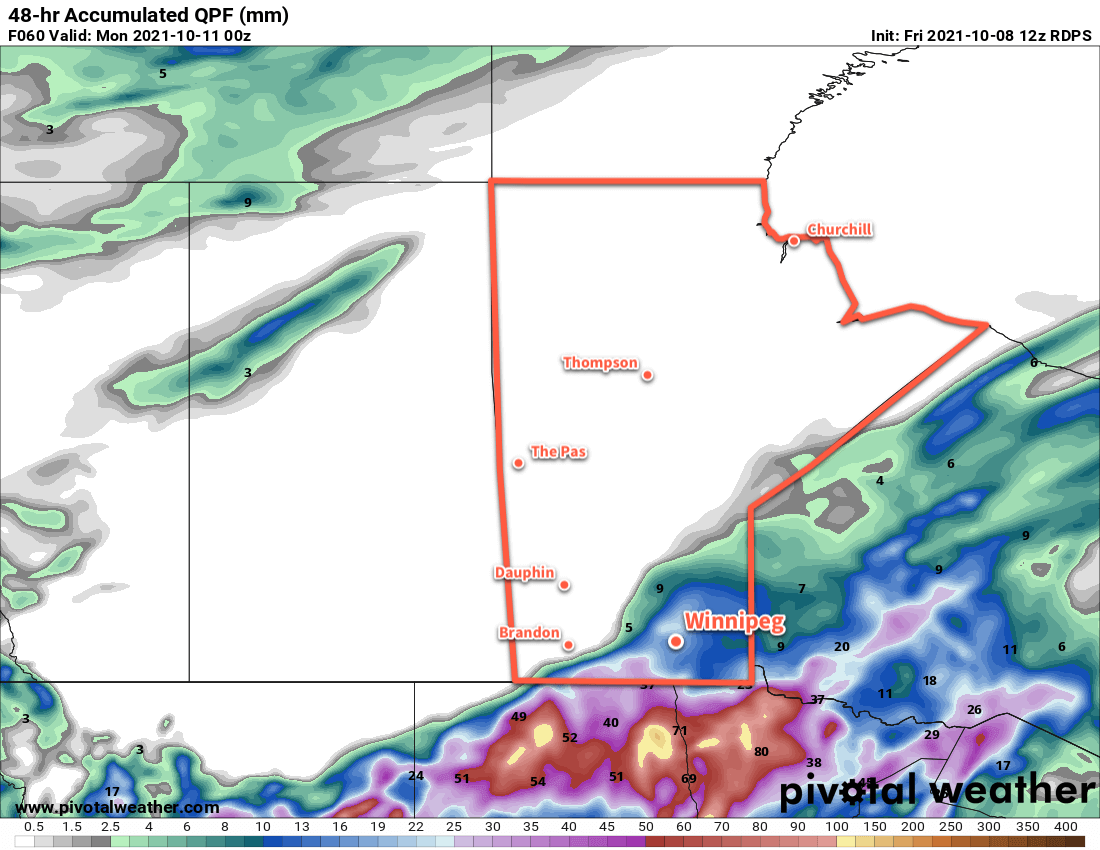
Saturday will bring cloudy skies and a high near 16 °C. Winds will shift to the northeast at 20–30 km/h as a low in the Dakotas lifts northeast towards the region. A broad area of rain will push into the region Saturday afternoon that will bring rain to Winnipeg into Sunday morning. Rainfall totals from this system by Sunday morning will likely sit in the 20–50 mm range. The highest amounts will fall along the western escarpment of the Red River Valley where northeasterly upslope winds will enhance the rain rates in that region. In Winnipeg, rainfall totals will likely sit in the 15–25 mm range. Some uncertainty associated with this system could nudge that a little bit in either direction.
The winds will ease Saturday night as temperatures dip to a low near 14 °C.
On Sunday the low pressure system will track across southern Manitoba. As it crosses the area, it will sustain a band of rain along its western flank that weakens through the day. It appears that this should stay west of Winnipeg, running from the central Interlake towards the Pilot Mound region. This band will produce another 5–10 mm of rain on Sunday. For Winnipeg and other areas to the east, Sunday will bring cloudy skies with a chance of showers or drizzle.
Temperatures will climb to a high near 16 °C on Sunday with northerly winds picking up to 20 km/h.
The location of the rain band to the west of Winnipeg will be very sensitive to the low track; if the low ends up further east than forecast, Winnipeg may end up under that band of rain on Sunday.
The low will track out of Manitoba on Sunday night. There will be a chance for scattered showers behind it as northwest winds of 20–30 km/h sweep through. Temperatures will dip to a low near 10 °C.
Long Range Outlook
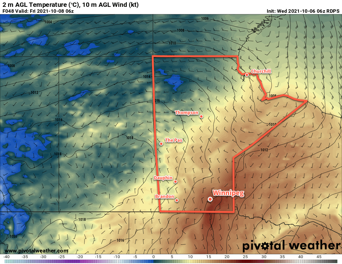
Winnipeg and the Red River Valley will see plenty of cloud through the first half of next week. Temperatures will stay near seasonal values and there will be a slight chance of showers. Heading into the second half of the week, weather models show a rather vigorous Colorado Low devloping. It is forecast to lift northwards into Saskatchewan and Manitoba on Thursday into Friday. This will likely mark the first major fall storm for the Prairies this year, and fortunately snow looks unlikely with it right now.
Winnipeggers may find themselves longing for the sun by the time it makes more than a brief appearance next weekend.
Today’s seasonal daytime high in Winnipeg is 12 °C while the seasonal overnight low is 1 °C.