Winnipeg’s long-frozen stacks will finally get some relief as above-freezing temperatures move through the region this week.
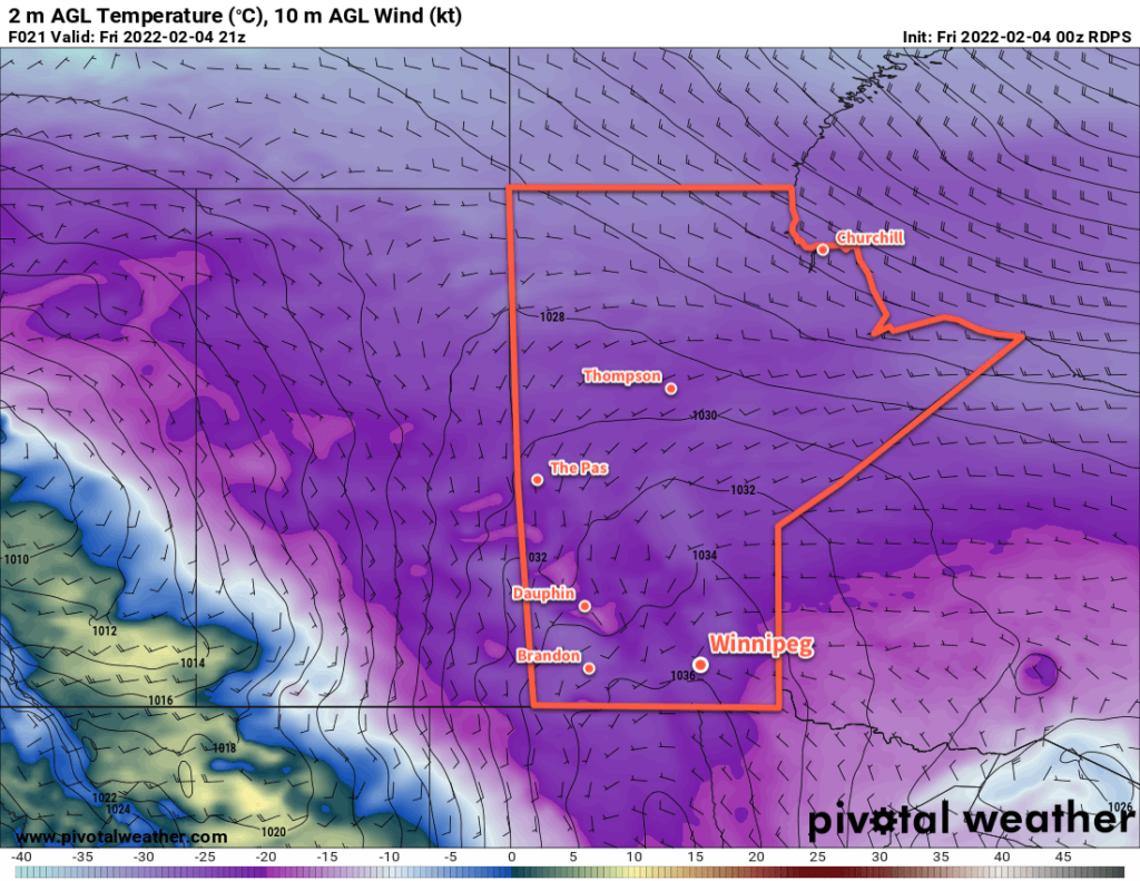
Today will be the first day this week to bring a high temperature above 0 °C to the city. A low pressure system sliding southeastwards through the province has pushed a warm front through the region overnight. As westerly winds move in behind it, temperatures have climbed up to near-freezing. They’ll continue to warm to a high near +2 °C later today.
The warm weather will be cut short by a cold front slumping through the region this evening. It will bring a chance of rain showers or flurries and northwest winds up to 40 gusting 60 km/h.
The northerly winds will continue on Wednesday as an Arctic high builds into the region. Temperatures will likely fall through the day into the mid-minus teens as skies clear out. Temperatures will likely drop to around -20 °C on Wednesday night, then begin to warm as the next system moves towards the region.
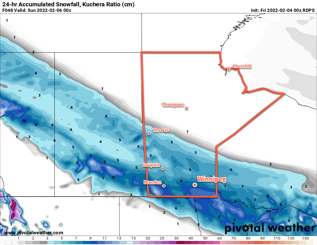
Another low pressure system will bring warm weather to southern Manitoba on Thursday. This system will be a bit more potent than today’s and bring more precipitation with it. As it moves from northern Saskatchewan into southern Manitoba on Thursday, it will spread 5–15 cm of snow through along a line from northwestern to southeastern Manitoba.
The Red River Valley may see some snow or freezing rain mid-afternoon as the warm front moves across the region and sends temperatures back up above freezing. The cold front will follow through shortly after, bringing strong northerly winds and some more snow.
Long Range Outlook
Temperatures will cool to below seasonal values heading into the weekend, with lows near -30 °C likely again on Friday night. After that, a disturbance might bring a bit of light snow on Sunday, followed by a moderation back towards seasonal temperatures.
Today’s seasonal daytime high in Winnipeg is -9 °C while the seasonal overnight low is -20 °C.