Temperatures are warming up in Winnipeg, but a battle between warm and cold air is setting up over the province.
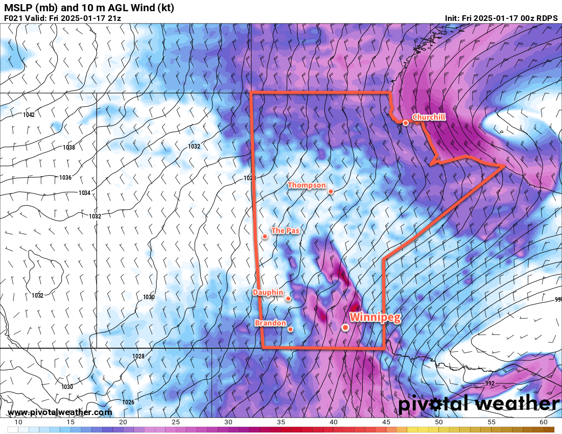
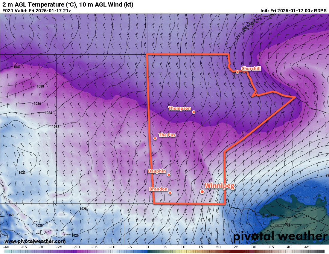
To end the work week, a warm front will push through the Winnipeg area this morning. This front will bring a couple centimetres of light snow and moderate southerly winds as it pushes through. The snow will ease midday behind the front with winds shifting to the west. Temperatures will climb to a high near -2 °C this afternoon.
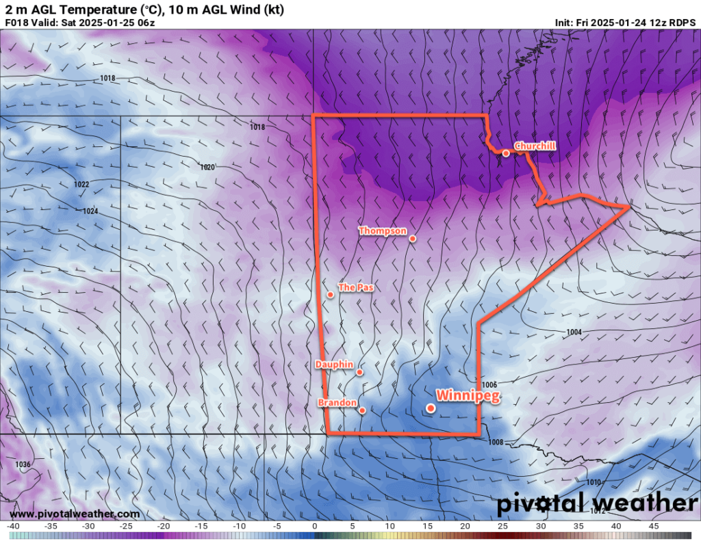
More snow will move into the region this evening, driven by a cold front following the warm front through the province. Another couple centimetres of snow will fall along with northwest winds up to 40 gusting 60 km/h. These winds will send temperatures back down into the mid-minus teens tonight and bring some blowing snow to the region.
Saturday will bring cooler, near-seasonal temperatures back to the region with a high just under -10 °C. Northwest winds will continue through the day at around 30 gusting 50 km/h, then ease off in the evening. A few flurries will be possible in the morning, then skies will clear. Another warm front will push into the region overnight, warming temperatures from a low in the mid-minus teens up to around -10 °C by Sunday morning.
On Sunday, a southwesterly breeze will bring mixed skies as temperatures climb into the -5 to 0 °C range. Temperatures will continue to warm towards the freezing mark on Sunday night as westerly winds of 20 to 30 km/h continue.
Long Range Outlook
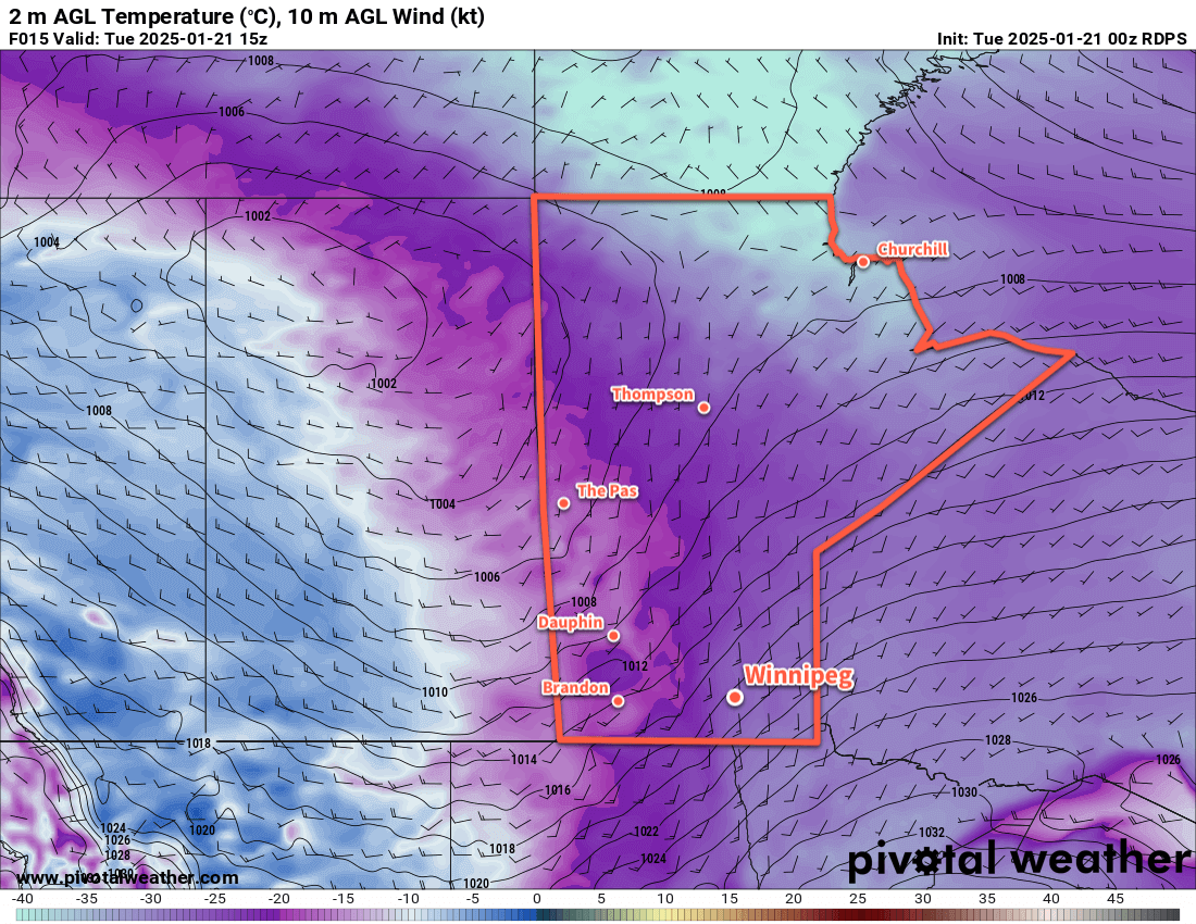
Heading into next week, long-range forecasts show mild conditions for Winnipeg with daytime highs regularly near the freezing mark. There’s some uncertainty, though, as to whether the warmth will be able to stay in place over the region.
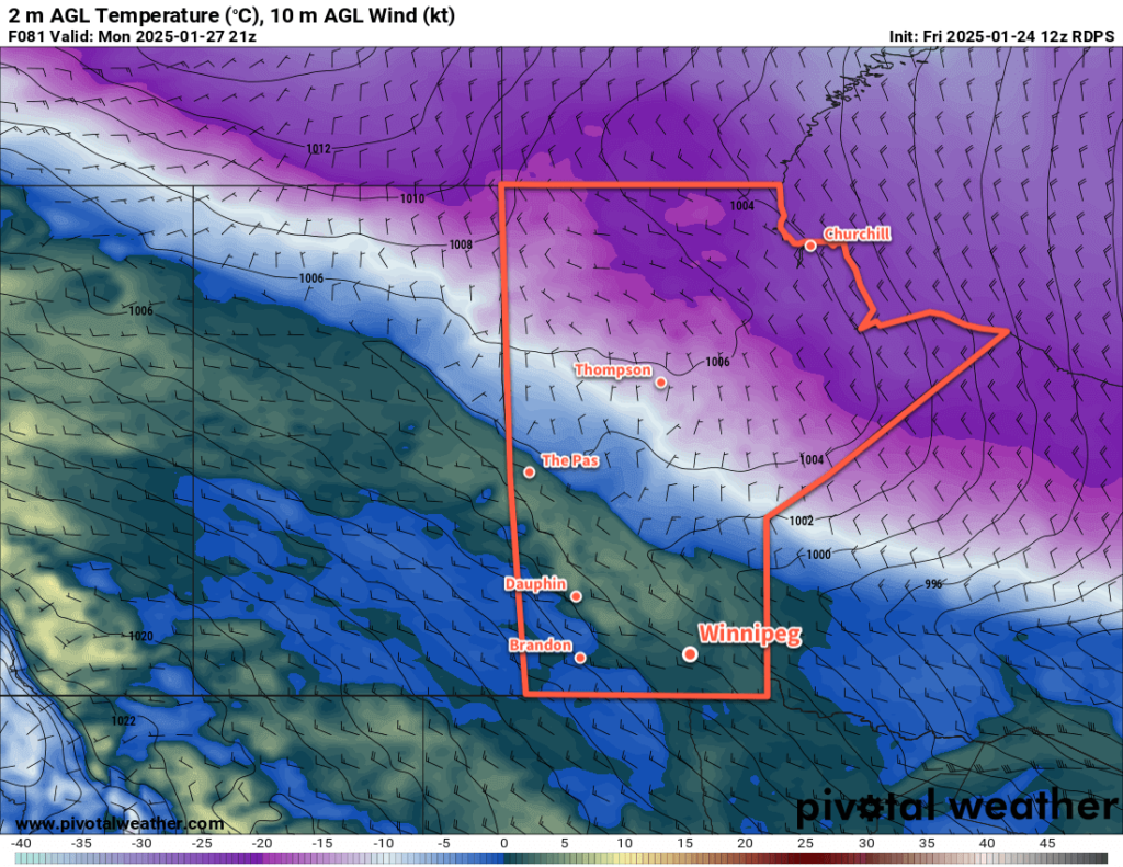
The Polar Vortex is forecast to dip southeast into eastern Canada, and a strong temperature gradient will likely set up across Manitoba as a result. Daytime highs could reach above freezing over parts of southern Manitoba while temperatures into the -20s and -30s will be possible over northern Manitoba. With such a strong temperature gradient in place over the province, minor changes in front location could result in large swings in expected temperatures.
It will likely be a mild week next week, but minor features could also result in brief outbreaks of rather cold temperatures later in the week.
Today’s seasonal daytime high in Winnipeg is -12 °C while the seasonal overnight low is -23 °C.