Winnipeg will gradually come out of the grip of bone-chilling cold that’s been in place over the last 10 days.
The polar vortex will slowly shift eastwards this week, allowing warmer temperatures to return to the Prairies. The temperature climb, unfortunately, is relegated mainly to the second half of the week. In Winnipeg, highs will only climb from around -23 °C today to -20 °C on Wednesday with a bit of a southerly wind at times. Overnight lows will hover in the low minus thirties.
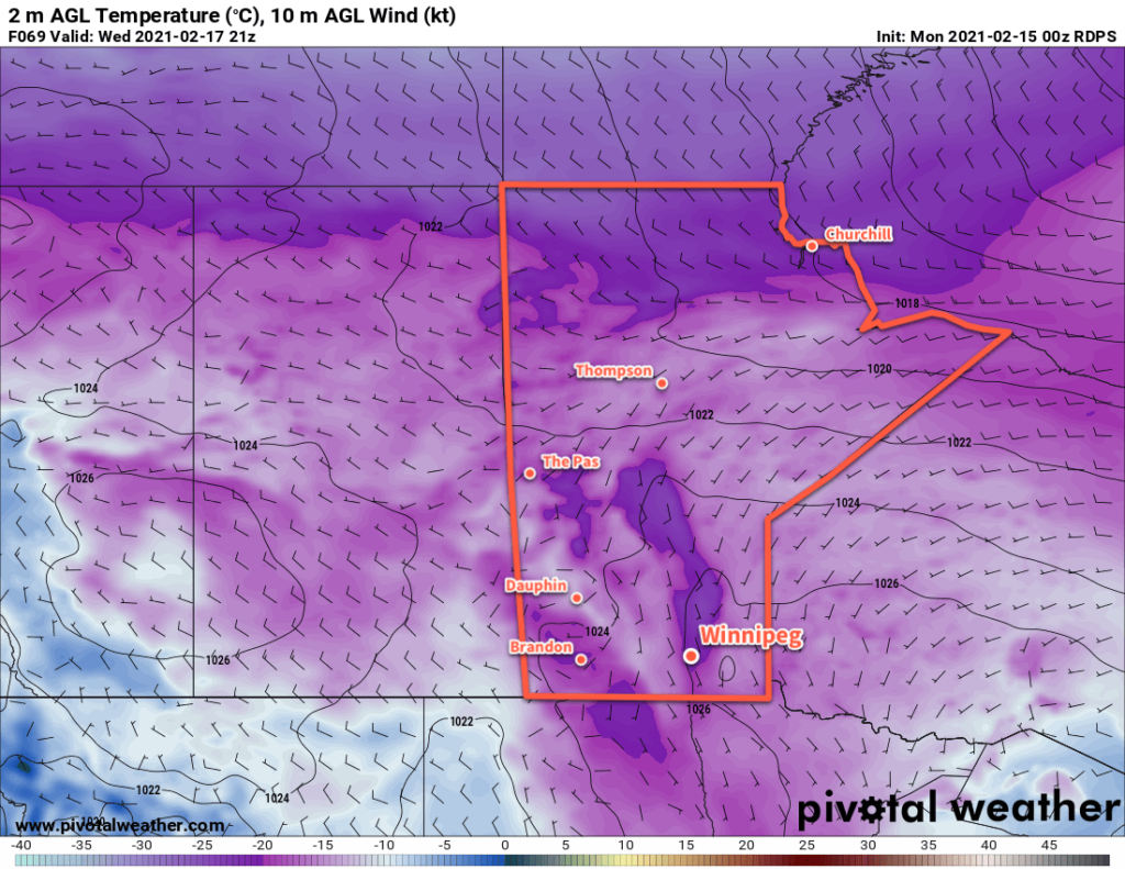
Wednesday will be a turning point for southern Manitoba where the bitter cold finally begins to break down.
Long Range Outlook
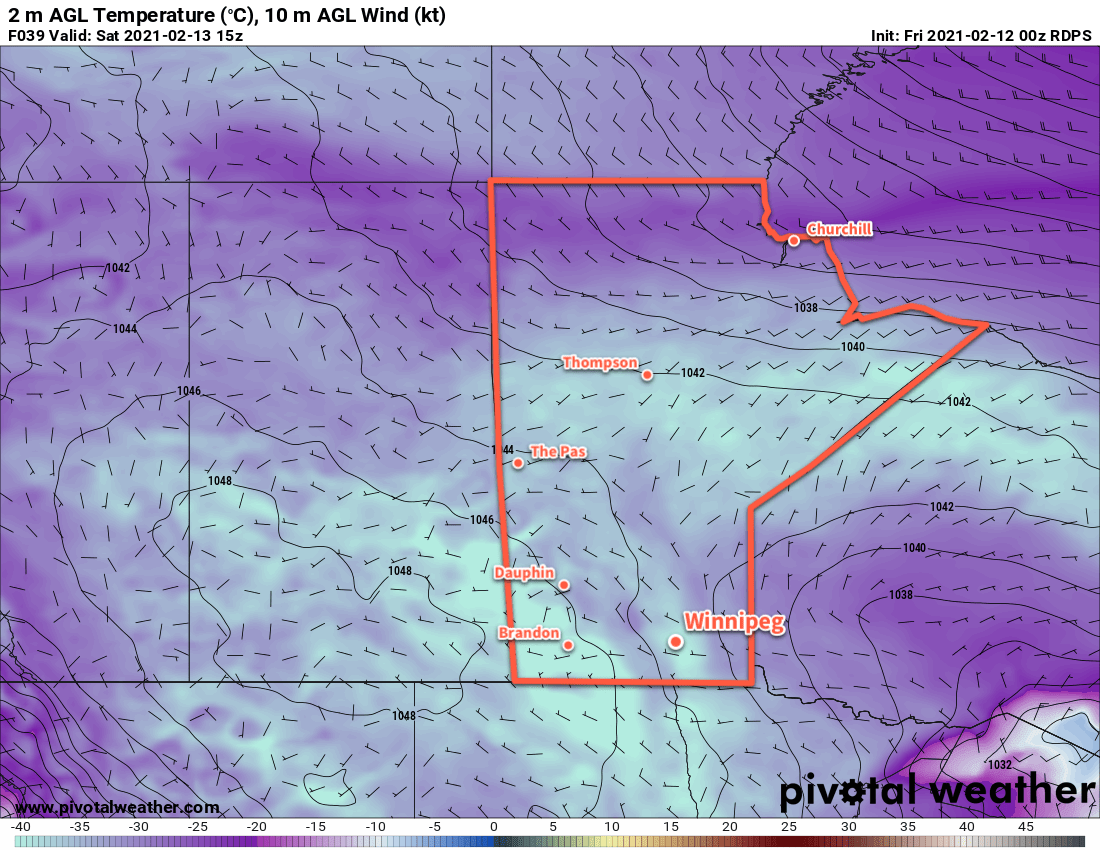
The rest of the week will bring partly cloudy skies to Winnipeg as temperatures climb back to seasonal values by Saturday. No notable snowfall is in the forecast between now and next week.
Temperatures will likely climb above seasonal values and close to the freezing mark by Sunday or Monday. Get the shorts ready!
Today’s seasonal daytime high in Winnipeg is -8 °C while the seasonal overnight low is -19 °C.
The polar vortex will keep Winnipeg in its grip with dangerously cold temperatures persisting this weekend.
Below-seasonal temperatures will continue this weekend as the polar vortex keeps dangerously cold Arctic air locked over the region. Daytime highs will stay in the mid- to lower minus twenties over the next few days with overnight lows dipping into the minus thirties.
It’s still really cold.
Winds will be light in Winnipeg through the weekend, but with temperatures so cold wind chill values of -40 to -50 will be regular across southern Manitoba this weekend.
Skies will stay mainly sunny.
Long Range Outlook
This bitterly cold weather pattern will finally break down through the course of next week. The polar vortex will begin to weaken and push off to the east through the first half of the week. As it then curls back northwards and reforms over the Arctic, milder Pacific air will begin to spill eastwards over the Prairies.
Daytime highs next week will tart off in the -15 to -20 °C range, but will climb to slightly above seasonal values in the -5 to -10 °C range by the end of the week. Overnight lows look to stay in the -20s through Wednesday night, then begin to warm heading towards next weekend.
Today’s seasonal daytime high in Winnipeg is -9 °C while the seasonal overnight low is -19 °C.
The bitterly cold Arctic air that has lead to severaltragicdeaths across Western Canada will stay entrenched over the region for the rest of the week.
The polar vortex will gradually slump through Manitoba in the second half of the week, sustaining the dangerously cold weather in the region. Daytime highs will fall back into the mid-minus 20s by the end of the work week with overnight lows in the minus 30s. Winds will stay light over the next few days.
Dangerously cold temperatures will continue through the end of the week.
Despite the cold conditions, low-level instability will develop this afternoon, producing cloud and light flurries.
Much of the region will see mixed skies with some flurries develop today as temperatures warm and low-level instability develops. Similar to yesterday, the air aloft is so cold that its able to generate cumulus clouds even with surface temperatures in the -20s. The clouds will taper off overnight, and then redevelop on Thursday. With slightly colder temperatures tomorrow, there will be less of a chance for flurries.
Sunny skies return on Friday.
Long Range Outlook
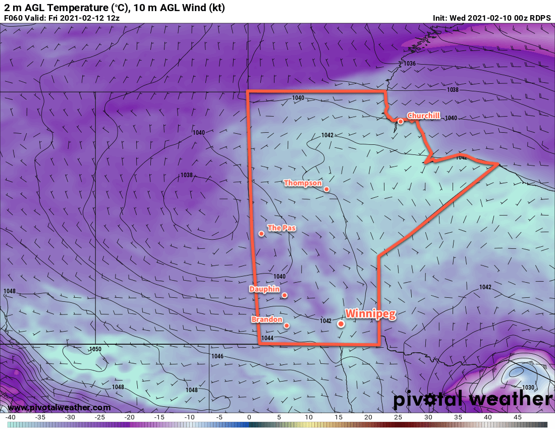
The bitter cold will stay in place for Saturday, but finally some relief will start developing on Sunday. Temperatures will warm back towards -20 °C on Sunday, followed by a gradual trend towards seasonal values through next week.
Today’s seasonal daytime high in Winnipeg is -9 °C while the seasonal overnight low is -20 °C.
There’s no relief in sight for Winnipeg as bitter cold stays entrenched over the region this week.
Dangerously cold conditions will stay this week for the Prairies, including Winnipeg. Temperatures will be dangerous today with a high near -26 combining with westerly winds increasing to around 30 km/h. This will produce wind chill values of -45 to -50 this morning and -40 to -45 this afternoon. Temperatures will drop back towards -30 °C tonight.
Tuesday and Wednesday will offer a semblance of “relief” from the cold; the coldest core of temperatures will shift towards the Rockies and some modified Arctic air will move into Manitoba. It’s not going to be that much of a change though; tonight’s low rising to -29 °C is the start of it and Tuesday and Wednesday will both bring high around -23 °C.
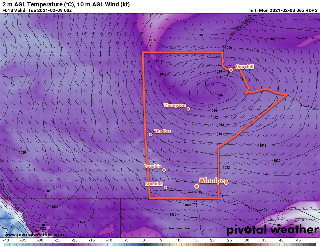
Bitterly cold temperatures are entrenched over the entire Prairies. The low over northern Manitoba will bring some cloud and marginally improved temperatures to southern Manitoba on Tuesday and Wednesday, then the colder temperatures return.
Winds on Tuesday will again hover in the 20–30 km/h range, producing wind chills near -40 early Tuesday morning that climb only to around -35 in the afternoon. Wind chills dip back into the -35 to -40 range on Wednesday night before beginning to ease on Wednesday as the winds let up. The return of “pure” Arctic air will begin on Wednesday night, with lows dropping back below -30 °C.
Long Range Outlook
Bitterly cold temperatures persist through Thursday, Friday, and Saturday. By Sunday, a shift in the upper air pattern will begin to break down the entrenched lobe of the polar vortex over the region. It will start moving off to the east and milder temperatures will begin to move in. Below seasonal temperatures will continue through the first half of next week, but highs should climb into the -15 to -10 °C range with lows eventually rising above -20 °C.
Today’s seasonal daytime high in Winnipeg is -9 °C while the seasonal overnight low is -20 °C.