The ship will be staying the course in Winnipeg this weekend with little change to the weather.
Southern Manitoba will see quiet weather this weekend as upper ridging stays over the region into next week. This upper pattern will support a broad area of high pressure across the southern Prairies over the coming days.
Little change in the weather is on on the way this weekend with mild winter temperatures persisting across the southern Prairies.
As a result, Winnipeg will see little change in the weather. The city will see highs near -1 °C and lows in the low minus single digits. Cloud will stick around today as fog in the area slowly lifts, followed by clearing skies on Saturday. Winds will be light today and tomorrow, but pick up out of the south to around 20 km/h on Sunday as the high slumps south of the province.
Long Range Outlook
Warm weather continues into the start of next week with variable cloudiness. Temperatures will begin to cool a bit through the latter half of the week, but still staying above seasonal values. No significant snow is in the forecast.
Today’s seasonal daytime high in Winnipeg is -13 °C while the seasonal overnight low is -24 °C.
Slack winds and a building upper ridge will continue to bring mild weather to Winnipeg as cloudier conditions move in.
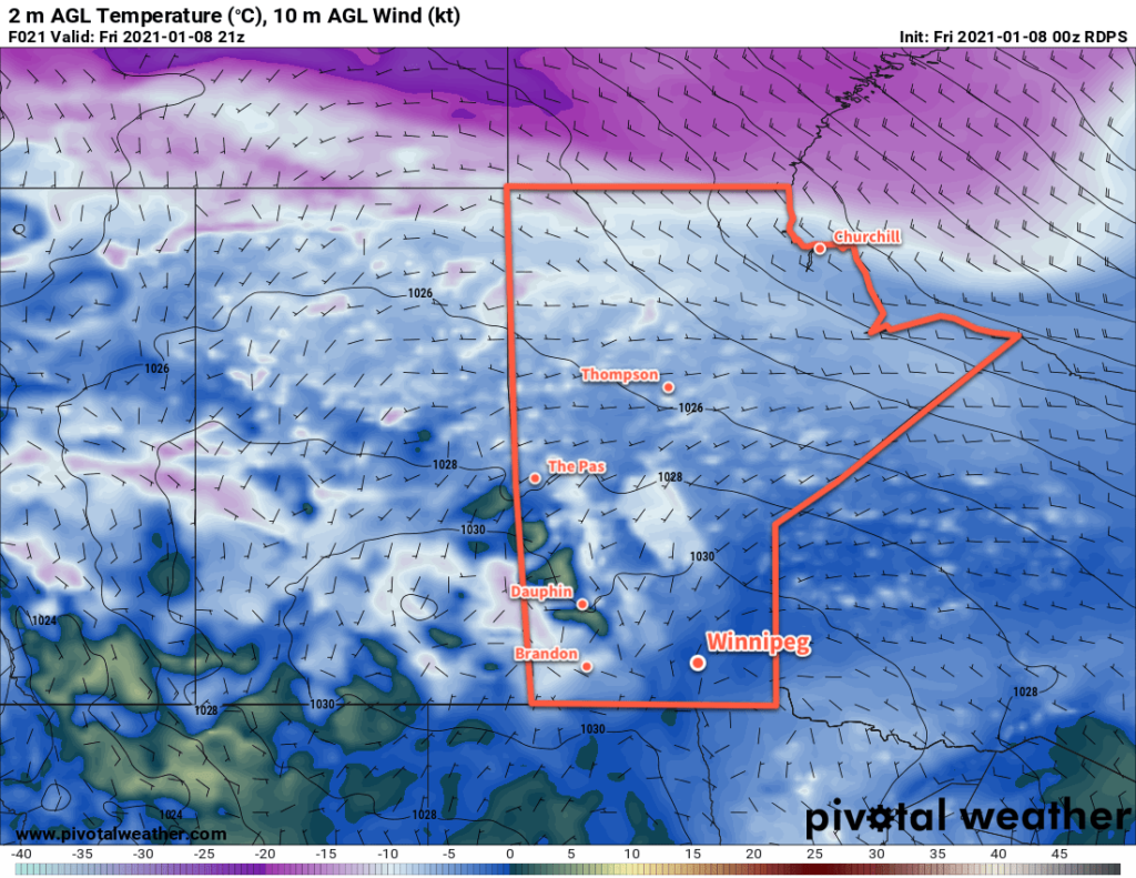
Winnipeg will sit on the northeastern edge of a col today, bringing quiet conditions with a light southerly wind. Skies should stay mostly cloudy today; some models want to clear skies out this afternoon, but low-level winds in Winnipeg are forecast to stay southerly through the day. With little change in the low-level winds, it seems more likely that the clouds will persist through much of the day. Temperatures will continue mild with a high near -1 °C. The southerly wind will strengthen into the 20–30 km/h range overnight as temperatures head to a low near -5 °C.
Southern Manitoba will see near-freezing highs this week as an extended period of above-seasonal temperatures continues.
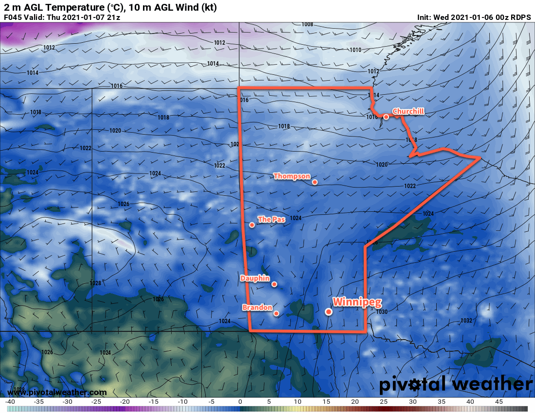
On Thursday and Friday, Winnipeg will see cloudy skies with mild weather continuing. The breezy southerly winds will continue through much of Thursday then taper off late in the day. Friday will bring a chance for some light snow to the region as a trough moves into the Red River Valley. Both days will see a high near -1 °C and lows around the -5 °C mark.
Long Range Outlook
The long-range forecast is rather astonishing for January in Winnipeg. Forecasts show little change to the broader weather pattern over the coming weeks. This means that the next 7–10 days will bring more of the same: mild temperatures and generally dry conditions.
Today’s seasonal daytime high in Winnipeg is -13 °C while the seasonal overnight low is -23 °C.
Winnipeggers will be able to continue easily enjoying the outdoors with temperatures over 10 °C above seasonal averages.
Today will start off with a low pressure system that moved into the region yesterday exiting eastwards into Ontario. As it pushes off, Winnipeg will see mainly sunny skies and westerly winds of 20–30 km/h. Temperatures inch up to a high near +1 °C through the day as the winds gradually ease. The city should see clear skies tonight with a low near -13 °C as a ridge moves through.
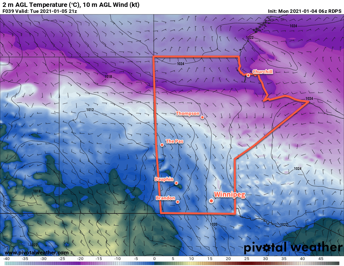
On Tuesday, an upper trough will move into Saskatchewan, spreading cloud cover eastwards ahead of it into Manitoba. Winds will shift to the southeast ahead of a surface low, but should stay light through the day. Temperatures will be a tad cooler as ridging remains across the region and Winnipeg will see a high near -3 °C. Skies will be mostly cloudy on Tuesday night with a low near -5 °C.
Mild temperatures will persist across the southern Prairies this week.
Wednesday will bring little change across the region as Winnipeg finds itself on the edge of a col. A col is an area of light winds found where a trough and a ridge intersect. In our case, the trough will run from Alberta southeastwards to a low over Iowa, and the ridge will run from NW Ontario southwestwards towards Idaho. As a result, any cloud left from Tuesday night should just stick around and give mostly cloudy skies. Winds will be light and temperatures should climb to a high near -1 °C. Skies will stay on the cloudier side on Wednesday night with a low near -4 °C.
On both Tuesday and Wednesday, the cloud cover could produce some periods of light snow, but accumulations would be insignificant. If it happens, the snow would be light enough that it’s only really worth mentioning in passing.
Long Range Outlook
Mild temperatures with conditions trending cloudier will continue through the week. The next chance for any organized snowfall looks to be on Friday night when an occluding frontal wave could bring a couple centimetres of snow to the region.
Today’s seasonal daytime high in Winnipeg is -13 °C while the seasonal overnight low is -23 °C.
Winnipeg will continue to see temperatures well above seasonal values this weekend. The deep freeze typical for this time of year looks to stay absent through the coming week.
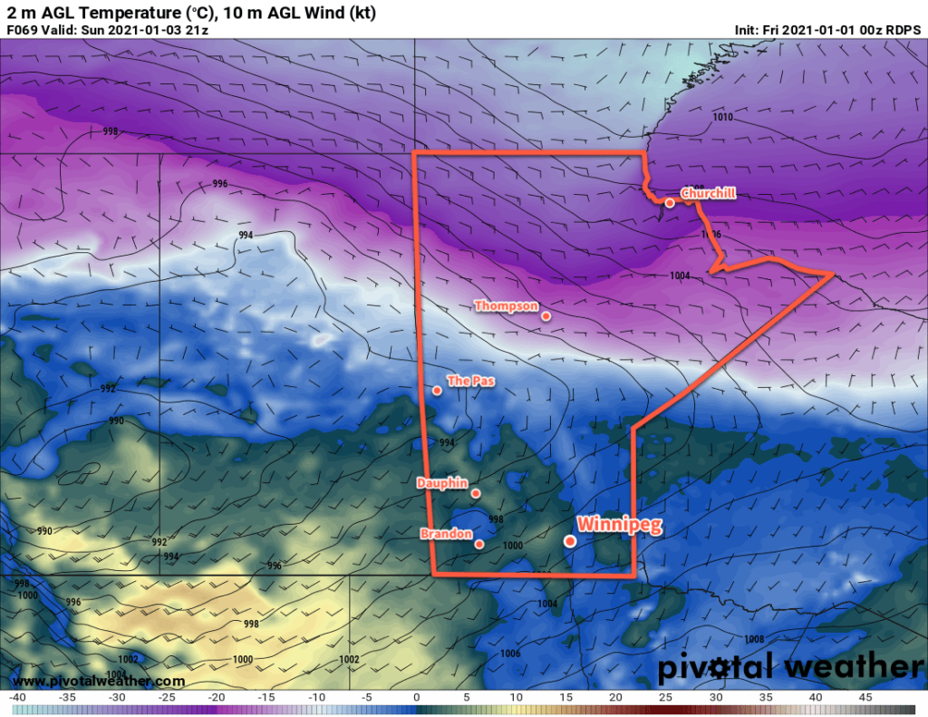
Instead of the cold, Winnipeg will instead see temperatures climb towards freezing over the coming days as a series of low pressure systems moving across the Prairies spread mild Pacific air into the region. First, though, Winnipeg will see a high near -8 °C today. Skies will likely stay cloudy for much of the day with plenty of stratus left behind from a disturbance that moved through overnight. With the cloud, the city will also likely see some light snow through the day. Clearing should work into the region this afternoon, though there’s a chance it could take until evening for it to reach Winnipeg. Once it clears out, Winnipeg will see mainly clear skies overnight with a low near -12 °C.
On Saturday, the first of two low pressure systems will work across the central Prairies into Manitoba. As it pushes eastwards, it will spread cloud into the region through the afternoon hours. Winds will start light, but strengthen out of the south into the 30–40 km/h range for the afternoon. Temperatures will climb to a high near -2 °C. More cloud will move through the region on Saturday night as the winds ease and temperatures hover around -1 °C.
Mild temperatures close to 0 °C will move into Manitoba this weekend. Temperatures may even be a few degrees above zero in the downslope winds of the Red River Valley’s western escarpment.
On Sunday, another low — slightly stronger than the first — will scoot across the Prairies. Temperatures will climb to around 0 °C in Winnipeg with skies clouding over. Winds will be light to start and gradually pick up to around 30 km/h in the afternoon. Heading into the night, a trough moving through the Red River Valley may bring some light snow or even a couple rain showers, depending on where exactly the temperature is at the time. Temperatures will dip to a low near -2 °C by Monday morning.
Long Range Outlook
Temperatures will cool slightly next week with highs slumping into the -5 to 0 °C range. Lows will also follow suit, staying well above normal for this time of year in the -5 to -15 °C range. Some snow is possible with a cold frontal passage on Monday, otherwise while skies stay on the cloudier side there should be little snow to speak of through the rest of the week.
Today’s seasonal daytime high in Winnipeg is -13 °C while the seasonal overnight low is -23 °C.