Heat Wave Builds Across Southern Manitoba

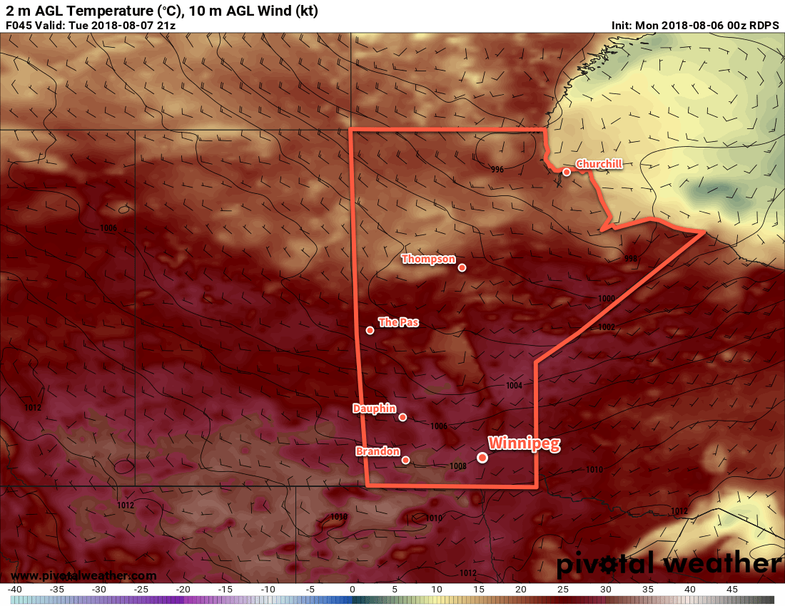
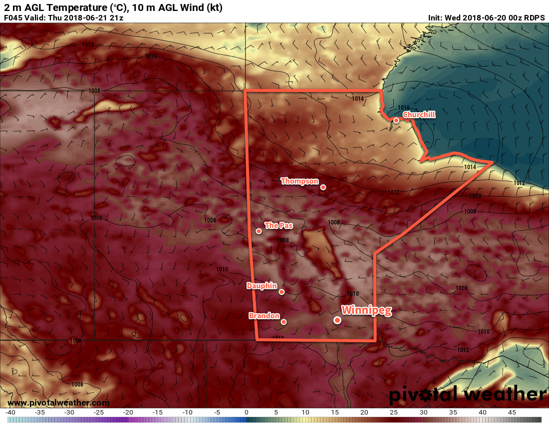
Temperatures in Winnipeg will soar for the remainder of the week as a heat wave builds across southern Manitoba.

Winnipeg will see mainly sunny skies over the next few days as a potent upper-level ridge builds into the region. This feature will send temperatures soaring with daytime highs in the low to mid-thirties through the remainder of the week. Dew point values will remain average, so fortunately mugginess won’t come into play with the heat. Overnight lows will remain warm but not excessively so. Winnipeg should see a low near 17°C tonight and increase to a low near 19°C on Friday night.

A potent upper-level ridge will spread well above-seasonal temperatures across the Prairies through the second half of the week.

That said, by Friday into the weekend, several days of highs near 35°C will result in significant heat stress. If you’re sensitive to heat, it would be best to ensure that you’ve prepared as much as you can by the end of the week. The hottest weather will occur Saturday into Sunday with overnight lows even climbing up into the low 20s.
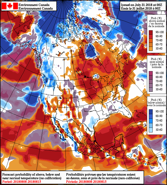
Long Range Outlook

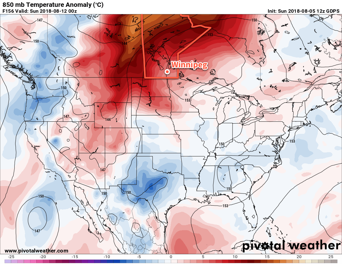
The relief from the heat is forecast to arrive with a cold front passing through on Sunday night. It looks like there’s a small chance of showers or thunderstorms as it moves through. Behind it, seasonal temperatures will return to the region with generally pleasant weather expected through the first half of the week.

Winnipeg’s seasonal daytime high is currently 26°C while the seasonal overnight low is 13°C.

Long Stretch Of Summer Heat Arrives This Week

Winnipeg will see a prolonged stretch of very warm temperatures move into the region this week, bringing highs in the 30s for the better part of a week.

Winnipeg will see one more cool day today as a high pressure system moves through. The city should see a below-seasonal high near 23°C under mainly sunny skies. Winds will be light. The high will depart to the southeast tonight, bringing southerly winds of 10 to 20 km/h and a low near 13°C.

On Tuesday, a warm front will push through the region, bringing south-southwest winds in the 20-30 km/h range. Temperatures will soar to a high near 31°C with a few afternoon clouds. There will be a slight chance of a few isolated thunderstorms as the system moves through the region, but it looks like much of that activity should remain north of the Red River Valley in the Interlake. Winds will ease into the 10 to 20 km/h range on Tuesday night as temperatures fall to a low near 17°C with just a few clouds sticking around.

Temperatures will climb into the low 30s across much of the southern Prairies on Tuesday

A strong upper-level ridge building into the region will dominate the weather for the remainder of the week. This will bring sunny skies to Winnipeg on Wednesday with west-northwest winds increasing into the 20-30 km/h range. Winnipeg will see a high near 30°C, then see temperatures dip to a low near 16°C on Wednesday night.

Long Range Outlook

The remainder of the week looks hot with daytime highs in the in the low to mid-thirties. The hottest weather looks to arrive Friday-Saturday with daytime highs potentially reaching as high as 35°C.

The GDPS 850 mb temperature anomaly forecast shows a significantly warmer-than-seasoanal air mass in place over the Prairies by the weekend

Humidity levels will remain average, which will help things feel slightly more comfortable. There’s a low chance of an isolated shower or thunderstorm over the coming days, but no real organized rain or thunderstorm threat exists until a low pressure system moves through on Sunday, bringing instability followed by more seasonal temperatures.

Winnipeg’s seasonal daytime high is currently 26°C while the seasonal overnight low is 13°C.

GDPS 2m Temperature Forecast valid 18Z Friday August 3, 2018

Warming For The Weekend

Winnipeg will see a single day of cooler than normal temperatures before they begin to soar back to 30°C and above for the weekend.

Temperatures will be cool today in Winnipeg as a high pressure system moves through the province behind the cold front that passed through on Tuesday morning. The high will clear out any remaining cloud and bring very light northeasterly winds to the region. Winnipeg should see a high near 22°C, followed by a low near 10°C tonight.

Thursday will be a transition day for Winnipeg. Near-seasonal temperatures will return to the region as a low pressure system develops over the western Prairies. This developing low will bring moderate southerly winds back to the region, drawing a more summer-like air mass northwards out of the American Plains. Winnipeg will see mixed skies with a high near 27°C, but that southerly wind increasing to 40 gusting 60 km/h will put a bit of a damper on things. Much of southern Manitoba will see a chance of showers or thunderstorms Thursday evening into the overnight as the low pressure system approaches. Winds will ease a bit into the 20 to 30 km/h range as temperatures head to a low near 18°C.

By Friday, Winnipeg will be back into full-fledged summer mode. The city will see partly cloudy skies as temperatures climb to a high near 32°C. Winds will be lighter than on Thursday, out of the south at just 15 to 25 km/h. Temperatures will remain warm on Friday night with a low near 19°C.

Long Range Outlook

The warmth that moves in on Friday will mark the beginning of a prolonged period of above-seasonal temperatures.

NAEFS 8-14 Day Temperature Anomaly Forecast — Valid August 8 to 15, 2018

Broad upper-level ridging will develop over the coming week as the subtropical high moves into the central United States. This will sustain a broad dome of very warm air that will easily be spread into our region. Winnipeg will see highs in the low 30s this weekend, followed by upper 20s to mid 30s next week. Lows will remain warm in the upper teens.

Rain-wise, forecasts are showing a high probability of dry conditions. That said, thunderstorms are tricky things, and several upper disturbances rippling through over the coming weeks will bring a few chances for showers or thunderstorms.

Winnipeg’s seasonal daytime high is currently 26°C while the seasonal overnight low is 13°C.

Hot, Dry Weather Continues

The summer heat will continue through the remainder of the work week with daytime highs climbing above 30°C.

A broad upper-level ridge building eastwards across the Prairies will continue to produce hot summer weather. While Winnipeg won’t see heat warnings like much of the northern Prairies are seeing1, that’s not to say that it won’t be hot. Temperatures will soar with daytime highs close to 30°C over the next several days. Overnight lows will also remain fairly warm with values in the upper teens.

RDPS 2m Temperature Forecast valid 21Z Thursday June 21, 2018
Hot temperatures will be in place for Winnipeg and the Red River Valley for the summer solstice on Thursday

Sunshine will be in abundance for the Red River Valley today and tomorrow. Some cloud will begin working into the region late Thursday as a low pressure system starts eastwards out of Alberta and across southern Saskatchewan. On Friday, skies will become mixed over the region and light southerly winds will bring more humid conditions to Winnipeg. By Friday evening, the chance for showers or thunderstorms will begin to creep back into the region.

Long Range Outlook

Saturday will continue to bring a chance of showers or thunderstorms to Winnipeg with mixed skies, but conditions will settle Sunday into the first half of next week. Temperatures will remain warm with highs in the upper 20s or low 30s and overnight lows in the upper teens.

It seems that the arrival of the summer solstice this year will be a marker for an extended stretch of hot summer weather!

Winnipeg’s seasonal daytime high is currently 24°C while the seasonal overnight low is 12°C.

  1. That’s largely because the criteria vary from region to region across the Prairies. In Manitoba, areas in the south require 2 consecutive days with highs of 32°C or greater with a low of 16°C or warmer between them. In northern Manitoba, the criteria is slightly lower with daytime highs of only 29°C needed.