Mild With a Chance of Showers

The warm spring weather continue in Winnipeg this week, but a passing low pressure system on Wednesday will bring a chance of showers to the region.

ECMWF 24hr. Precipitation Accumulation Forecast valid 18Z April 11, 2024
Rain showers are possible across southern Manitoba from Wednesday afternoon through Thursday night.

Temperatures will stay warm in Winnipeg through the rest of the week as more mild Pacific air spills across the southern Prairies. Daytime highs will hover in the low to mid-teens this week with lows in the 0 to +5 °C range.

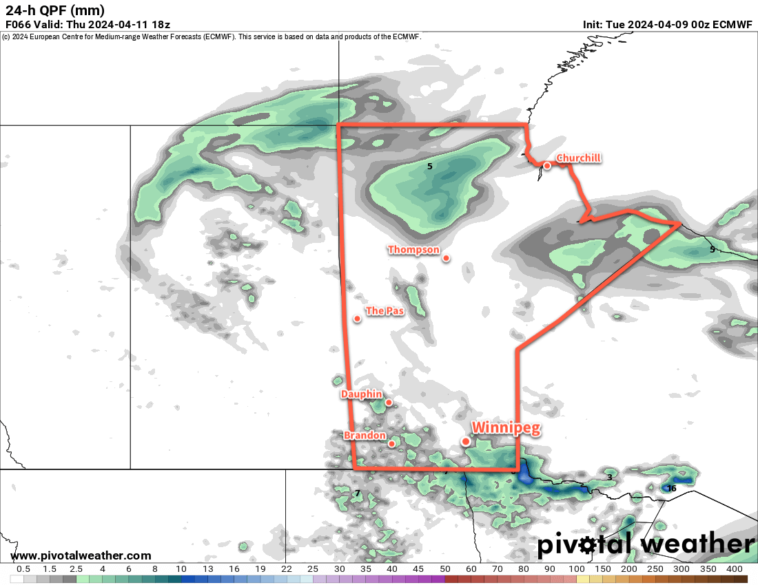
While today will be mainly sunny, clouds will move in tonight as a low pressure system moves into southern Manitoba from central Saskatchewan. This system will support an area of showers that develops on Wednesday afternoon near the Saskatchewan/Manitoba border that drifts southeast into the evening. The chance of showers will last through the night, then taper off on Thursday morning as the low moves into Ontario.

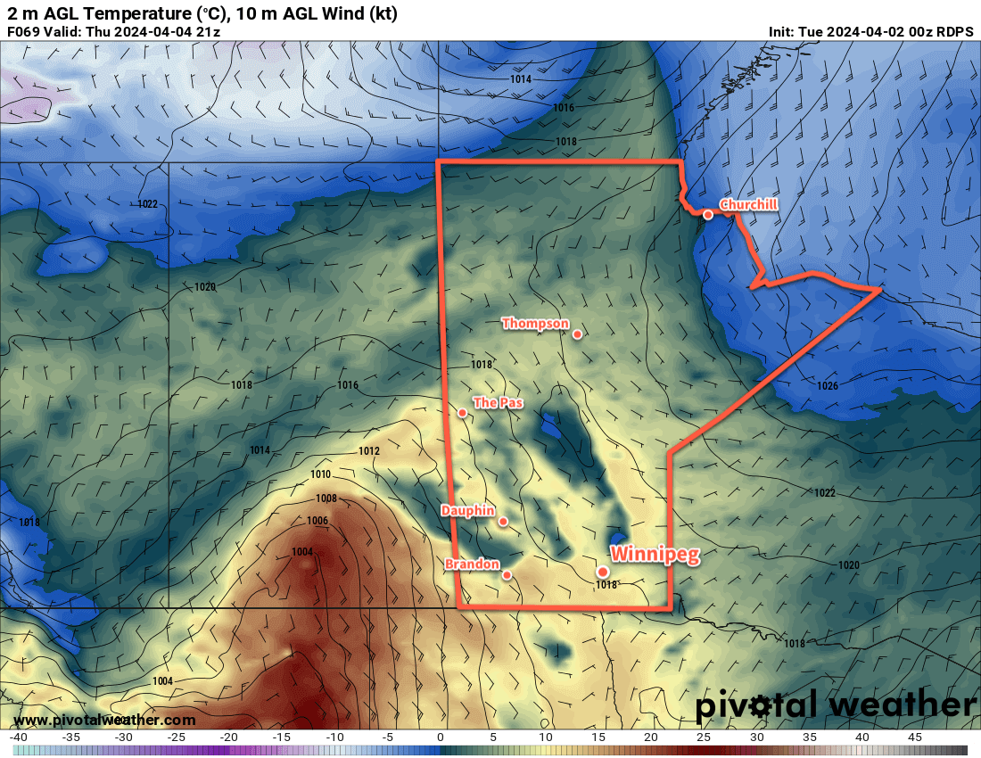
Behind the low on Thursday, cloud cover will slowly break up as moderate northwest winds develop. By the afternoon, Winnipeg should see clearing skies with northwesterlies into the 30 to 40 km/h range. A ridge of high pressure will move in on Thursday night, bringing clear skies and light winds.

On Friday, the ridge will depart to the east and another low pressure system will begin its trek across the Prairies. This will bring increasing southeast winds with sunny skies giving way to late day cloud. There will be a chance of showers on Friday night as a warm front moves across the province.

Long Range Outlook

Saturday will bring the warmest weather of the year thus far to the Winnipeg area. With the warm front through and no snow cover left, daytime highs should be able to climb into the upper teens or low 20s with west-southwest winds. There could be a chance of a shower on Saturday evening as a cold front swings through with the passage of a low pressure system.

Sunday will bring cooler, but still mild, weather to the region. Daytime highs should sit in the mid-teens with breezy northwest winds and mixed skies.

Heading into next week, many forecast models suggest that a potent Colorado Low will develop and move towards the province. It’s too early to say anything definitive at this point, but this system could bring a broad swath of notable rain and/or snow to much of the eastern Prairies as it moves through. This storm could bring dangerous winter storm conditions to parts of the eastern Prairies; at this point it looks like much of the worst of the storm will move through eastern Saskatchewan and western Manitoba, but we’ll be sure to keep an eye on it as it develops.

Today’s seasonal daytime high in Winnipeg is 8 °C while the seasonal overnight low is -4 °C.

Spring Warmth Moving In

Temperatures will warm into the teens this week as Spring warmth continues to build across the Prairies.

RDPS 2m Temperature Forecast valid 21Z Thursday April 4, 2024
Mild temperatures will build eastwards across the Prairies this week.

A lingering low pressure system will gradually clear out of the region today, but it will leave lingering cloud cover across the region. A few light rain showers or flurries are possible today as temperatures head to a high in the low single digits with northerly winds near 30 km/h. With a ridge of high pressure moving in tonight, the winds will drop off with clearing skies and a low near -5 °C.

A stagnant pattern will develop for the rest of the week, rooted by a low complex anchored over the American Rockies. Manitoba will be on the eastern edge of this system with warm air slowly edging eastwards as the high in the area inches eastwards.

The result will be many sunny or partly cloudy days for the rest of the week with daytime highs near 10 °C on Wednesday increasing into the 10 to 15 °C range for the rest of the week. Overnight lows will dip to around the freezing mark right through the end of the week.

Long Range Outlook

There will be little change for the weekend and the start of next week. Mild weather will continue across southern Manitoba with highs in the mid-teens and overnight lows in the 0 to 5 °C range. The next organized chance of rain doesn’t look like it will come until at least mid-week next week.

It appears that the last of winter will be melted away this week and the dry, dusty spring weather can commence! Time to get the shorts out?

Today’s seasonal daytime high in Winnipeg is +6 °C while the seasonal overnight low is -6 °C.

Mild Week Ahead With Above-Freezing Highs in Winnipeg

With daytime highs above freezing through the rest of the week, Winnipeg will see cloudier conditions develop as the snowpack across the region undergoes significant melt.

RDPS 2m Temperature Forecast valid 21Z Wednesday March 13, 2024
Mild temperatures with daytime highs above freezing will be commonplace across the southern Prairies this week.

Warm Pacific air will sweep across the Prairies this week as upper ridging gradually dominates the upper air pattern over the coming days. As a result, Winnipeg will see daytime highs that climb above freezing throughout the work week.

It won’t all be sunshine though; a cold front dipped southwards overnight and another frontal boundary will slowly drop southwards through the province over the coming days. This will bring cloudier skies to the region with daytime highs in the +1 to +4°C range. Dew point values are expected to climb above freezing both today and tomorrow which will aid in the melting and erosion of the snow pack. Overnight lows will dip into the -5 to 0 °C range over the next several nights.

A weak disturbance will bring light snow to southwest Manitoba on Wednesday; while there may be a chance of flurries in Winnipeg, the system is likely to fall apart west of the Red River Valley.

As the melt continues through the week and the cloud lingers across the region, the chance of seeing fog patches or mist will increase. Northerly winds will pick up in the second half of the week which should help clear out any lingering moisture in the air.

Long Range Outlook

The next system of note will be a low pressure system dropping southeastwards through Manitoba on Friday. This system could bring a mix of rain and snow to the Red River Valley, though current indications are that it should pull enough warm air eastwards that most of the precipitation would be rain.

GDPS Precipitation Type and Rate Forecast valid 00Z Saturday March 16, 2024
A low pressure system moving through Manitoba on Friday will bring a mix of rain and snow to the province.

This system could bring rain amounts ranging from a trace to the 5–10 mm range across the Red River Valley. With a cold front swinging through on Friday night, it would leave behind cooler weather with a chance of flurries into the weekend.

Today’s seasonal daytime high in Winnipeg is -2 °C while the seasonal overnight low is -12 °C.

Warm Weather Continues for Winnipeg

It will be a warm week in Winnipeg with seasonably warm temperatures continuing.

RDPS 2m Temperature Forecast valid 18Z Thursday February 22, 2024
Temperatures will climb back above freezing on Thursday, but a strong cold front will move through later in the day.

Sorry that we’re a day late, but fortunately, the weather’s a broken record these days and we didn’t miss much. The weather through the rest of the work week will be driven by a low pressure system moving through northern Manitoba over the next 24 to 48 hours. As it moves into the province today, more warm air will spread into southern Manitoba. This will bring cloudier skies to Winnipeg and area as temperatures climb to a high close to the freezing mark this afternoon. The cloud cover will break up tonight as westerly winds pick up and temperatures fall to a low in the -10 to -5 °C range.

On Thursday, with Winnipeg firmly in the warm sector of this system temperatures will quickly climb to a high just above freezing before a cold front sweeps through later in the afternoon. The cold front will bring some cloud and a chance of flurries to the region as it moves through, along with northerly winds to around 30 gusting 50 km/h. Skies will clear quickly behind the front as an Arctic high drops southwards through the province. Temperatures will head to a low in the -20 to -15 °C range with light winds on Thursday night.

For Friday, the region will see near-seasonal temperatures with a high near -7 °C under mainly sunny skies. Southerly winds will strengthen through the day in the return flow from the departing high. Another low pressure system tracking through the north will be pushing a warm front eastwards into the province through the day. By Friday evening, the warm front will likely be draped through western Manitoba; it will continue to push eastwards through the night, bringing more cloud to the Red River Valley but keeping overnight lows mild near -10 °C.

Long Range Outlook

Winnipeg will move into the warm sector of this second low pressure system on Saturday. The warmer air mass should combine with moderate westerly winds to help send daytime highs well above freezing; Winnipeg will likely see temperatures climb into the 5 to 10 °C range on Saturday afternoon.

The warmest air will move out of the region on Saturday night, but it will stay mild across the region. Sunday should bring daytime highs closer to 0 °C to the region.

Next week wills tart warm, but a strong cold front is forecast to move through on Tuesday. This would usher an Arctic air mass back into the Prairies and send temperatures tack to below-seasonal values for a couple days. That said, the cold snap is expected to be short with milder weather returning by the end of the week.

Today’s seasonal daytime high in Winnipeg is -7 °C while the seasonal overnight low is -17 °C.