More Cold Weather on the Way

While you may have fond memories of the 20°C weather we were having at this time last year, spring-like weather looks to be a long way off as a low pressure system deepening in Alberta will usher below-seasonal temperatures into the Prairies in it’s wake as it moves through our region tomorrow.

12hr. precipitation totals from the GDPS

12hr. precipitation accumulations from the GDPS for Thursday night as snow moves across southern Manitoba.
Wednesday

Increasing cloudiness.
-7°C / -10°C

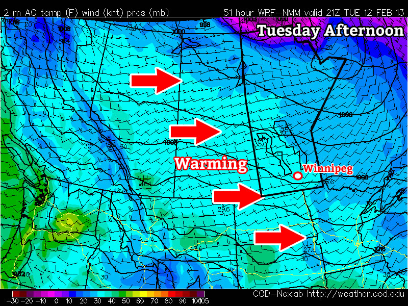
The warm front associated with this system will move towards the Red River Valley this afternoon bringing with it increasing cloud cover and a breezy southerly wind. By late this afternoon the Red River Valley will be mainly cloudy with a southerly wind at around 30km/h and we’ll have climbed to a temperature of about –7°C. There will be a slight chance for some light flurries in Winnipeg and areas south this evening with the passage of the warm front, but meager moisture along the front combined with very dry air being advected into the RRV from the ridge of high pressure to our east will likely mean that most of the snow developed by the front will evaporate in the dry air before it hits the ground. If any organized snow does manage to develop, amounts will be insignificant as the snow will be light and short-lived. Temperatures will only drop to about –10°C under cloudy skies tonight as we sit in the warm sector before the cold front sweeps through.

Thursday & Friday

Thursday

Increasing cloud with evening flurries. 1-4cm expected.
-5°C / -15°C
Friday

Clearing.
-12°C / -22°C

Skies will briefly clear out on Thursday morning before more clouds move in midday in advance of the approaching cold front. Temperatures will climb up to around –5°C with light winds. The cold front associated with this system will begin to push it’s way through the Red River Valley in the evening and will bring some snow along with it. The snow should start a little later on Thursday evening and let up early Friday morning. Accumulations will not be very significant with only 2–4cm expected to be maximum amounts across the RRV. There’s a slight chance that some areas close to the U.S. border such as Morden, Gretna, Altona and Emerson, may see closer to 5cm as the bulk of the snowfall associated with this front is expected to fall in North Dakota and the slightly higher amounts may brush the extreme southern Red River Valley.

On Friday, we’ll see clearing skies as an Arctic ridge begins working into the Prairies. Temperatures will be quite cool for mid-March with daytime highs only hitting –12 or –13*°C, a whole 6–8°C below seasonal.

Weekend at a Glance

Saturday will be a near carbon-copy of Friday with sunny skies and a cool daytime high of around –11°C. Current indications for Sunday show a strong potential for a potent Alberta Clipper system to race along the U.S. border and spread snow through the Red River Valley by Sunday afternoon. It’s fairly early to focus too much on details, but forecasts currently indicate that 5–10cm of snow is quite possible from Winnipeg & the Trans-Canada highway south throug the RRV to the border. We’ll have more details on this system in our post later this week.

Alberta Clipper To Blast SW Manitoba

A powerful Alberta Clipper system will push through southwest Manitoba this evening bringing heavy snowfall and blowing snow to the region.

Probability of > 2cm of snow from this AB Clipper

Probability of > 2cm of snow from this AB clipper. Blue boundary marks > 30% chance, green boundary marks > 60% chance.

The weather across Southern Manitoba will be fairly benign today with daytime highs generally sitting just below the freezing mark with increasing clouds through the day. Winds will remain light through the day. Light snow will push into southwestern Manitoba this afternoon, potentially pushing into the western Red River Valley as well. Winnipeg may see some light snow this afternoon, but it’s going to likely remain to our southwest; should snow push into the city, there will be little-to-no accumulation. Regions that see more persistent snow today, potentially including the western Red River Valley, accumulations will likely total around 2-ish cm.

Wednesday

Mostly cloudy with patchy light snow.
-3°C / -16°C

Early this evening the Alberta Clipper will begin working it’s way into the Virden & Melita regions, quickly expanding eastwards towards Brandon and Pilot Mound. General snowfall accumulations will be close to 5cm, but there will also be a very narrow band, just north of the track of the clipper, where accumulations will be closer to 10cm. This corridor of heavy snow will lie across the Trans-Canada highway near the Saskatchewan border; anybody travelling west tonight should prepare to encounter heavy snow, snow drifts and near-zero visibilities near the Saskatchewan border. Further east, there’s a little disagreement on what will happen; most models suggest very little snow will fall in the Red River Vally tonight, however the NAM guidance is suggesting that a fair amount could fall. At this point, I think that most of the snow will push into North Dakota before it pushes eastwards towards Winnipeg or the central Red River Valley. Areas near the International Border may get clipped with a couple cm of snow as this clipper exits the region. Winds will remain relatively light, picking up to 20 gusting 40km/h out of the northeast overnight through much of Southern Manitoba. Temperatures will drop to around –14 to –16°C across Southern Manitoba.

Thursday

Thursday

Clearing in the morning.
-14°C / -21°C

Cooler air will filter into Southern Manitoba on Thursday behind the clipper, bringing us a return to seasonal temperatures. The remaining cloud from Wednesday’s system should clear out fairly early in the day, leaving us with mainly sunny skies. We’ll climb to around –13°C with a light north wind. Temperatures will drop into the –20’s tonight as another Arctic ridge slumps into the Prairies.

Friday

Friday

Clearing in the morning.
-14°C / -20°C

Southern Manitoba will be locked under the Arctic ridge on Friday which will result in another day with seasonal temperatures. Highs will sit near –15°C on Friday across most of Southern Manitoba with temperatures dropping back towards –20°C for the night.

After that, it looks like we’ll head back towards above-normal temperatures for a few days. Little-to-no precipitation is expected over the next while.

Warm for a Bit Longer

With the exception of Monday, we’ll see our fairly warm weather continue into this week.

image

Surface temperatures as forecast by the NAM for Tuesday afternoon

Monday

Monday
image
Clearing. Chance of flurries.
-18°C / -8°C

Monday will be a day of transition, as a strong Colorado Low to our south moves off into Ontario, causing a cooler air mass to filter into Southern Manitoba. It won’t be a super-cold day, but definitely chillier than the conditions experienced on the weekend. Skies will clear through the day as low-level moisture is gradually removed from the area. There may be a bit of light snow in the morning, but otherwise no precipitation is expected.

Tuesday

Tuesday
image
Mix of sun and cloud
-1°C / -9°C

Tuesday looks to a rather mild day in Southern Manitoba, with high temperatures around the zero mark in many areas. Parts of south-western Manitoba are most favoured to get up to, or slightly above, zero. In the Red River Valley temperatures will be in the low minus single digits, with some areas potentially getting just up to the freezing mark.

Wednesday

Wednesday
image
Snow
-1°C / -6°C

We’ll see one more warm day on Wednesday, though the warm conditions will be tempered by another batch of snow. An Alberta Clipper will roll through on Wednesday, bringing light to moderate snowfall to Southern Manitoba. This could be a fairly significant snowfall in some areas, but it’s too early to give a more precise forecast with numerical accumulations. Temperatures will remain quite mild in spite of the, with highs generally in the low minus single digits in most areas.

It looks like this clipper will draw down another cold air mass which will stick around for awhile. Colder weather is expected to last into next weekend.

Another Clipper System Brings Snow to Southern Manitoba

Another Alberta Clipper system is racing eastwards across the Prairies and will bring another shot of snow to Southern Manitoba today.

Snowfall Accumulations for February 6, 2013

Snowfall accumulations through the day today. A swath of 5–10cm of snow will cut across Southern Manitoba as an Alberta Clipper dives into North Dakota.
Wednesday

Snow. Total 2-4cm.
-13°C / -20°C

Riding along the strong northwesterly jet stream that’s been in place over our region over the past few days, another clipper system will race across Southern Manitoba today. This system will prove to be slightly more challenging than Monday’s clipper system as it looks to be more compact and intense. When these two aspects combine, it always proves to be a tricky forecast; small changes in the track of the system (for example, even a shift of 25–30km north or south) can result in dramatically different weather for places along the edges of the track.

The low will slice across northern portions of North Dakota before diving into central Minnesota this evening. The heaviest snow should run just north of this low track with 5–10cm on the ground by the evening. Accumulations will drop off quite quickly to the north of this band which is, of course, where Winnipeg will sit. As seems to be near-climatological wizardry, Winnipeg will yet again sit right on the edge of heavier snow, making the forecast quite sensitive.

The most probable outcome today will look something like this: snow will push into Winnipeg early this morning and intensify fairly quickly. The heaviest snow will mid-to-late morning, and we’ll pick up a fairly quick 2–4cm of snow. It will start to taper off quite quickly after noon, with some lingering light snow lasting through into the evening. Like Monday’s system, there is a chance that the light snow could add another cm or so to the totals for the system. If this system tracks a little further north (even 20–30km), it’s entirely possible that we’ll see another 5–8cm of snow here in Winnipeg. We’ll provide some updates as soon as we can more definitively say which outcome is going to happen.

To the south of Winnipeg, snow will last through more and more of the afternoon the further south you go with accumulations increasing. For communities close to the international border such as Altona, Gretna and Morden, as much as 8–10cm of snow may be on the ground by the end of the day. Winds should remain light enough that blowing snow should not be an issue through the valley today. Things will clear out this evening with some lingering cloud left behind as we head to a low near –20°C.

Thursday


Mix of sun & cloud.
-16°C / -19°C

Thursday will bring a mix of sun and cloud and a high just a few degrees cooler than the day before. Instead of plunging back into the deep freeze like we normally do after many clipper systems, this one is embedded within a larger warming pattern; the highly meridional flow[1] we’ve had lately is slowly being modified and forced into a more zonal flow[2] by a developing complex of low pressure systems over Alaska. Temperatures will climb to around –16°C today and drop only a few degrees tonight as a southwesterly flow aloft kicks in and starts pushing warmer air over our region.

Friday


Mix of sun and cloud.
-6°C / -13°C

We’ll transition into the milder air that we’ve been advertising would be on it’s way by Friday. A solid southwesterly flow aloft will help push temperatures up to around –5 or –6°C across the Red River Valley under a mix of sun and clouds. This warmer weather will continue through the weekend, with highs generally between –5°C and –8°C with overnight lows dropping just below –10°C.


  1. A meridional flow is one that has a larger north-south component than east-west in the flow directions. In Winnipeg, meridional flows often bring in bitterly cold air in the winter (from the north) and oppressively hot weather in the summer (from the Gulf of Mexico).  ↩
  2. A zonal flow is one that whose east-west component is greater than it’s north-south. Zonal flows tend to moderate temperatures across the Prairies as mild Pacific air washes out the colder Arctic air.  ↩