The Chill Returns

We’ll see a return to colder weather this week, though it won’t be quite as bad as what we saw earlier this month.

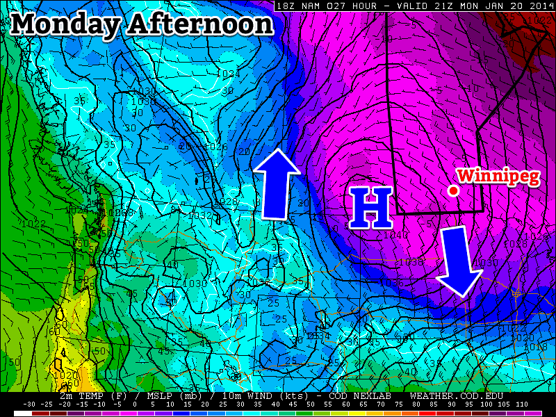
A large arctic high will bring colder weather to southern Manitoba early this week. The arrows indicate the clockwise circulation around the high.

A large arctic high will bring colder weather to southern Manitoba early this week. The arrows indicate the clockwise circulation around the high.

Monday

Monday

Clearing
-22°C / -30°C

Today will be our coldest day in awhile. High temperatures will remain stuck in the minus twenties, with a breezy north-west wind. As a result, wind chill values will remain in the -30s for most, if not the entire day. But on the bright side we’ll see sunny skies return, as the lingering cloud cover clears out during the day.

Tuesday

Tuesday

Mainly cloudy. Chance of flurries.
-16°C / -23°C

It looks like we’ll see a slight warm-up for Tuesday with temperatures climbing into the minus teens. The wind will also be light, making it a decent day overall. We may see a few flurries on Tuesday, but they won’t amount to anything of great significance.

Wednesday

Wednesday

Mainly Sunny
-21°C / -31°C

The weather will turn cold again on Wednesday as another arctic high drops south into the region. High temperatures on Wednesday will once again remain in the minus twenties. It also looks to be a somewhat windy day, generating chilly wind chill values in the -30s yet again.

Long Range

The long range forecast continues to look very up and down. Models suggest we’ll see more cold weather over the next 7-10 days, but also some warm days mixed in here and there. No major weather systems are in the forecast, but we’ll likely see little systems bring us small dumps of snow every once and awhile.
Brisk Weather for Start of Weekend; Warmer Sunday

The chilly, below normal, temperatures are set to continue through the beginning of this weekend. There is a glimmer of hope though as a clipper system is expected to bring a bit of reprieve from the bone-chilling temperatures towards the end of the weekend, but this “warmer” weather will be short-lived.


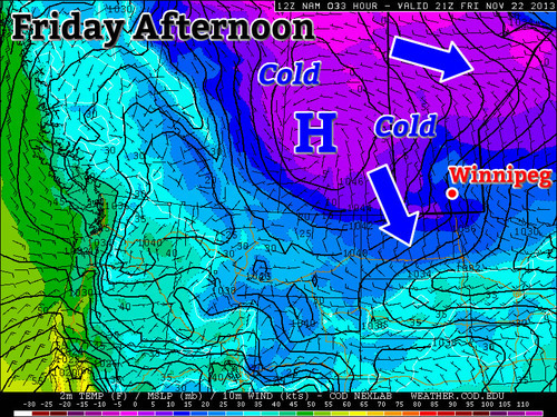
Arctic high sliding down into Southern Manitoba on Friday afternoon.

Friday

Friday

-12°C / -22°C
Winds gusty, clouds clearing in the evening.

The day will start off as overcast, if not for lingering flurries still affecting Winnipeg from a weak system that passed last night. Winds will be stiff today coming from the north-west in the 25-30km/h range as the high pressure pushes south. Tonight you will want to make sure to crank the heat up as the low temperatures will bottom out around -22°C in Southern Manitoba, and even colder in the southwest corner of the province as the Arctic high slides down.

Saturday

Saturday

-15°C / -18°C
Winds around 10km/h and mainly sunny skies. Cloud moving in overnight.

Saturday will be cold again. The Arctic high that pushed down will now be centered near the international border, which should keep us mainly cloud-free throughout the day but brisk temperatures will remain in place. Winds won’t be too strong from the west, perhaps 10km/h switching to southerly overnight. Lows won’t be dropping to levels as low as Friday night thanks to some cloud cover moving in associated with an approaching system.

Sunday

Sunday

-4°C / -11°C
Could be a few flurries, winds south becoming west in the evening.

For Sunday there is a chance for some flurry activity as a clipper system slides by. Accumulations shouldn’t be higher than a few centimeters for the Red River Valley, but higher accumulations to the northeast of Winnipeg are possible. High temperatures for Sunday won’t be as cold as Saturday thanks to some warmer air aloft associated with the clipper but don’t be deceived, winds will be quite gusty, especially in the afternoon.

Looking ahead into the next work week there does not appear to be too much significant weather, once again – both the CPC (Climate Prediction Center) and the NAEFS point towards near average temperatures. In addition to that he models don’t show any significant systems, at least for the beginning of next week.

A Blast of Winter to Start the Week

We’ll get an early taste of winter today as an arctic high settles in over Manitoba.

It Will be a Cold Start to the Week with a Large Arctic High Over the Region

It Will be a Cold Start to the Week with a Large Arctic High Over the Region

Monday

Monday

Mainly Sunny
-10°C / -15°C

Today will be a cold day by early November standards. Temperatures will remain well below zero for the duration of the day thanks to an arctic high over the region. Thankfully the wind won’t be very strong, which is some slight consolation for what will otherwise be a rather algid day.

Tuesday

Tuesday

Mainly Sunny
-2°C / -6°C

Temperatures will begin to recover on Tuesday as a surge of warmer air begins pushing in from the west. Temperatures on Tuesday will be around or just below zero in Southern Manitoba, with a breezy wind out of the south-west.

Wednesday

Wednesday

Increasing Cloudiness
4°C / -2°C

Wednesday looks to be one of the warmer days this week, with temperatures in the mid positive single digits. The wind will be from the west or south-west and skies will be on the cloudy side.

Long Range

The late week period looks to remain on the warm side, with daytime temperatures staying above zero. Weather models suggest that another push of arctic air may be on the way for next weekend, though we can always hope that the models are wrong. At least we can say that no significant snow is currently in the forecast – but as today’s weather has shown us, winter is certainly not far off.