Seasonably Cool Weather Ahead With Chance of Snow Mid-Week

A stubborn Arctic High will keep temperatures on the cool side this week across Manitoba. Sun will give way to cloud, though, as a developing low in the United States looks likely to bring snow to the region.

RDPS 24hr. Snowfall Accumulation Forecast (Kuchera SLR) valid 12Z Thursday February 5, 2025
A disturbance tracking through the United Staes will spread a swath of fluffy snow across southern Manitoba this week.

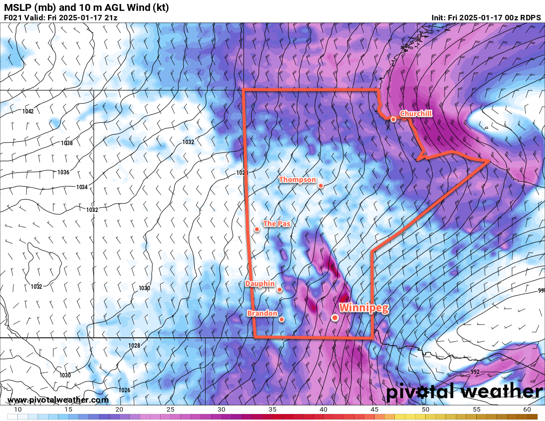
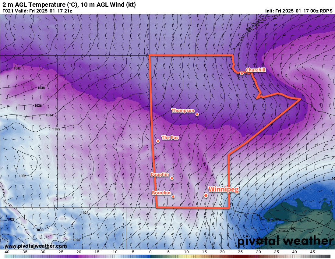
An Arctic high over the region will keep winds light and temperatures cool in Winnipeg today. A sunny start to the day will give way to mixed skies as some high-level cloud begins to stream into the area from the southwest. This cloud cover is part of a low pressure system developing in the United States that will continue to extend its influence northwards over the next couple days. The Winnipeg area should see a high in the -20 to -15 °C range this afternoon with westerly winds of 10 to 20 km/h.

Mixed skies will continue overnight, gradually clouding over by Wednesday morning. Temperatures will dip to a low in the -25 to -20 °C range.

Through the night, snow will spread out of Montana and across southern Saskatchewan and into Manitoba. A broad area of snow will gradually work its way across southern Manitoba through Wednesday into the evening.

Temperatures will climb close to around -15 °C on Wednesday with light southerly winds. The winds will shift westerly in the evening and pick up into the 30–40 km/h range as this system exits the region. Temperatures will dip to a low close to -20 °C.

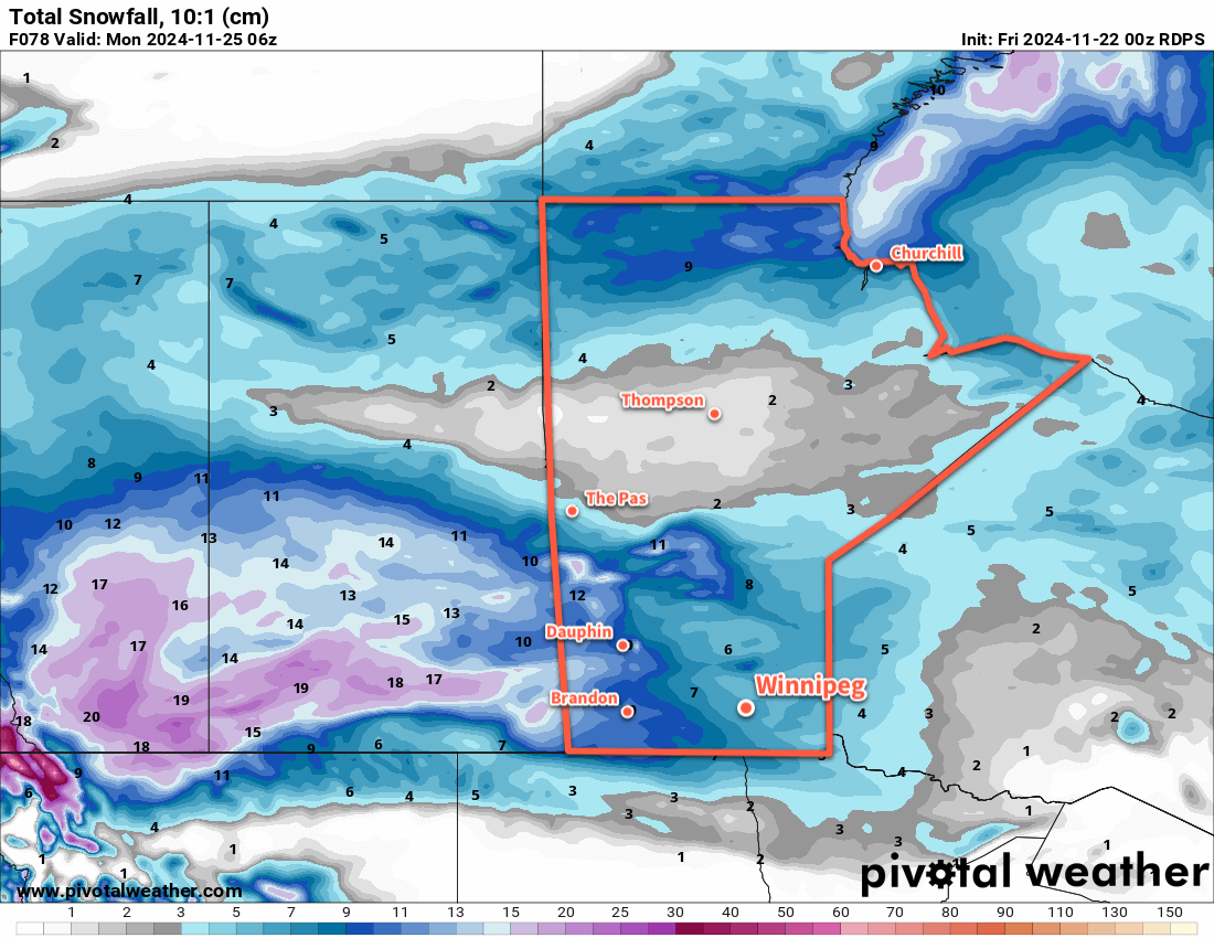
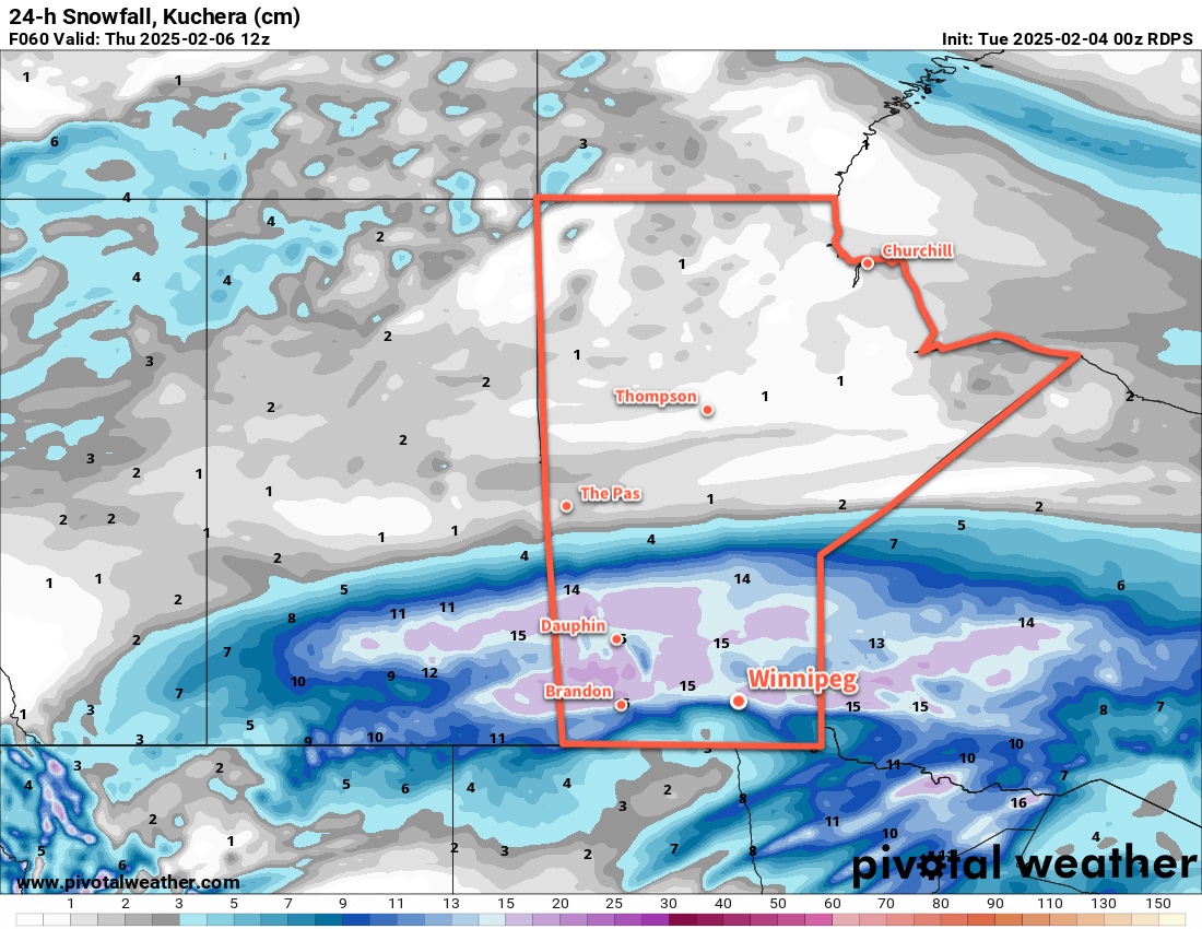
Indications are that this system will bring a notable snowfall to the region. As the snow pushes into the cold air over the region, its snow-to-liquid ratios (SLR) will climb. These values will likely reach into the 20:1 to 25:1 range and bring rather fluffy snow to the region.

For areas along and south of the Trans-Canada Highway corridor, it looks like 5 to 10 cm is likely by the time it tapers off. For areas north of this, a broad swath of 10 to 15 cm is likely for the Parkland and Interlake regions.

A few flurries will linger on Thursday as west-northwest winds continue in the 30 to 40 km/h range. Skies will gradually clear thorough the day with highs around -15 °C. The wind will drop off with clearing skies on Thursday night as temperatures head into the -25 to -20 °C range.

Long Range Outlook

The long range forecast for Winnipeg looks quiet with no major snow events on the horizon. Arctic highs will continue to dominate the weather pattern here and bring seasonably cool weather right through next week.

Today’s seasonal daytime high in Winnipeg is -10 °C while the seasonal overnight low is -21 °C.

Alberta Clipper Plunges Winnipeg Into Bitter Cold

An Alberta clipper exiting the province will bring strong to severe north winds and blizzard conditions to the Red River Valley. Behind this system, strong northerly winds will drive a massive outbreak of Arctic air through region, sending Winnipeg into the deep freeze.

Strong northerly winds in the Red River Valley will drive bitterly cold Arctic air southwards into the region.

Temperatures in the Winnipeg area will plunge from close to freezing early this morning into the -15 to -20 °C range this afternoon, driven by northerly winds blasting through the region. A cold front will sweep through the Red River Valley early this morning, ushering in northwest winds that will strengthen to as high as 60 gusting 90 km/h. Combined with flurries moving through the region, these winds will likely produce blizzard conditions across much of the Red River Valley, especially in areas west of Winnipeg. The Elie-Portage la Prairie corridor of the Trans-Canada Highway will likely be exceptionally hazardous and very well could close today.

In Winnipeg, visibilities may not deteriorate as much as areas outside the city as the recent warm weather and limited new snow may limit the ability for substantial blowing snow development.

Conditions will begin to improve this evening. Winds will ease to 30 gusting 50 km/h after the sun goes down, bringing an end to most of the blowing snow across the region. Temperatures will drop down into the mid-minus 20s as skies clear with wind chills in the mid-minus 30s.

The weekend will be dominated by a strong Arctic high building into the Prairies. Daytime highs will likely sit in the -25 to -20 °C range with overnight lows dropping towards -30 °C. Skies will be clear through the weekend as the northwest winds gradually shift towards the west and weaken. Wind chills will dip down into the -35 to -40 range at night and will bring a chance for extreme cold warnings across the region at some point over the weekend.

Long Range Outlook

The bitter cold will stay entrenched over the region through the first half of next week. Several long-range weather models show warmer weather arriving in the region mid-week with a chance for some accumulating snow.

Stay safe today; if you must travel on area highways, make sure you have a winter survival kit in your car in case of an emergency. Make sure to cover up if you need to spend time outside this weekend as a northwest wind will be persistent over the coming days.

And just as a final note, we hope the start of 2025 finds you well. Life has kept me extremely busy over the last 6 weeks with family events, Christmas, and moving for a renovation. That didn’t leave much time (or energy) for writing which is why the site went quiet for a while. Things are starting to calm down, so we hope to get back into the rhythm of regular writing soon!

Today’s seasonal daytime high in Winnipeg is -13 °C while the seasonal overnight low is -24 °C.

First Blast of Bitter Winter Cold Incoming

Winnipeg will see its first shot of bitterly cold Arctic air as a ridge of high pressure builds into the region this week.

RDPS 2m Temperature Forecast valid 12Z Thursday December 12, 2024
An Arctic high will bring bitterly cold temperatures with lows in some places falling below -30 °C this week.

With the system that brought 15 to 20 cm of new snow to Winnipeg on its way out, the next system to shape the weather in the region will be an Arctic High building into the province from the north.

Before it gets here, though, a weak disturbance will move through the region today. It will bring a little bit of light snow, perhaps another 2–4 centimetres, today and then sweep a strong cold front southwards.

Temperatures will plummet behind the front as northerly winds of 30–40 km/h drive Arctic air southwards. A seasonable high near -10 °C today will quickly be forgotten as skies clear tonight and temperatures head to a low in the mid-minus 20s.

The Arctic High will be in full force through the rest of the work week. With plenty of sunshine, daytime highs will struggle to climb into the -25 to -20 °C range with overnight lows dipping back into the -25 to -35 °C range. Wind chill values will likely get close to -40 at times on Wednesday night and Thursday night.

Long Range Outlook

Temperatures will begin to moderate on Friday as the high begins to weaken and the core of coldest air moves out of the region. Daytime highs should climb back above -20 °C but breezy southerly winds will have a bite to them and produce wind chills that make it feel much worse.

Temperatures will climb back to seasonal values for Saturday and continue warming on Sunday. The region will likely see mixed skies through the weekend.

A bit of snow is possible later Sunday into Monday ahead of colder temperatures slumping back into the region.

Today’s seasonal daytime high in Winnipeg is -9 °C while the seasonal overnight low is -18 °C.

Snow Moves Across Southern Manitoba This Weekend

Winnipeg likely won’t escape snow a second time; a low pressure system moving through the province will spread accumulating snow across southern Manitoba this weekend.

RDPS Total Accumulated Snowfall Forecast valid 00Z November 22, 2024 to 06Z November 25, 2024 at 10:1 SLR.
A disturbance crossing the Prairies this weekend will bring heavy snow to Saskatchewan and accumulating snow to southern Manitoba.

Unfortunately, those missing the sun won’t find much relief in the days ahead. Cloud cover will continue to smother the Winnipeg area in the days ahead with only limited opportunities for the sun to shine through.

For today, skies will stay cloudy as a weak disturbance tracks by north of the region. Temperatures will climb to a high in the -5 to 0 °C range with light southwesterly winds. There is a chance of flurries in Winnipeg; the main snow associated with this system will pass through the Interlake, but the Winnipeg area could get clipped by the southern edge. A couple centimetres are possible in the southern Interlake with less than a centimetre likely in the northern Red River Valley.

The cloud cover may break up a little bit overnight as light northwest winds move into the region. Temperatures will dip down into the -10 to -5 °C range by Saturday morning.

A ridge of high pressure will move across the region on Saturday. Some sunny breaks are possible, but the next low moving towards the area will spread more cloud into the Red River Valley later in the day. Winds will be light with a high around -5 °C. Some light snow could push into the area in the second half of the night.

An upper disturbance will track across the southern Prairies on Sunday and support an inverted trough that will build into Manitoba. This will spread a large area of snow across Saskatchewan on Saturday and Manitoba on Sunday. The heaviest snow will fall in Saskatchewan, where as much as 15 to 25 cm will fall across central and eastern portions of the province. In manitoba, the Parkland and Interlake will likely see 10 to 25 cm of snow, while areas along the Trans-Canada Highway corridor receive 5 to 10 cm. Amounts will diminish into the 2 to 5 cm range further south towards the international border. In Winnipeg, over 5 cm is likely to fall by Sunday evening.

Aside from the snow, temperatures will climb to a high just over -5 °C with light northeast winds. Temperatures will dip down into the -10 to -5 °C range overnight with a continued chance of flurries overnight.

Long Range Outlook

Winnipeg will get a break from the snow on Monday morning, but some more snow is likely to develop Monday afternoon as northerly winds move into the region. In addition to general light snow, areas in the lee of Lake Winnipeg and Lake Manitoba will likely see some lake-effect snow through the afternoon hours.

The cloud cover will start to break up on Monday night, leading into the return of some sun for the middle of next week. The return of some sunshine will be driven by colder air that will continue to filter into the region all week. Daytime highs are likely to fall into the -15 to -10 °C range with overnight lows dipping into the -20 to -15 °C range, bringing the first real push of wintery air into the region this year.

Today’s seasonal daytime high in Winnipeg is -4 °C while the seasonal overnight low is -12 °C.