Beautiful Weekend Ahead for Winnipeg

Winnipeg will see a cool Friday to round out the work week, but sunshine and warm temperatures return for the weekend.

Temperatures will be cool today as Winnipeg remains in cool air brought south behind yesterday’s cold front. Skies will cloud over early this morning then clear sometime mid- to late afternoon. Winnipeg’s high temperature will only reach around 12°C, tempered by cool northwesterly winds of 30 gusting 50 km/h that will persist until evening.

Tonight will be chilly as a ridge of high pressure brings clear skies and a low near -1°C.

An upper-level ridge will build into the Priaries this weekend, bringing warmer temperatures.

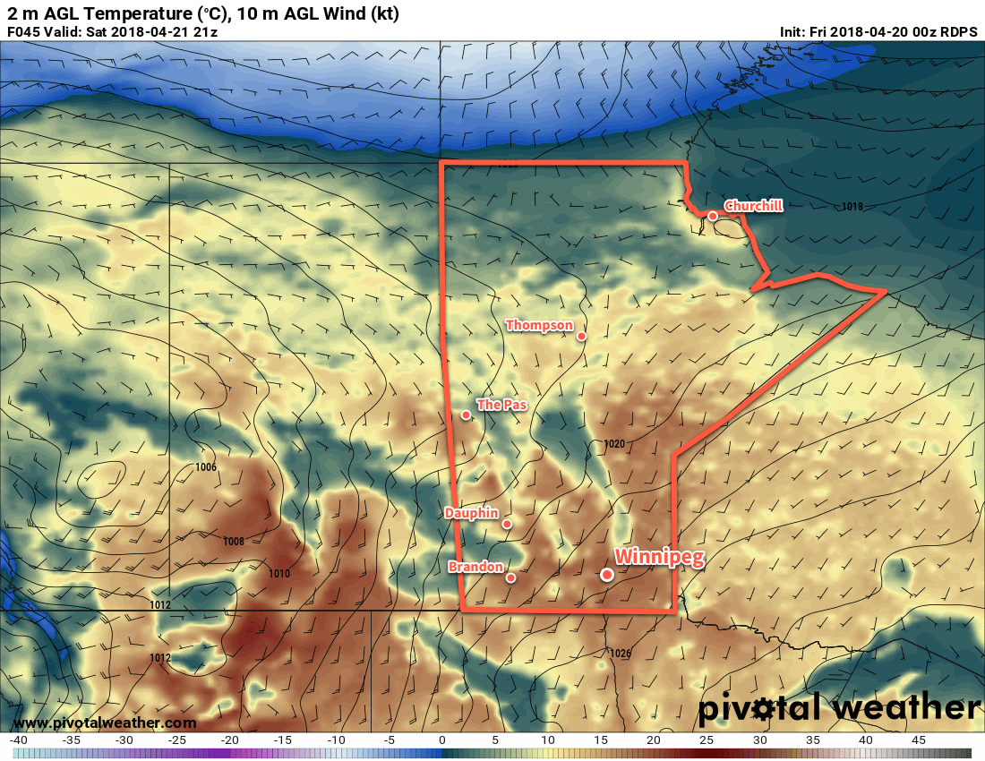
Things turn around quickly for the weekend though. An upper ridge building into the Prairies will bring sunny skies both Saturday and Sunday. Southerly winds will draw warmer air into the region with highs reaching 15°C on Saturday and a mild 23°C on Sunday. Winds will become more pronounced as the weekend progresses. Saturday will see southerly winds strengthen to 20 to 30 km/h. Sunday will bring southerly winds of 30 to 40 km/h.

Long Range Outlook

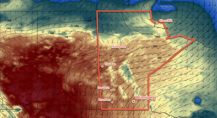
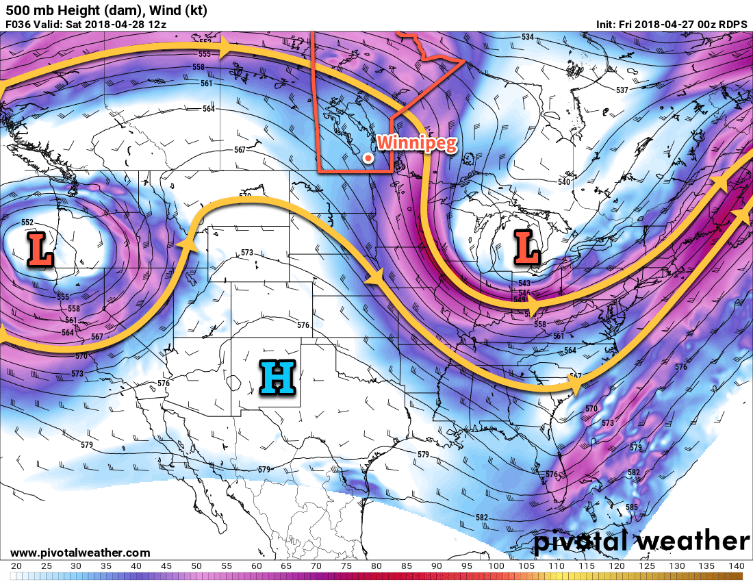
As we’ve mentioned several times over the past week, the beginning of next week will see a rather complex low pressure system lift out of the northern Plains into the Prairies. Details are still hazy, but the general idea is beginning to come into focus.

At this point, it looks like Winnipeg will see a chance of showers or thunderstorms on Monday morning. Most models are showing an area of thunderstorms developing over southeastern Saskatchewan on Sunday night that spreads eastwards. There’s still significant uncertainty in exactly where everything will set up, but in general Winnipeg will see cloudier, unsettled weather on Monday and Tuesday.

Winnipeg’s seasonal daytime high is currently 15°C while the seasonal overnight low is 2°C.

Warm and Windy Weather On The Way

Breezy conditions will develop over the Red River Valley this weekend as temperatures climb to above-seasonal values.

A low pressure system tracking through the northern Prairies will be the main driver for Winnipeg’s weather over the next several days. As it develops in Alberta and moves eastwards, warmer temperatures will spread across the southern Prairies. Daytime highs will sit comfortably in the mid-teens today, then climb into the upper teens for both Saturday and Sunday. This weekend’s mild temperatures will be matched by increasing winds out of the south to around 30 gusting 50 km/h by Saturday afternoon.

These warmer daytime highs will be matched by overnight lows climbing to above-seasonal values, particularly on Saturday night where southerly winds of 20 to 30 km/h will help produce a mild low near 6°C.

Of particular note, alongside the temperature, the dew point temperature will also be increasing. This value is a measure of how much water is in the air.  Not only is it important summer-focused weather such as thunderstorms, it also has major impact on the spring snow melt. Dew point temperatures will climb above 0°C on Saturday, combining with the mild temperatures to speed up the melting of any remaining snow in the Red River Valley.

Temperatures will climb into the upper teens across the Red River Valley on Saturday

Skies will be variably cloudy over the next couple days. Winnipeg will see mixed today, but Saturday will bring more sun with just partly cloudy skies. Winnipeg should see sunshine Sunday morning change to mixed skies in the afternoon as a cold front moves through.

There is a chance of a passing shower as the cold front swings through on Sunday, otherwise conditions look dry.

Long Range Outlook

More of the same in the long range: seasonal to above-seasonal temperatures and variable cloudiness. No big rainfall events are on the horizon. With continuing mild temperatures drying out the ground, all should be aware of the increasing fire hazard heading into the end of the month.

Winnipeg’s seasonal daytime high is currently 12°C while the seasonal overnight low is 0°C.

Variable Cloudiness, Above-Seasonal Temperatures Ahead

This week is shaping up to be pleasant in Winnipeg with variable cloudiness and slightly above-seasonal temperatures.

Winnipeg will remain under the influence of a stationary high pressure system for the rest of the week. The result will be dry conditions with pleasant temperatures and variable cloudiness lasting into the weekend.

RDPS 2m Temperature Valid 21Z Thursday April 19, 2018
Temperatures will climb into the mid-teens on Thursday afternoon in the Red River Valley

Temperatures over the coming days will trend to slightly above-seasonal values. Winnipeg will see highs in the low teens and overnight lows near 0°C as milder air gradually spreads across the Prairies. Thanks to the stationary high pressure system, winds will remain relatively light over the region. Wind speeds should remain around the 10 to 20 km/h range while the direction backs from northeasterly today to westerly on Thursday to southerly on Friday.

Long Range Outlook

The weekend looks great, likely bringing daytime highs in the mid- to upper-teens and overnight lows well above 0°C. Notably, there are suggestions that dew point values will finally climb above 0°C, significantly helping melt any remaining snow. Precipitation continues to look unlikely.

I don’t want to count chickens before they hatch, but it seems likely that over the next week Winnipeg will finally be able to say goodbye to winter and start the spring cleaning!

Winnipeg’s seasonal daytime high is currently 11°C while the seasonal overnight low is -1°C.

Spring-Like Weather Finally Arrives

Temperatures are finally beginning to move back towards seasonal with 2018’s warmest temperatures thus far on the way!

Finally. The relentless chill that has remained over the province for a significant portion of March and April is giving way! Milder temperatures will build back into the region this week, sending daytime highs to the warmest values seen so far in 2018. While temperatures will still remain slightly below-normal, it will be a huge improvement over the days earlier this month that were 10 to 15°C colder than seasonal values!

It all begins today with a ridge of high pressure bringing sunny skies and light winds to Winnipeg. Temperatures will climb to a high near 7°C. This is still below the seasonal +10 to +11°C, but still significantly better than seen over the past weeks. Temperatures will dip to a low near -5°C tonight under clear skies.

Tuesday will bring partly cloudy skies to Winnipeg. The Red River Valley will be on the eastern edge of a system lifting into Northern Manitoba spreads overcast skies through parts of Saskatchewan and western Manitoba. Winds will be a bit more noticeable than Monday out of the east-southeast at 15 to 25 km/h. Temperatures will be quite mild, though, with a near-seasonal high of 10°C. Skies will cloud up Tuesday night as temperatures head to a low near 0°C.

RDPS 24hr. QPF valid 06Z Thrusday April 19, 2018
Some light showers will try to work into the Red River Valley Wednesday afternoon and evening.

Wednesday will bring cloudy skies to Winnipeg & the Red River Valley as systems pass by to the north and south of the region. There may be a slight chance for some showers later in the afternoon into the evening, but a light northeasterly wind will continue to push dry air into the Red River Valley and do its best to keep things at bay.1 Temperatures will climb to a high near 7°C again, then head to a low near 0°C on Wednesday night under cloudy skies.

Long Range Outlook

Long-range outlooks show the potential for some showers or snow on Thursday morning, then clearing working into Winnipeg later in the day. After that, it’s a trend towards seasonal to above-seasonal temperatures with highs in the mid- to upper-teens possible by the weekend!

Winnipeg’s seasonal daytime high is currently 11°C while the seasonal overnight low is -1°C.

  1. This dry air often spreads underneath precipitation, evaporating it either partially or fully before it reaches the ground.