Unremarkable Weather On The Way As Temperatures Inch Towards Seasonal

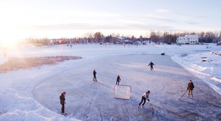
Winnipeg will see very little weather of note as temperatures slowly trend back towards seasonal values.

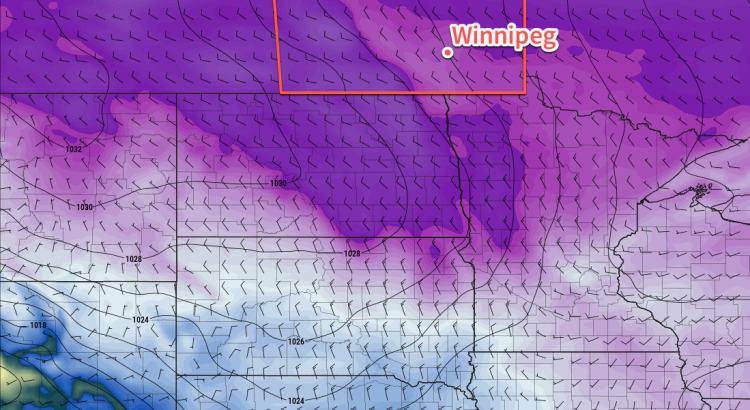
A low pressure system moving eastwards through northern Manitoba will bring just a few clouds to Winnipeg today as it drags a cold front across the southern Interlake. Fortunately, Winnipeg will remain on the warmer side of the front, and temperatures should climb to a high near -12°C with winds out of the west-southwest at 10 to 20 km/h. The city will see a few clouds tonight as temperatures dip to a low near -19°C with light winds.

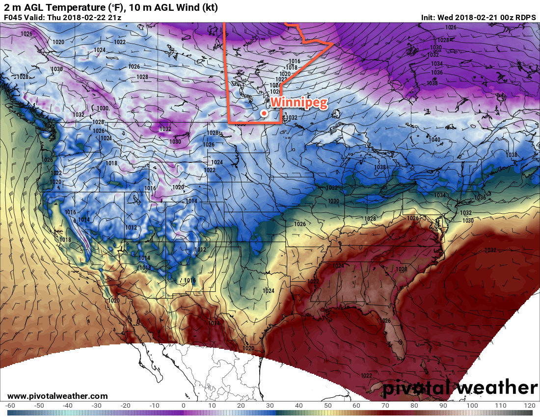
Thursday will be a beautiful day in Winnipeg with sunny skies, light winds, and a high near -7°C. Skies will cloud over on Thursday night as outflow from a high pressure system in the United States meets warmer air advecting into the Prairies from the west. Winnipeg should see a low near -15°C.

RDSP 2m Temperature Forecast valid 21Z Thursday February 22, 2018
Winnipeg will see near-seasonal temperatures on Thursday

Friday will bring mostly cloudy skies to Winnipeg. The extensive cloud cover will keep temperatures cooler with the high for the day likely around -9°C. Winds will be light, and it doesn’t appear that there will be any chance for snow, so the day may end up being a relatively pleasant one given how February has gone so far. Winnipeg will likely continue to see a fair amount of cloud on Friday night as temperatures head to a low near -16°C.

Long Range Outlook

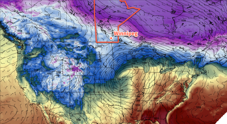
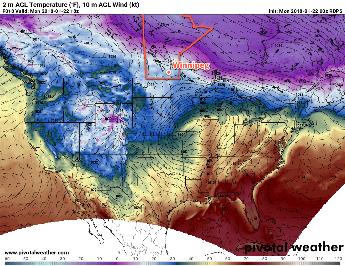
The large-scale pattern over North America continues to shift, with the polar vortex now retreating back towards the North Pole and a secondary cold vortex that has been over Northern Manitoba/Nunavut also shifting off to the east. This change in pattern will allow milder air to build eastwards across the Prairies from the Pacific, finally getting southern Manitoba out of the “Arctic pipeline” that’s been in place for so long now.

As a result, it looks like Winnipeg will actually be entering a stretch of near- to above-seasonal temperatures! With the warmer temperatures will come more variability in cloud cover, but that seems like a reasonable price to pay for some warmer weather at this point.

For those hoping for any precipitation, you’ll have to continue waiting, though. Despite the milder air, snow remains elusive in the forecast, with the main storm tracks continuing to pass to the north and south of the Red River Valley. There are some indications that southern Manitoba may see a storm to kick off March – in like a lion, perhaps? – but there’s plenty of time for that forecast to change. We’ll be keeping an eye on it; in the meantime, enjoy the break from the cold!

Winnipeg’s seasonal daytime high is currently -7°C while the seasonal overnight low is -17°C.

The Best Weather…Is No Weather?

It’s steady sailing for Winnipeg through the remainder of the work week with no notable changes in the weather expected.

The persistent Arctic ridge that has been building across the southern Prairies will continue to remain in place for the remainder of the week, bringing very little change to the weather over the next 3 days. Winnipeg will see daytime highs right around the -16°C mark with plenty of sunshine through the remainder of the work week. Overnight lows will dip to around -26°C tonight and Thursday night, but slightly warmer temperatures will move in ahead of a low pressure system on Friday night, keeping lows a bit warmer near -20°C with some cloud cover building into the region.

Long Range Outlook

A low pressure system passing through on the weekend will bring some cloud and a chance of flurries. Temperatures aren’t really forecast to climb too much, but the passage of this low may begin shifting the overall weather pattern and allow seasonal or slightly above-seasonal temperatures to move into southern Manitoba next week.

In the meantime, grab those skates, or skis, or boots, and get out and enjoy the sunshine!

Winnipeg’s seasonal daytime high is currently -10°C while the seasonal overnight low is -20°C.

Quiet, Cool Weather Ahead

After yesterday’s cold turning windy weather, the coming few days are set to be entirely unexciting with benign, cool weather.

Winnipeg will find itself on the northern side of an Arctic ridge for the next few days, which will bring fairly benign weather to the region and keep temperatures on the cool side.

For the next several days, daytime highs near -16°C, give or take a degree or two, are expected while overnight lows sit near -26 or -27°C. Winds will be a bit breezy this afternoon, out of the northwest at 20 to 30 km/h, but will taper off this evening and remain light for Tuesday and Wednesday. Skies will also become increasingly sunny, with a mix of sun and cloud today giving way to partly cloudy skies tomorrow, and finally mainly sunny skies on Wednesday.

Long Range Outlook

The remainder of the week looks like more of the same. The Pacific storm track will remain to the west and south, while any weaker polar disturbances remain to the north. Below-seasonal temperatures will remain in place for the remainder of the work week, but indications are that the Alaska high that has helped entrench the cold northerly flow over the Prairies may collapse towards the end of the week, forcing the coldest Arctic air back into the north and allowing temperatures on the Prairies to moderate.

This would also likely result in the chance for some snow, but there’s little confidence in any potential storms at this point.

Enjoy a quiet and sunny, albeit chilly, week ahead!

Winnipeg’s seasonal daytime high is currently -10°C while the seasonal overnight low is -21°C.

Pleasant January Weather Continues

Winnipeg will continue to see pleasant January weather over the next few days with mild temperatures and light winds.

The weather over the next 3 days will defined by a stalled frontal boundary draped from Parkland Manitoba southeastwards through the Red River Valley and onwards towards the Great Lakes. This stalled boundary will keep winds light and temperatures mild for the next 3 days. The one downside will be the generally cloudy skies that persist along the front and the potential for patchy fog in any areas that manage to see some clearing at night or are stuck near the edges of cloud boundaries.

Temperatures for the first half of the week will be remarkably steady with highs around -6°C and lows dipping to around -10°C. The only chance for any sort of organized snow looks to be on Tuesday afternoon as a weak low pressure system moves through the region; Winnipeg will likely see light snow through the afternoon hours, but only around 1-3 cm is forecast to fall.

Mild conditions will remain in place across much of the southern Prairies over the next few days

In some ways, it’s almost as good as can be asked for in a Winnipeg January: warm enough to be outside but cool enough that it’s not too sloppy, no winds making it miserable, and much of the outdoor winter activities up and running. The lack of sun is a bit of a hindrance, but cloud is often the price you pay for warmer weather in the winter.

Long Range Outlook

The remainder of the week looks quite cloudy with several chances for snow and mild temperatures continuing. Early indications are that a fairly significant low pressure system will move into the Dakotas on Friday, but there’s still quite a bit of uncertainty on how exactly it will affect southern Manitoba.

Temperatures will take a dip back towards seasonal values on the weekend as slightly cooler air slumps southwards behind the Dakotas low. The cool-down looks short-lived, however, with milder temperatures returning to start off February!

Winnipeg’s seasonal daytime high is currently -13°C while the seasonal overnight low is -23°C.