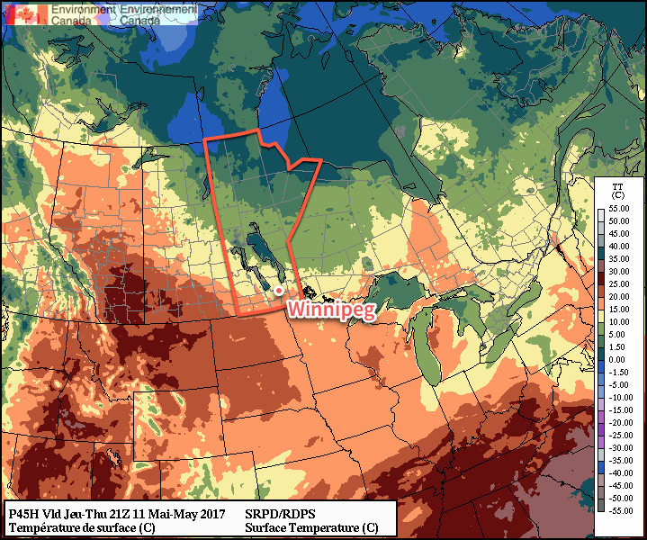
Winnipeg will see plenty of sunshine through the second half of the work week, but temperatures will remain slightly below seasonal values.
Today will be the cloudiest day of the next few as an area of low cloud brought into the southern Manitoba overnight by a low pressure system in northwestern Ontario gradually moves out of the region. Once the cloud clears through the afternoon and evening, Winnipeg & the Red River Valley will be left with mainly sunny for Thursday and Friday.
A ridge of high pressure building into the region will keep winds northerly and light over the next few days.
A ridge of high pressure will keep temperatures cooler in the eastern Prairies and help much warmer air build into Alberta and parts of southern Saskatchewan
Daytime highs and overnight lows will be fairly constant; expect daytime highs between 14-16°C and overnight lows near 2-4°C through to Friday.
No precipitation is expected.
Long Range
The weekend continues to look pleasant with daytime highs climbing back towards seasonal and more sunny skies.
There are hints of some cloud cover possible on Sunday—perhaps even a chance of a shower—but most guidance suggests another sunny day. Next week will start off with more calm & warm weather.
Winnipeg’s seasonal daytime high is currently 18°C while the seasonal overnight low is 4°C.
Winnipeg will see calm weather through the first half of the week filled with plenty of sunshine as temperatures return to more seasonal values.
It’s another short and sweet forecast today with little weather in store for Winnipeg over the next couple days.
Today & tomorrow will both be sunny days, however temperatures will remain below normal. Today will see a high near -10°C, and there will be another chilly night ahead with a low near -20°C. Tuesday will be milder, with highs climbing to around the -5°C mark with southerly winds to 15-20 km/h. Expect a low near -12°C on Tuesday night.
Warmer air will be pushing eastwards over the coming few days.
Wednesday will see cloud cover move into the region, creating mixed to cloudy skies, as even milder air pushes eastwards. Highs will climb to around -2°C with strengthening southerly winds to around 30 km/h. Lows will be mild on Wednesday night near the -4 or -5°C mark.
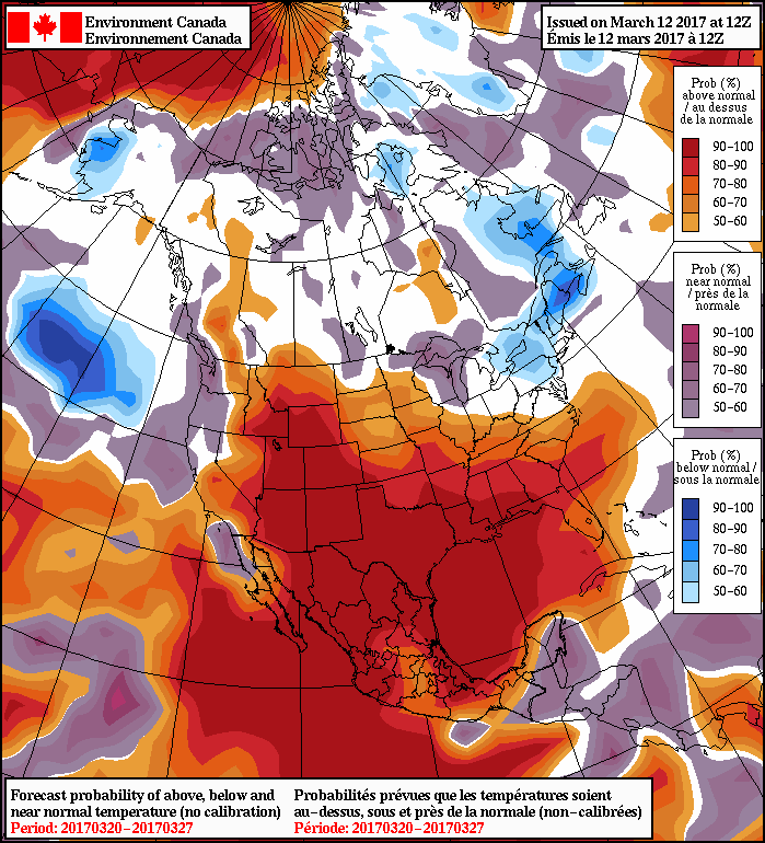
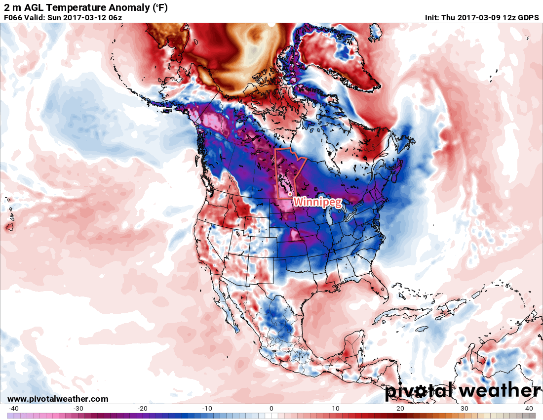
Long Range
NAEFS 8-14 Day Temperature Anomaly Forecast — Valid March 20-27, 2017
Temperatures will moderate towards seasonal values for the long-range, however in the second half of this week temperatures will likely climb above-normal for a few days before returning to seasonal values for next week.
Precipitation wise, it looks like there will be a chance for some rain or snow this Thursday into Friday, and then the threat for a more potent storm system for the start of next week.
Winnipeg’s seasonal daytime high is currently -2°C while the seasonal overnight low is -12°C.
There’s not too much to say about the upcoming weekend, which is a bit of relief after the relentless storm earlier this week. Below-normal temperatures and sunny skies ahead.
Temperatures over the coming few days will be well below normal due to a rather potent Arctic ridge entrenched over the region. The upside to the colder weather is that we’ll see plenty of sunshine for the next couple days before some cloud, and warmer temperatures, moves in for Sunday.
The Arctic ridge over the Prairies will keep temperatures well below normal across a vast swath of Canada.
So for both today & tomorrow, expect highs near -15 to -13°C, with overnight lows in the -20 to -25°C range. Skies will be sunny today, but more mixed tomorrow as some cloud cover moves in from the west ahead of the next disturbance that will clip across southeastern Saskatchewan and southwestern Manitoba.
The bigger change will come on Sunday as the disturbance clips through the region. Skies will be mainly cloudy, although it should be noted that Winnipeg may see a little more sunshine if the system edges just a little bit southwards or more cloud if it tracks a bit further north. Temperatures will also warm up a tad with highs climbing towards the -10°C mark but lows will still be quite cool on Sunday night, bottoming out near -19°C.
Long Range
While a few weak clipper systems are expected to pass over southwestern Manitoba over the coming week, it looks to remain fairly dry here in the Red River Valley. Temperatures will move towards seasonal to above-seasonal mid-week, and with that shift to warmer weather we may see a bit of precipitation, but at this point it’s simply too early to tell.
Winnipeg’s seasonal daytime high is currently -3°C while the seasonal overnight low is -13°C.
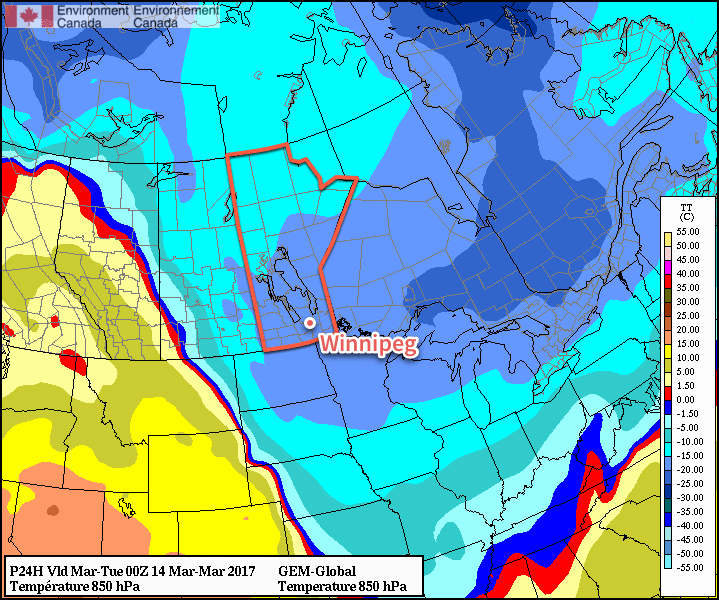
Winnipeg will finally get a break from the clouds and settle into its new reputation as a winter city thanks to an Arctic air mass that is bringing closer-to-seasonal temperatures back to the region.
Get settled in for significantly cooler temperatures than we’ve seen over the past week as daytime highs hover in the minus teens over the next few days. Generally expect daytime highs near -15°C increasing to -12 or -13°C by Friday. This will be slightly below the seasonal high of -11°C for this time of year.
The nights will be much colder than we’ve seen lately too, with lows hovering just below the -20°C mark both tonight and tomorrow night. Temperatures will moderate slightly on Friday night to a low near -18°C as some warmer air moves in associated with a weak disturbance that will move through on Saturday.
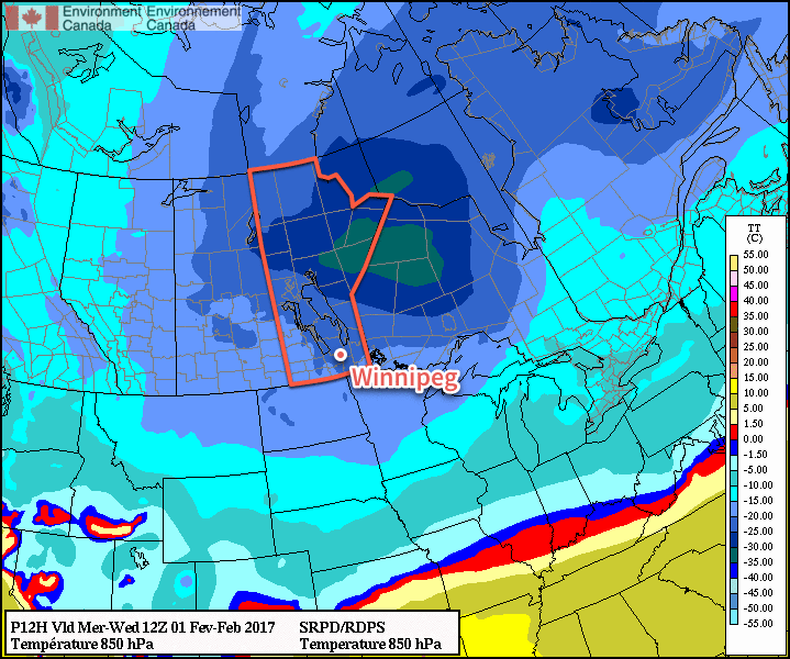
The forecasted 850mb temperatures clearly shows the colder air building into Southern Manitoba today and tonight.
Skies will be fairly sunny all 3 days as well with just a patch of mixed skies likely later this afternoon and into the early evening, then spotty clouds on Thursday & Friday. Winds won’t be too much of a bother either; both today and Thursday should see winds out of the west to northwest at 10-20 km/h, and then Friday will bring calm winds ≤ 15 km/h as the main ridge of high pressure rolls through.
Long Range
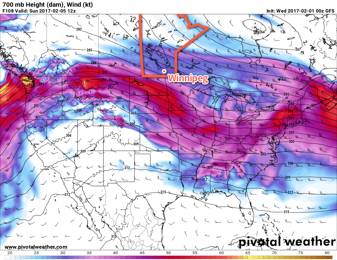
Conditions look to become more settled this weekend as the jet stream intensifies along the U.S. border, shifting the main storm track into our region.
The jet stream will be draped along the US border this weekend, bringing several weak disturbances along its path.
Systems will roll through roughly 18-24 hours apart, so there will be a chance for snow on Saturday, Sunday and Monday, however most of these systems look fairly weak and will be faster-moving systems. Unfortunately with the strong jet stream running west-to-east along the border, the warmest air will remain locked up to our south, and while temperatures may climb slightly above seasonal on Saturday, it will be a quick return into cooler weather once again.
There is some uncertainty as to how cold it will get once things settle down next week, but at this point daytime highs in the bottom half of the minus-teens seem fairly likely.
Winnipeg’s seasonal daytime high is currently -11°C while the seasonal overnight low is -22°C.