Calmer Weather On Tap For The Weekend

Calm weather is expected in Winnipeg and across the Red River Valley over the next few days, a welcome reprieve from the severe thunderstorm activity that moved through the region on Wednesday.

Today will be an improvement over the cool and blustery conditions that moved through the Red River Valley yesterday. While skies will be mixed remain mixed, temperatures will be a couple degrees warmer than Thursday with a high temperature near 23°C. Gusty winds will remain out of the northwest at 20-30 km/h.

Temperatures will dip down to around 13°C tonight with partly cloudy skies.

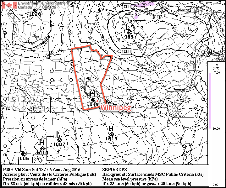
Saturday will be a very pleasant day as a ridge of high pressure moves over the province. Winnipeg & the Red River Valley will see daytime highs near 25°C under mainly sunny skies and light northwesterly winds. Temperatures will dip down to around 13°C once again on Saturday night under clear skies.

A ridge of high pressure will bring sunshine to Southern Manitoba on Saturday.

Sunday will bring warmer weather back to the Red River Valley as the ridge moves off to the east, winds switch around to the south, and a warm front begins lifting northwards out of the United States. As the warm front moves into the province through the day, skies will become gradually mixed with temperatures climbing into the upper 20s. Fortunately, despite the southerly flow, it appears that the humidity will be kept at bay and the weekend will be ending with warm, comfortable conditions instead of another muggy mess.

Long Range

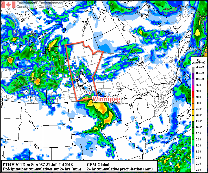
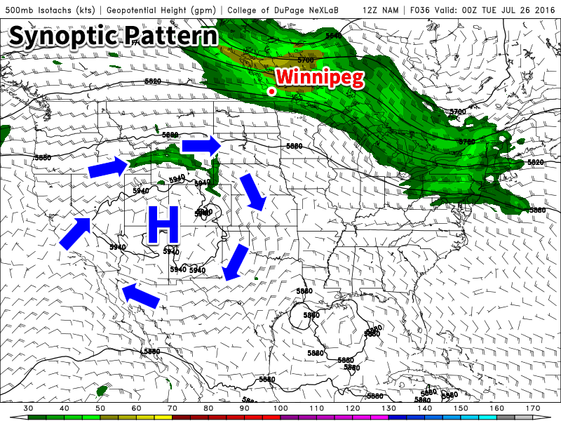
Early indications are that our nice dry weather will come to an end early next week as yet another low pressure system tracks out of the northern United States and into the southeastern Prairies. This system will spread another batch of thunderstorm activity across southern Manitoba with the main event on Monday night into Tuesday.

The GDPS is forecasting a swath of 30-50mm across Southern Manitoba on Monday night through Tuesday.

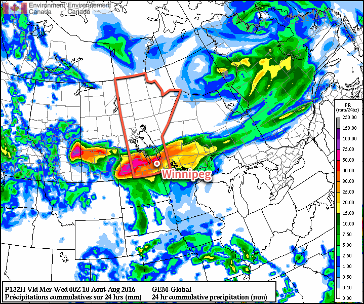
Initial indications are that severe weather may also be possible with this system as moderate CAPE values1 combine with 35-45 kt of bulk shear, which in this timeframe certainly indicates the potential for organized thunderstorms with, at a minimum, the potential for large hail. Ultimately we’ll simply have to wait until later in the weekend for clarifying details on what this system early next week will entail.

It’s getting to be a tiring summer to be the weather messenger, with every tiny stretch of nice weather being cut short by the looming news of more thunderstorms. It’s been an incredibly active summer over Southern Manitoba, and one can only hope that we transition into a pattern of more stable, drier weather in the coming weeks.

Winnipeg’s seasonal daytime high is currently 26°C while the seasonal overnight low is 13°C.


  1. CAPE is a measure of the energy available to a thunderstorm. 

Hot, Dry Weather Ahead

In what seems like an almost unbelievable stroke of luck this year, hot and dry weather will continue throughout the second half of the work week for Winnipeg and the Red River Valley.

We finally get a bit of a break here at A Weather Moment with not just one, but two (!) short blog posts in a row as a ridge of high pressure dominates the weather over the Red River Valley.

Today and tomorrow will both be pleasant days with daytime highs near 25 and 27°C respectively and overnight lows near 13°C. Winds will be fairly light out of the north both days. Skies will be partly to mainly sunny.

By Friday, a low pressure system pushing eastwards across Saskatchewan will begin spreading cloud across Southern Manitoba. While some shower activity is possible over southwestern Manitoba, nothing is expected here in the Red River Valley. Temperatures will climb to a high near 28°C with winds fairly light out of the south. Lows will be near 16°C on Friday night.

Long Range

The weekend brings back the potential for some wet weather as a slow-moving low pressure system moves across the region. There's still a fair amount of uncertainty associated with this system, however, so this will be more of a generalized outlook.

The GDPS is forecasting a swath of 10-35mm near the US border Friday night through Saturday night.

Current guidance suggests the development of a slow-moving area of rain through North Dakota on Friday night which will have the northern edge extending into Southern Manitoba. This system will very slowly move eastwards through Saturday, spreading rain across the Southern Red River Valley. Guidance suggests that the bulk of the rain would leave the region on Saturday night with 10-35mm of rain having fallen in the heaviest hit areas on the Canadian side of the border. Sunday would then bring just a slight chance of showers.

Again, there is a substantial amount of uncertainty associated with this system at this point and a slight shift north or south could dramatically alter the amount of precipitation expected.

Winnipeg’s seasonal daytime high is currently 26°C while the seasonal overnight low is 13°C.

Calmer and Drier to Start the Week

We will be in a much drier and calmer pattern early this week as an upper ridge of high pressure build over western North America. This should provide many areas an opportunity to dry out after what has been an exceptionally wet pattern over the past two months.

An upper ridge of high pressure over western North America will bring drier weather to southern Manitoba

This Week

Today will be a nice day in southern Manitoba. High temperatures will climb up near the 30C mark in most areas under mainly sunny skies. Winds will be westerly near 20 km/h, offering a bit of natural air conditioning from the heat of the day.

Tuesday will see a bit of a cool-down from today as a cold front brings a cooler air mass to the region. However, it won’t be a significant cool-down, as high temperatures will remain in the mid twenties. Winds will shift to northerly at around 20 km/h. Skies will be a mixture of sun and cloud as some high-level cloud moves through the region.

Wednesday will see temperatures once again in the mid twenties under a mixture of sun and cloud. Winds will be light as we sit within a slack surface pressure regime.

Long Range

The long range forecast shows us remaining under the influence of high pressure aloft until at least the end of the week. This should generally mean warm and dry conditions, although the odd thunderstorm cannot be ruled out. It doesn’t appear that an organized precipitation should be expected until next week, although some models hint at perhaps a semi-organized convective system affecting border regions midweek. However, it’s too early to say if such a system may transpire.

Drier Weather to Start the Week

This week will start out on a drier note after the heavy rains of the weekend left many parts of southern Manitoba in a very soggy state.

Mild and breezy weather is expected in southern Manitoba on Monday

This Week

Today will be mainly sunny with temperatures climbing into the low twenties. The sunshine will be welcomed by many in southern Manitoba as it will give a chance for many water logged areas to dry out. Winds will be northwesterly at 20-30 km/h.

Tuesday will feature much the same weather as today, with temperatures in the low twenties and mainly sunny skies. Winds will be a bit lighter however, making it an even better day.

Wednesday’s weather is the most uncertain of the early week period. Most models suggest southern Manitoba will see mainly sunny conditions with temperatures in the mid twenties. However, an area of precipitation is expected to pass to our south. Should the forecast shift that precipitation northward, we could see more rain. At this time that does not appear likely, but it is something to bear in mind.

Long Range

The long range forecast continues to show us in a generally above-seasonal pattern through the end of June. However, we are also forecast to remain near the storm track through month’s end, suggesting more wet weather may be on the way later this month. Forecasting weather in the long range can be quite difficult in summer, so unfortunately you’ll just have to take the conditions as they come to some extent.