Major Spring Storm On The Way For Southern Manitoba

The most significant spring blizzard in decades is bearing down on southern Manitoba, but there’s nuance in the details. What follows is the best interpretation of the upcoming weather we can discern as of the time of writing. The forecast for this system may change on short notice, so be sure to keep alert of any updated forecasts or warnings from official sources.

GDPS Total Snowfall Forecast valid 00Z Saturday April 16, 2022
The Canadian GDPS model has slightly less snow than many of its peers, but shows well the very large area that will likely see 20–40 cm of snow. Other forecast models show accumulations over 25% higher than these values.

A complex storm system will bring a major spring blizzard to southern Manitoba beginning later today. While the broad strokes of this system have been quite clear for several days now — a testament to improvements in medium-range weather modelling over the past decade — there are many nuances to this system that will add layers of complexity to the forecast.

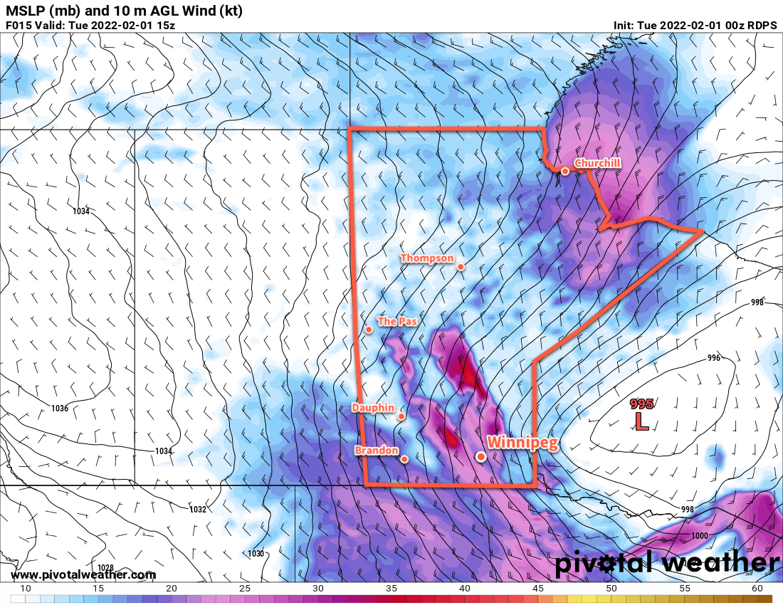
A pair of low pressure systems have merged overnight and now exist as a single potent low centred over western Nebraska and Colorado. This system is supported by two distinct features: an upper low over Iowa and a digging upper trough over Utah and Colorado. These two upper features and their evolution will guide the development of this system over the next 36 hours.

As this system pushes eastwards today, it will split into two surface lows: one that lifts northwards through the Dakotas through the day, and another that lingers in Colorado for a while longer before ejecting northeastwards into Minnesota. The northern low will be supported by the upper low, while the southern low will move along with the upper trough and strong frontal wave.

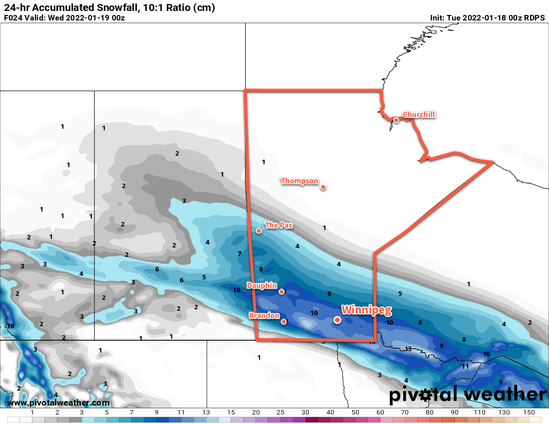
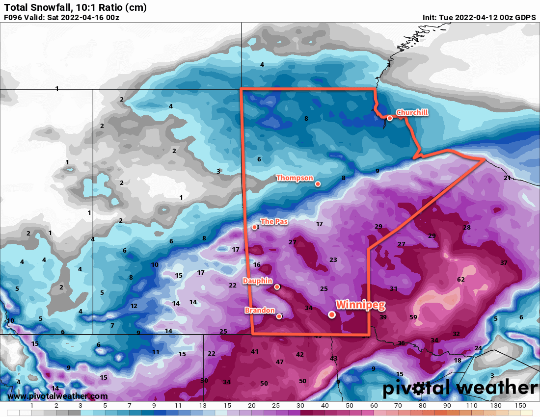
The first wave of snow will move into southern Manitoba this evening, supported by the northern low pressure system. This snow will likely be quite heavy with snowfall rates reaching as high as 3–5 cm/hr. This first shot of snow will lift from North Dakota into SE Saskatchewan and SW Manitoba, then spread eastwards across the Red River Valley and into NW Ontario. By the end of Wednesday, it’s likely that 20–40 cm of snow will have fallen over the southwestern corner of the province and the western escarpment/Riding Mountains, and 10–20 cm of snow in the Red River Valley and southeast corner of the province.

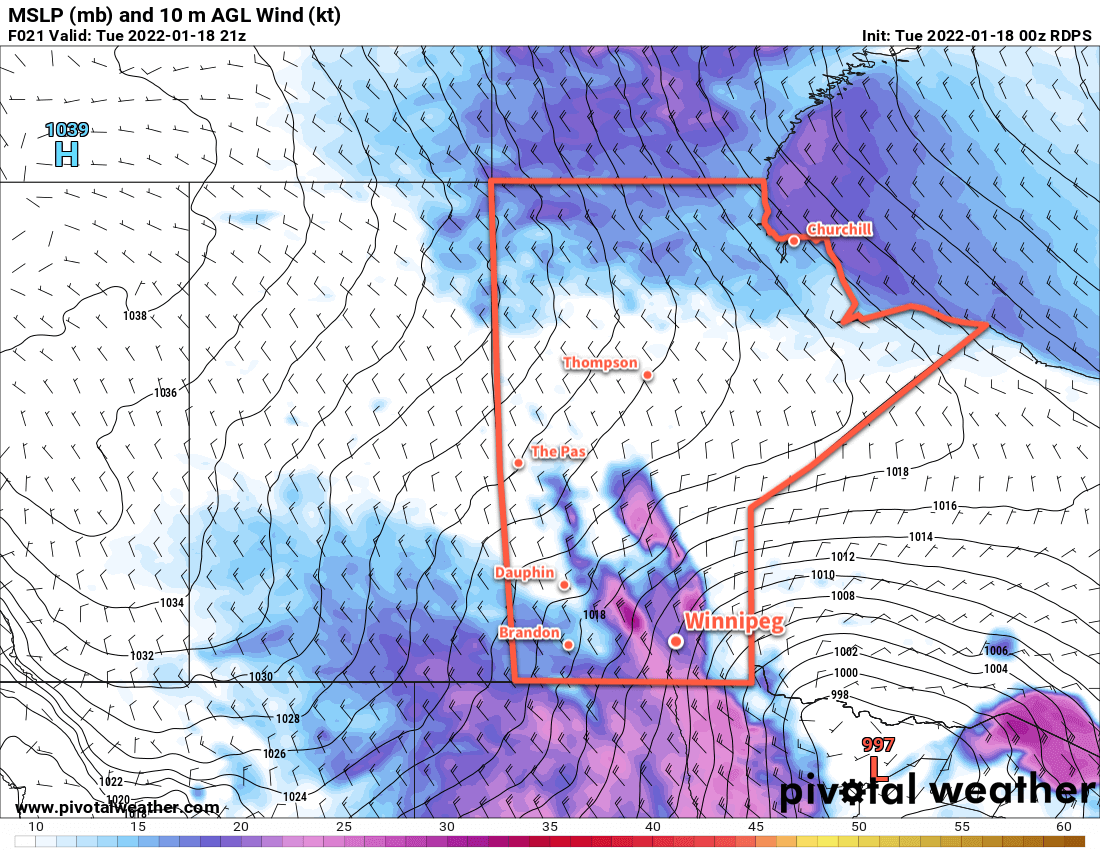
As the day progresses on Wednesday, the precipitation lifts northwards as the northerly surface low stalls out near the MB/ND/MN borders. It looks quite likely that this system’s dry slot will spread into southern Manitoba, bringing an end to most of the snow over the Red River Valley and southeastern Manitoba. If this happens, the region would see a reprieve from the snow later Wednesday through the night, but with a decent chance of [freezing] drizzle or few flurries through that period. The snow will continue elsewhere in Manitoba, albeit comparatively lightly with general accumulations overnight of 5–10 cm. Terrain features will continue to see enhanced accumulations with 10–20 cm possible, particularly closer to Lake Manitoba and the Riding Mountains.

On Thursday, the Colorado Low will become dominant in NW Ontario, producing heavy snow that will spread westwards across the Interlake into western Manitoba through the day. Light to moderate snow will spread back through the Red River Valley for Thursday. The stalled surface low in Manitoba will collapse as the Ontario low strengthens, and the strongest winds will shift eastwards into the Red River Valley with sustained northerlies of 50–60 km/h. Close to 5 more centimetres of snow is likely for Winnipeg on Thursday.

The snow will begin to ease on Thursday night, then clear out of the region through Friday.

RDPS 10m Wind Forecast valid 15Z Wednesday April 13, 2022
This storm will bring moderate to strong north-northeast winds to parts of southeastern Saskatchewan and southern Manitoba on Wednesday morning. The winds will ease slightly and shift into the Red River Valley on Thursday.

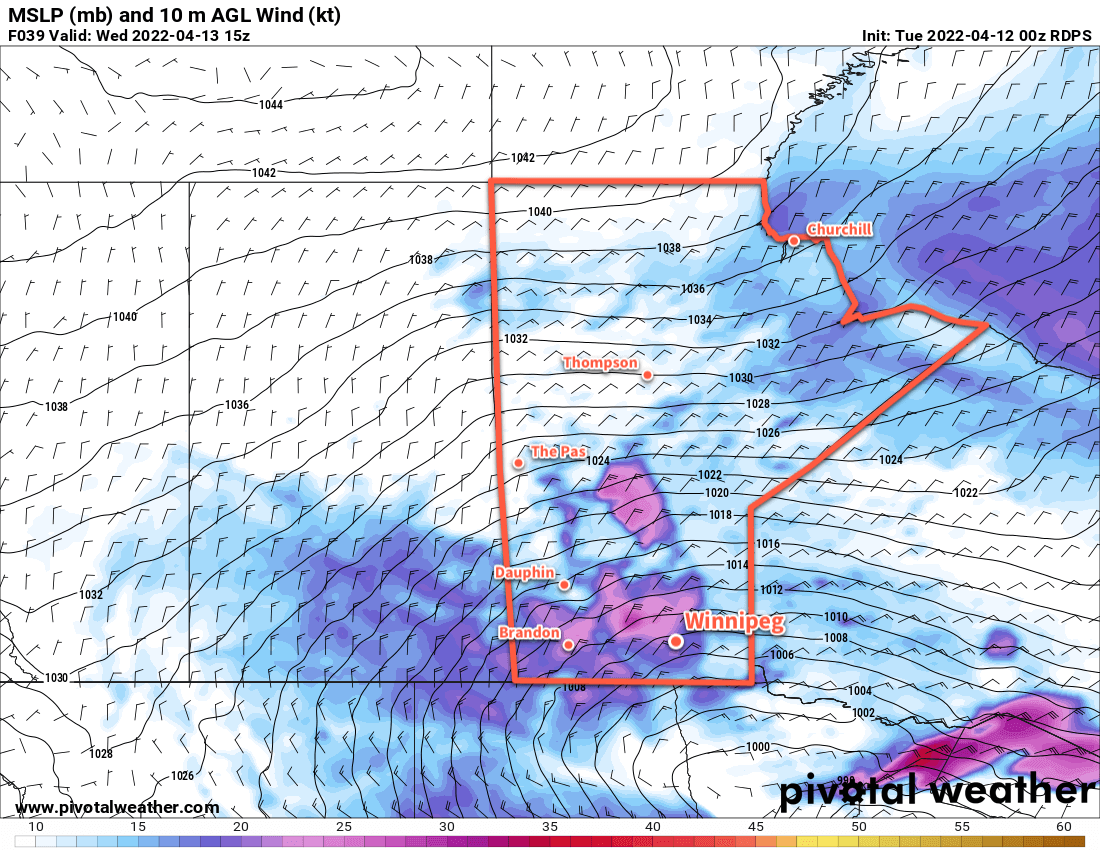
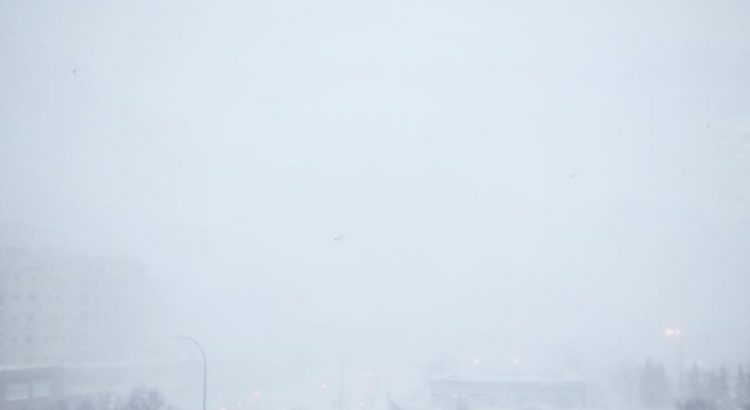
Regarding the wind and blowing snow, the stalling of the low near the MB/ND/MN border and timing of the NW Ontario low takeover will result in full-fledged blizzard conditions being most likely in SE Saskatchewan into SW Manitoba. Lighter winds are likely in the Red River Valley, and the peak forecast winds for this system have subdued slightly. That said, especially in the first wave, white-out conditions will be possible in heavy snow.

So, by the time the snow tapers off on Friday, it still look likely that 30 to 50 cm of snow will fall widespread across southern Manitoba. It will be a fairly persistent event from areas in SE Saskatchewan through southwest and western Manitoba as well across the Interlake. It looks like the situation in the Red River Valley will be different though, with multiple waves of snow. Winnipeg and area will likely see a wave of very heavy snow on Wednesday morning taper off later in the day with as much as 15–25 cm possible. Snow will likely ease for the city Wednesday evening/overnight with a chance of [freezing] drizzle. The wind will pick up on Thursday as more snow moves back into the region; the Winnipeg area will likely could see as much as 5–10 cm of snow.

Lighter amounts will fall to the south, but a heavier band of snow the north will give 10+ centimetres to the Interlake and other parts of central Manitoba.

The snow, wind, and blowing snow will begin to ease Thursday night, with conditions continuing to improve on Friday. For Winnipeg, this means that about half of the expected snow will likely fall on Wednesday alone, with the other half or so coming over the following 24–36 hours as a separate wave of snow. It will still amount to quite a bit, but it won’t be the 3-day raging blizzard like it looked like it could be even a day ago.

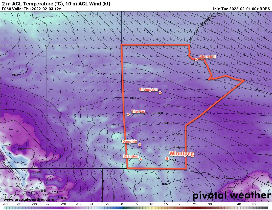
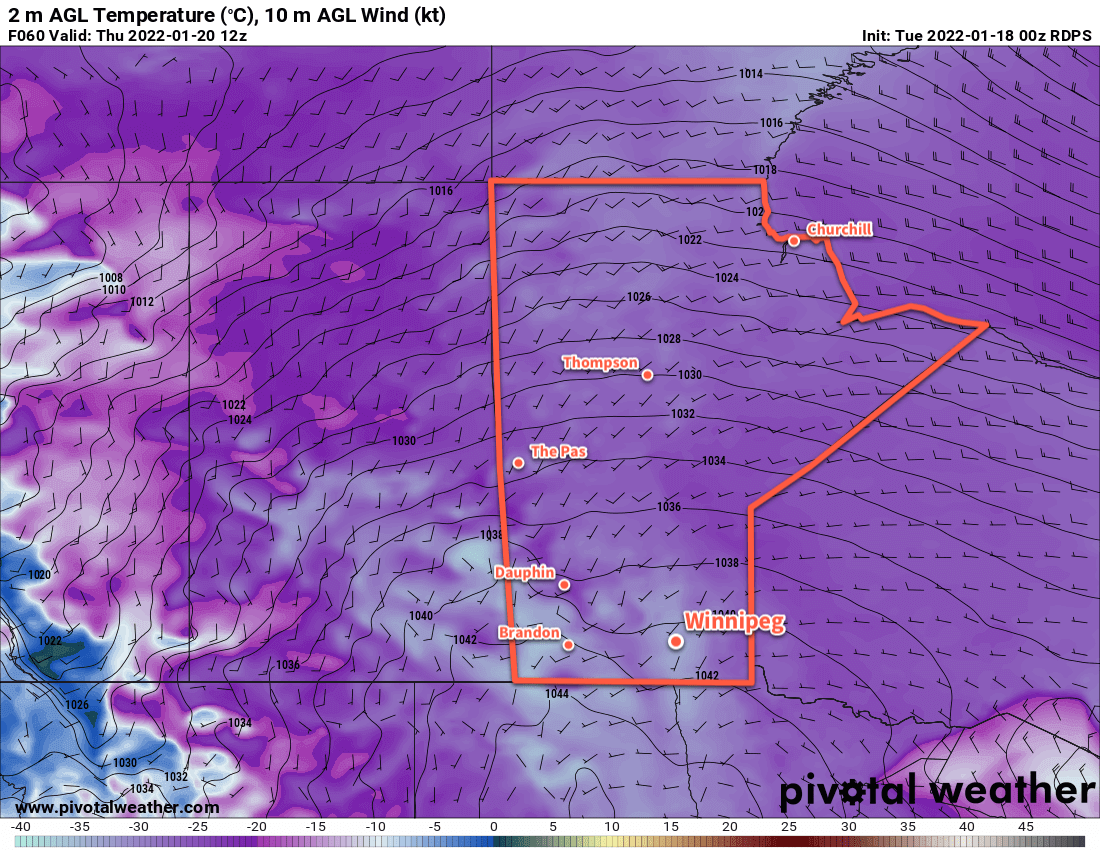
Temperatures will hover just above freezing today and tomorrow, then fall below freezing on Thursday.

Long Range Outlook

Cooler temperatures will stick around for the weekend with sub-freezing highs and seasonably cool lows. It should be a relatively quiet period for several days after this event, giving plenty of time to clean up after this storm.

Today’s seasonal daytime high in Winnipeg is 9 °C while the seasonal overnight low is -3 °C.

Alberta Clipper Brings Blizzard, Plunging Temperatures

A potent Alberta Clipper is bringing very strong winds and blowing snow to southern Manitoba this morning. In its wake, a surge of Arctic air will send temperatures plummeting back to bitterly cold values.

RDPS 10m Wind Forecast valid 15Z Tuesday February 1, 2022
Strong northwest winds will bring blizzard conditions to the Red River Valley on Tuesday morning.

Starting the day today, the clipper has moved off to the east and brought strong northwest winds as high as 60 gusting 80 km/h to the Red River Valley. This, combined with the 5–10 cm of snow overnight, is producing widespread blizzard conditions through the Red River Valley. Temperatures have also fallen from a high close to 0 °C near midnight into the -10 to -15 °C range. The snow will taper off today as temperatures continue to fall towards -20 °C by the end of the day.

Those strong winds will ease to 40 gusting 60 km/h by the end of the day. This will ease the blizzard conditions, but areas of poor visibility in blowing snow will likely persist across the region into the evening hours.

The wind will ease Tuesday night as skies clear and temperatures head to a low dipping below -30 °C. Extreme cold warnings may be issued if enough wind persists to hit -40 wind chills (only 10–15 km/h winds will be needed).

RDPS 2m Temperature Forecast valid 12Z Thursday February 3, 2022
Bitterly cold temperatures with lows into the -30s will return to southern Manitoba later in the week.

Mid-week will bring plenty of sun but temperatures will stay quite cold with highs in the -20 to -25 °C range and lows dipping into the -30 to -35 °C range. Extreme cold warnings are all but a certainty on Wednesday night.

A weak disturbance will begin to push a little bit of warmer air into the province on Thursday night, bringing some cloud and a chance of some light snow. Skies should clear out again for Friday.

Long Range Outlook

The end of the work week will continue cold, but a substantial push of warm air and cloud will move into the region Friday night. Another 5–10 cm of snow could fall by Saturday evening.

After that, the region will see variable cloudiness with a general warming trend to the forecasts. Next week looks like it could be a return to seasonably mild temperatures with highs climbing back above -10 °C.

Today’s seasonal daytime high in Winnipeg is -11 °C while the seasonal overnight low is -21 °C.

Alberta Clipper Brings Winter Storm And Bitter Cold

An Alberta clipper is bringing heavy snow to the province, but the worst conditions will arrive upon its exit. Blizzard conditions will develop Tuesday afternoon, followed by bitterly cold temperatures mid-week.

RDPS 24hr. Snow Accumulation Forecast (10:1 SLR) valid 00Z Wednesday January 19, 2022
Heavy snow will taper off over the Red RIver Valley this morning with a widespread 10–15 cm storm-total accumulation.

The heavy snow has arrived in the Red River Valley and will continue until around midday. The heaviest snow will exit to the east with the clipper itself, but a few flurries will continue through the day. Conditions will continue to deteriorate behind the low as northerly winds increasing to 50 gusting 70 km/h.

Widespread blowing snow will develop on Tuesday afternoon from the Parkland region into the Red River Valley. The worst visibilities will occur in the Red River Valley Tuesday evening through the night. Ample quantities of fresh snow combined with howling northwesterly winds and falling temperatures will produce [near-]blizzard conditions. It will be a unpleasant and dangerous night out in the open.

RDPS 10m Wind Forecast valid 21Z Tuesday January 18, 2022
Strong northwest winds will likely produce blizzard conditions through the Red River Valley beginning on Tuesday afternoon.

Temperatures will reach a high in the -5 to -10 °C range early Tuesday, then fall through the rest of the day. The region will see lows into the -20 to -25 °C range by Wednesday morning.

The winds will begin to ease Wednesday morning, bringing an end to the blowing snow. It will be cold on Wednesday with temperatures barely recovering a few degrees from the overnight low as skies clear. Temperatures will plummet down below -30 °C on Wednesday night. Extreme cold warnings are likely across much of southern Manitoba on Wednesday night as wind chill values of -40 to -45 will be widespread.

RDPS 2m Temperature Forecast valid 12Z Thursday January 20, 2022
Bitterly cold temperatures will return to southern Manitoba on Wednesday night with lows dipping below the -30 °C mark.

Thursday will also be cold with highs in the -20 to -25 °C range and light southerly winds. A warm front pushing across the Prairies will bring cloud to the region on Thursday night with temperatures rising close to -10 °C by Friday morning. That warmer weather won’t come without a cost, though. As it moves into the region on Thursday night, southerly winds will strengthen into the 40–50 km/h range.

Long Range Outlook

The winds will ease on Friday with a high in the -5 to -10 °C range. Some snow will move through southern Manitoba — perhaps close to 5 cm — followed by a cold front later in the day. Northwest winds near 30 gusting 50 km/h will move in behind the front, sending lows back into the -20 to -25 °C range overnight.

The weekend will bring seasonably cool conditions with highs in the -15 to 20 °C range and overnight lows near the -20 to -25 °C range. Saturday should bring sunshine, but some flurries may be possible on Sunday as another disturbance brushes by the region.

Today’s seasonal daytime high in Winnipeg is -13 °C while the seasonal overnight low is -23 °C.

Update: Mackenzie Low Brings Blizzard to Southern Manitoba

A potent Mackenzie Low dropped southeastwards through Saskatchewan yesterday riding along with a frontal wave that increased temperatures here in Winnipeg overnight. Behind this system is—for one of the first times this year—a potent Arctic air mass ready to surge southwards.

Today’s major weather features.

As a result, very strong winds developed in the rear of the cold front, supported through a deep layer as evident by a 120 km/h+ jet just off the surface that was visible on Doppler RADAR earlier this morning. Surface winds reached as high as 80-90 km/h behind the cold front which, combined with plenty of loose snow from our extra fluffy snowfall event the other day and some light falling snow, produced white-out conditions across many parts of Southern Manitoba.

The strong winds will move off to the east-southeast with the low pressure system through the morning and visibilities will improve. However, that bitterly cold Arctic air mass will move in through the day, sending temperatures south to around -26 or -27°C by the end of the afternoon here in Winnipeg. Temperatures will continue to drop to a low near -33°C on Friday morning with wind chill values of -42 to -45.

The cold weather will be short-lived as a mild Pacific air mass will begin building into the region this weekend.