Don’t Put The Shovel Away, More Clippers Ahead

Winnipeg will see cool conditions and more snow as clipper after clipper moves through the region.

RDPS Total Accumulated Snowfall (Kuchera SLR) valid 06Z Wednesday February 16, 2022
5–10 cm of snow will fall across most of southern Manitoba today.

The snow will gradually pile up this week as multiple disturbances move through southern Manitoba. This train of clippers will keep temperatures generally below seasonal and add to the ever-growing snow banks around the city.

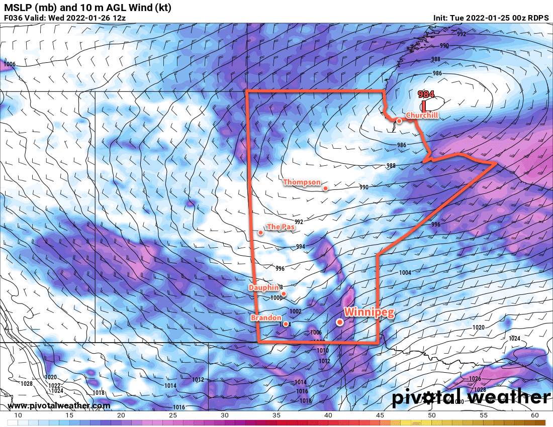
The first clipper will move through the region today, bringing moderate southerly winds, some blowing snow in open areas, and 5–10 cm of new snow by the time it tapers off in the evening. The wind will ease off in the afternoon with a high around -10 °C. Temperatures will head back into the low minus teens tonight with some blowing snow and moderate northwesterlies.

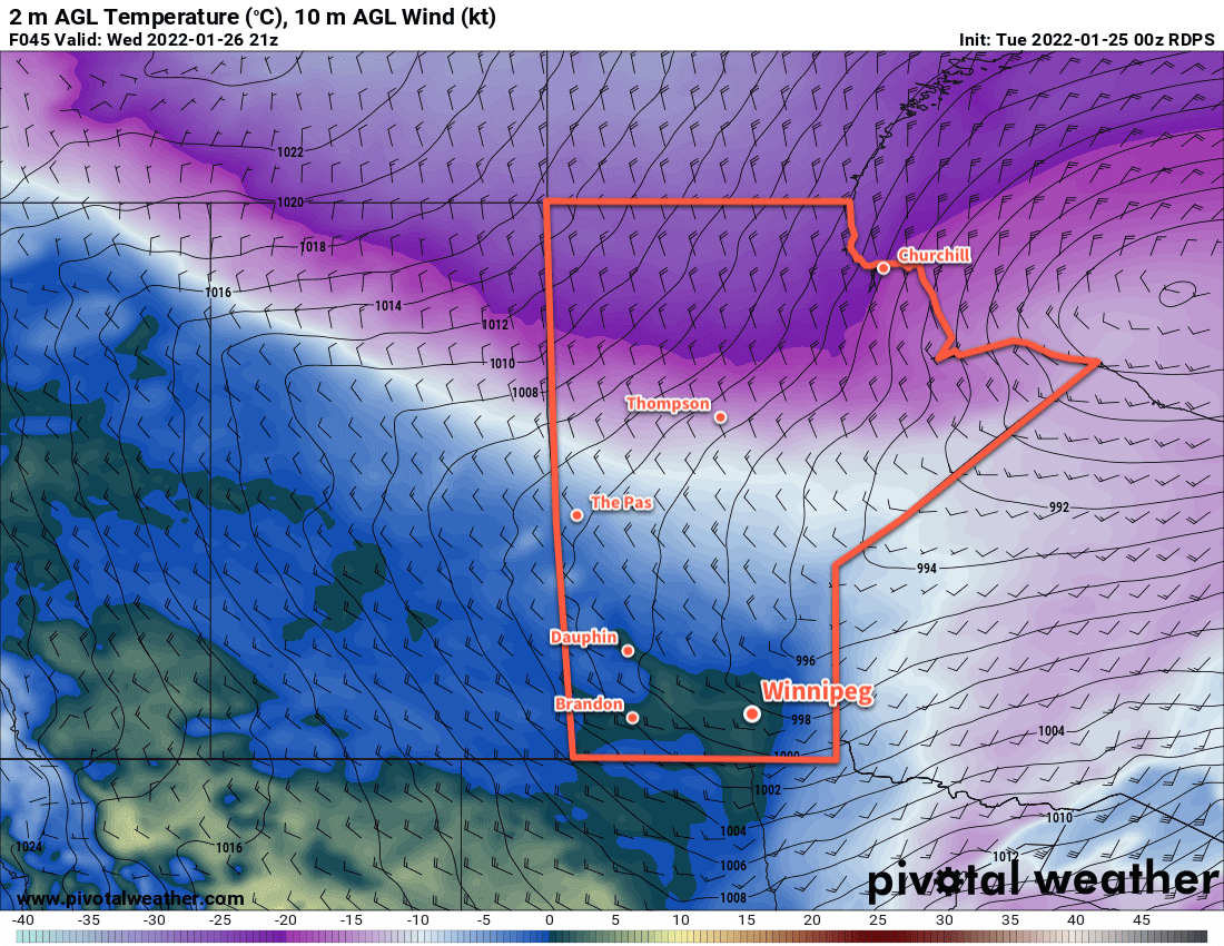
The cloud cover will break up on Wednesday as an Arctic ridge moves into the province. Expect some blowing snow in open areas in the morning, followed by improving conditions as the northwesterlies ease through the afternoon. Temperatures will hover in the -15 to -20 °C range through the day, then quickly drop in the evening with clear skies. Winds will be light on Wednesday night with lows dropping back below -30 °C.

RDPS 2m Temperature Forecast valid 12Z Thursday February 17, 2022
Bitter cold returns to southern Manitoba on Wednesday night with lows bottoming out below -30 °C on Thursday morning.

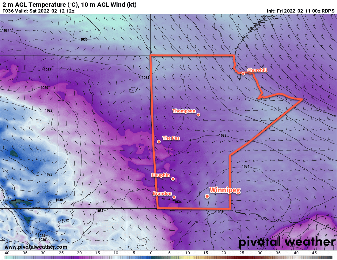
Thursday will be a sunny, cold day with temperatures topping out in the -20 to -25 °C range. The next clipper to impact the region will start pushing in on Thursday evening, bringing increasing cloud and warming tempreatures. Snow will begin overnight as southerly winds strengthen and temperatures warm into the mid-minus teens. More blowing snow will again develop through the Red River Valley by Friday morning.

Long Range Outlook

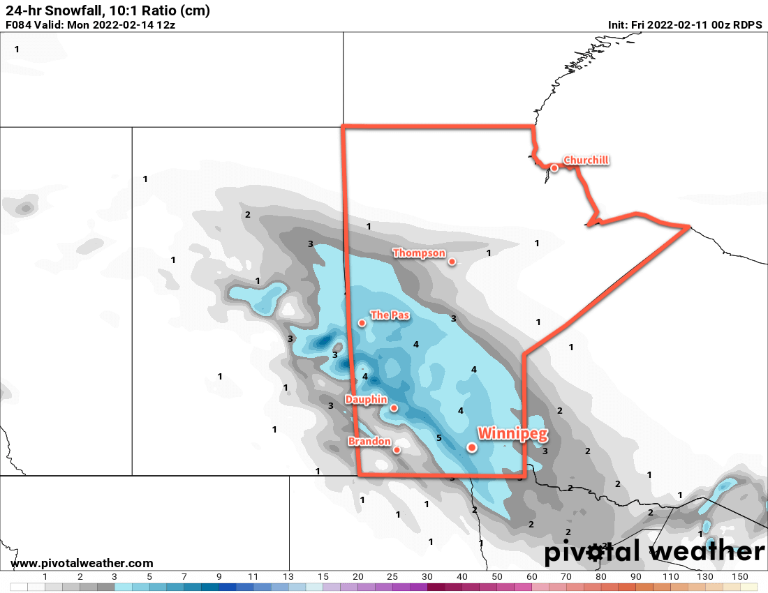
Another clipper moving through the region on Friday will bring 5–10 more centimetres of snow to the Red River Valley. There will be little reprieve afterwards, as forecast show yet another low impacting the province on Saturday. This system could end up bringing closer to 10 cm of snow to the region on Saturday into Sunday.

Temperatures will trend on the cooler than seasonal side of things through the weekend and potentially cool a little bit more heading into next week.

Today’s seasonal daytime high in Winnipeg is -8 °C while the seasonal overnight low is -18 °C.

Cooler Weekend Ahead for Southern Manitoba

Winnipeg will see temperatures slide back into the “cold” category this weekend as another Arctic ridge settles into the province.

RDPS 2m Temperature Forecast valid 12Z Saturday February 12, 2022
Temperatures will plummet back into the -30s Friday night into Saturday morning.

Today will start out with unpleasant conditions as the region sees blowing snow with moderate northwest winds of 40–50 km/h. The wind will ease through the day with gradual clearing as an Arctic high settles into the region. Temperatures will be notably colder than yesterday with little recovery from the overnight low. Temperatures will hover in the -20 to -25 °C range through the day, then drop below -30 °C tonight under clear skies.

The cold weather will stick around for Saturday, a weak upper trough moving through will likely bring some cloud cover as well. Highs will again sit in the -20 to -25 °C range, and temperatures will head back towards -30 °C tonight.

RDPS 24hr. Snow Accumulation valid 12Z Monday February 14, 2022
More snow will move through southern Manitoba on Sunday.

The next low pressure system to impact the region will move through on Sunday. Moderate southerly winds of 40–50 km/h will develop as cloud moves in early in the day, likely producing some areas of blowing snow through the Red River Valley. Snow will move into the region sometime midday, then taper off in the evening.

This system will push the coldest air out of the region, and while it will stay cool into next week, temperatures won’t be as bitterly cold as the region will see this weekend.

Long Range Outlook

Next week will bring varied conditions with some snow possible on Tuesday and towards the end of the week. Otherwise, the region should see sunshine in between with cool highs in the -15 to -20 °C range.

Heading towards next weekend, several forecast show moderating temperatures, with highs returning to seasonal values for the weekend.

Today’s seasonal daytime high in Winnipeg is -9 °C while the seasonal overnight low is -19 °C.

Alberta Clipper Brings Blizzard, Plunging Temperatures

A potent Alberta Clipper is bringing very strong winds and blowing snow to southern Manitoba this morning. In its wake, a surge of Arctic air will send temperatures plummeting back to bitterly cold values.

RDPS 10m Wind Forecast valid 15Z Tuesday February 1, 2022
Strong northwest winds will bring blizzard conditions to the Red River Valley on Tuesday morning.

Starting the day today, the clipper has moved off to the east and brought strong northwest winds as high as 60 gusting 80 km/h to the Red River Valley. This, combined with the 5–10 cm of snow overnight, is producing widespread blizzard conditions through the Red River Valley. Temperatures have also fallen from a high close to 0 °C near midnight into the -10 to -15 °C range. The snow will taper off today as temperatures continue to fall towards -20 °C by the end of the day.

Those strong winds will ease to 40 gusting 60 km/h by the end of the day. This will ease the blizzard conditions, but areas of poor visibility in blowing snow will likely persist across the region into the evening hours.

The wind will ease Tuesday night as skies clear and temperatures head to a low dipping below -30 °C. Extreme cold warnings may be issued if enough wind persists to hit -40 wind chills (only 10–15 km/h winds will be needed).

RDPS 2m Temperature Forecast valid 12Z Thursday February 3, 2022
Bitterly cold temperatures with lows into the -30s will return to southern Manitoba later in the week.

Mid-week will bring plenty of sun but temperatures will stay quite cold with highs in the -20 to -25 °C range and lows dipping into the -30 to -35 °C range. Extreme cold warnings are all but a certainty on Wednesday night.

A weak disturbance will begin to push a little bit of warmer air into the province on Thursday night, bringing some cloud and a chance of some light snow. Skies should clear out again for Friday.

Long Range Outlook

The end of the work week will continue cold, but a substantial push of warm air and cloud will move into the region Friday night. Another 5–10 cm of snow could fall by Saturday evening.

After that, the region will see variable cloudiness with a general warming trend to the forecasts. Next week looks like it could be a return to seasonably mild temperatures with highs climbing back above -10 °C.

Today’s seasonal daytime high in Winnipeg is -11 °C while the seasonal overnight low is -21 °C.

Wind and Blowing Snow Usher in Warmer Weather

The Red River Valley will see another period of strong winds and blowing snow as a surge of mild Pacific air moves into the region.

Before the warmth arrives, though, the region will see another cold day today. Recovering from our cold morning, highs will climb to around -22 °C today under mainly sunny skies. The wind will stay light through the day as an Arctic ridge slumps over the region.

RDPS 10m Wind Forecast valid 12Z Wednesday January 26, 2022
Strong southerly winds will develop over the Red River Valley on Tuesday night.

Conditions will deteriorate tonight as southerly winds strengthen. With warmer air pushing in from the west, southerly outflow winds from the Arctic high will intensify. The wind will pick up to around 30 km/h by midnight, then to 50 gusting 70 km/h by Wednesday morning. These strong winds will combine with the loose snowpack to produce widespread blowing snow across much of the Red River Valley. White-out conditions will be possible in some areas. The worst of the blowing snow will likely be between 5 AM and 10 AM Wednesday morning, followed by improving conditions midday. Temperatures will rise close to the mid-minus teens by the time the sun comes up on Wednesday morning.

Temperatures will continue to rise as the wind and blowing snow eases. A warm front pushing through the region will shift winds towards the west through the day with a high climbing above freezing on Wednesday afternoon. The region should see a fair amount of cloud, but little by way of any notable snowfall.

RDPS 2m Temperature Forecast valid 21Z Wednesday January 26, 2022
Very mild temperatures will move through the Red River Valley on Wednesday afternoon.

A cold front will then slump through the region on Wednesday evening, shifting winds back to the north with some flurries. A bit of blowing snow is again possible on Wednesday night, but with after a mild day and with slightly weaker winds near 40 gusting 60 km/h, it shouldn’t be as extensive or severe as seen earlier in the day. Temperatures will head back into the -15 to -20 °C range for Thursday morning.

The Winnipeg area will see seasonably cool temperatures for the rest of the work week. Highs will sit near -15 °C with lows dipping into the -20 to -25 °C range. The city should see partly cloudy skies, but more cloud cover will work into the region on Friday evening.

Long Range Outlook

Cloudier conditions will move into the Red River Valley this weekend with seasonably mild conditions. A near-seasonal temperature trend will continue into next week with skies likely staying on the cloudier side.

The general long-wave pattern shows a consistent shift of the polar vortex back to the high Arctic. This should mean that, for the next little while at least, the extremely cold Arctic outbreaks should come to an end!

Today’s seasonal daytime high in Winnipeg is -12 °C while the seasonal overnight low is -23 °C.