Deep Freeze Blasts Back Into Southern Manitoba

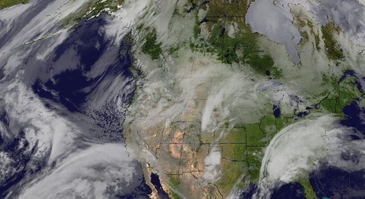
After a break that seems all too short, Winnipeg will plunge into the deep freeze tonight. A reinforced surge of Arctic air will spread back into southern Manitoba in the wake of an Alberta clipper moving through the province today.

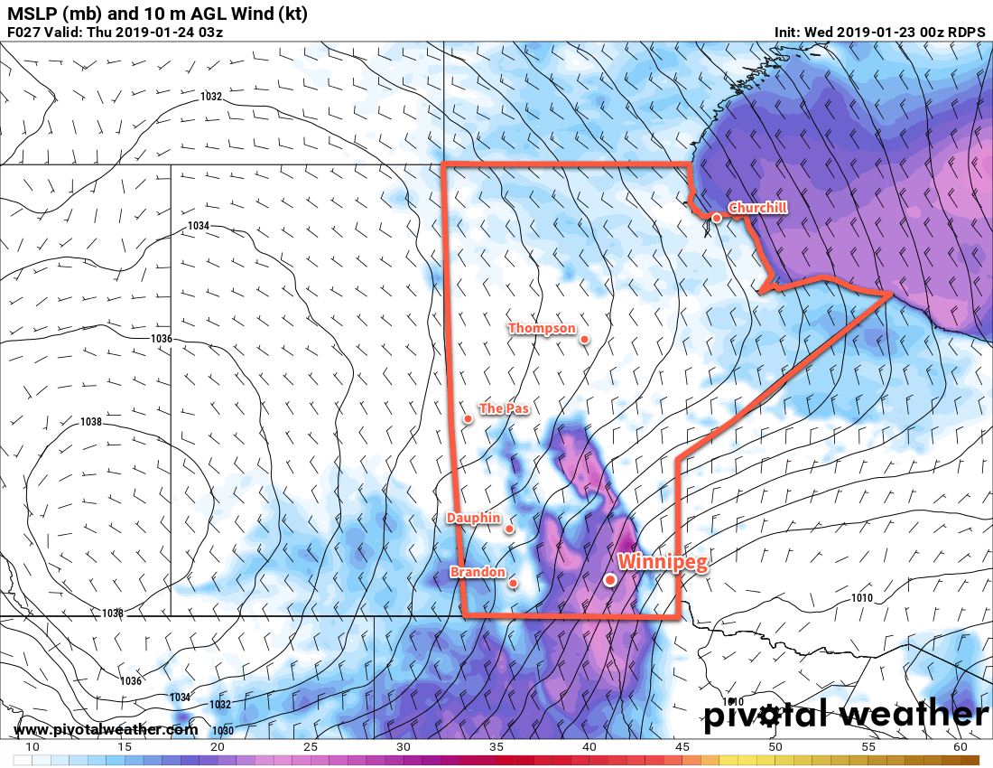
Winnipeg will see cloudy skies with a mild high near -9°C today. By mid-afternoon, the city will likely see some light snow push into the region with 1-2 cm accumulation possible. The big change in the weather will come this evening as a cold front surges southwards through the Red River Valley behind this clipper system. Winds will pick up out of the northwest to 40 gusting 60 km/h and begin ushering in a much colder air mass. These winds will produce areas of blowing snow, however the worst conditions will occur in the lee of Lake Manitoba. In this area, roughly along a line from Lake Manitoba SSE to Emerson, white-out conditions in blowing snow will be possible. Skies will gradually clear overnight as temperatures plummet to a low near -28°C. The wind will ease overnight to 30 gusting 50 km/h by Thursday morning.

Moderate north-northwest winds will bring widespread blowing snow to much of the Red River Valley on Wednesday evening.

The rest of the week? Cold. A potent Arctic ridge will settle over the province for the next couple days, bringing temperatures well below seasonal back to the region. Winnipeg will see a high of just -24°C today with partly cloudy skies. Temperatures will drop to a low near -33°C tonight with light winds. Friday will see temperatures climb to -24°C again under clear skies. Temperatures will dip to a low near -28°C on Friday night.

Long Range Outlook

Temperatures will moderate just slightly this weekend with daytime highs reaching just above -20°C. A low pressure system may bring some snow to the city on Sunday, then will usher in another shot of potent Arctic air. Next week will bring a prolonged period of cold with daytime highs below -20°C expected through the week.

Looks like “Winterpeg” wants to end January by living up to its name!

Winnipeg’s seasonal daytime high is currently -12°C while the seasonal overnight low is -23°C.

Winnipeg Sets Off On A Temperature Roller Coaster

Winnipeg will see temperatures swing from the deep freeze back to seasonably mild by the end of the weekend as an Alberta clipper pushes out an Arctic high.

Temperatures will be cold in Winnipeg today as an Arctic high settles over the region. Temperatures today will be seasonably cold in the Red River Valley at around -20°C. Breezy northerly winds this morning of 20 to 30 km/h will ease through the day. Then, attention turns to a potent Pacific system making landfall. As it moves onshore, it will push a warm front eastwards across the Prairies. That surge of warm air pushing across the Prairies will keep temperatures from dropping too much tonight. Winnipeg should see a low near -24 or -25°C before temperatures begin to moderate early Saturday morning. Skies will start the night clear, but should see cloudiness increase early Saturday morning.

Saturday will bring mainly cloudy skies to Winnipeg. Snow isn’t too likely, but a few flakes may fall through the day. Temperatures will return to seasonal values with a high near -11°C. Winds will become an issue in the afternoon, though, increasing out of the south to into the 30 to 40 km/h range. This will result in some blowing snow through the Red River Valley. Expect locally poor travel conditions on west-east highways in the area. Those breezy winds will continue into the night and keep temperatures mild. Winnipeg will see temperatures remain steady near -11°C under cloudy skies with a chance of light snow.

Total snowfall is forecast to be near 2-4cm in WInnipeg with this weekend's clipper system.
Total snowfall is forecast to be near 2-4cm in WInnipeg with this weekend’s clipper system.

By Sunday, that Pacific system will have developed into a punchy Alberta Clipper. It will move from central Saskatchewan into southwestern Manitoba on Sunday morning, dragging an area of snow southwards from the central Prairies. Winnipeg will see periods of snow through Sunday with light winds. While it will snow all day, accumulations should remain relatively low in the Red River Valley. Winnipeg may see 2 to 4 cm with decreasing amounts south of the city. Temperatures will be mild with a high near -7°C, but things will take a turn on Sunday night as a cold front surges southwards behind the clipper system. Winnipeg will see a low near -19°C with even colder temperatures on the way to start next week.

Long Range Outlook

Some snow may linger into Monday morning, but by the end of the day things should clear out. Then, another outbreak of Arctic air will move into the region. Daytime highs will plummet back into the low minus teens or minus twenties to start the week. Tuesday morning may even bring the first -30°C overnight low of the season!

Many long-range models are forecasting temperatures near -30°C bright and early on to kick off January 1, 2019.

The cold outbreak will be short-lived with seasonal temperatures returning mid-week. The end of next week should bring seasonably mild conditions with little to no chance for any accumulating snowfall.

Winnipeg’s seasonal daytime high is currently -12°C while the seasonal overnight low is -22°C.

Colorado Low Brings Snow, Wind, and Colder Temperatures

Southern Manitoba will be under the influence of a potent Colorado Low moving out of Minnesota into northwestern Ontario, bringing snow, strong winds, and colder temperatures to the region.

It’s been a bit of a path to get here, but Winnipeg will finally see some snow today, only 12 hours later than originally expected. Snow will blossom across the region early this morning — briefly mixed with freezing rain early this morning — and slowly push eastwards through the day, tapering off to light snow this evening. Snowfall totals will vary significantly across the Red River Valley, with as little as 2 or 3 cm expected over the western edge of the valley, and nearly 10 cm over the southeastern corner. Here in Winnipeg, 3-5 cm is most likely by the evening.

A Colorado Low will bring anywhere from 2 to 15 *cm* of snow to southern Manitoba today.

As the snow pushes eastwards this afternoon, it will be replaced by strong northwesterly winds of 40 to 50 km/h with gusts up to 70 km/h. These winds will combine with the fresh snow to produce areas of poor visibility in blowing snow. If you must travel this evening, be sure to check highway conditions, carry a survival kit, and give yourself plenty of extra time.

The strong winds will continue through Monday night and much of Tuesday.

These strong northwesterly winds will usher in a much cooler air mass and will seem a bit of a shock given the mild temperatures that have been in place the past weeks. Temperatures in Winnipeg will drop from -3°C this morning to around -7°C this evening, then continue towards a low near -12°C tonight. Temperatures will struggle to recover on Tuesday with a high of only around -10°C. As the strong winds begin to ease on Tuesday evening, temperatures will head towards an overnight low near -5°C.

GDPS Forecast Surface Temperature valid 06Z Thursday December 7, 2017
Wednesday night will bring very cool temperatures to the Red River Valley with overnight lows approaching -20°C

On Wednesday, the cloud cover should finally clear out of the region as temperatures head to a high near -11°C. Winds will continue out of the northwest at 20 to 30 km/h. An Arctic ridge will then move in on Wednesday night, turning winds light and sending overnight lows down to around -18°C.

Long Range Outlook

The remainder of the week will continue with sesaonal to below-seasonaltemperatures, with more cloud pushing back into the region. The coming weekend looks to bring variable cloud and near-seasonal temperatures before colder temperatures return next week.

Winnipeg’s seasonal daytime high is currently -8°C while the seasonal overnight low is -17°C.

More Snow as Colorado Low Grazes Manitoba

More snow is on the way for Southern Manitoba as a Colorado Low grazes the region as it moves through the Dakotas and Minnesota. After the passage of that system, the upper-level pattern will shift and bitterly cold Arctic air will spill southeastward across the Prairies.

Snow will build into Southern Manitoba through the day today from the southwest, with a few isolated flurries in the morning intensifying into more persistent snow through the afternoon. By 6PM, most areas along and south of the Trans-Canada Highway will be seeing snow. The snow will persist through much of the night before tapering off on Tuesday morning.

NAM-based accumulated snowfall for the next storm based on a 10:1 snow ratio.

The NAM model pictured above has been consistently producing a total of between 6-8 cm at a 10:1 snowfall ratio (SLR), however it appears likely that the SLR will be higher at around 14:1, which would push storm-total snowfall ranges in the Red River Valley from around 8-12 cm in Winnipeg to 10-20 cm near the US border. Amounts States-side will be higher, with nearly 25cm of snow expected through east-central North Dakota into Minnesota.

Temperatures will be seasonal with highs in the -9 to -11°C range today and temperatures dropping to -18°C by Tuesday morning.

Winds will be breezy through the day today out of the northeast at around 20-30 km/h. As Winnipeg & the Red River Valley move onto the back-side of this system tonight, winds will strengthen out of the north to northwest to around 40 km/h. These gusty winds will combine with the fresh snowfall to produce blowing snow on area highways with locally poor visibilities. The winds will begin to ease through the early afternoon, bringing an end to the blowing snow.

Cooler Weather For The Remainder Of The Week

Temperatures will be much cooler on Tuesday with little movement from the overnight low near -18°C as colder air moves into the region from the northwest. Even colder conditions will move in on Tuesday night with overnight lows expected to drop to around the -27°C mark. Wednesday will see Winnipeg & the Red River Valley entrenched in the Arctic air with highs near the -22°C mark and an overnight low dipping back down to around the -27°C mark.

The upcoming cold snap can be seen in this forecast for the second half of the week showing the cold air aloft building into Southern Manitoba.

Skies on Tuesday will remain fairly cloudy until the late afternoon when things begin to break up. It doesn’t appear that this cold snap will be associated with particularly sunny skies, though. The main ridge axis will pass well to our west, making it more difficult for all of the cloud to clear from Southern Manitoba. The Red River Valley will mainly see mixed to cloudy skies through much of the week.

Long Range

Little pattern change is expected in the next 7-10 days.

NAEFS 8-14 Day Temperature Anomaly Forecast — Valid January 9-16, 2016

As this NAEFS outlook shows, below-normal temperatures will likely remain in place for the next 1-2 weeks. Temperatures may moderate next week to be closer, but still below, seasonal values. Conditions look fairly dry with little snow expected; the next potential for some snow may be with a clipper system early next week.

So after this snowfall, Winnipeg & region will be falling into a relatively quiet and cold pattern, holding strong for at least the next 7-10 days.

Winnipeg’s seasonal daytime high is currently -13°C while the seasonal overnight low is -23°C.