Elsewhere in Weather News: July 19th, 2014

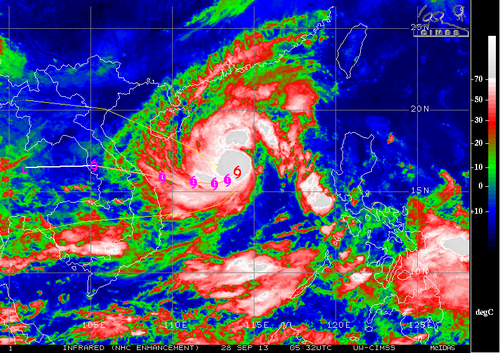
Another Super Typhoon Spins Up in the Western Pacific

The Western Pacific Ocean has been very active in the past few weeks, churning up numerous typhoons including its most recent – super typhoon Rammasun. Rammasun made landfall at least twice; once in the Philippines and China, respectively, during its trek across the Western Pacific.

The first landfall occurred southeast of Manila, Philippines, where it brought with it winds of 185km/h. Many precautions were taken ahead of this storm in the Philippines as it was the first typhoon to hit the country since super typhoon Haiyan. Over 500,000 people decided to ride out the storm in evacuation centres and plenty of warning (3 days) was given to residents before the typhoon made landfall. Despite the warnings, many homes could not be saved – as many as 7,000 as reported by authorities. Unfortunately 38 people died due to the typhoon in the Philippines.

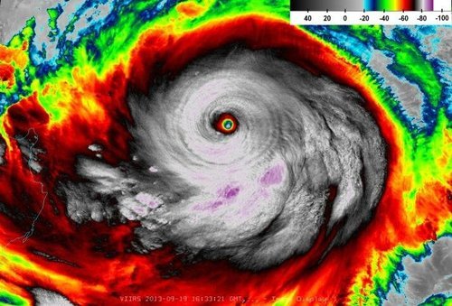
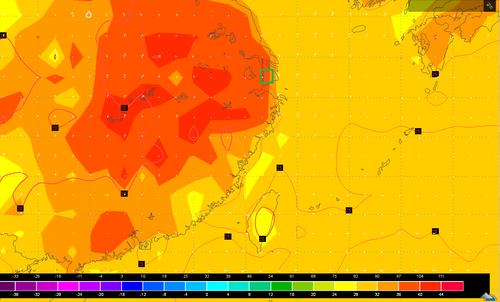
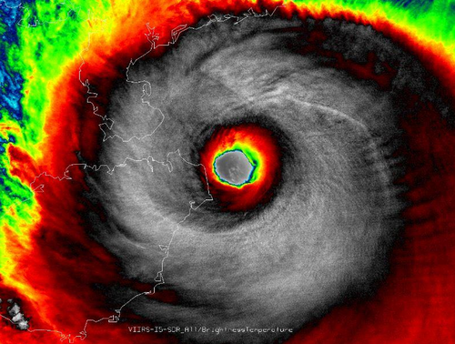
After making landfall in the Philippines, Rammasun quickly strengthened with help from the very warm sea surface temperatures (SSTs) that approached 30°C in the South China Sea. With these warm SSTs conditions were primed for the storm to reorganize. Rammasun quickly developed a well-defined eye and became a super typhoon (category 4) as it approached China for a second landfall. The typhoon made landfall on Friday morning with sustained winds of 250km/h gusting to 280km/h on one of China’s southern provinces; Hainan. All modes of damage were possible with a storm of this intensity; including flooding rains, landslides and severe storm surge. It is still unclear how the region is doing in the aftermath of the storm as of Friday night. A report of 178mm of rain in the coastal city of Haikou (pop. 900,000) in 6 hours on Friday combined with expected storm surges of 20 feet in the general area made for big flooding/landslide concerns. Rammasun is expected make a turn for China’s mainland and die off this weekend, but not before bringing widespread torrential rains to the region.

IR image of Rammasun just before it made its second landfall. (Source: NASA/NOAA)

More tropical storms are expected to spin up this week with possibilities in both the Atlantic and Western Pacific as depicted by some models. The strength or paths of these are uncertain.

Elsewhere in Weather News: September 29th, 2013

Wutip Forms, Typhoon Usagi Update

This week the Northwest Pacific typhoon season continues to be active as another typhoon – typhoon Wutip – has spun up in the South China Sea and is tracking westward. Although this is good news for the residents of Hong Kong and southern China who have been affected by last week’s typhoon, Vietnam will now have to closely monitor Wutip. As of Friday night Wutip was only a high-end tropical cyclone but is expected to slowly continue to strengthen over the open waters of the South China Sea. It will likely only have enough time to strengthen to a category one typhoon before it makes landfall near the city of Da Nang. Still, residents of Vietnam will have to watch for storm surge that could wreak havoc in low lying coastal areas as well as flooding; much rain will be associated with Wutip. It’s expected that Wutip will make landfall Sunday night.

Wutip

Infrared enhanced image of Wutip on Friday night. A bit of dry air to the south-east of it’s center but very cold tops (white) near it’s center as it was attempting to organize itself. (Source: CIMSS)

The storm talked about in last week’s EIWN, typhoon Usagi, has caused significant damage to coastal areas of China, in the Guangdong province. In total, 25 people have died in China due to landslides triggered by the heavy rains and storm surge. Search and rescue teams are still looking for survivors in the mud though, and cleanup efforts are now underway. Usagi made landfall 140km to the north-west of Hong Kong; there it brought with it sustained winds of 175km/h which gusted to over 200km/h. In Hong Kong over 200 flights had to be cancelled. Although once a powerful super typhoon, Usagi is no more as it moved over China’s mainland and fell apart this past week.

Elsewhere in Weather News: September 21st, 2013

Super Typhoon Usagi Takes Aim at Hong Kong

The strongest typhoon of the year up to date has formed in the Pacific and is taking aim at Hong Kong. Super typhoon Usagi is currently located in the Luzon Strait between Taiwan and the Philippines and is moving in a west north-westerly fashion. Thursday and Friday morning, Usagi was packing sustained winds of around 260km/h – considered category five strength. It has since slightly weakened but is still a dangerous category four super typhoon as it eyes (no pun intended) Hong Kong and the southern coast of China.

Usagi

Awesome image of Usagi Thursday afternoon. (Source: Colorado State University/Capital Weather)

This super typhoon is not only a very powerful typhoon but also a very large one; its diameter reaching over 1,000km. A very distinct eye could be seen on satellite as well as more than one eyewall present; it is not as common for a tropical system to have more than one eyewall, though it does happen with storms of category three or higher.

Usagi is expected to make landfall sometime on Sunday along the south China shores. Its impacts remain to be seen though, with seas expected reaching 10 meters in the South China Sea all vessels will have to steer clear or dock. Another concern is the rainfall; already copious amounts of rain have fallen in Taiwan, especially on its east coast where about a meter of rain was not out of the question before the weekend’s end.

In addition to Usagi, a second typhoon is expected to form this weekend behind (to the east) of Usagi, it will be named Pabuk. Although still a ways out, Pabuk has a good chance at becoming a severe typhoon due to the warm sea surface temperatures and low shear in the area. Currently, the models show Pabuk reaching the eastern shores of Japan but then quickly curving back out to sea – this would suggest minimal impacts to Japan.

Elsewhere in Weather News: August 10th, 2013

Potent Heatwave Strikes China; Possible Typhoon on the Way

A prolonged heatwave has been in place for this whole week and even a part of last week over most of Eastern China, including the megacity of Shanghai. An upper-level ridge centered directly over Shanghai (but covering the whole region) is contributing to abnormally high temperatures in the region. Scorching heat, ranging from the high thirties to low forties, covered the whole region while remaining in place yesterday. Numerous heat alerts were issued by the Chinese government urging residents to limit outdoor activities, spend time in air conditioned buildings and most importantly, to stay well hydrated. Unfortunately the death toll had risen to 10 people as of Friday, with Shanghai hardest hit.

China surface temperatures

Map of Eastern China’s surface temperatures for today at 4pm, dark orange is over 36 degrees Celcius. (Source: Wunderground maps)

Such a potent heatwave in this region is not common – it has been said that this one is the worst in 140 years. On August 7th Shanghai broke its all-time record temperature, recording an official high of 40.8°C. Before the recent heatwave began, the highest temperature ever recorded in Shanghai was 40.2°C set in 1934. Shanghai’s average high temperature for August is 32°C. Drought concerns are now coming into play as water sources are starting to run low in the east-central region of China where little to no rainfall is expected in the coming week while the heatwave continues.

The southern coast of China could be under the gun for some drenching rains associated with an incoming typhoon: Typhoon Utor. Utor has still not passed over the Philippines but it is expected to make landfall to the northeast of Manila as a category two. Following its first landfall, it will continue travelling into the South China Sea though there is still a lot of uncertainty as to whether it will curve north into China’s mainland or simply brush the south coast.

Utor

Infrared satellite image of Utor on Friday evening, and it’s expected track. (Source: CIMSS)