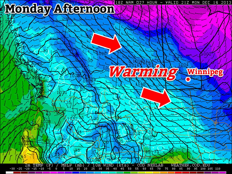
After a record cold morning on Sunday, we’ll see a dramatic warm-up to start the week.
Monday
Chance of Flurries in the Morning, then Clearing
-5°C / -14°C
Today will be the warmest day of the week with temperatures climbing into the minus single digits. There may be a few flurries in the morning, before skies clear later in the day. It will be a windy day too, as westerly winds help to bring in that warmer air. Winds will be 20-30km/h gusting to 40-50km/h.
Tuesday
Mainly Sunny
-13°C / -15°C
Temperatures will cool down a bit for Tuesday, with highs in the low minus teens. It will not be as windy as Monday though, so conditions will remain fairly pleasant.
Wednesday
Mainly cloudy. Chance of flurries.
-8°C / -24°C
A low pressure system is expected to pass through Manitoba on Wednesday, signalling the beginning of the end of this little warm spell. At this point it appears that this system will pass far enough to our north that we won’t see much, if any, snow with it – although that may change. Temperatures on Wednesday look to be around -10C with fairly light winds. A cold front associated with this low will move through Southern Manitoba on Wednesday afternoon and evening, allowing another arctic airmass to surge into the region.
Long Range
Models suggest we will continue to see arctic air dominate our weather until Christmas. There may be the odd break in the deep freeze here and there, but in general there are no lengthly warm-ups currently in our future.

