Winter Storm Races across Southern, Midwest US
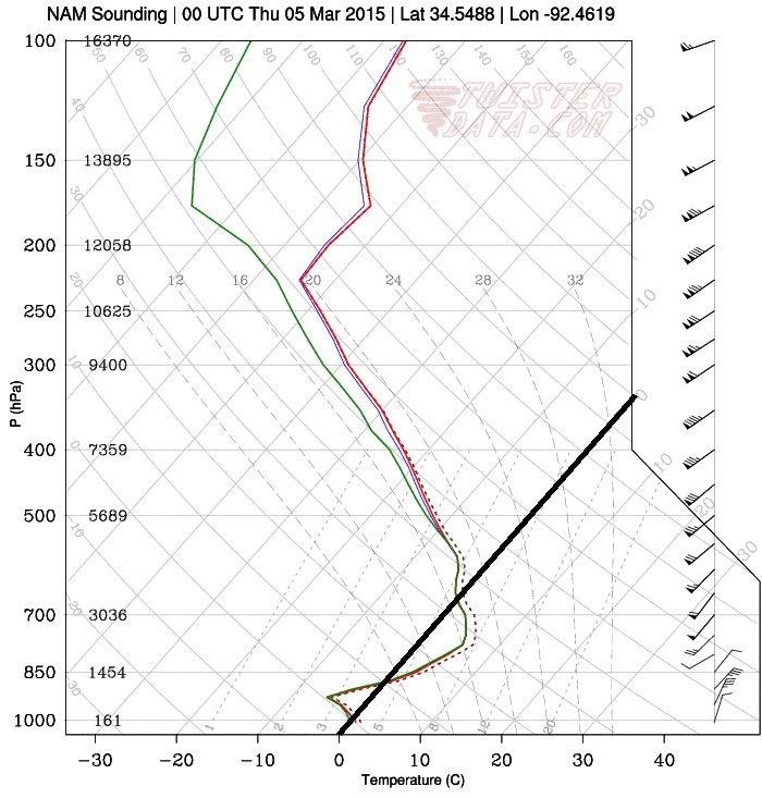
This past week a strong late season winter storm made its way across the southern and east-central parts of the United States bringing with it all kinds of precipitation: rain, snow, ice pellets and freezing rain. An Arctic front pushing south across the region was the culprit for the mixed precipitation types. Warm air was able to ride over the cooler air racing south near the surface which made for a melting layer above ground and able to melt/partly melt the precipitation. Before it reached the ground the precipitation encountered below freezing temperatures once again which resulted in the freezing rain, or ice pellets if the melting layer was not as deep.

Large traffic jams on the freeways due to accidents, school closures and power outages were the result of the storm and 13 deaths across several states were directly related to the storm. Impressive and unusual snow amounts for this time of the year were recorded anywhere from Dallas, Texas to Lexington, Kentucky. Here are a few impressive amounts recorded from the storm, provided by the National Weather Service:
- Lexington, KY: two-day total of 43.4cm (all-time two day record)
- Tupelo, MS: one-day total of 18.5cm (second snowiest day on record)
- Dallas, TX: storm total of 8.9cm
No more snow is expected in the near future, but record-breaking cold temperatures followed last night. Warmer and closer to normal temperatures are on the way for next week as a pattern change takes place and colder air remains locked up further north.
