Elsewhere in Weather News: April 11th, 2015

Severe Weather Outbreak Strikes Plains and Midwest

As April rolls around the severe weather season in the United States is on an uptick, and with that comes a higher threat for tornadoes. The latest severe weather outbreak occurred Wednesday and Thursday of this past week and hit hardest a few small communities of northern Illinois.

[map autofit=”1″ disable_scrollwheel=”1″] [pin]Medicine Lodge, Kansas[/pin] [pin]Fairdale, Illinois[/pin] [/map]

The setup on Wednesday was a fairly typical setup that you would see for a Southern Plains outbreak – surface low in central Kansas with sharp warm front extending eastwards and dryline extending southwards. This, combined with an upper-level trough moving in aloft, destabilized the environment sufficiently for supercells. Only a few tornadoes were observed on Wednesday, with most spotted just west of Wichita (including a large cone tornado near Medicine Lodge) and one unconfirmed in western Oklahoma. No damage was reported as tornadoes mainly touched down in open areas.

Thursday was a different story however, as the system progressed eastwards. The main risk for the day zeroed in to an area near the triple point where both CAPE and shear values were high and surface winds were slightly more backed compared to further south along the cold front. Once again, supercells were triggered in the early evening hours – this time in northern Illinois. One supercell near the triple point stood out from the others however; there no other cells to its southeast to inhibit growth and it latched along the warm front. What came of this supercell was a long tracked tornado that was on the ground for an estimated 25-35km and measured just less than a kilometre in width. It tore through mostly rural area and outskirts of two other towns before striking the town of Fairdale, Ill, which sustained heavy damage from the twister. On Friday, National Weather Service teams were out to examine the damage and gave it a preliminary rating of EF-4 (winds of about 315km/h). Two people were killed and a dozen more injured by the tornado. Cleanup is currently underway in the town as calmer weather sets in for the weekend.

Note: there is some strong language near the end of the video clip

Elsewhere in Weather News: March 14th, 2015

Powerful Cyclone Strikes Pacific Islands

The strongest Pacific cyclone of 2015, Pam, struck the small island nation of Vanuatu located in the South Pacific this past week and brought with it extreme conditions as it topped the cyclone scale at a category five storm.

[map autofit=”1″ disable_scrollwheel=”1″] [pin]Port Vila[/pin] [pin tooltip=”Where Pam formed”]-7.092716, 169.442139[/pin] [/map]

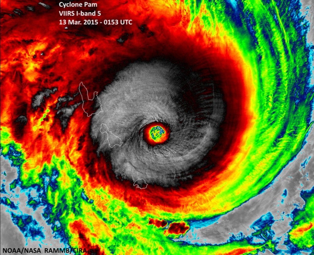
The cyclone developed about 1,000km northwest of Fiji last weekend as an area of thunderstorms organized under ideal conditions – sea surface temperatures were very high in the region, as high as 31°C, and shear was minimal. Pam continued to organize early this week. It struggled as it ingested some dry air into its core while heading towards Vanuatu but by Thursday morning it formed a large eyewall that was fairly symmetric. This meant that it had fought off the dry air and was intensifying rapidly. Peak strength was reached several hours before it reached the Vanuatu Islands, winds were sustained at 270km/h, gusting over 300km/h, and pressure bottomed out at extremely low values estimated by satellites to be around 890mb. Early Friday morning the storm’s eye passed very close to several of Vanuatu’s islands making it a worst case scenario situation. The islands were battered with 250km/h winds, storm surges of 6-8m and extremely heavy rainfall.

Typical buzz-saw appearance of a category five cyclone seen as Pam approached Vanuatu and was near peak strength. (Source: NOAA)

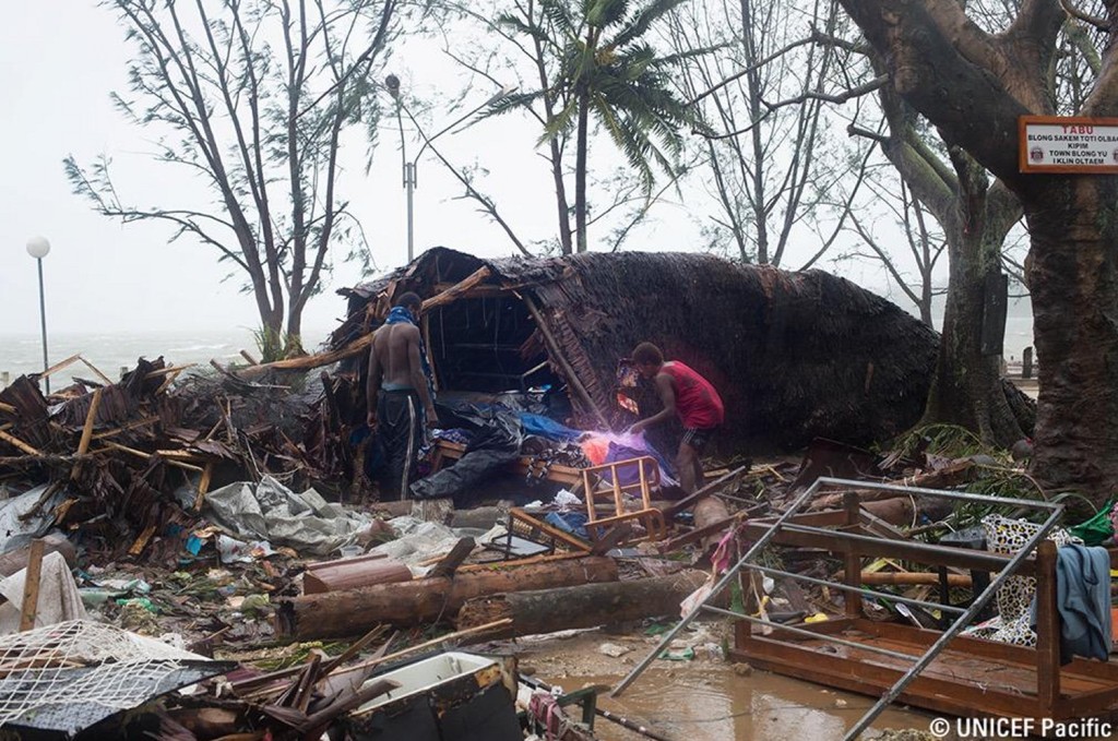
As of Friday evening rescue efforts were still underway while searchers made their way into remote regions that were completely isolated from the storm. Overall the infrastructure on the islands is not the best, with some houses simply made out of mud resulting in more damage than you’d typically see in a developed country. The largest city, Port Vila, was reported to be out of power and running water and had debris scattered across roads making travel difficult. There are unconfirmed reports of numerous deaths associated with this storm, but they have not been confirmed yet.


Damage seen on Friday evening (our time) as Pam was on its way out. (Source: UNICEF Pacific)

After Pam has finished its swipe through the Vanuatu islands, it is not expected have any other significant effect on any other island nations as it heads Poleward where it will weaken. The Pacific/Eastern Indian oceans have been extremely active this week, not only because of Pam, but there have been three other cyclones that were active at one time this week. Two of these made landfall on Australian soils (category three and category two), with minimal damage reported. With that said, there are no other areas of interest for possible formation of other cyclones as of Friday night.